It’s been more than six and a half years since the devastating Station Fire burned 160,577 acres in Angeles National Forest.
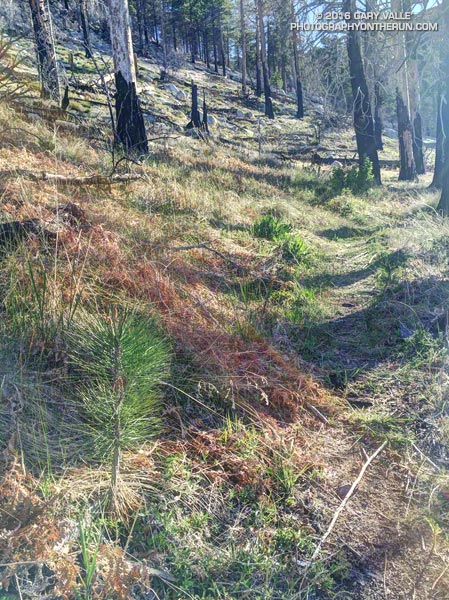
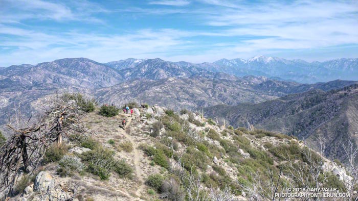
The pine seedling above is on the Three Points – Mt. Waterman trail (10W04) in an area burned by the Station Fire. It’s 3.5 miles from Three Points and at an elevation of about 7000′. It’s about three years old.
How long will the seedling have to grow to replace the mature trees lost in the fire?
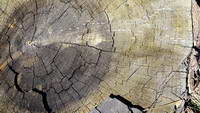
Jeffrey pine burned in the 2009 Station Fire
A couple more miles up the trail, near the Twin Peaks Trail junction, is a Jeffrey pine burned by the Station Fire and then cut by fire fighters. The tree is representative of the mature trees in this area of the forest. An inexact, but conservative, count of its growth rings is in the neighborhood of 325.
So the burned tree was a seedling sometime around 1690. If the seedling survives the drought, increasing temperatures, subsequent fires and droughts, and other maladies that can befall a tree, it will reach the age of the burned tree around 2340.
Here’s hoping that it does, and that the forests will be as enjoyable then as they are now…
Update August 4, 2020. In July 2018 a count of the tree rings of a large Jeffrey pine cleared from the Three Points – Mt. Waterman Trail revealed approximately 500 rings!
A couple of weekends ago we had cool weather for a 28 mile Angeles Crest 100 training run from Islip Saddle to Chilao Flat. It was a bit windy and chilly at Islip Saddle, but once we were up and over the shoulder of Mt. Williamson the wind settled down and the weather for the remainder of the run was near perfect.
This was the second of four supported AC100 training runs, each covering a different section of the course. These organized runs account for just a tiny fraction of the total mileage a runner does to prepare for this event, and much of the mileage is done on the AC100 course.
Where is the AC100 course? Incorporating segments of iconic trails such as the Pacific Crest Trail, Silver Moccasin Trail and Gabrielino Trail, the AC100 starts in the mountain community of Wrightwood, California and ends in Altadena near JPL, traversing a large part of the San Gabriel Mountains.
Mountain weather — even Los Angeles County mountain weather — can be extremely varied and changeable. At about mile 18 the AC100 course reaches an elevation of more than 9,200′, near the summit of Mt. Baden-Powell. On the same day temperatures on the course can differ by 50 degrees or more. One section can be inundated by a flash flood while another is bone dry. During a Spring training run it might be 100 in the sun at Echo Mountain, while it is snowing on Baden-Powell.
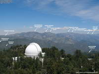
Annotated Mt. Wilson Towercam Image
The Mt. Wilson Towercam is usually pointed in the direction of the Angeles high country. When it is, it provides a great overview of about two-thirds of the AC100 course. The view extends from the top of the Acorn Trail at about mile 4 (in the distance on the far right), along the crest past Mt. Baden-Powell, Throop Peak, Twin Peaks and Waterman Mountain to Three Points at about mile 43. Chilao is hidden from view, but the Charlton Flat area and a section of Edison Road is visible on the left. Newcomb Saddle, at about mile 68, is on the lower right. Here’s an annotated Towercam image that shows the approximate location of these features.
Bill Westphal’s Altadena Weather & Webcam gives a lower elevation view of the San Gabriels, near the AC100 Finish. The view is NE toward the Sunset Ridge Trail and Mt. Lowe Road, around mile 93 or 94. The course goes from the right of the photo to the left, but is mostly hidden from view.
If you are willing to jump through some Java security hoops the Mountain Hardware Live Interactive Cam in Wrightwood is a couple blocks from the AC100 Start. It has views of downtown Wrightwood, Wright Mountain, the Heath Canyon landslide, Blue Ridge and several other locations. I temporarily enabled Java and followed the troubleshooting info linked on the web cam page. I’ve been able to get it to work on a desktop system using Firefox or Internet Explorer. Note that enabling Java and adding non-secure URLs to the Java exceptions list decreases the security of your computer.
Following are several Remote Automated Weather Stations (RAWS) and Weather Underground Personal Weather Stations (PWS) along or near the AC100 course, in order from Start to Finish.
It is important to note that the air temperature given by RAWS stations is the temperature inside a sun-shielded, ventilated enclosure 4-8 feet off the ground. Basically it’s the temperature in light shade. The temperature in full sun can be 15°F higher. I’ve found the “Fuel Temperature” to be a better gage of how hellish it’s going to be on exposed areas of trail. (The Fuel Temperature is the temperature of a ponderosa pine dowel in direct sun.)
Big Pines BPNC1 RAWS (6964′) – Off Hwy 2 near Mountain High Ski Area. Top of Mt. Baden-Powell can be 12+ degrees cooler and much more windy. Was 64°F at 6:54 a.m. for 2015 AC100. Fuel temp at 11:54 a.m. was 92°F.
Chilao CHOC1 RAWS (5450′) – Approximately 1.25 miles WNW of Chilao aid. Fuel temp at 1:53 pm was 95°F for 2015 AC100. Air temp at 6:53 pm was 79°F.
Clear Creek CEKC1 RAWS (3000′) – Approximately 6.8 miles W of Shortcut Aid (~4793′) and 2.9 miles W of Red Box Aid (~4620′). Was 71°F at 8:54 p.m. for 2015 AC100.
Mt. Wilson MWSC1 (5710′) – Approximately 1.5 miles NW of and 780′ above the top of Mt. Wilson Toll Road (~4930′). Compare to JPL 5600′. Was 69°F at midnight for 2015 AC100.
Henninger Flats HNGC1 RAWS (2800′) – Approximately 0.8 miles WSW of Idlehour Aid (~3168′). Marine layer can increase humidity on this section of the course. Was 69-70°F from 4 a.m. to 7 a.m. for 2015 AC100. Fuel temp was 89°F by 11a.m.
Altadena KCAALTAD18 PWS (1214′) – Approximately 0.6 miles S of Finish. For 2015 AC100 temp ranged from 66°F at 2 a.m. to 63°F at sunrise. Temp was 79°F at 9 a.m., 82°F at 11 a.m., and 86°F at 1 p.m. Humidity was high with dew point about 70°F.
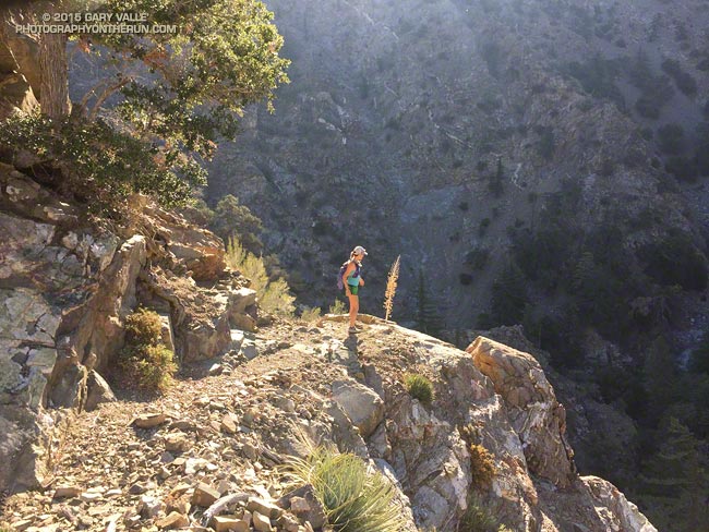
I stepped on top of the waist-high rock and with some effort pressed upward. It felt like my leg was going to blow apart at the seams. We were hiking up a steep section of Strawberry Peak, and were about a mile from the summit. I’d done Strawberry from Red Box innumerable times, but my legs had never felt like this.
Trail runners — and all of us that love the outdoors — are very good at finding ways to spend a little extra time outside. The first half of the day Skye and I had done the Bear Canyon loop and now we were climbing Strawberry Peak.
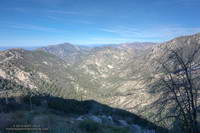
Bear Canyon
On its own the Red Box – Bear Canyon – Gabrielino loop is a demanding run. Because the canyon has been subject to numerous flash floods the Bear Creek Trail is a mix of classic mountain trail and segments of “use trail” through washouts and flood debris. Add in the elevation gain going from Red Box to Mt. Disappointment and from Switzer Falls back up to Red Box and you’ve got an adventurous run.
Bear Creek Trail near Arroyo Seco
About halfway through the canyon is Bear Canyon Trail Camp. Perched on a bench above the creek this idyllic camp was spared by the 2009 Station Fire. Because of the camp’s popularity the section of trail between Bear Camp and Arroyo Seco sees the most use and generally is in better condition than the section between Tom Sloan Saddle and Bear Camp.
The 16 mile loop we did today is the shortest that goes through Bear Canyon. The loop can be extended by linking in the Valley Forge Trail or circuit around Strawberry Peak, or doing what we did today — the out and back to the summit of Strawberry Peak.
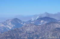
The area in the image above was burned by the Station Fire on September 7, 2009. That morning I’d just crossed the peak-top finish line of the Baldy Run to the Top and using a tiny point and shoot camera took this snapshot of the Station Fire burning on Mt. Waterman.
Station Fire on Mt. Waterman
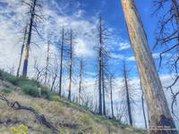
The image of the fallen trees and ferns is from today’s counterclockwise circuit of Waterman Mountain from Three Points. It was taken at an elevation of about 7100′ about 3.5 miles from Three Points and about 1.5 miles west of the Twin Peaks Trail junction. Here the Station Fire burned swaths of forest, running up steep gullies and ridges on the south slopes of the mountain.
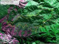
Ikhana BAER Burn Intensity
The purple hues in this Burned Area Emergency Response (BAER) image taken by the NASA Ikhana remotely piloted aircraft in 2009 are indicative of the burn severity in the vicinity of Three Points and Mt. Waterman. (Ikhana image courtesy of NASA Dryden and NASA Ames. Composite image created using Google Earth Pro.)
Pines Burned by the Station Fire
The yellow track in the BAER image is of the Three Points – Mt. Waterman loop. The track includes a side trip to the summit of Mt. Waterman I didn’t do today. About one-third of the approximately 20 mile loop was impacted by the fire. If the loop is done counterclockwise the first couple of miles are the most severely burned and have the most downed trees and Poodle-dog bush. Use trails have developed around the fallen trees, but it seems a new tree or two has fallen each time I do the route. With care the Poodle-dog bush is generally avoidable.
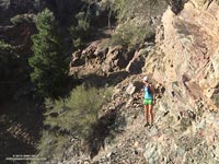
I asked Skye what her watch had for the mileage. Had we gone two miles yet? We were running down the South Fork Trail from Islip Saddle and hoping to do one of my favorite adventure runs in the San Gabriel Mountains. The 23.5 mile loop descends to South Fork Campground, then climbs to the summit of Mt. Baden-Powell via the Manzanita Trail and PCT; and then continues on the PCT back to Islip Saddle.
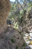
Rock slides on the South Fork Trail
A few days before there had been a report on Facebook that the South Fork Trail “was gone” about two miles down from Islip. With the heavy rains we’d seen in July that was certainly a possibility. Even without the rain it was a possibility. The South Fork Trail is under constant bombardment and it is normal for some sections of the trail to be covered by rock slides. I can’t think of an “official” trail in the San Gabriel Mountains with a more primitive character.
The condition of the South Fork Trail wasn’t the only possible problem. Earlier in the week I’d run the Manzanita Trail most of the way to South Fork Campground to be sure that if the South Fork Trail was passable, we would be able to complete the loop. There were two things to check. Was the spring running 1.4 miles from Vincent Gap? It was. And had the heavy July rain washed out the trail in the landslide area above Paradise Springs? It hadn’t. So if we could get to South Fork Campground we were good to go.
As things worked out the condition of South Fork Trail was about the same as it always is. I’ve seen it in better condition and I’ve seen it worse. With care it was passable — but that isn’t a recommendation. It’s the kind of trail some love and others hate.
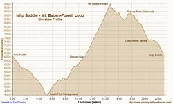
Elevation Profile
Once down at South Fork Campground the adventure isn’t over. There are some rock and boulder strewn washes to navigate and there’s the small matter of the nearly continuous 10 mile, 5000′ climb to the top of Mt. Baden-Powell. Having recently completed the Angeles Crest 100 and climbed Mt. Whitney, the tough climb from the South Fork was a piece of cake for Skye. On the other hand, I was very happy to round the final corner and see Baden-Powell’s busy summit come into view. On the way up we ran into Mt. Disappointment race organizers Gary & Pam Hilliard, getting in a little work after doing the Julian Station Full Moon run the previous weekend. Next year will be Mt. Disappointments’ 10th running.
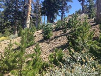
Lodgepole pine saplings
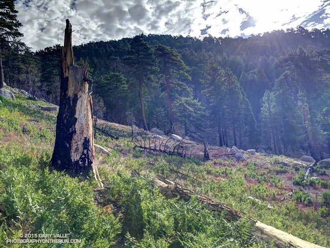
Between Baden-Powell and Windy Gap the weather was cool and the running comfortable on the PCT. Perhaps because of the heavy July rain the pines and firs seemed to be especially green. In several areas young, healthy trees grew in nursery-like stands amid the bleached trunks of trees burned in the 2002 Curve Fire.
I was just about out of water when we pulled into Little Jimmy Spring, and as always, the water was clear, cold and rejuvenating. Another 2.5 miles and the loop would be done. Although it’s difficult for its length, it’s also very enjoyable. If the weather holds I’ll probably do it again this Fall before Winter settles in.
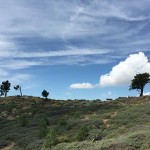
The day before the Angeles Crest 100, after checking in for the race in Wrightwood, I drove over to Inspiration Point to have lunch, go for a short hike, and enjoy being in the mountains. The day was exceptional.
Lightning Ridge skyline and clouds
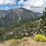
Pine Mountain and Mt. Baldy from Lightning Ridge
Blue Ridge, Pine Mountain and Mt. Baldy from Lightning Ridge
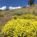
Sulphur flower
Mt. Baden-Powell from Lightning Ridge
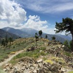
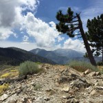
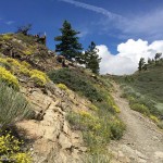
PCT near Inspiration Point
Sulphur flower along PCT near Inspiration Point
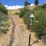
PCT marker at Inspiration Point
Click an image for more info and to display the image full-size.