Category Archives: trails|san gabriels

The Kenyon Devore Trail and Mt. Disappointment 50K

Strayns Canyon from the Kenyon Devore Trail in Angeles National Forest

Note: The Mt. Disappointment Endurance Run is now the Angeles National Forest Trail Race.

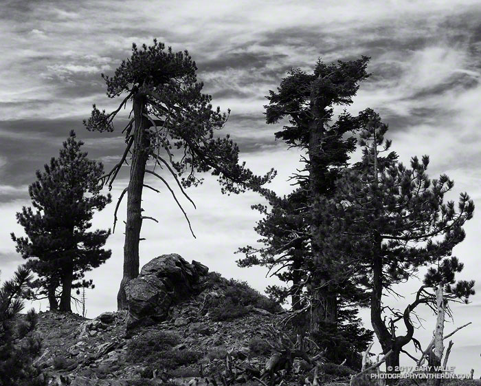
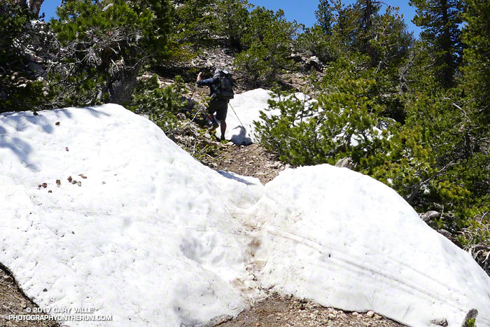
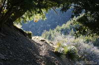
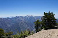
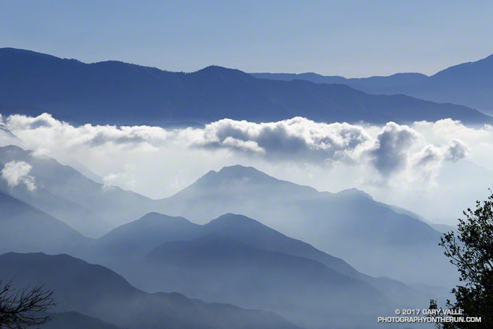
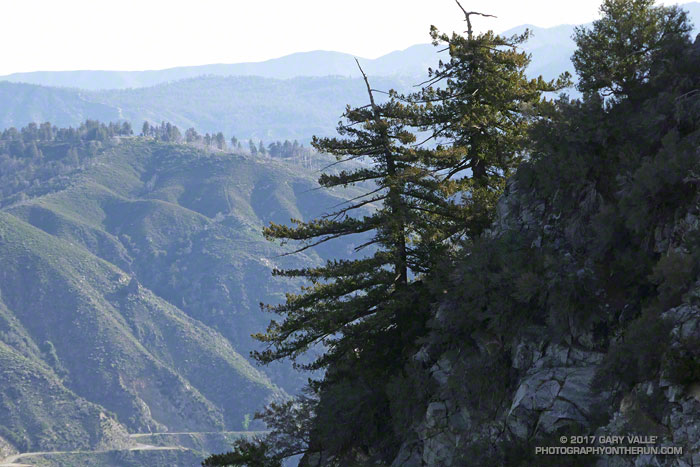
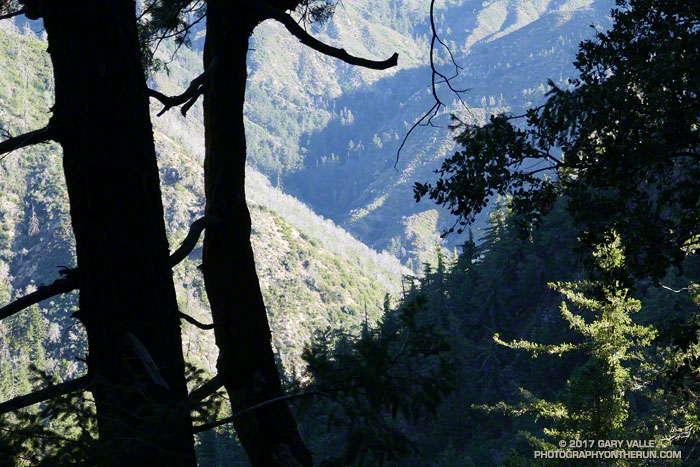
The photograph above was taken a little more than a mile from the top of the Kenyon Devore Trail, in the San Gabriel Mountains, near Mt. Wilson. The deep canyon seen through the trees is Strayns Canyon, which the trail follows on its way from the West Fork San Gabriel River to the shoulder of Mt. Wilson.

Bright green Bigcone Douglas fir cones
Bigcone Douglas fir

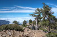
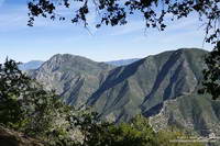
Today, I’d run down the Kenyon Devore and Gabrieleno Trails to West Fork and then up the Red Box – Rincon Road to point on the map marked Camp Ah-DA-Hi. (A former Woodcraft Rangers Camp.) With hot weather forecast next Saturday for the Mt. Disappointment 50K, I’d been glad to see the small streams that had been dry during the drought were running again.

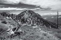
Trails have stories to tell and when I run or hike a trail I’m always curious about its history. A trail between the West Fork San Gabriel River and Mt. Wilson is shown in the 1:62500 1897 edition of the USGS 1894 Los Angeles Sheet. Like many trails of the era, it followed a ridge, in this case a ridge just east of Strayns Canyon.

Antennae on Mt. Wilson at the top of the Kenyon Devore Trail.

The first USGS map to show a trail along Strayns Creek was the 1:24000 1934 Mt. Wilson Advance Sheet. The trail remained unnamed in USGS maps until the 1966 edition of the 1:24000 Mt. Wilson Quadrangle, when it was labeled the Rattlesnake Trail. The trail was renamed the Kenyon Devore Trail in the 1995 edition of the map in tribute to Forest Service patrolman, hydrographer, and Angeles National Forest volunteer, Kenyon DeVore.

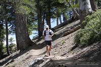
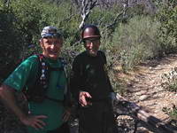
The Kenyon Devore Trail is part of the Mt. Disappointment 50K course. It is one of several trails maintained by runner-volunteers under the guidance of Forest Service volunteer and Mt. Disappointment Race Director, Gary Hilliard. Today, as I was on my way back up to Mt. Wilson, I ran into Gary and two volunteers cutting logs from the trail in preparation for next Saturday’s event.

Gary Valle and Gary Hilliard on the lower Kenyon Devore Trail.
Gary and the Other Gary on the lower Kenyon Devore Trail.

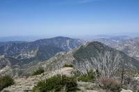
The grueling 5 mile, 2650′ climb from West Fork to Mt. Wilson on the Gabrieleno & Kenyon Devore Trails comes at about mile 26.5 of the 50K and is the highlight of the run.

I have to laugh about what happened on the Kenyon Devore climb one hot year. I’d jammed my Camelbak(TM) with so much ice at the West Fork aid station that when water was added, it melded and froze into one large chunk. I didn’t discover this until about halfway up the climb, when I ran out of water. You can’t drink a chunk of ice and even at 90 degrees, the ice was melting at an agonizingly slow rate. At best I could only get a minuscule sip of water from the pack every few minutes, and it nearly imploded from my efforts.

Some related posts: Mt. Disappointment 50K Returns!, Mt. Disappointment 50K 2012 Notes

Along the Crest

Trees and clouds along the crest of the San Gabriel Mountains. Photography by Gary Valle.

I rounded the corner, driving from deep shade into the golden glare of the rising sun. There was almost no traffic on Angeles Crest Highway. Up ahead, in the shade of some trees, there was something in the road. Was it a rock or a pine cone? Driving into the sun it was hard to tell. At this time of the morning — before the CalTrans truck has swept the road — one small rock can ruin your whole day. Getting to the trailhead unscathed is always the first challenge of the day.

Middle Hawkins from the Pacific Crest Trail. Photography by Gary Valle.
Middle Hawkins from the Pacific Crest Trail.

Today, Craig and I were planning to do a point to point run from Inspiration Point to Islip Saddle — one of the best stretches of trail in the San Gabriel Mountains.

PCTA volunteer Ray Drasher often takes care of clearing the trees from this section of the Pacific Crest Trail. It’s quite an undertaking to get the required stock and equipment to the trailhead and then cut trees spread over several miles of trail. Because of conflicting reports, Ray wasn’t sure whether there were trees still on the trail or not. We’d let him know after the run.

On the drive up you could see it was going to be a spectacular day in the Angeles high country. A low pressure trough moving through central California had pulled in the marine layer and a tumultuous ocean of cloud reached from the south-facing canyons far out over the Pacific.

Trail runner descending the PCT near Mt. Burnham.
Craig descending the PCT near Mt. Burnham.

I drove through the double tunnels at Mt. Williamson and then around a left-hand curve. Up ahead I could see the northwest ridge of Mt. Islip dropping down to Islip Saddle. What the heck? Orange cones? The gate is closed? The HIGHWAY is closed? That didn’t make sense; the Winter closure had ended weeks before.

After parking, I talked to a hiker who said it was closed for “road work.” I assumed there must have been a rock slide in one of the problematic areas between Islip Saddle and Vincent Gap. Later I learned the problem was a “sink hole” west of the Grassy Hollow Visitor Center.

After Craig arrived we discussed route options to Mt. Baden-Powell. Either we did the South Fork loop, which I’d done a couple weeks before, or we did an out and back on the PCT. We opted for the out and back.

Weather-beaten limber pine near the summit of Mt. Baden-Powell. Photography by Gary Valle.
Weather-beaten limber pine near the summit of Mt. Baden-Powell.

The run was as spectacular as expected. The visibility above the deck of stratus was at least 100 miles. San Bernardino Peak, San Gorgonio Mountain and San Jacinto were easy marks to the east and Owens Peak and the Southern Sierra could be seen to the north. Before it was immersed in a tide of cloud, the summit of Santiago Peak (Saddleback) had been visible to the south. High clouds and a gusty westerly wind kept the temperatures moderate. Only one very small patch of snow remained on the trail.

I’d hoped to be able to tell Ray the trees had been cleared from the trail, but no — they were still there. He said the next time I ran there, they would be gone. Thanks Ray!

Say Goodbye to the Snow in the San Gabriel Mountains

Patches of snow on the PCT west of Mt. Baden-Powell

Each year around Memorial Day weekend I like to do a run that includes Mt. Baden-Powell (9399′). It’s a good time to check how much snow remains at the higher elevations of the San Gabriel Mountains. In a heavy snow season, such as 2004-2005, higher sections of trail may still be buried in snow and drifts can persist into July. In below average years, such as we experienced from 2013 to 2016, there may be little or no snow.

South Fork Trail below Islip Saddle

There are several good runs that summit Mt. Baden-Powell. If Hwy 2 is still closed between Islip Saddle and Vincent Gap, I’ll usually do an out and back from Islip Saddle to Mt. Baden-Powell. If Hwy 2 is open, then a point to point run from Inspiration Point to Islip Saddle or Eagles Roost is a good option. Today the choice was one of my favorite loops in the San Gabriels. It starts at Islip Saddle, descends to South Fork Campground, then climbs about 5000′ to the summit Mt. Baden-Powell. From Baden-Powell the route follows the Pacific Crest Trail back to Islip Saddle.

Pine Mountain, Dawson Peak and Mt. Baldy from the summit of Mt. Baden-Powell.

This was my third time on the PCT between Islip Saddle and Mt. Baden-Powell this Spring. The first was at the beginning of April and was more of a snow hike than a run. The micro spikes went on at 7000′, less than 0.7 mile from the Islip Saddle trailhead. The second trip was two weeks later, in mid-April. Micro spikes were still helpful in a couple of places and there was still plenty of snow on the north side of the crest. Based on other seasons with a similar amount of snow, I thought some patches of snow might last into June, or even early July. Today (May 27) only a few patches remain on Baden-Powell and along the crest, and these will soon be gone.

Manzanita Trail between South Fork Campground and Vincent Gap

Except for being a little disappointed there wasn’t more snow, the run went well. The South Fork Trail was rocky and rough — as usual. The Manzanita Trail, which connects South Fork Campground to Vincent Gap, has seen a lot of work in recent years and is in relatively good shape. Even the gnats weren’t bad. I saw no one on the South Fork and Manzanita Trails. As might be expected on a Saturday on Memorial Day Weekend, there were “a few” hikers, thru-hikers and runners on the PCT.

The South Fork Trail is part of a long and little-used “official” PCT detour around the mountain yellow-legged frog closure at Eagles Roost. Based on the number of thru-hikers I see on Hwy 2, most opt to hike the 2.7 road miles between Eagles Roost and Buckhorn Campground and then descend the Burkhart Trail to the PCT. It’s been more than 11 years since the initial “temporary” closure of the Williamson Rock area in December 2005. Hopefully it won’t be too many more years before the proposed plan to reopen the PCT and partially reopen Williamson Rock is completed.

Misplaced on Mt. Wilson

View from the Rim Trail on Mt. Wilson

I’d just finished an 18 mile loop from the top of Mt. Wilson and was changing my shoes, when I noticed a group of six hikers walking down the Mt. Wilson loop road toward me. I’d started my run before the Mt. Wilson gate was open and was parked in a turnout near the top of the Kenyon Devore Trail.

Poodle-dog bush along the Rim Trail on Mt. Wilson.

The run over to Newcomb Pass, down to Chantry Flat, and then back up to Wilson had gone well. If you don’t mind a little Poodle-dog bush and a lot of poison oak, the Rim Trail is one of the hidden gems of the San Gabriels. And the Gabrielino Trail’s excursion through the forests and along the creeks of Big Santa Anita Canyon is a classic.

When the group reached me, one of them asked,”We’re looking for the Winter Trail, do you know where that is?” I did know where the Upper Winter Creek Trail was, because I’d just been at the top of it about 45 minutes earlier.

With its maze of antennae, telescopes and other facilities, it’s not uncommon for hikers and runners unfamiliar with the top of Wilson to become temporarily misplaced. The trails are, of course, on maps — including Google Maps — and described in various online and offline resources.

Bigleaf maple along the Gabrielino Trail in Big Santa Anita Canyon.

In this case the hikers didn’t know where they had parked and they didn’t know the route that had taken up the mountain. If you don’t have a clue where you need to go, a map isn’t very useful.

When I described where they needed to go, there were groans all around.

It was midday, the weather was good, it wasn’t hot, they had water and a phone, they would be hiking mostly downhill, and there were plenty of other hikers on the trail. Unless they did something really stoopid, it was just going to be a long day.

Front Range Duo: San Gabriel Peak and Strawberry Peak

Bigcone Douglas-fir on San Gabriel Peak

The two highest peaks in the front range of the San Gabriels, Strawberry Peak (6164′) and San Gabriel Peak (6161′) are about three miles apart as the raven flies and about 6 miles apart by trail. If you don’t mind running/hiking a third of a mile on Mt. Wilson Road, you can do both of them from Red Box as a 12 mile run/hike with a total gain of about 3000′.

Strawberry Peak and Mt. Lawlor from San Gabriel Peak.

Earlier this morning, I’d done San Gabriel Peak. It’s the shorter of the two ascents — from Red Box it’s about 2.4 miles to the summit. While the elevation gain is nearly the same as climbing Strawberry, it is a less strenuous and more straightforward peak. Except for a short stint on the service road below Mt. Disappointment, the grade of the San Gabriel Peak Trail is relatively constant — and the trail goes all the way to the summit.

Josephine Peak (5558') and Mt. Lukens (5074') from the summit of Strawberry Peak.
Josephine Peak and Mt. Lukens from the summit of Strawberry Peak.

The route up Strawberry Peak is distinctly different. The initial 2.5 miles follows the Strawberry Peak Trail to Lawlor Saddle, gaining a moderate 500′ along the way. From there a steep, rough and sometimes rocky use trail ascends 950′ in a little over a mile to Strawberry’s summit.

That’s where I was now — nearly at the end of that brutal mile-long climb. My heart was racing and my legs felt like Jello. Reaching the crest of Strawberry’s final false summit, I jogged across the shoulder of the peak and on uncooperative legs climbed the final few feet to the summit.

To the southeast, San Gabriel Peak and Mt. Disappointment stood across the canyon and further to the east, indistinct in the morning haze was snow-capped Mt. Baldy. To the west, the view extended past Josephine Peak and Mt. Lukins to the San Fernando Valley, Santa Monica Mountains and Santa Susana Mountains.

The southwest side of San Gabriel Peak was burned in the 2009 Station Fire.

Recovery from the devastating 2009 Station Fire continues on both peaks. The amount, extent and size of Poodle-dog bush (Eriodictyon parryi) in the burn area is slowly diminishing. Some plants have died, but there are still viable plants of which to be wary. These plants were on the San Gabriel Peak Trail, above the notch, on the final climb to the summit of the peak. I don’t recall seeing any Poodle-dog bush on the ascent of Strawberry from Red Box, but it is still present on the west side of the peak.

Some related posts: Strawberry Peak, Switzer’s and the Old Colby Trail, Bear Canyon Loop Plus Strawberry Peak, After the Station Fire: Ten Miles – Four Peaks