Category Archives: trails|smmc open space

Upper Las Virgenes Canyon – Cheeseboro Ridge Loop

This weekend I decided to give my legs a break and instead of 9 pounds per foot of ski, binding, boot and climbing skin, treated them each to 13 ounces  of running shoe. I was thinking about it the other day — skiing up San Jacinto with my tele gear is a little like strapping two 5 lb. bags of sugar to each foot, going up to (on average) 9,500 feet, and then climbing 4,000 or so stairs. I either need to get lighter gear, or go back to using my Europa 77s!

Today’s run was an elongated loop through one of the more isolated and rustic areas of upper Las Virgenes Canyon. From the Las Virgenes trailhead of Upper Las Virgenes Canyon Open Space Preserve the 14.5 mile route followed upper Las Virgenes Canyon and Bell Canyon roads to the overgrown (and easy-to-miss) single track that leads to the west and connects to the Edison powerline service road. This Park Service PDF includes a map of the area, and this interactive Cesium browser View shows a trace of my route.

After climbing up and over a rocky ridge and down to the junction with the Sheep Corral Trail, the service road continues south along Cheeseboro Ridge all the way back to the Las Virgenes Canyon trailhead. With all the rain, and recent warm weather, Spring was happening in a big way in the chaparral. Over the course of the run I photographed nearly 40 species of plants that were in bloom. Here are a few of the wildflowers:


Chia


California Buckwheat


Chinese Houses
               
Paintbrush


Deerweed


Yerba Santa


Related post: Upper Las Virgenes Canyon Backcountry

Looking for Snow in the Santa Monica Mountains

View from Sandstone Peak, the highest point in the Santa Monica Mountains

Perhaps the only thing more difficult than forecasting rain in Los Angeles is forecasting snow in Los Angeles. A NWS Winter Weather Advisory issued Friday evening for the Santa Monica Mountains Recreation Area forecast the snow level to drop overnight from above 3000′ to between 1000′ and 1500′. Snow accumulations from 1 to 3 inches were expected.

When getting ready for a run on those searing 100 degree days at Ahmanson Ranch, I look longingly at the Lasky Mesa snow photos from 1943 displayed in the information kiosk at the Victory Trailhead. Would that rare snow scene be repeated? If so, I wanted to see it. I’m a skier from way back, but snow in the hills near my Los Angeles area home is an altogether different thing.

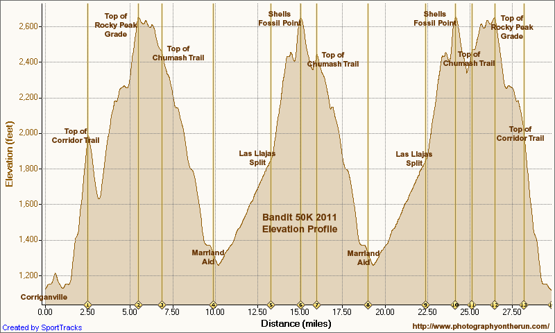
Last weekend it looked like we might get some snow on the higher parts of Rocky Peak Road for the Bandit 15K/30K/50K trail runs. There was some snow on Oat Mountain, but not down to Rocky Peak. The Rocky Peak area is about 500′-1000′ higher than Lasky Mesa, so snow there isn’t quite as rare. The last time I ran in the snow on Rocky Peak Road was in December 2008, and before that in March 2006.


Snow is an iffy thing in the Los Angeles area. The ocean is the dominant moderating influence. Storms generally bring in air warmed by the ocean, and the coldest air often doesn’t move in until after most of the precipitation has ended. To get low elevation snow, the timing and conditions have to be just so. Whether it snowed or not, it looked like it would be an interesting weather day, so I planned to get up early and do a morning run.

At dawn the lack of snow on the local foothills made it plainly evident that all the ingredients required for very low elevation snow had not come together.  Overnight there had plenty of snow — four feet of it at 7500′ at Mt. Baldy — just not much low elevation snow. (Later in the day post frontal convection would produce some isolated showers of icy snow in the east San Fernando Valley and La Crescenta.)

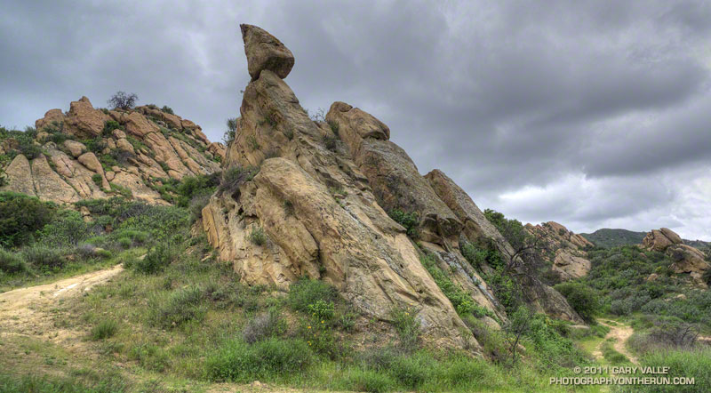
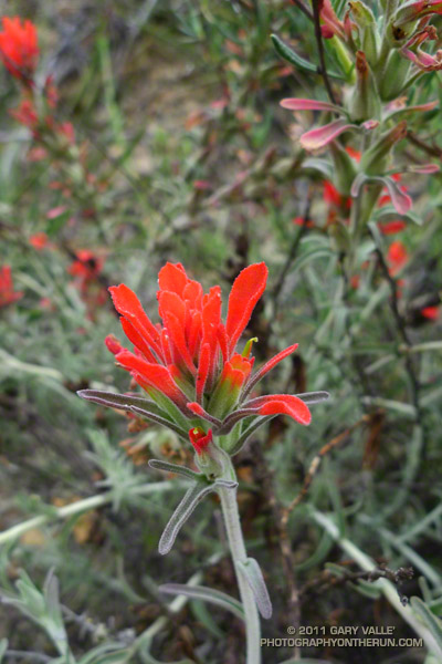
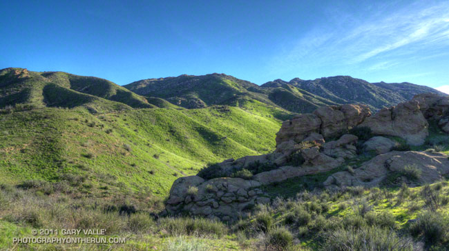
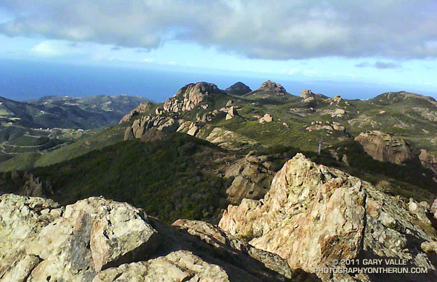
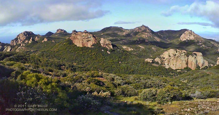
On the off chance there had been a dusting of snow at the higher elevations of the Santa Monica Mountains, I decided to do the Mishe Mokwa – Backbone Trail loop and check out the conditions on 3111′ Sandstone Peak, the highest peak in the range.


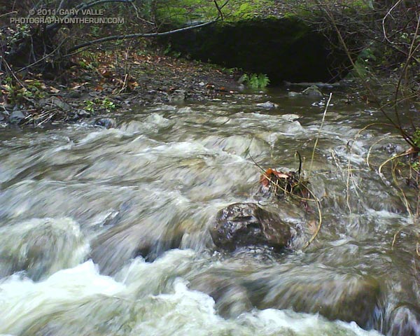
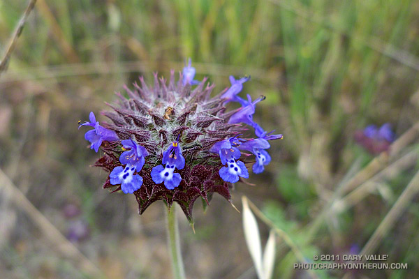
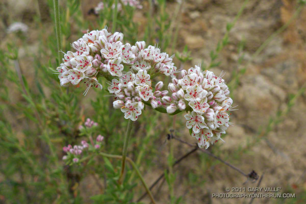
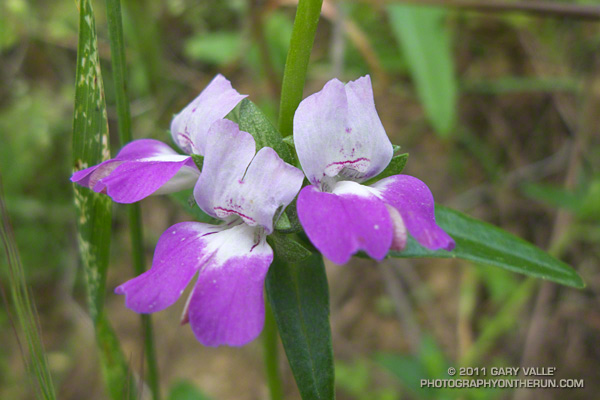
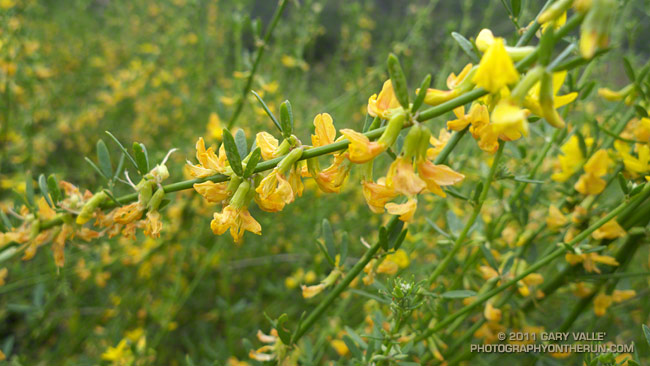
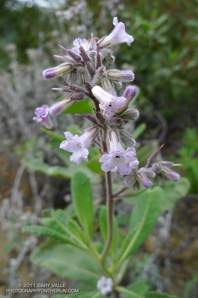
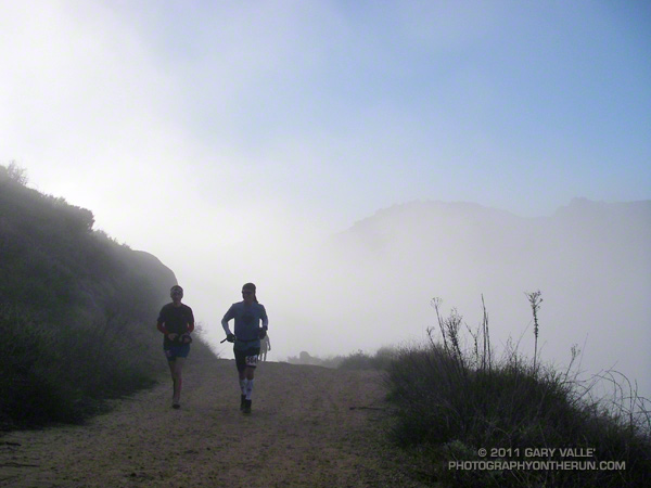
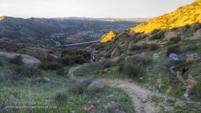
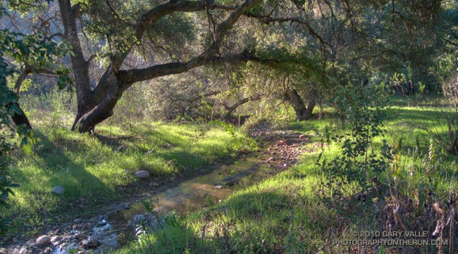
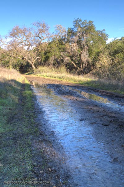
What a great morning for a trail run! When I started the loop, it was partly cloudy and the temperature at the Mishe Mokwa trailhead (el. about 2100′) was a chilly 37 degrees. The ground was soaked, and the chaparral wet with rain. Streams filled every gulch and gully, and the gorge along Echo Cliffs roared with runoff. Level sections of the Mishe Mokwa Trail were nearly one continuous puddle. Two creek crossings — one at Split Rock and another near the Backbone Trail — were wide enough to require wading.

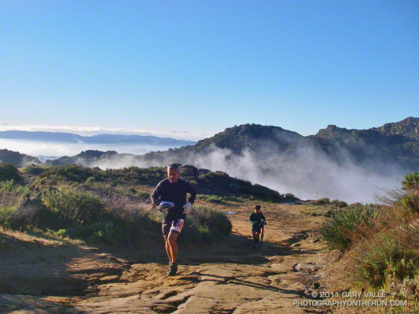
Running the rocky trail with care, it took a little under an hour to reach the Backbone Trail junction. As I puffed up the trail toward Sandstone Peak, each exhalation was visible. I found myself reveling in each frosty cloud, as it would hang briefly in the morning sun, and then dissipate.

Although I could see no snow, it was cold enough that I thought there was a chance there might be some residual snow in the shade on the northwest side of the peak. Rounding the corner, I started up the makeshift stairs at the beginning of the spur tail leading to the summit. On top it was cold, windy, wet and spectacular, but — sigh — there was no snow.

Note: The rain from this storm pushed the water year rainfall total for Downtown Los Angeles to above the 100% mark. Although this might seem unusual in a La Nina influenced rain season, during two of the strongest La Ninas in the past 60 years — 1955-56 and 1973-74 — Los Angeles recorded 99% and 106% of normal rainfall.

Bandit 50K 2011 Notes

50K runners climbing up Rocky Peak road.

50K Runners Returning from the Rocky Peak Trailhead

Cool temps, clearing skies, and snowy vistas greeted runners doing the 2011 edition of the Bandit trail races at Corriganville Park in Simi Valley, California.

If you’re going to have a trail race after a rainstorm, Rocky Peak is the place to do it. Rain gauges in the area recorded as much as two inches of rain in the 48 hours leading up to the race, and for a while it looked like there might be a dusting of snow on the highest points of the course. Except for a couple of short muddy sections, and having to dodge a few mud puddles, the dirt roads and trails were in good shape.

This year the race was expanded to include a 50K. This new option doubled the fun on the Chumash-Las Llajas loop of the 30K course, running the loop twice, and also took a short sightseeing trip down to the Rocky Peak trailhead at Santa Susana Pass. The 30K course was the same as last year, but the 15K course was shortened from last year’s 16K or so to 15K.


The 50K course is a tough one, including about 7 miles of technical single track trail, 22 miles of fire road, and a mile of paved road. The elevation gain/loss is about 5400′, which is a little more than the Bulldog 50K course, and a little less than the original Mt. Disappointment 50K course. Here’s an elevation profile of the Bandit 50K course.

There are several difficult stretches on the 50K course. Just a mile into the race runners have to deal with a very steep climb — an 800 foot ascent in just one mile. In my mind it’s the most important mile on the course, and how hard you push here can have a big effect on how you feel over the next 28 miles! There are a couple of other long climbs. The 2.3 mile climb from the Rocky Peak trailhead to the top of the Rocky Peak grade gains over 1000′, and the gain over the 1.75 miles from the Las Llajas split to the highpoint at Shells/Fossil Point is 800′. Runners doing the 50K get to do the Las Llajas to Shells climb twice.


One of the toughest sections for me was the run up Las Llajas Canyon on the second Chumash-Las Llajas loop. This section starts at about mile 19 and ends at the Las Llajas split, where the road forks right and up through the oil fields. For the most part the grade is not steep, but the miles are deceptively long and grueling. Also tough on tired legs is the very technical plunge back down to Corriganville at the end of the race.

Congrats to 50K winners Chris Price and Nancy Ishizawa. Clearly enjoying the day, Chris flew through course in a remarkable time of 4:12:51, averaging 8:28 minute miles. In the 30K Marcelo Mejia set a new course record with a blazing time of 2:52:31. On a slightly shorter course than last year, Fernando Ramirez and Jen Todd put down fast 15K times. For all the results and race photos, see the Bandit web site.

All in all it was fantastic day for a run! Many thanks to the race organizers — Randy & Sarita Shoemaker, Larry Lee, and Todd Baker — and all the volunteers and sponsors for an outstanding event!

Here are a few additional photos. Click for a larger image and description:


Start of 800′ Corriganville Climb


Running Up from Rocky Peak Trailhead


Snow on Ventura Mountains


15K Runner Headed Back


Descending Chumash


Casey’s Water Cache

Chumash Trail Green

Chumash Trail in Simi Valley

It’s now been 17 days since there’s been measurable rain at Downtown Los Angeles (USC). A trace of rain was recorded on a couple of days, but for the time being a big blocking ridge has shut the door on Pacific precipitation.

So far this January, only 0.58 of rain has been recorded, which is a little less than one-third of normal for the month. However, because of our frequent December storms the water year total at Los Angeles is currently about double the normal amount — and why open space areas of Southern California have turned so lush and green.

Bandit Training

Top of the Wildlife Corridor Trail

What a difference 5 days makes! In the cold morning shadows before the start of the Boney Mountain race last Sunday, the dew on the fences was frozen and frost was everywhere. This morning in Corriganville Park the temperature was a balmy 65 or so, and the high was expected to be around eighty.

Today I was running the Bandit 30K course as part of a training run organized by Bandit 15K/30K/50K R.D. Randy Shoemaker. Good thing too. Even though these are my backyard trails, it reminded me just how tough these courses are. The numbers — about 3300 ft. of gain/loss over 19.5 miles for the 30K — don’t tell the whole story.


The title photograph is of runners at the top of the Wildlife Corridor Trail. This gnarly trail links Corriganville Park to Rocky Peak Road, and it is just one of the special treats you’ll encounter on the 15K, 30K and 50K courses. I don’t know if it tougher going up, when your legs are fresh; or going down, when your legs are worked. From personal experience I know it is really easy to push too hard on this climb, and mutter to yourself, “Why did I do that?” for the remainder of the race.

Today, the conditions could not have been better. Well, if we’re going to nitpick, maybe a little less wind. But who can complain on a January day when skies are blue, the hills are green, and the temperature is in the seventies?

Las Virgenes Creek Near the Sheep Corral Trail

Upper Las Virgenes Creek

At the start of my run East Las Virgenes Canyon was deep in shadow, and it was cold, cold, cold. At least by Southern California standards. But it would be warm enough, soon enough, and being a little chilly now would make the sun feel even better when I escaped from the canyon. The good news was the temperature was near freezing, and the muddy sections of dirt road in the canyon were mostly frozen.

I was doing a run I often do before a race, or when I want to back off the distance and elevation gain a bit — a 13 mile route from the Victory trailhead at Ahmanson Ranch, through Cheeseboro Canyon. The route starts the same as the run to Simi Peak, but when you get to Shepherds Flat, you turn left (south) down Cheeseboro Canyon.


Picking up the pace to try and generate some warmth, it took about 30 minutes to get to Las Virgenes Canyon. In another 15 minutes or so, I had forked left off the dirt road onto the Sheep Corral Trail. This singletrack trail meanders through live oaks along upper Las Virgenes Creek before working up and over to Shepherds Flat.

For the first time in several years, this part of Las Virgenes Creek was flowing. The last time it had more than puddles of water was during the record setting El Nino rain season of 2004-2005. That year Downtown Los Angeles recorded more than twice it’s normal amount of rainfall.

At the six mile point I reached the junction at Shepherds Flat and turned onto the Sulfur Springs Trail. With the exception of one very wet section, Cheeseboro Canyon was mostly in good shape. There was still some ice on the mud puddles in the lower part of the canyon.

Keeping my shoes mostly dry and mud free had become kind of a game, but a game I was destined to lose. When mud thaws it becomes incredibly sticky, and that happened on the connector that links Cheeseboro Canyon to Las Virgenes Canyon. It was like running in 5 lb. Hokas.

The worst of the unavoidable mud ended at Las Virgenes Canyon, and after another 30 minutes or so of dodging mud puddles, I was back at the Victory trailhead. It was a fun run and a great way to start the New Year.