Category Archives: trails|smmc open space

Ladyface Loop

Small crag east of the summit of Ladyface.

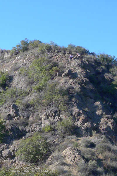
Like many good peaks that are mostly “walkups,” the ascent of Ladyface requires a bit of scrambling. By that I mean some use of the hands is required. And some care. Some of the rock is sound, and some of it isn’t. A few short sections on the frequently used east/southeast ridge are very loose and manky.

I like to do the 2.5 mile loop counterclockwise — ascending the northeast ridge, and descending the east/southeast ridge. The route generally follows the ridges, but the route-finding can be quirky in places.

Ladyface summit
Ladyface summit

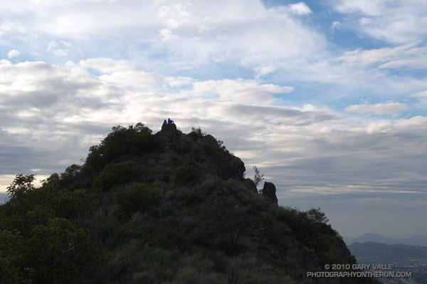
The path up the northeast ridge doesn’t appear to be as popular as the east/southeast ridge route, but is cleaner overall. Sections of the northeast ridge are brushy, but no significant bushwhacking is required — if you stay on route. The northeast ridge ends a couple hundred feet below the top of the peak. A zig-zag path up the steep north face winds its way through knobby volcanic rocks to the summit.

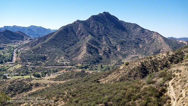
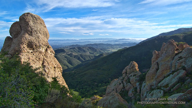
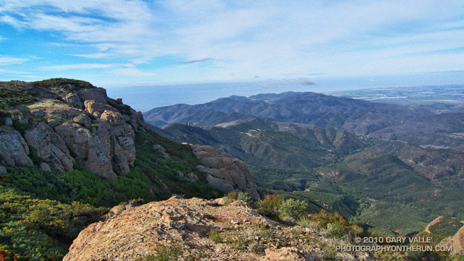
The volcanic rocks on Ladyface include several components of the Conejo Volcanic Suite, and tell a story of volcanism associated with plate subduction, rifting, and continent-building.

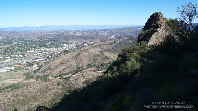
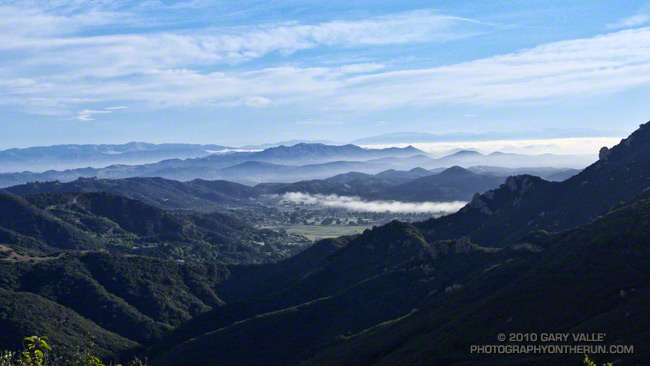
If you don’t pay too much attention to the cars zooming along the 101 Frwy a thousand feet below, the Ladyface loop in Agoura Hills is one of the more scenic and interesting short hikes/climbs in Southern California.

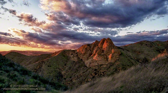
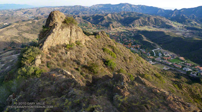
The title photo is of a subsidiary crag, east of the summit of Ladyface. In the background is Saddle Peak, Malibu Creek State Park and Brent’s Mountain.

Related post: Ladyface the Long Way

Cranking Up Las Llajas

Connector from Las Llajas Canyon to Rocky Peak Rd.

Ran a variation of the Chumash-Las Llajas loop this morning. One of the reasons for the run was to check out one of the larger vernal ponds in the Rocky Peak area and see if it had water. It didn’t.

Another reason is the loop is part of the grueling Bandit 30K/50K course, and the February 20th race date will be here before we know it.

The hill the MTBers are cranking up covers about miles 12 to 13 on the Bandit 30K course, and follows a gradual — but long — uphill in Las Lajas Canyon that gains 600′ of elevation over 3 miles. It’s just one of the fun parts of a tough 30K course, and 50Kers get to do it twice!

Some related posts: Bandit 30K Course Preview, Running Rocky Peak Road, Bandit 30K 2009, Bandit Country

Simi Valley Open Space

View northwest from Rocky Peak road in Rocky Peak Park.

The view is northwest from Rocky Peak road in Rocky Peak Park. In the distance is Marr Ranch Open Space, Tapo Canyon Regional Park, and Whiteface Open Space. The Ventura Mountains are shrouded in clouds.

From today’s out and back run from Chatsworth Oaks Park, near Chatsworth Reservoir, to “fossil point” on Rocky Peak road.

Waiting for the Sun

Chumash Rocks Sunset

The temperature was in the low fifties, but with a 20 mph wind it was cold. I had just run up the Chumash trail, and was on my way down. The sun was nearing the horizon and hidden by a band of clouds. It had been like that since I topped out at Rocky Peak road. I hoped by the time I reached a vantage point of Chumash Rocks the setting sun would break underneath the clouds and illuminate the formation.

Nope. When I reached the viewpoint, the rocks were still in shadow. And the wind was even stronger. Squeezed between two hills, it rushed through the little col in cold, turbulent gusts. Buffeted by the wind, and chilled to the bone, I waited for the sun.

And waited. It was too cold to just stand there. I took a few photos, but the sun and clouds were not cooperating. At some point, minutes away, the sun would set, and that would be that. The photo just wasn’t going to happen. I returned to the trail and began to run down the hill.

In the lee of the hills the wind lessened, and it was not so cold. It was still a few minutes before sunset, and as I rounded a corner I could see a bright glow at the edge of the clouds.

I was several hundred yards down the trail when the first hint of sunlight appeared on a distant hill. It was veiled and muted, but it was sun. Maybe there was time. I turned and hurried back up the trail.

Ladyface the Long Way

Ladyface from Heartbreak Ridge

I wasn’t familiar with the routes on Ladyface, and wasn’t certain I could get to the peak directly from the Heartbreak Ridge trail. But that’s part of the fun of an adventure run. I had a general idea of what I wanted to do — an out and back from the Phantom trailhead in Malibu Creek State Park to the top of Ladyface. And I had an idea of the time available to do it — about four hours. The details would sort themselves out along the way.

Or at least that was the theory. It was now three in the afternoon, and I was one hour and 56 minutes into sorting out those details. Theoretically, I was supposed to be on the summit of Ladyface in about four minutes.

View from Ladyface to Heartbreak Ridge and Ventura Frwy.

Earlier, I had run out of trail descending Heartbreak Ridge, and had used a network of coyote paths to get down to Cornell & Kanan roads. But then I chosen the wrong “trail” to start the climb of the peak.

For sure the route would follow one of the prominent ridges on the east side of the mountain. Since the descent of Heartbreak Ridge left me on the northeast side of the peak I had looked for a route there. One car was parked at the start of a dirt road, and a street vendor had indicated he’d seen people start the climb there. My thought was that maybe an established trail would work up the canyon and onto the northeast ridge.

Wrong Charlie Brown! The trail, which (ha!) turned out to be a freeride course, was a dead end. Following it burned about 10 minutes and a good chunk of elevation gain. I ran down and jumped up onto the northeast ridge, where I found a use trail.

Hikers descending the east/southeast ridge of Ladyface

Low on the ridge it looked like this trail might go to a subsidiary peak and not the true summit of Ladyface. Whatever it did, I was now short on time, and committed to this approach. I would follow it until either I ran out of time, or reached a summit.

The face was deep in shadow and wet from Friday night’s rain. Still a couple hundred vertical feet below its top, I zig-zagged up through the steep outcrops of Conejo volcanic rock. It wasn’t how I had pictured the trail on Ladyface, and I hadn’t expected to be climbing on wet, mossy holds for the second weekend in a row.

Two hours and 3 minutes into the adventure I scrambled onto the summit. A surprised hiker asked, “Where did you come from?” I explained, and he commented, “I’ve never climbed Ladyface that way.”

I jogged down the well-used, but somewhat manky trail on the east/southeast ridge, followed Kanan back to Cornell Rd., climbed back up Heartbreak Ridge, and made it back to the car a couple of minutes after five o’clock.

Boney Mountain Morning

Crags on Boney Mountain's western ridge.

The face was not steep, but I was glad the pockmarked volcanic rock had big holds. Rainwater filled some of the pockets, and patches of lichen and moss on the face were saturated and slippery. It wasn’t a runout climb at the Needles or Tuolumne Meadows, but gravity still worked the same way. I reminded myself not to do something “stoopid.”


At the top of the face I looked around and sighed, and then looked around and sighed again. It was another stunning morning on the western ridge of Boney Mountain. To the west a nearly full moon struggled to remain above the hills, its brightness veiled in a mix of clouds. Another storm was expected in the evening, and the sky told of its approach. Broad strokes of cirrus brushed the blue above, and here and there fingers of tattered stratus reached into the coastal canyons and clung to the wet hillsides.

Today’s forecast for the Santa Monica National Recreation Area had called for mostly cloudy skies, and a high in the 60s. At the moment it was mostly sunny, but already there were hints of clouds developing on the ridges and mountaintops. At some point in the day the clouds would envelop the mountains, and transform the morning’s expansive vistas into a dimensionless gray. I hoped to get up the ridge, over Tri-Peaks, and to Sandstone Peak before that happened.


By chance the clouds behaved, and the splendid views and weather continued all the way to Sandstone Peak, and beyond. The run back to the Wendy Drive trailhead on the Backbone, Sycamore Canyon, and Upper Sycamore trails could not have been better.

As I climbed the final little hill to the parking area I noticed I had no shadow. Over the course of the afternoon the cloud deck would continue to lower and thicken, and by evening light rain would begin across the area.

Some related posts: Clouds and Crags, Conejo Valley Sun and Boney Mountain Clouds, Sandstone Peak from Wendy Drive