Category Archives: weather

Fox Mountain Frost

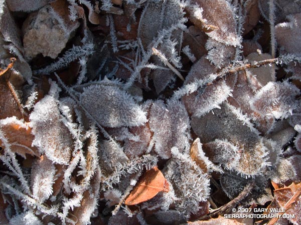
Hollow columnar hoarfrost deposited on leaves and twigs on Fox Mountain in the San Gabriel Mountains, near Los Angeles.

When I see crystals of hoar frost sparkle in the Winter sun it triggers a child-like awe. On Sunday’s Condor Peak Trail Run, several sections of trail glittered as we ran into a low morning sun. On the cold east face of Fox Mountain, a fine, needle-like frost coated the edges and surfaces of leaves and twigs that had collected in pockets on the steep slope.

Digitally magnifying a small section of a 10 Mp image revealed that the frost is comprised of  hollow columns, and further magnification shows that the columns are hexagonal, with lengthwise facets.

This type  of frost – hollow columnar hoarfrost – is described in STUDIES OF FROST AND ICE CRYSTALS by W.A. Bentley, in the Monthly Weather Review, Volume 35, Issue 9 (September 1907), pp. 397-403. Here is an excerpt:

“When formed in the open, they are essentially mild-weather types. They are most common to early autumn and late spring, and the hoarfrost that collects upon the plants and grasses during the so-called destructive frosts at those dates is almost invariably of this type. Hoarfrost deposits of this character form in the open during calm, clear nights when the surface air temperatures range from 56 degrees to 40 degrees at nightfall, and from 33 degrees to 25 degrees during the latter part of the night or early morning.”

Here is a graph of weather data recorded by the Mill Creek (ANF) RAWS on December 1 and December 2. The elevation of the station is 3510′ and it is about 8.5 miles from Fox Mountain (5033′). Parameters graphed are the hourly average wind speed, air temperature, fuel temperature, relative humidity, and dew point.

At Mill Creek the fuel temperature dropped below the frost point at 10:00 p.m Saturday, and did not exceed the frost point again until 8:00 a.m Sunday. For a 5 hour period from 2:00 a.m. to 7:00 a.m. the mean air temperature was 30°F-31°F and the fuel temperature was 22°F-23°F — suggesting strong radiative cooling. Similar conditions probably produced the frost on Fox Mountain.

Racing the Sun

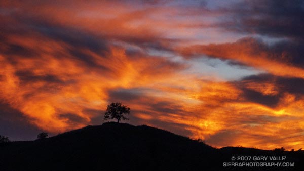
Sunset at Ahmanson Ranch.

Racing the sun,
Waiting for rain,
Listening to a meadowlark sing.

From a run at Ahmanson Ranch — now Upper Las Virgenes Canyon Open Space Preserve. Here’s a larger view of the full 16:9 frame.

For an update on this Winter’s austere outlook for rain, see my November 29 Weathernotes.

Southern California 2007-2008 Winter Precipitation Outlook

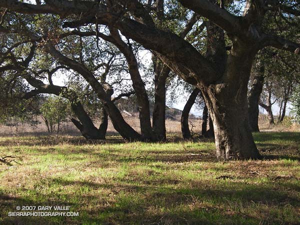
New grass sprouting amid oaks at Sage Ranch on October 1, 2007

Updated January 10, 2008. The ESRL-PSD Composite ENSO plots page was updated today to correct an issue that resulted in the wrong set of years being used for its Winter La Nina composites. As a result the La Nina composite precipitation map in this post has been updated.

Grasses sprouting as a result of our record setting September rainstorm have brushed our sun parched hills, fields, and woodlands with pleasing hints of green. Whether these areas will remain green depends on how much rain we receive this Fall and Winter.

According to the Climate Prediction Center’s Weekly ENSO Update, issued October 1, La Niña conditions are present across the tropical Pacific and are likely to persist through early 2008. As a result, several longer range U.S. precipitation outlooks are similar to this Nov-Dec-Jan Precipitation Outlook, issued September 20 by the CPC.

The precipitation pattern projected for the western U.S. is typical of a La Niña, with an increased chance of higher than normal precipitation in the Pacific northwest and an increased chance of lower than normal precipitation in the southwest.

The September 20 CPC outlook indicates an “equal chance” of below normal, near normal, or above normal precipitation in the Los Angeles area. However, the La Niña has strengthened recently, so the next precipitation outlook may reflect a more pessimistic projection of Los Angeles area rainfall.

As mentioned above, the ESRL-PSD Composite ENSO plots page was updated today to correct an issue that resulted in the wrong set of years being used for its Winter La Nina composites. This updated precipitation map shows the mean Nov-Mar precipitation for the U.S. during 9 La Niña events from 1948 to the present. Note that the average La Niña rainfall indicated for coastal Southern California is in the 7.0-10.5 inch range, rather than the  10-15 inch range previously indicated in the ESRL-PSD graphic.

The two driest water years recorded in Los Angeles since 1877 have occurred in the last seven years. During the most recent, from Jul 2006 to June 2007, downtown Los Angeles (USC) measured only 3.21 inches of rain. In that context 10-15 inches sounds quite wet! We’ll see.

The photograph of new grass sprouting amid oaks is from a run at Sage Ranch on October 1, 2007.

September Storm

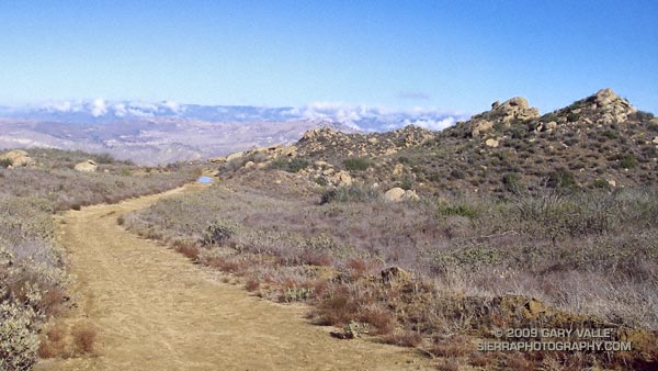
Rocky Peak road 

Los Angeles sometimes gets rain in September, but usually it is the result of tropical moisture from a dissipating hurricane, or perhaps the passage of the tail end of a weakening front. It is rare to see a low as cold, deep and energetic as the upper level low that deluged many areas of Los Angeles county Friday afternoon into Saturday.

Thunderstorms raked the San Fernando Valley Friday night, and several locations in and around the Valley recorded more than an inch of rain over the course of the storm. Los Angeles set a new rainfall record on Saturday, recording 0.40 inch of rain, and rainfall records were broken across the area.

In Southern California the first rain of the season often doesn’t occur until October or November and is always savored. Especially this year, when Los Angeles has recorded only 3.21 inches of rain in the last 15 or 16 months, and a developing La Nina threatens to put the kibosh on Winter rain.

I celebrated the rain by doing an out and back run to “Fossil Point” on Rocky Peak fire road. Based on the size of the mud puddles on the dirt road, this unseasonable storm appeared to be wetter than any in last year’s record dry rain season. Here’s a panorama of the view northwest from the fire road to Oak Ridge, the Santa Susana Mountains and beyond.

Some related posts: San Fernando Valley from Rocky Peak, Rainy Morning on Rocky Peak Road.

Department of Coyote Comportment

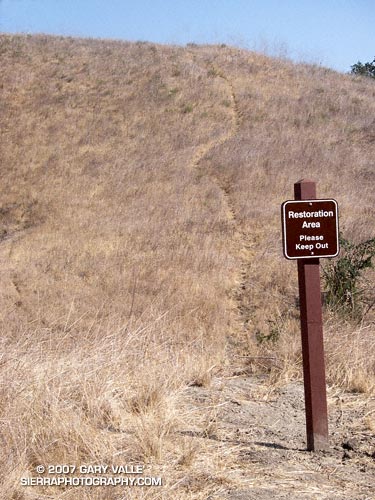
Coyote path at Ahmanson Ranch.

With little new growth this Spring and Summer, coyote paths at Ahmanson Ranch have become so well worn that several have recently been posted with “Restoration Area – Please Keep Out” signs. Whether the canny coyotes will choose to cooperate remains to be seen.

Note: Ahmanson Ranch was acquired as open space in part to protect several sensitive species and their habitats. Some (human) use trails have evolved and “Restoration Area – Please Keep Out” signs are a reminder that the area is a preserve.

From a recent run at Upper Las Virgenes Canyon Open Space Preserve (formerly Ahmanson Ranch).

Related post: Trickster

Snowless San Gabriels

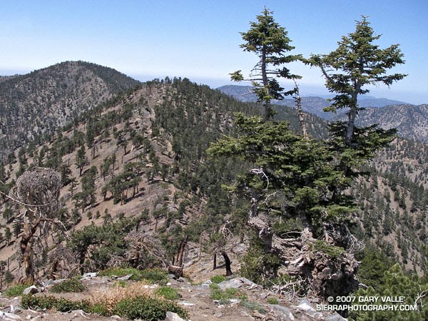
Ridge between Mt. Baden-Powell and Mt. Burnham in the San Gabriel Mountains. 
Ridge between Mt. Baden-Powell and Mt. Burnham

Standing on the summit of Mt. Baden-Powell (9399′), I squinted through the haze at Mt. Baldy (10,064′). Nope, no snow.

It’s not often that the highest elevations of the San Gabriel Mountains are snowless on Memorial Day weekend. If nowhere else, there will usually be a patch of white on the north side of Mt. Baldy. Two years ago there were 10-15 ft. drifts on Baden-Powell that persisted into July. Not this year.

This year, usually dependable water sources might not make it through the Summer. On the way to Baden-Powell I  stopped at Little Jimmy Springs. Descending to the spring, I didn’t hear the usual splitter-splatter of water streaming onto the rocks. For a worried moment I wondered if the spring could already dry.

It wasn’t dry, but the spring was nearly as low as it was in August 2002, following the driest water year ever recorded in Los Angeles. Whether Little Jimmy Spring will last through this Summer, after what is likely to be an even drier year, we’ll just have to see. To date, Los Angeles has received only 3.21 inches of rain since July 1, 2006, and will very likely break the record set in 2001-2002.

When on the trail between Islip Saddle and Mt. Baden-Powell, I almost always visit Little Jimmy Spring. The area surrounding the spring is lush and green, and in midsummer is accentuated with the yellows and reds of wildflowers. There are several impressive Incense Cedars nearby, and one huge tree must have enjoyed the idyllic setting and refreshing waters for at least a few centuries. The tree was threatened by the 2002 Curve Fire, but fortunately only a part of its fire-resistant trunk was burned.

At the spring, I filled my Camelbak to the brim. On the way back from Mt. Baden-Powell, I was planning to climb Mt. Burnham, Throop Peak, Mt. Hawkins and Mt. Islip. Most of these peaks are relatively easy ascents requiring short detours from the main trail. Mt. Islip requires a little more effort, and is about a mile by trail from Windy Gap.

According to my Forerunner 205, the distance from Islip Saddle to Mt. Baden-Powell is about 8.1 miles. Depending on how Islip is done, the total mileage including the five peaks is in the neighborhood of 17-18 miles, with an elevation gain and loss of about 4700′.

Note: Angeles Crest Highway (SR2) was open to Islip Saddle.

Related post: PCT Above Windy Gap.