Category Archives: weather|southern california

La Nina and the 2010-2011 Southern California Precipitation Outlook

Clouds on Rocky Peak road

The second of two vigorous upper level lows to batter Southern California this Autumn has pushed the water year rainfall totals for many stations around the area to above normal.  Does that mean we’re likely to see the wet weather continue through the 2010-2011 rain season?


Probably not. Since last Winter, ENSO conditions in the equatorial Pacific have flip-flopped. The Multivariate ENSO Index (MEI) has plunged from the fifth strongest El Nino for Feb/Mar to the strongest La Nina for Aug/Sep. The Aug/Sep value of the MEI is the lowest since Jul/Aug of 1955. Generally, El Nino conditions result in wetter weather in Southern California, and La Nina drier.

A precipitation composite for eight years in which ENSO was transitioning from El Nino or Neutral conditions to La Nina indicates that “on average” the coastal Southern California climate division recorded about 4 to 5 inches less precipitation than normal for the period November through March. The percent of normal water year rainfall recorded at Downtown Los Angeles (USC) ranged from a low of 53% (1988, 8.08″), to a high of 99% (1973, 14.92″). The average rainfall for these years was 77%, or 11.7″.

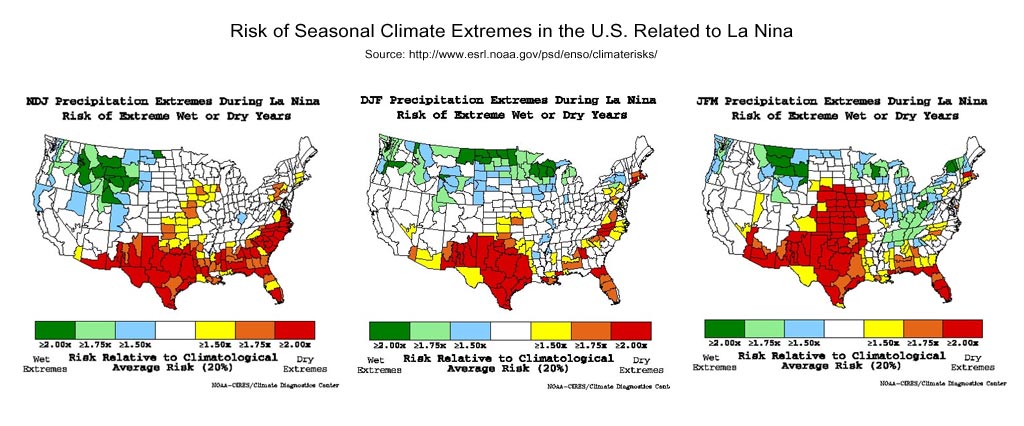
Maps generated using the ESRL/PSD page Risk of Seasonal Climate Extremes in the U.S. Related to ENSO do not indicate a higher than normal risk for an extremely dry rain season in Southern California when La Nina conditions are present.


0

La Nina composites from CPC’s ENSO Temperature & Precipitation Composites page suggest the period Jan-Feb-Mar may be particularly dry, but this is not reflected in CPC’s official seasonal precipitation forecasts.

CPC’s Three-Month Precipitation Outlooks and NOAA Winter Outlook were updated yesterday. The precipitation outlook for Nov-Dec-Feb in the Coastal Southern California climate division shows equal chances of above average, near average, or below average precipitation. As the rain season progresses, these probabilities become only slightly skewed toward below normal precipitation. The skew becomes more pronounced in Feb-Mar-Apr when the probability of below normal precipitation increases to 45%.

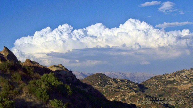
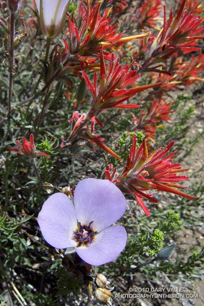
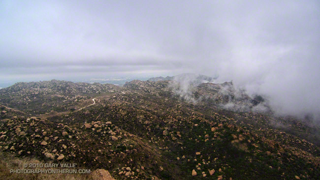
The title photograph is from Sunday’s out and back run from Chatsworth Reservoir to Rocky Peak.

Subtropical Flow from an Upper Low

Hot on the heels of our record setting Autumn heatwave, an upper level low off the coast has been spinning subtropical moisture into Southern California. The unstable weather has produced some impressive clouds, isolated showers, strong thunderstorms, as well as a few rainbows. This thunderstorm development is north of Los Angeles.

From today’s run in the Simi Hills.

The Heat Was Hot

Record heat in Southern California

Today at 12:15 p.m. PDT the temperature at Downtown Los Angeles (USC) reached 113°F (45°C), which is the highest temperature recorded downtown since weather recordkeeping began in 1877.

It wasn’t quite as hot in the San Fernando Valley. The high temperature at Pierce College reached 110°F.

When I started my run at Ahmanson Ranch it was 106°F. I took two bottles with ice water. One was used to keep my arms, legs and head/neck wet. With the relative humidity low, this was very effective for cooling. I picked a 45-50 minute course that was not too strenuous, and kept the pace moderate.

It was a surprisingly moderate run, but I sure wouldn’t want to run out of water or have some other problem when the temperature is that high!

Waterman Mountain Cool

View east from Mt. Waterman to Mt. Baldy

Weekend highs in California were down 30-40 degrees from the searing temps earlier in the week. After dealing with the heat, my jaw dropped when I read Sunday’s NWS forecast for the Eastern Sierra:

 .SUNDAY…PARTLY SUNNY. A CHANCE OF SNOW SHOWERS AND A SLIGHT
 CHANCE OF RAIN SHOWERS IN THE MORNING…THEN A CHANCE OF
 THUNDERSTORMS AND SNOW SHOWERS IN THE AFTERNOON. SNOW LEVEL ABOVE
 9000 FEET IN THE MORNING. HIGHS 40 TO 52 IN THE HIGHER ELEVATIONS…
 AROUND 59 NEAR 8500 FEET. WEST WIND AROUND 10 MPH SHIFTING TO THE
 SOUTH IN THE AFTERNOON. CHANCE OF PRECIPITATION 40 PERCENT.
 
Now that is great August weather forecast!
 
I couldn’t get to the Sierra, but I could do a run in the Angeles High Country — and I was willing to bet the upper level trough that was producing unsettled weather in the Sierra would also result in a cool, Autumn-like day in the San Gabriel Mountains.

And it did! Compared to my midweek runs, running up the Mt. Waterman trail was like going for a swim in a high mountain lake. Just spectacular!

Rocky Peak Heat

Simi Valley from Rocky Peak

Simi Valley and the Pacific Coast from Rocky Peak Road

What better way to recover from the Bulldog 50K than running Ahmanson and Rocky Peak on two of the hottest days of the year?

Yesterday, Pierce College in Woodland Hills hit a scorching 111°F, and then today 109°F. At the start of today’s run it was still over 100°F on Rocky Peak, but extra (ice) water, and a bit of a breeze kept things mostly reasonable.

No matter the weather, you’ll always see someone else on Rocky Peak!

Some related posts: Rocky Peak Rainstorm, Snow on Oat Mountain

Cooler Climes

Paintbrush on the Vincent Tumamait Trail

Paintbrush on the Vincent Tumamait Trail

Thursday afternoon the temperature in Woodland Hills hit 107°F. Friday was 103°F, and Saturday 104°F. Weekdays I run in the afternoon, and after running in that heat, I needed to escape to cooler climes. One way to beat the broiling temps was to head for the high country.

There are several higher elevation areas within a couple hours drive of Los Angeles. My favorites are Mt. Baden-Powell (9399′), Mt. Baldy (10,064′), Mt. Pinos (8831′), Mt. San Jacinto (10,834′) and San Gorgonio Mountain (11,499′).


Mariposa and paintbrush
Today the choice was Mt. Pinos. It had been a few weeks since I’d run there, and the driving time to the Chula Vista parking lot on Mt. Pinos is about the same as that to Islip Saddle in the San Gabriels. Also, it’s usually cooler running between Mt. Pinos and Mt. Abel, than between Islip Saddle and Mt. Baden-Powell.

It was a little breezy and chilly up on Mt. Pinos, Sawmill Mountain and Mt. Abel. What a change from during the week. At the start of the run the temperature was about 40-50 degrees cooler than my last run at Ahmanson Ranch.

I did an extended version of the usual 14.5 mile out and back course on the Vincent Tumamait Trail. This variation drops down to Lilly Camp (6600′) on the North Fork Trail before continuing to Mt. Abel. The side trip adds about 6 miles and 1700′ of gain. It was a bit warmer down at Lilly Meadow Camp, but the air conditioning kicked back in once I returned to the main trail.

Some related posts: Running Hot & Cold, Up & Down Mt. Baldy’s South Ridge, Vincent Tumamait Trail, Autumn Trail Running on Mt. San Jacinto, San Gorgonio High Line 2009