Classic Cheeseboro Canyon

Cheeseboro Canyon

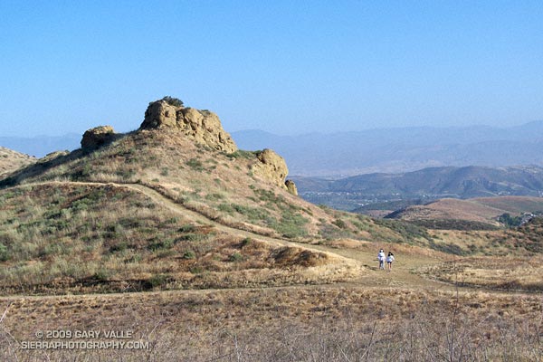
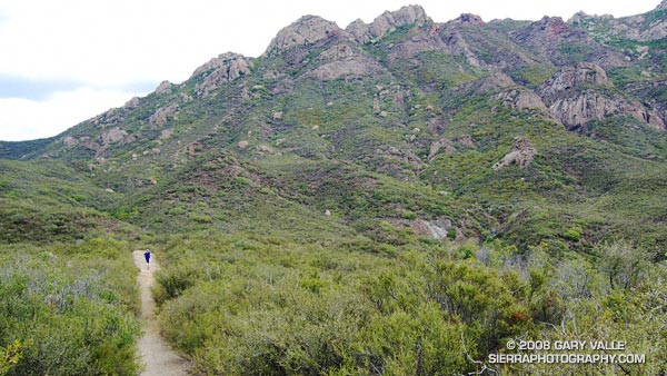
The 13 mile keyhole loop through Las Virgenes and Cheeseboro Canyons from the Ahmanson Victory trailhead is a classic Southern California mix of multi-use fire roads and single track trail.

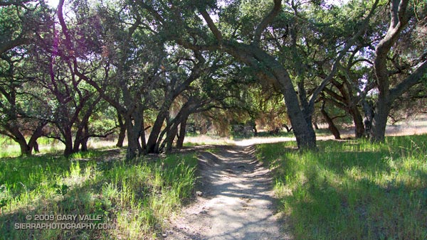
The segment from Shepherd’s Flat down through Cheeseboro Canyon is especially popular, and on the weekend you’ll find an assortment of hikers, runners, mountain bikers, and sometimes an equestrian group or two. Even on a warm day, the oak-shaded sections of the canyon can be surprisingly comfortable.

Here’s a Google Earth image and Cesium browser View of a GPS trace of the loop, and links to trail maps for Upper Las Virgenes Canyon Open Space Preserve (formerly Ahmanson Ranch) and Cheeseboro/Palo Comado Canyons.

Long Canyon to Simi Peak and China Flat

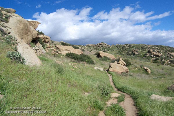
Wood Ranch Open Space

Wood Ranch Open Space

The fire road was covered with crawling and darting bees — so many I could feel the low, resonating buzz of the colony. Standing in the middle of the buzzing bees, I heard an “Oh crap!” from behind me. A mountain biker — stopped about 20 yards away — explains he’s allergic to bee stings.

We were a little east of the China Flat “T” on the Albertson “motorway” — a fire road in the Simi Hills. Taking advantage of cool, sunny weather in the Los Angeles area, I was doing a course I had not done for years, an out and back trail run from the Wood Ranch trailhead to Simi Peak, with a short circuit around China Flat.

I had taken a short detour to check a small vernal pool hidden in the oaks off the fire road. There are surprising number of these ephemeral water sources in the Simi Hills. They sometimes have water when it’s unexpected, but this time the pool was dry.

The bees on the road were digger bees, ground nesting bees that look like fuzzy honeybees. Like honeybees, males have no stinger. Males swarm over the burrows of females, waiting for them to emerge. Females can sting, but in my experience, and from what I’ve read, are generally not aggressive. Here’s a very short video (from later in the run) of a second colony on the Simi Peak Trail.

Not being able to risk being stung, the mountain biker waited on the side of the road for his buddy to realize he wasn’t behind him anymore. I headed back to the China Flat Trail, and then continued to Simi Peak. Here’s a Google Earth image and Cesium browser View of a GPS trace of my approximately 10.75 mile route.

Note: A mountain biker on the Long Canyon trail told me he had seen a mountain lion in the area earlier in the morning. He was certain that it was a mountain lion, and not a bobcat or coyote.

Changing Seasons, Changing Colors

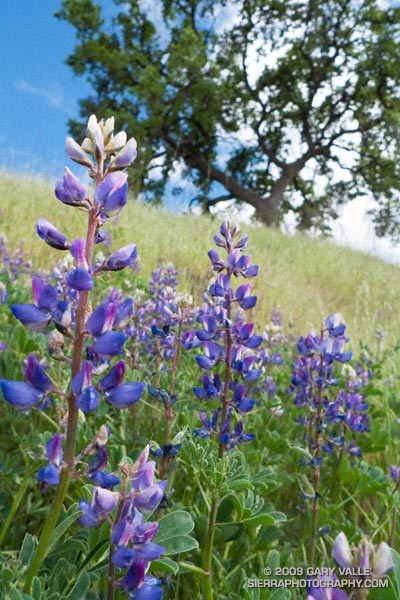
Lupine at Ahmanson Ranch.

Lupine is blooming yards from the parking area at the Victory Trailhead of Upper Las Virgenes Canyon Open Space Preserve (formerly Ahmanson Ranch), and the Valley Oaks are now nearly fully leaved. Annual grasses have gone to seed, and the hills are just starting to turn from green to gold.

Lower Stagecoach – Hummingbird Loop

Hummingbird Trail in Rocky Peak Park

Hummingbird Trail

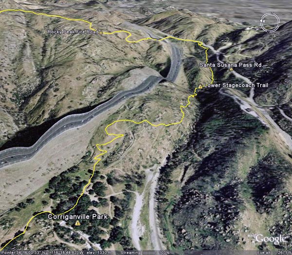
 The Lower Stagecoach – Hummingbird loop is a shorter, somewhat less strenuous alternative to the Chumash – Hummingbird and Chumash – Las Llajas loops. Approximately 6 miles long, about a mile of the route is on pavement, with the remainder on single track trail and fire road. The elevation gain/loss on the loop is about 1300 ft.


https://photographyontherun.com/content/binary/LowerStagecoachGoogleEarth.jpg
I usually start the loop at Santa Susana Pass and pick up the Lower Stagecoach Trail a short distance west of the pass down Santa Susana Pass Rd. The route climbs out of the canyon before descending to Corriganville Park. It does not follow the old road bed (with a lot of poison oak) down the canyon, or cross the Metro Link railroad tracks.

As discussed in the post Chumash – Hummingbird Loop, the area on Kuehner Dr. near the start of the Hummingbird Trail is being developed, but it appears that development has been suspended. The Hummingbird trailhead is located at the end of Kuehner Dr., near the entrance to Hummingbird Ranch. Trail signs have been placed indicating the route of the trail over park district property. Here’s a Google Earth image and Google Earth KMZ file of a GPS trace of the loop.

Some related posts: Chumash – Hummingbird Loop, Chumash – Las Llajas Loop, Old Santa Susana Stage Road

T-storms and Trail Work

Old Boney Trail in the Boney Mountain Wilderness

When I woke to the rumble of thunder, rain pounding the roof, and wind roaring in the trees, I wondered if a planned run of the Boney Mountain Half Marathon course with John Dale was going to turn into an epic. Radar and satellite imagery showed subtropical moisture streaming in from the southwest, producing bands of showers and thunderstorms. Things don’t always look as bad at the trailhead as they do on weather radar, so I grabbed my gear and headed for Wendy Drive.

The weather looked promising driving through Agoura, but the further west I drove, the more ominous the skies became. Somewhere around Lynn Road KNX announced that the NWS had issued a severe thunderstorm warning for the Santa Clarita area, with cloud to ground lightning, heavy rain, possible damaging winds and dime-sized hail. It was with that thought in mind, and a shower pelting the car, that I pulled into the parking area on Potrero Rd.

If anything, weather is fickle, and sometimes that quirkiness can work for you. There was an area of heavy rain to the west, but the activity appeared to be skirting the area, so we opted to start the run.
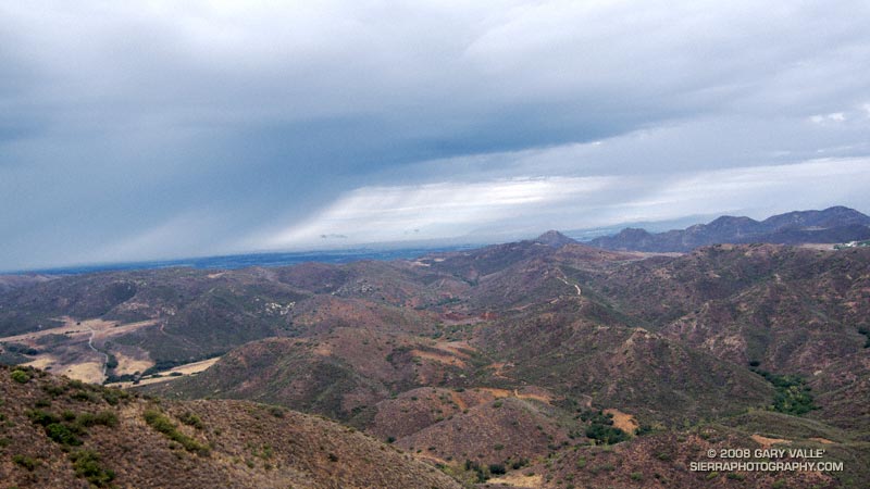

Thunderstorm marching northeast from the Santa Barbara Channel across the Oxnard Plain.
There were a few sprinkles as we jogged down the blacktop into Big Sycamore Canyon, and a few more as we did the first easy mile of the Hidden Pond Trail. Down in the canyon it was hard to tell what the weather was doing, but after gaining some elevation we reached a better vantage point. Just a few miles away thunderstorms were being swept northeast from the Santa Barbara Channel, across the Oxnard Plain, and into the Ventura Mountains.

Skies darkened and the shower intensity increased as we ran down Ranch Center Fire Road. The wind was blowing in the fitful gusts that precede a thunderstorm, and it felt as if the sky might fall at any moment. With a slight shift in the track of the thunderstorms we might be running in a deluge, dodging lightning strikes.

But it didn’t shift. Following the shower, the sun broke through the clouds just long enough to add glints to the raindrops dripping from the leaves of sycamores and oaks in Blue Canyon. Under overcast skies, we climbed up the Old Boney Trail and into the Boney Mountain Wilderness.

We had not seen a hiker, runner, or rider since turning onto the Hidden Pond Trail early in the run. So it was a bit of a surprise when we rounded a corner and ran into Ed Reid and several other volunteers with the Santa Monica Mountains Trails Council doing trail maintenance on a section of the Old Boney Trail.

Just about any weekend of the year, dedicated members of the SMMTC will be somewhere in the Santa Monica Mountains, working on a trail. To get a better idea of the amount of work done and the number of trails involved, take a look at this list of recently maintained trails! How many of these have you hiked, run or ridden?

There are several ways to help support SMMTC:

  • Volunteer to do trail maintenance.
  • Join the SMMTC.
  • Make your REI purchases using the REI link on the SMMTC web site. REI will donate a percentage of the purchase to SMMTC.

See the Santa Monica Mountains Trails Council web site for more info.

Some related posts: Boney Mountain Half Marathon, Return to Hidden Pond
More Musch Trail Mule Deer

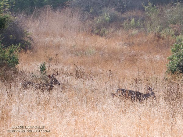
A young buck and a doe along the Musch Meadow Trail near Trippet Ranch in Topanga State Park.

When running in the Trippet Ranch area of Topanga State Park, more often than not, I see mule deer browsing among the oaks along Eagle Springs Fire Road, or along the Musch Meadow Trail.

On Sunday’s Trippet Ranch loop, these deer were near the Musch Meadow Trail. The young buck appeared to be taking more than a passing interest in the doe. The breeding season for mule deer varies widely, and begins as early as mid-September in some locations.

Here is a zoomed view of the doe and buck.

Related post: Musch Trail Mule Deer