Clearing Clouds on Boney Mountain

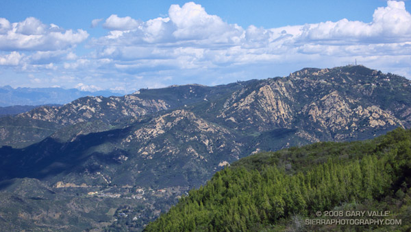
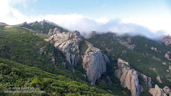
Clearing clouds on Boney Mountain in Southern California's Santa Monica Mountains.

Clouds still covered the rocky summit of Boney Mountain as we scrambled up the steep trail on its northern flank. A few hours before a weak front had passed through the area, thickening the clouds and generating a few showers.

Now the clouds were lifting and dissipating, and the just-bathed chaparral glistened in the intermittent sun. This morning, like many mornings in recent weeks, was remarkable. The mountains were alive with the color and vitality of Spring. Purple shooting stars and wild hyacinth adorned the trail, and groves of manzanita and red shanks shone electric green in the warm light.

What better way to begin a day?

Related post: Boney Mountain – Big Sycamore Canyon Circuit

Google search: $g(landscape photography), $g(trail running), $g(Boney Mountain), $g(red shanks)

Ahmanson – Cheeseboro Ridge Loop

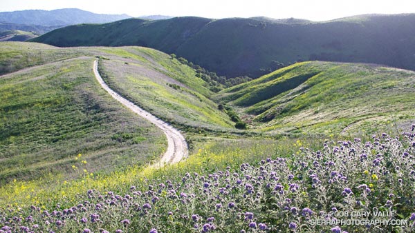
Spring afternoon on the Cheeseboro Ridge Trail.

The Cheeseboro Ridge keyhole loop is a slightly shorter variation of the Ahmanson – Cheeseboro Canyon keyhole loop described in the post Classic Cheeseboro Canyon. Since it ascends the Cheeseboro Ridge Trail, instead of descending Cheeseboro Canyon, the ridge route has a bit more elevation gain.

Cheeseboro Ridge separates Las Virgenes Canyon and Cheeseboro Canyon and on a clear day the views are outstanding. Running the ridge is particularly enjoyable in the Spring when temps are cool and the hills are green. In the heat of summer, the surface of the road develops a powder-like layer of silty dust and the experience isn’t nearly so pleasant.

If starting at the Victory Trailhead of Upper Las Virgenes Canyon Open Space Preserve, the length of the run is about 12.75 miles with an elevation gain and loss of about 1600 ft. Here are a Google Earth image and Google Earth KMZ file of a GPS trace of the route, and links to trail maps for Upper Las Virgenes Canyon Open Space Preserve and Cheeseboro/Palo Comado Canyons.

All in Which Family?

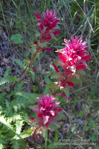
Indian warrior (Pedicularis densiflora) on the Backbone Trail in the Santa Monica Mountains.

Indian warrior’s varying tones of carmine contrast sharply with its lush green leaves and create a striking combination of colors when seen along a trail. Surprisingly, it is the green of its leaves that is one of its interesting features.

Indian warrior (Pedicularis densiflora) resembles two other wildflowers you might see along a Southern California trail — Indian paintbrush (Castilleja affinis) and Owl’s clover (Castilleja exserta). All three are related root parasites that obtain water and nutrients from their host, but also contain chlorophyll and can photosynthesize carbohydrates.

It seems this characteristic would be of value in a climate where seasonal rainfall is highly variable, extending the parasitic plant’s access to water.

Recent genetic analysis has revealed that Pedicularis and Castilleja are related to plants in the Broomrape family (Orobanchaceae), rather than those in the Figwort family (Scrophulariaceae), in which they have been classified. This was a somewhat unexpected result because one of the distinguishing characteristics of Orobanchaceae had been the lack of chlorophyll.

The photograph was taken on the Backbone Trail on the run described in A Long Run Kind of Day.

Technical References:

The Physiology of Plants Under Stress By Erik T. Nilsen, David M. Orcutt

PLANTS THAT LIKE HOSTS By Toni Corelli

Phylogeny of the parasitic plant family Orobanchaceae inferred from phytochrome A[1]

Jonathan R. Bennett and Sarah Mathews

Google search: $g(parasites), $g(Orobanchaceae), $g(chlorophyll), $g(phylogeny), $g(genetics)

Salomon SpeedCross 2 & adidas Response Trail 14 Trail Running Shoes

Salomon SpeedCross 2 and adidas Response Trail 14 Trail Running Shoes

Ounces count when you’re fighting gravity — in your pack, on your body, and especially on your feet.

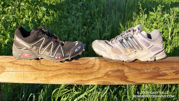
The Salomon SpeedCross 2 (left) and adidas Response Trail 14 are my two lightest trail running shoes. My Response Trail 14’s weigh 24.2 oz./pair (US 9.5), and the SpeedCross 2’s weigh 21.3 oz./pair (US 9.0).

In round numbers a runner takes about 5,000 strides an hour. Even on smooth, level pavement there is significant effort involved in taking those 5,000 strides. But add to the mix the irregular surfaces and ups and downs of trail running, and the effort required increases.

Every time a trail runner speeds up or slow down, or lifts a foot to clear a rock, or ascend a trail, additional effort is required. The heavier the shoe, the higher the energy cost of all these speed changes and gait adjustments. Imagine what it would feel like to run a technical trail in a 5 lb. pair of shoes!

But there is more to designing a trail running shoe than just reducing the weight. A drastic reduction in weight might also reduce durability, cushioning, support, or other desirable characteristics. A shoe that falls apart, or does not provide adequate cushioning or support isn’t of much use, even if it is feather light.

I’ve run in the Response Trail 14’s for several months and the SpeedCross 2’s about a month. Both are comfortable, seem to have adequate support and stability, and feel good under foot on dirt roads and most hiking trails.

There are some differences in the two designs. The SpeedCross 2 is exceptionally light, with good cushioning. The knobby ‘Winter Contragrip’ waffle tread provides good traction in soft conditions and appears to contribute to the shoe’s cushioning and shock adsorption. Some might find the tread too aggressive in less inclement conditions.

Update 03/31/08. Yesterday I used the Salomon SpeedCross 2 on a demanding 19 mile trail run with 4000 ft. elevation gain/loss. The run was primarily on single track trail, but also included some dirt and paved road. Some of the single track was very technical and rocky. On the more technical sections of trail the SpeedCross 2 felt very light and agile.

The Response Trail 14 seems to be exceptionally well-cushioned. The shoe runs a little more like a road shoe than most of my other trail shoes. That isn’t a criticism — I’ve used the shoe on many trails, and used it a couple of months ago in a trail half marathon that featured a mix of pavement, dirt road and single track trail.

Every runner’s shoe requirements are different, and these requirements can change from day to day, and run to run, depending upon the  trail conditions, the terrain, the length of the run, your fitness, where you are in your training cycle, and a host of other factors. I tend to use the SpeedCross 2’s and Response Trail 14’s for short and medium length runs, and my XT Wings for longer runs.

I’m always counting ounces — a lighter shoe, a lighter pack, a lighter rain shell, a lighter camera — it all adds up in my battle against gravity.
A Long Run Kind of Day

Saddle Peak from the Backbone Trail, in the Santa Monica Mountains, near Los Angeles. Mt. Baldy can be seen in the distance.

The beauty and intensity of the day was infectious. Hours before a cold low pressure trough digging down from the Pacific Northwest had carried showers, thunder, hail, and chilly temps into Southern California. Its rainfall had refreshed the greens of the hills, and accentuated the yellows, purples and reds of the wildflowers along the trail. Its blustery winds had cleansed the sky.

A few minutes before I had completed one run, and now was starting another. I wasn’t certain how much farther I would run — I just knew I had to run.

The day had begun with friends on the Secret Trail in Calabasas. We had run up and over the shoulder of Calabasas Peak, and then ascended Saddle Peak via the Stunt High Trail and Backbone Trail. The view from the summit of Saddle Peak had extended beyond Santa Monica Bay and Palos Verdes Peninsula to the South Bay and Saddleback Mountain. New snow glistened on Mt. Baldy, and to the west the rocky summits on Boney Mountain stood in bold relief.

That 14.5 mile run had ended at Tapia Park. Now I was on the Tapia Spur Trail on the first climb of the Bulldog Loop. On the wind sheltered slope the bright yellow blossoms of tree poppy had begun to unfurl, absorbing the warmth of the midday sun. Distant peaks loomed to within an arm’s reach, and my legs seemed to draw energy directly from the trail. It was a long run kind of day.

Notes: The title photograph is of Saddle Peak from the Backbone Trail, in the Santa Monica Mountains, near Los Angeles. Mt. Baldy can be seen in the distance. The combined length of the runs was about 29 miles with an elevation gain of about 5000 ft.

Some related posts: Tapia Bound, Bulldog Loop and the Corral Fire, Fog Along Malibu Creek