Running Hot & Cold

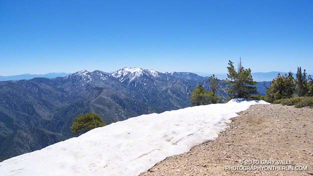
Mt. Baldy from the summit of Mt. Baden-Powell

Mt. Baldy fron the summit of Mt. Baden-Powell

Yesterday, Woodland Hills topped the 90° mark for the first time this year. But somebody forgot to tell the local mountains about the warmup. This morning, I was about a mile into an out and back trail run from Islip Saddle to Mt. Baden-Powell, and with the wind chill, it felt like the temp was in the 40’s.

It was chilly in running shorts, and I debated pulling some warmer clothes from the pack. In addition to a short-sleeve shirt, I did have on a pair of pull-on long sleeves. For the moment that seemed to be enough. Rounding a corner, the trail leveled, and up ahead I could see a hiker headed my way. Based on the time, I figured he was descending from Little Jimmy Campground. We exchanged greetings, and as we passed, he commented, “you know there’s a lot of snow on the trail.”
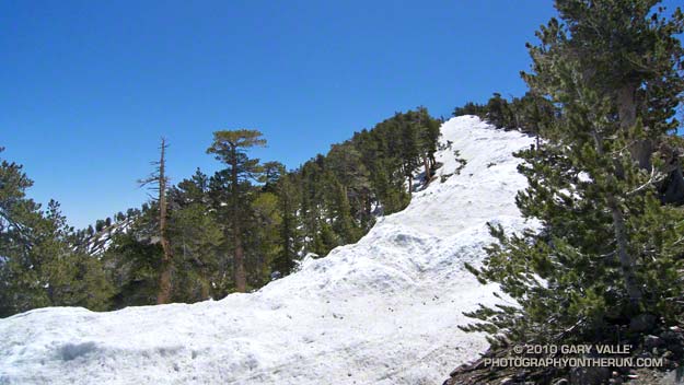

Snow on the crest near Mt. Baden-Powell
This Spring the weather in California has been dominated by a series of cool troughs, slowing the snow melt and in some cases adding to it. It its May 27th Summary of Snow Water Content, California Cooperative Snow Surveys reported the statewide snowpack at nearly twice the normal amount for the date. Squaw Valley reopened for Memorial Day weekend; and with over 100 inches of snow since April 1, Mammoth Mountain plans to operate through July 4.

On the shaded, north facing slopes of Mt. Islip there was more snow than I’d seen since the Spring of 2005.  It couldn’t be avoided. However, the route was well-traveled, and where there was snow, dirt-covered steps eased the way. I had picked up a short length of downed fir, and it worked OK as a crude ice axe, or if you prefer, a stubby trekking pole. It enabled me to move a little faster, and had the added benefit of keeping my upslope hand out of the snow.
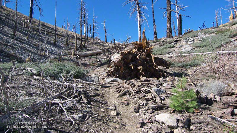

Seedling Jeffrey Pine in ghost forest
It didn’t take long to reach Windy Gap (7588′), and soon I was working up the trail to the gap above Windy Gap. Here the trail winds through a ghost forest of old growth trees, burned in the 2002 Curve Fire. Recovery has been slow, and it was heartening to see a young Jeffrey pine in the midst of all the deadwood. It also gave me a sobering perspective of the time that was going to be required for the recovery of the forests decimated by the Station Fire.

The trail climbs up to the crest of the San Gabriels near peak 8426, about a mile east of Windy Gap. From here it more or less follows the prominent divide all the way to Mt. Baden-Powell (9,399′). It’s the “more or less” part that’s key in a snowy year. The shaded north side of the divide may be completely snowbound, while the crest and south side are snow free. The way the ridgeline is oriented, storm winds create deep bands of snow along and just north of the crest. In places the trail can be buried in several feet of snow.
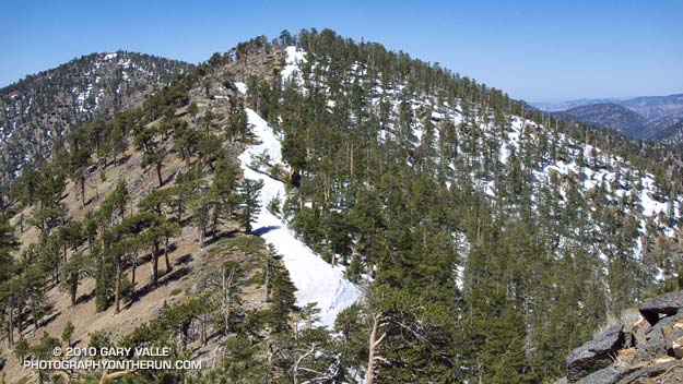

Snow on the crest east of Mt. Burnham
On the east side of Mt. Hawkins I checked out a tree that had been struck by lightning, and then continued along the ridge. The wind was little more than a breeze now, and the temperature comfortable. I pulled off my running sleeves, and then followed the trail across the warm, south facing slopes of Throop Peak. Sometimes on the trail, and sometimes on the crest, I descended to a saddle and then climbed up and over Mt. Burnham (8997′).

On the summit of Mt. Baden-Powell there was almost no wind. The sun was warm and the air clear. Across Vincent Gulch Mt. Baldy gleamed alpine white, its summit ridges still heavy with corniced snow. Many miles to the east, snow could also be seen on San Gorgonio Mountain, and Mt. San Jacinto. A Clark’s nutcracker complained raucously from the top of a Lodgepole Pine, and I assured the bird that I would be leaving the summit soon.

Some related posts: San Gabriels High Five, Islip Saddle – Mt. Baden-Powell Out & Back

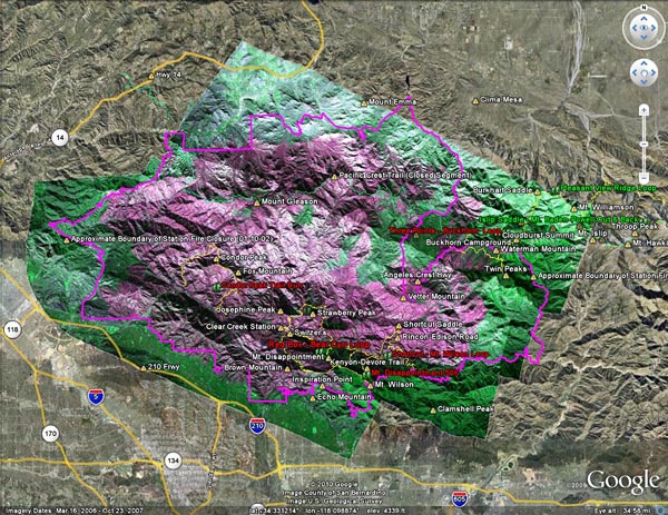
Updated Station Fire Closure Boundary with NASA Ikhana BAER Image Overlay

In November 2009 NASA used its Predator B remotely piloted aircraft “Ikhana” to collect post-burn assessments of the Piute Fire in Kern County and the Station Fire in the Angeles National Forest. This interactive Cesium browser View shows the area of the San Gabriel Mountains burned in the Station Fire, with an overlay of the Ikhana Burned Area Emergency Response (BAER) image. (Image courtesy of NASA Dryden and NASA Ames.)

According to NASA, the various purple hues are indicative of the differences in burn severity. The view can be panned, zoomed and tilted (help info) in order to get an idea of the burn severity along a particular trail, or in a particular area. This can be used with other assessment data and on the ground observations to evaluate burn severity. Here is the BAER Station Fire Soil Burn Severity Map (1.1MB PDF) from the Forest Service. Additional BAER information can be found on the Angeles National Forest Station Fire BAER page.

Earlier this week Angeles National Forest reopened some areas of the forest closed by the Station Fire, and issued Forest Order 01-10-02, redefining the boundary of the Station Fire Closure Area. The magenta line in the previous view, and in this Cesium browser View without the burn severity overlay, is the approximate boundary of the Station Fire Closure Area as derived from Angeles National Forest Order No. 01-10-02, Exhibit A and Exhibit B. The boundary, as depicted, is intended to provide a general overview of the closed area — not an exact rendering. Please contact Angeles National Forest to determine whether a particular resource is open or closed. Note, for example, that a road may be open or closed depending upon which edge of the road is the boundary.

One of the reasons for putting this information together was to check the status of several peaks and trails. With so much of the forest closed it is essential that every trail and area that is in reasonable condition be opened to the public. For example, the north approach and summit of Twin Peaks are outside the burn area but remain closed. The trail from Buckhorn to Twin Peaks Saddle and up to the peak should be open, and if the short section of trail burned near Three Points is OK, trail 10W04 from Three Points to Mt. Waterman and Twin Peaks should be opened.

GPS traces of some trail runs inside and outside the Station Fire area have been added to both Google Earth views, along with links to related photos and stories. Trail runs that fall partially or entirely inside the closure area have a red label. Click on the green hiker icon for additional info. Some placenames have also been added –the locations should be considered approximate.

The views also include a partial track of the Pacific Crest Trail (2009 ver. 1) from the Pacific Crest National Scenic Trail website. Note that the PCT is closed in the Station Fire Closure area and the northbound PCT has been rerouted at Islip Saddle. See the Pacific Crest Trail Association website for more info.

May… or March?

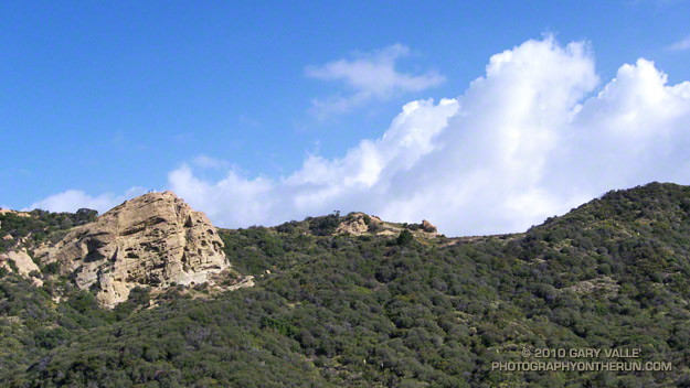
Eagle Rock From Eagle Springs Fire Road

Eagle Rock From Eagle Springs Fire Road

Is it May or March? With all the blustery weather systems that have been moving through Southern California, it’s been hard to tell.


Today I had planned to head back to the high country of the San Gabriels, but instead decided to take advantage of the spectacular weather and do a rambling 24 mile run in the Santa Monica Mountains.

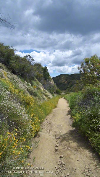
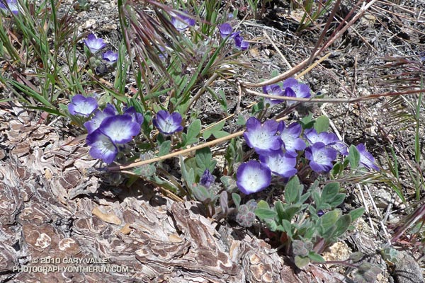
It was a good choice. Early in the run growing mountains of silver-lined cumulus towered above the Hub, and a brisk wind tempted me to pull the sleeves from the pack. Wildflowers lined the trails, and the chaparral teemed with color, sound and scent. It was a long run kind of day.

Note: Later in the day I talked to a runner who had been at Lake Arrowhead early in the morning. He said it had been snowing down to 3000 ft! According to the NWS, record low temperatures for today were set at Lancaster (41°), San Luis Obispo (38°), and Sandberg (28°).