Artichokes and Chop-Suey Greens?

Artichoke thistle (Cynara cardunculus)

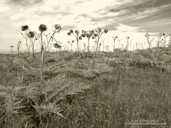
I would not have guessed these alien-looking thistle plants along the XTERRA race course in Black Mountain Regional Park are a wild form of the cultivated globe artichoke.

In its description of the artichoke thistle, the California Invasive Plant Council (Cal-IPC) notes the Mediterranean plant was found by Charles Darwin in South America in 1833. It had already escaped cultivation and spread over “several hundred square miles” of the Argentine pampas. Surveys in California from 1860 to 1864 also reported the artichoke as having escaped cultivation. The plant was reported in a pasture in San Diego County as early as 1897.


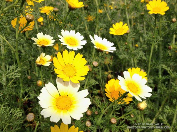
Another surprise was that the pretty yellow and white flowers along some sections of the course appear to be another Mediterranean plant known as crown daisy or chop-suey greens (Glebionis coronaria). If so, the plant is reportedly used as an ingredient in a number of Asian recipes.

Note: Great care is required when identifying and using wild food plants. Even if the plant is positively identified there can be contamination from herbicides and pesticides, and other potential problems. There may also be conservation concerns, especially if the plant is uncommon, rare or endangered. For example see Safety Guidelines For Edible Wild Food Plants and Foraging Guidelines.

Perfect Weather for the 2012 XTERRA Black Mountain 15K

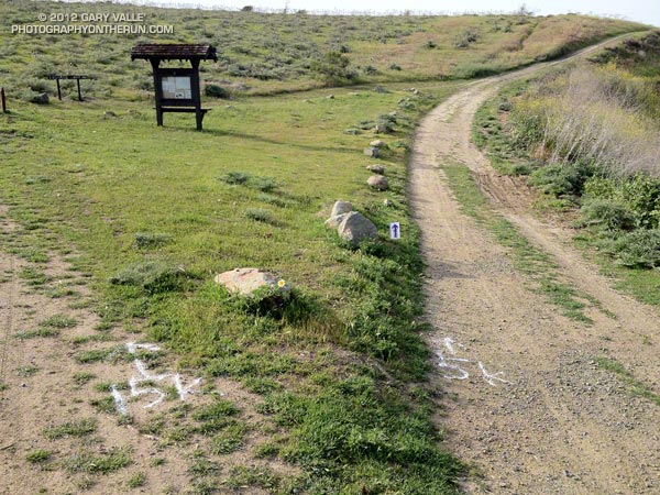
When the starter yelled “GO!” at the beginning of the XTERRA Black Mountain 15K I wondered if it was raining yet in the San Fernando Valley. I was not looking forward to driving home on the 405 in pouring rain. But I’d worry about that later. Here at Black Mountain Regional Park, a little north of San Diego, the weather was about as good as it gets for running.

Heavy rain was forecast later in the day and you could tell it was on the way. High clouds muted the morning sun, and a layer of threatening-looking clouds lurked on the northwestern horizon. It was cool — but not cold. After the first quarter mile I was glad I was running in short sleeves.

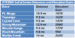
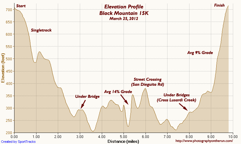
XTERRA SoCal Trail Run Series Distances and Elevation GainsAn email from the race organizers described the 15K course as “fairly flat” with “twists, turns and some minor hills.” I’d checked out the course profile on the trailrace.com and except for a not so minor hill at the end, the course did look pretty flat. Lots of downhill at the start, a couple of “minor” climbs in the middle of the course, and about an 8% climb over the last mile or so. A friend warned me about the hills around mile 5, so I wasn’t caught totally off guard by the steep climbs on the power line service road.

At just under a 1000′ of elevation gain, Black Mountain is the least hilly of the XTERRA SoCal Trail Run Series. But in a series noted for its climbs, flat is a relative term. To the left are the distances and elevation gains for the Series courses calculated using SportTracks* based on Garmin GPS tracks from the 2012 races, except for Malibu which is from 2011.


Here’s a more detailed Black Mountain 15K elevation profile with some notes added. Imagine running this course at an average pace of just over 6:30 min/mile! That’s what overall winner Paul Fraire did, cranking through the 9.8 mile course in 1:03:48.6. Heather Fuhr, Women’s winner and 4th overall, finished in 1:05:36.5, averaging 6:42 min/mile!

Like all the XTERRA SoCal Trail Run Series courses, the Black Mountain course was fun! There were a variety of trails and terrain, and some other interesting elements. And it’s the only race in the series that ends with a challenging climb! I really enjoyed the course.

*SportTracks elevation data smoothing set to 55. Elevations corrected using pkan’s Elevation Correction Plugin and NED 1/3 arc second DEMs.

Tapia Spur Trail Being Modified to Accommodate Multi-Use

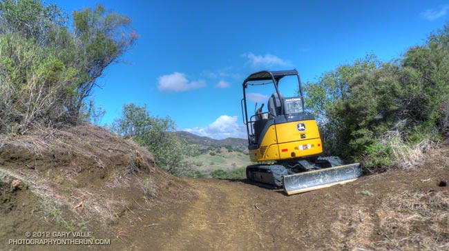
Excavator on the Tapia Spur Trail

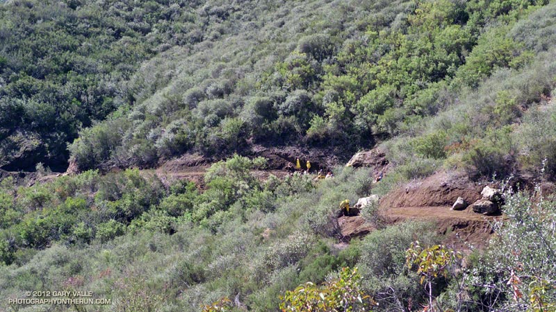
In addition to some melting white stuff that looked like snow and a mountain lion sighting, another surprise on my run last Sunday is that the Tapia Spur Trail is being reworked to better accommodate multiple user groups.


A little more than a mile in length, the Tapia Spur Trail connects Tapia Park to the group campground parking area in Malibu Creek State Park. This provides a linkage between the Backbone Trail and MCSP’s main trailhead and parking area, enabling a variety of hikes and rides, including the popular 14.5 mile Bulldog loop.

Modifications include restoring the trail tread, brush maintenance, swale crossings, smoothing the grade, changing the trail alignment to improve sight distance and grading, adding pinch points to slow cyclists, adding areas of retreat, and other changes. Here’s an aerial overview of the work being done (PDF) and a description of project (PDF).

According to Craig Sap, District Superintendent of the Angeles District of California State Parks, the work is expected to be completed during the first week of May. The trail remains open during the project.

Surprise on the Bulldog Loop

Brents Mountain, Malibu Creek State Park

BIG. That was my first impression when I saw the animal loping across the road. Quite a bit bigger than a coyote or bobcat, with a long black-tipped tail. It was a mountain lion, and it was reacting to me before I’d even seen it. Had I rounded the corner a couple seconds later, I never would have known it was there.
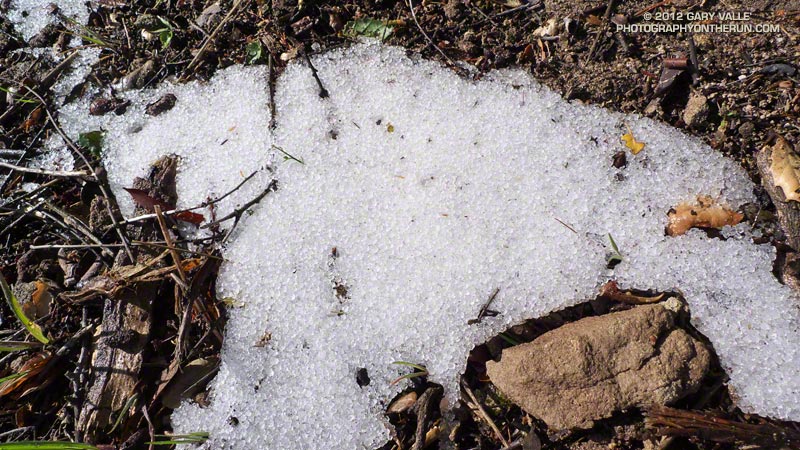


I was on Castro Mtwy fire road, between the top of the Bulldog climb and Corral Canyon Road. Just a few seconds before I’d been kneeling on the ground photographing snow pellets (graupel) along a road cut. I’d just started to run again when I saw the lion. It was 40-50 yards away and crossing the road left to right, diagonally down the road. It seemed interested in avoiding me, and I reinforced this idea by clapping my hands and yelling. It was moving at a speed that fit the situation — faster than a walk or trot, but by no means wasting energy or overly concerned. I watched as, like a ghost, it disappeared into the thick chaparral along the south side of the road.

I didn’t want to overreact. Although we usually don’t see them, anyone that runs in the open space areas of the West has likely been watched by a mountain lion. Attacks are extremely rare and often have extenuating circumstances. Even for someone that spends a lot of time outdoors, there are much higher risks in their lives, such as driving to the trailhead. And there are other risks on the trail. Two of my trail running friends have been run down by startled deer, and I was nearly trampled when I spooked a band of horses grazing in a natural cul-de-sac!

In this particular set of circumstances I didn’t think it would be any more dangerous to continue down the road than to retreat. If the animal was interested in me it wouldn’t matter which direction I went. The Corral Canyon parking area was about a half-mile away, and chances were good there would be hikers there.

But it was going to be unnerving to pass the spot where the lion had gone into the brush. For sure I was not going to run past the spot — as any owner of a cat knows, that can elicit a response. Had I seen a stout stick or branch nearby I would have grabbed it. Not only for defense, but to look bigger.

I jogged down the road a little further and stopped. On max alert and facing the threat, I walked past the point where the lion had entered the brush. Once past this point, I began to walk a little faster, constantly checking the road and brush to the side and behind me. After about 50 yards I transitioned to a slow jog, and sometime after that resumed my normal downhill pace, all the time being very wary of any sound, noise or motion behind me.

One car was parked at Corral Canyon, but its owner was nowhere to be seen. Still on edge, I continued on the Backbone Trail into the rock formations east of the parking area, and then past the rock gateway onto Mesa Peak Mtwy fire road. The farther I got from where I’d seen the lion the better I felt. I really didn’t think the lion was interested in me, but was still glad to have the Corral Canyon parking area between me and the cat.
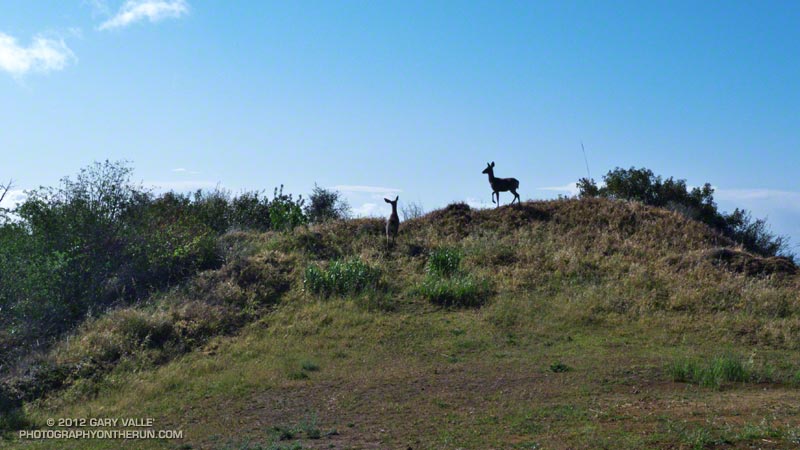


As I ran along Mesa Peak fire road, I started to calm down. I had just passed the “Morrison” caves and rock spiral and was rounding a corner when, without warning, there was a blur of brown from the left. Three deer bounded across the road just feet away. Put my heart back in my chest!

Deer are very common in Malibu Creek State Park, but I normally see them in the grasslands down in the valley. This morning I’d seen deer tracks going up Bulldog. Whenever I see deer tracks it’s a reminder there might be a mountain lion in the area. That was certainly the case this time!

Related post: Mountain Lion Saga
After the Station Fire: Shortcut – West Fork – Newcomb Saddle Loop

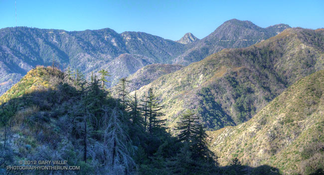
Mt. Wilson area peaks from the Silver Moccasin Trail

Did the “back 25K” of the Mt. Disappointment 50K course this morning, plus a couple of bonus miles on the Gabrielino Trail and the bottom of the Kenyon Devore Trail. Like last Sunday’s run, today’s run was in a part of Angeles National Forest that was closed by the 2009 Station Fire and reopened last May.


This loop was part of the Mt. Disappointment 50M course in 2007, 2008 and 2009, and the 50K course in 2010 and 2011. Today I started the loop at Shortcut Saddle, running down the Silver Moccasin Trail to West Fork, then up to Newcomb Saddle, and then completed the loop by returning to Shortcut on Edison Road. In the 50K, the loop starts at West Fork, but the sequence of trails is the same.

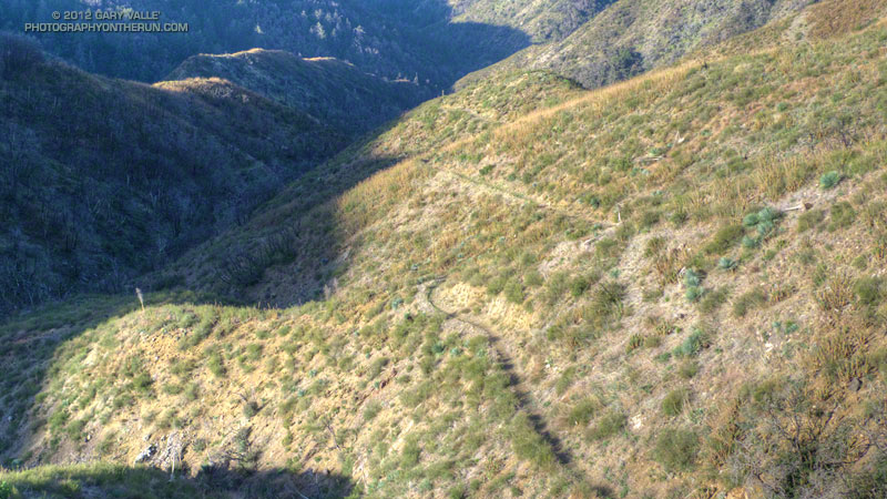
Because of increased foot traffic and our dry Winter, last year’s trailwork on the Silver Moccasin Trail held up well. Most of the trail between Shortcut Saddle and West Fork was in great shape and very runnable. There were a couple of trees across the trail, but these were easy to work under, over or around.


The reason for the side trip on the Gabrielino Trail was to check out the bottom of the Kenyon Devore Trail. This section of trail was severely burned in the Station Fire, then overrun by a debris flow and overgrown by Turricula (Poodle-dog bush). The Mt. Disappointment 50K/50M volunteer trailwork group has worked many hours here, as well as on the rest of the Kenyon Devore Trail, the Valley Forge Trail and the Silver Moccasin Trail. The trail had seen a lot of traffic and was in good shape.

As was the case last week, there was still Turricula along the trails and roads, but for the most part it was easy to avoid.

The last time I’d run up Edison Road was last August during the 2011 Mt. Disappointment 50K. Temps were about 25-30 degrees warmer that day. With the cooler weather I actually enjoyed the climb and was able to run more of it. A lot of work was being done on Edison Road and I chuckled as I passed each “No Loitering” sign posted along the road. I hoped I wouldn’t be doing too much of that in the 2012 Mt. Dis 50K.