California Bluebells Along the Gabrielino Trail

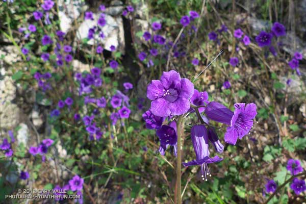
California bluebell (Phacelia minor)

Like Turricula (Poodle-dog bush)*, California bluebell (Phacelia minor) has been shown to cause a contact dermatitis similar to poison oak. The results from one study suggest the “dermatotoxic potential” of California bluebell approaches that of poison ivy/oak and that it is more likely to produce a reaction than Turricula.

Fortunately California bluebell doesn’t appear to be as prolific a fire follower as Turricula and is a much smaller plant.

The photograph is from a trail run in May.

*The taxonomic name for Turricula parryi (Poodle-dog bush) has changed to Eriodictyon parryi. The Jepson Manual: Vascular Plants of California, Second Edition (2012) has returned Turricula to the genus Eriodictyon, as originally described by Gray. According to the Wikipedia entry for Turricula (April 11, 2012), “… molecular phylogenetic analysis carried out by Ferguson (1998) confirms that Turricula should be treated as a separate genus within a clade (Ferguson does not use the term “subfamily”) that includes Eriodictyon, and also the genera Nama and Wigandia; Eriodictyon is the genus to which Turricula is closest in molecular terms, and is its sister taxon.” I use “Turricula” and “Poodle-dog bush” interchangeably as a common name.

Related post: Contact Dermatitis from Turricula parryi – Poodle-dog Bush and these additional posts.

Rime Ice

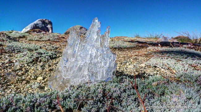
Glistening in the morning sun, this 1.5″ high piece of melting rime caught my eye as I was running along the PCT west of Mt. Hawkins. Fortunately no PCTers came bounding down the trail while I was sprawled across it taking this photograph!

The linear structure of the accreted ice can still be seen. Rime builds on the windward side of an object as wind-driven supercooled water droplets come in contact with a surface whose temperature is below freezing. This piece of rime had fallen from a tree.

From Sunday’s run on the PCT between Islip Saddle and Mt. Baden-Powell.

Raining Rime

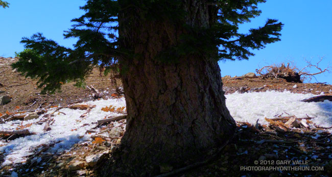
Fallen rime around a white fir

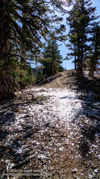
As I ran across the ice my footfalls made a loud crunch, crunch, crunch. Nearby a barrage of rime cascaded from a white fir. Friday’s cold system had rimed the trees along the crest, and now the ice was thawing, shedding from the branches and creating a patchwork of white beneath the trees. The ice wasn’t dense but I still didn’t want a large chunk falling on my head!

The cutoff upper level low that moved into Southern California Friday really cooled things down. The Big Pines RAWS (6917′) recorded an overnight low of 26°F Friday night. It was even colder in the Sierra. A snow sensor at 11,400′ in the Kern River headwaters recorded an overnight low of 12°F. Most of yesterday the temperature at Big Pines was in the 40s.


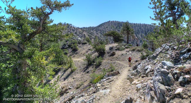
I was running on one of the most scenic segments of trail in the mountains of Southern California — the Pacific Crest Trail between Mt. Hawkins and Mt. Baden-Powell. There are three trail runs I like to do that include this stretch: Inspiration Point to Islip Saddle on the PCT, the Islip Saddle – South Fork – Baden-Powell Loop, and the route I was doing today, the Out and Back to Mt. Baden-Powell from Islip Saddle.

Warmer weather was forecast today, but this morning it had been cool and blustery at Islip Saddle. The temperature in the sun-warmed — but windy — parking lot had been around 43°F. In the shade of Mt. Islip at the start of the run the temperature felt like it was in the 30s. It had taken a while to warm up chugging up the first long hill.

It was the first time this season I’d been on this stretch of trail and I wondered if any well-shaded patches of snow had managed to survive on the north side of the crest near Mt. Baden-Powell. I doubted it. The Mt. Waterman ski area never opened this year, and there had already been several periods of warm weather. There would probably be some remnants of snow on the north side of Mt. Baldy.


It was PCT season. Islip Saddle is at about the 386 mile mark on the Pacific Crest Trail and PCTers hiking the trail from the Mexican border to the Canadian border usually do this section of trail sometime in May. There were a number of PCTers on the trail, including a couple of guys that appeared to be fast-packing the PCT. Their packs looked light, and they were really booking on the downhill west of Mt. Hawkins. (For well done, downloadable PDF maps of the PCT — with notes — check out Halfmile’s Pacific Crest Trail Maps and GPS Information.)

Although chilly at the start, the weather was near perfect for running and I had expected to see at least a couple of groups of runners training for the AC100. There were only about six or seven long run weekends remaining before this hundred miler. I did see one AC100 runner — twice. He was on day two of a three day Memorial Day training stint that would total some 90 miles. Now that is serious training!

Boney Mountain Eclipse Run

Narrative about 2012 solar eclipse

Some things in nature are supposed to be constant. The ground shouldn’t move; a mountain that is here today should be here tomorrow; and if skies are clear and blue, the sun shouldn’t grow mysteriously dim.
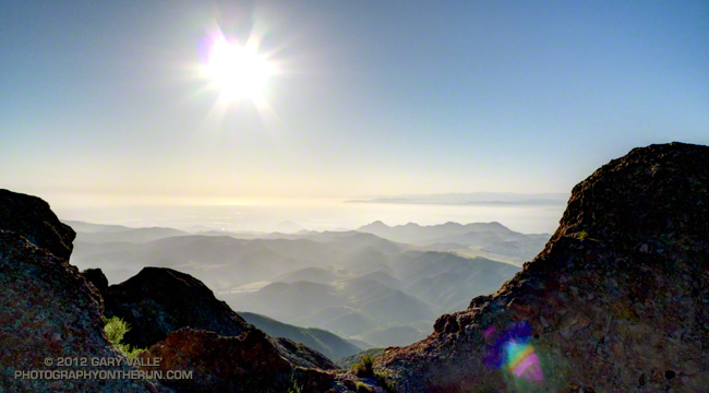


Imagine the consternation of our early ancestors, keenly attune to nature, feeling the sun dim and then looking for a cloud they could not find. There is still much of them in us. When the earth shakes or the sun fades, even moderately, we can’t help but react at the most visceral level.

While ee still can’t predict an earthquake with any certainty, we can predict eclipses. Fred Espenak’s NASA Eclipse Web Site includes maps and tables for several millennia of solar and lunar eclipses. Using the web site’s JavaScript Solar Eclipse Explorer you can find the solar eclipses that will be (or have been) visible at a particular location, as well as the type of eclipse, it’s magnitude, and when it will start, end, and reach its maximum. In 2002 I used the Eclipse Web site to plan a trail run to coincide with the June 10 solar eclipse. This afternoon I was doing another eclipse run — the north side loop on Boney Mountain.
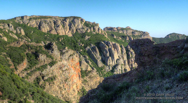


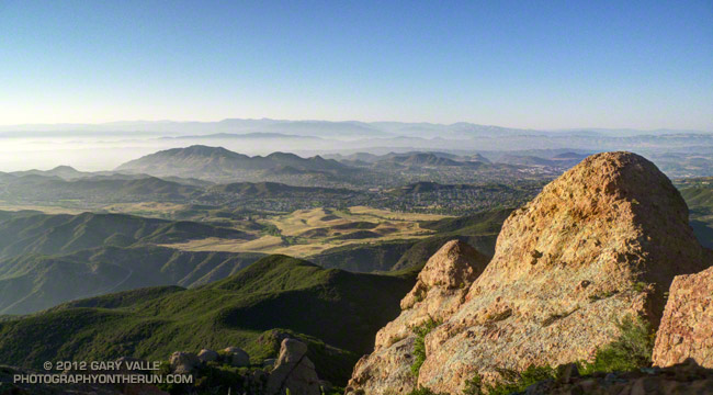
Perched on rocky ledge on the western ridge of Boney Mountain, I watched as the light on the landscape became increasingly muted. At the eclipse’s maximum almost 80% of the sun’s area would be obscured and about 85% of its width. The descending veil was tangible. I could not only see it, I could feel it. Even though I understood what was occurring, and that it would not last, ancestral fears were welling up and whispering, “Something is wrong…”
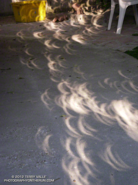


As the time of maximum eclipse approached, bird songs increased as if it was dusk. The wind, which had been blowing in fits and starts began to blow steadily from the west. The temperature dropped another degree or two.

Once the eclipse’s maximum had passed, I continued to work up the ridge, enjoying the extraordinary light. I hoped my wife was getting some good shots of the eclipse in our backyard. Many eclipse viewers are so focused on the sky, they don’t notice the spectacular lensed images projected on the ground and elsewhere by sunlight filtering through trees. The gaps between the leaves of a tree work like a giant pinhole lens, with a focal length of many feet. In the case of the trees in our backyard this produced images of the eclipsed sun 10 inches or more in diameter. Lensed eclipse images were also projected by  sunlight filtering through the chaparral on Boney Mountain.

I topped out on the western ridge around 7:10 and jogged up to the high point between the western and eastern ridges. Across the way three fellow eclipse watchers were on Tri-Peaks, and it sounded like there was a party over on Sandstone Peak. Even with the sun low on the western horizon, you could feel its intensity returning. Only about one-third of the sun was now obscured, and minutes before sunset — about 7:43 — the eclipse would end.
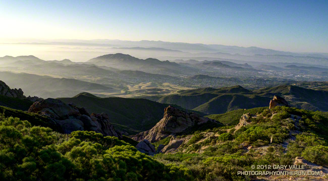


Marine layer haze and long shadows were filling the valleys as I began the second half of my eclipse adventure — running down the eastern ridge and trying to reach the trailhead before it was pitch black. Much of the route was illuminated by the setting sun, and I was able to get past most of the technical running and down to the Danielson cabin site before it became difficult to see. Once on Danielson road the bright western sky provided enough light to run. I made good time down to the creek in Upper Sycamore Canyon and then pushed up the road to Satwiwa. Just enough light remained to run the connecting single track back to the Wendy Drive trailhead.
Tree 75

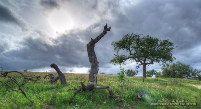
Valley oak at Ahmanson Ranch killed by 2005 Topanga Fire

The collapsed tree above is number 75 of 80 dead oaks counted on a 7.5 mile loop encompassing much of Ahmanson Ranch. The trees were burned in the 2005 Topanga Fire. Most of the trees were valley oaks, but some coast live oaks were also burned.

Most of the oaks in the Ahmanson Ranch area survived the fire, but perhaps as many as one in 20 trees were killed or severely injured. Of those that were severely burned, a small number, such as the valley oak above, attempted to replace its foliage through the process of epicormic sprouting.

Oaks that lost all of their foliage generally survived in proportion to the number of epicormic sprouts they were able to produce. Those that produced only a few epicormic sprouts generally succumbed after 3-4 years. Oaks with numerous epicormic sprouts generally survived.

Although Tree 75 didn’t make it, most of the surrounding trees survived the fire. And if you look next to Tree 75 you’ll see that its progeny, a young valley oak, appears to be doing well.