Missing Snakes at Ahmanson Ranch

Legend has it that St. Patrick chased all the snakes from Ireland, and while there have been no reports of the 5th Century cleric being sighted at Ahmanson Ranch, I don’t recall a Spring and Summer when I’ve seen so few snakes in the 3,000 acre preserve.

I’ve run at Ahmanson Ranch — now Upper Las Virgenes Canyon Open Space Preserve — more than a decade. I generally run at Ahmanson a few times a week and have become very familiar with the area’s plants and wildlife.

So far this year I’ve seen no mature rattlesnakes and only one gopher snake at Ahmanson. I’ve seen a couple of baby rattlesnakes and a handful of tracks, but that’s it. In some years I’ve counted more than a dozen snake tracks during one 7 mile run.

The reduction in the snake population is likely related to back-to back years with low rainfall. This year Downtown Los Angeles has recorded only 2.72 inches of rain since January 1. That’s a deficit of nearly 8 inches and about 25% of the normal amount of rainfall.

The reduced rainfall not only reduces the population of rodents, reptiles and other prey animals sought by snakes, but also increases the likelihood snakes will be preyed upon by animals higher on the food chain. Snakes, including rattlesnakes, are eaten by a long list of birds and mammals, and may also be preyed upon by other snakes. Humans also kill a large number of snakes.

The title photograph is the track of a Southern Pacific rattlesnake.  The snake was moving from the upper left of the photo to the lower right.

Some related posts: Big Southern Pacific Rattlesnake at Ahmanson Ranch, Southern Pacific Rattlesnake

San Gorgonio Mountain: Dollar Lake – Dry Lake Trail Run

Craig running on the Sky High Trail on San Gorgonio Mountain

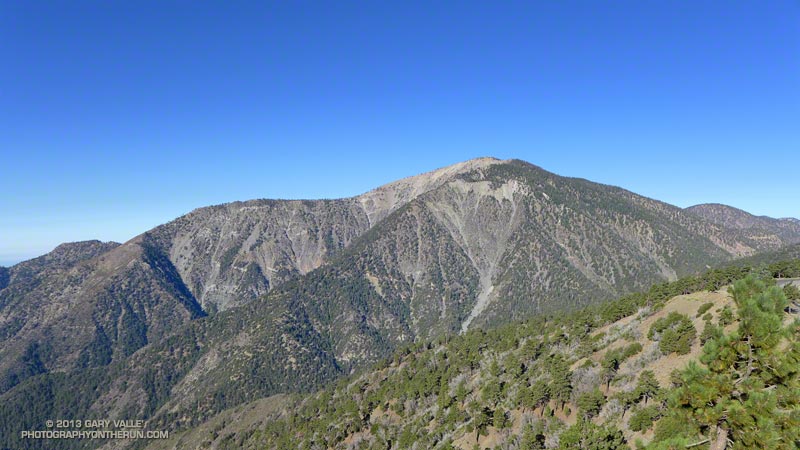
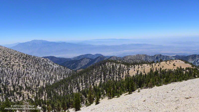
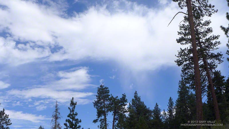
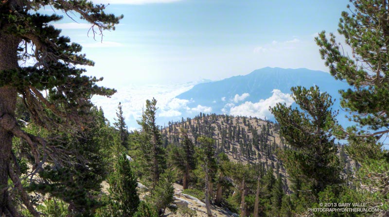
As we rounded the shoulder of Jepson Peak the pyramidal form of San Jacinto Peak came into view. A strong southerly flow was pushing a layer of cumulus clouds up the Coachella Valley, into Banning Pass, and toward San Gorgonio Mountain. Above, a higher layer of clouds was beginning to coalesce.

Moisture from the remnants of Tropical Storm Ivo was being drawn into the monsoonal flow, and if the weather models had it right the increasingly strong flow would result in an increasing chance of thunderstorms over the next few days. Even today the NWS Zone Forecast indicated a slight chance of a showers and thunderstorms:

SAN BERNARDINO COUNTY MOUNTAINS-
330 AM PDT SAT AUG 24 2013
…FLASH FLOOD WATCH IN EFFECT FROM SUNDAY MORNING THROUGH MONDAY
EVENING…
.TODAY…MOSTLY SUNNY IN THE MORNING…THEN PARTLY CLOUDY WITH A
SLIGHT CHANCE OF SHOWERS AND THUNDERSTORMS IN THE AFTERNOON.
WARMER. HIGHS 76 TO 86 ABOVE 6000 FEET TO 88 TO 98 BELOW
6000 FEET. SNOW LEVEL ABOVE 8000 FEET. AREAS OF WINDS SOUTH
15 MPH. GUSTS TO 25 MPH IN THE AFTERNOON. CHANCE OF MEASURABLE
PRECIPITATION 20 PERCENT.


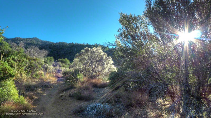
We had left South Fork trailhead a few minutes late, but were making good time. Including stops for photos and a wilderness permit check it had taken us about 2 1/4 hours to reach Dollar Lake Saddle. A quick calculation put us on the summit of Gorgonio around 11:00-11:15. Based on what I was seeing over and around the mountain I thought that we would probably get to summit before weather became an issue. The key word was “probably.” Experience has taught that computer weather models don’t always get it right, and mountain weather often seems to have a mind of its own.

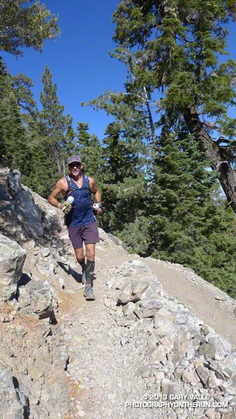
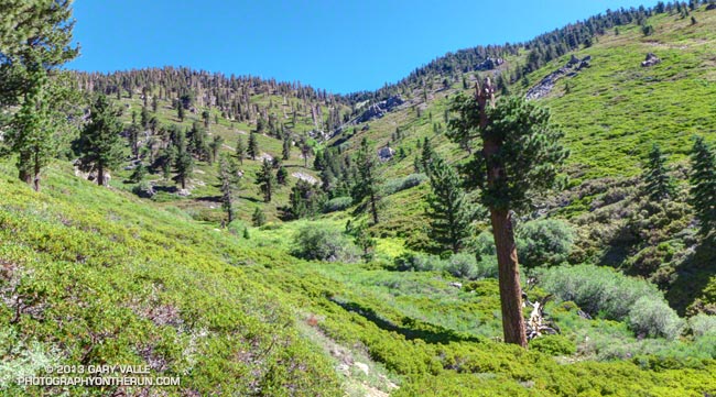
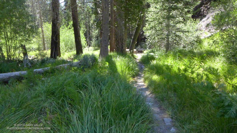
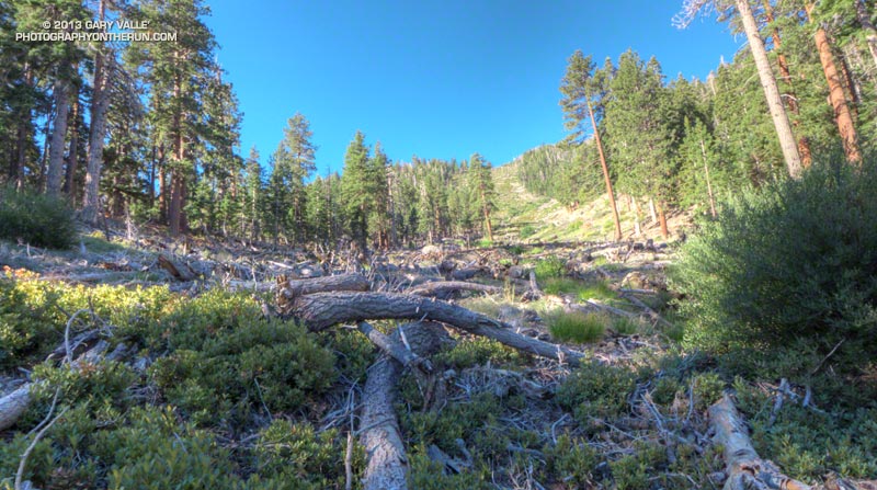
Craig and I were doing the reverse a route I’d done three weeks before. This time at South Fork Meadows we’d turned right at the fork and gone up the Dollar Lake Trail to Dollar Lake Saddle. I was curious to see if the counter-clockwise version of the loop was a better trail run than the clockwise loop.

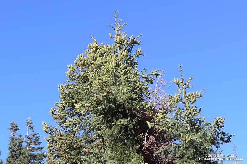
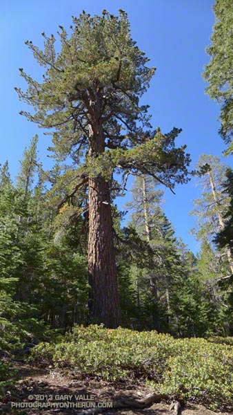
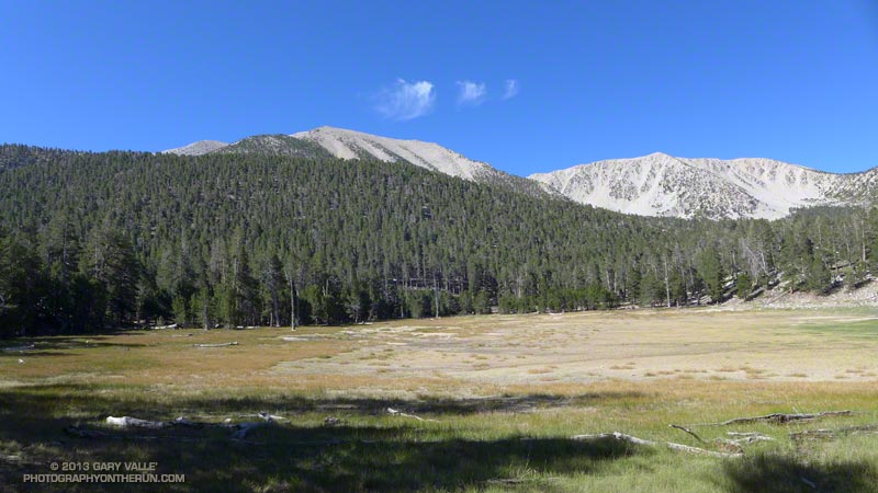
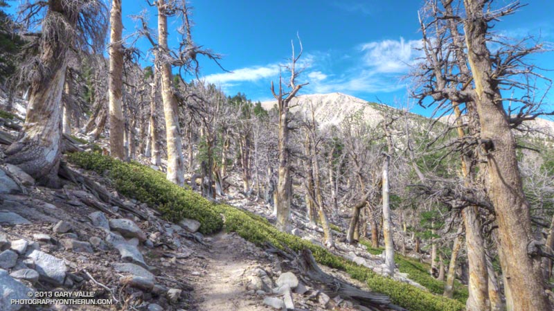
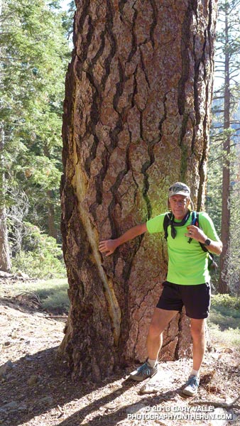
On the way up to Dollar Lake Saddle we’d stopped to take a closer look at a tall pine I’d noticed on my last run here. It had been struck by lightning. Judging from the width of the scar and its ragged, pitch-covered margins, the stroke had been a strong one and had occurred within the last couple of years. Based on the tree’s elevation (about 8400′), the size of the cones, and the shape of the prickles on the cones, the tree was a Jeffrey pine.


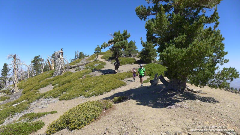
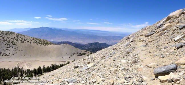
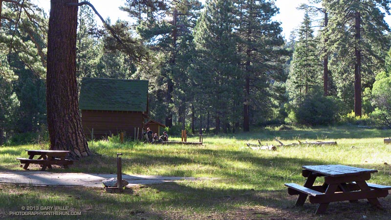
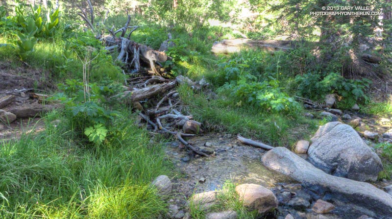
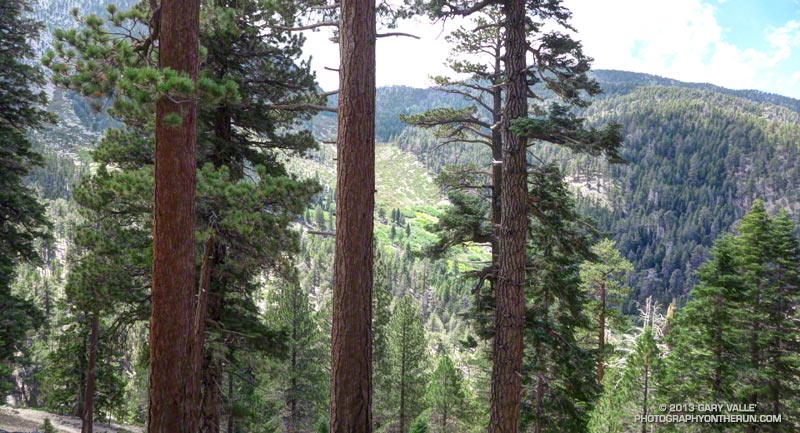
Now we were on the San Bernardino Divide Trail, about 1 1/2 miles beyond Dollar Lake Saddle and about 2 miles from the summit. After doing the peak we would descend via the Sky High and Dry Lake Trails to South Fork Meadows, where we’d refill our hydration packs and continue down the South Fork Trail to the trailhead. We’d be descending directly to Dry Lake, rather than taking the route via Fish Creek Saddle and Lodgepole Spring.

It was chilly! For the first time in several weeks of mountain running I pulled on my sleeves. There was a different feeling about the mountain today. A fitful wind streamed through the branches of the lodgepole and limber pines, its flow noisy and turbulent, and its speed and direction unsettled.


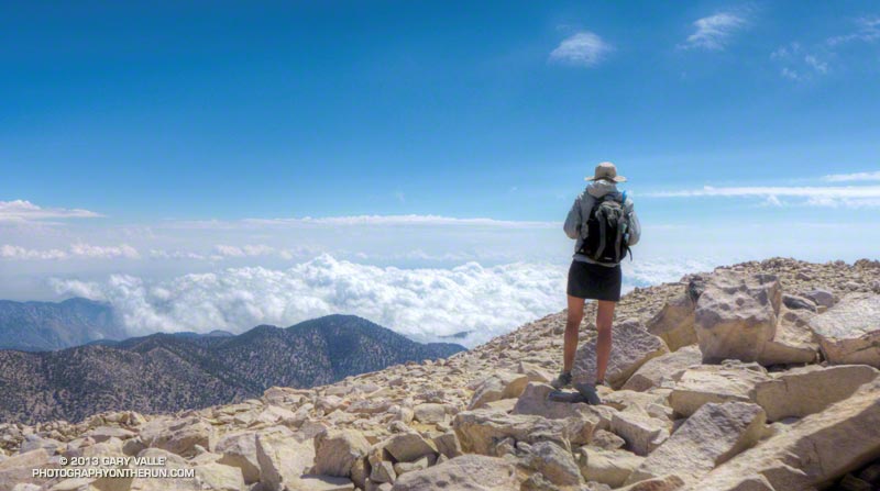
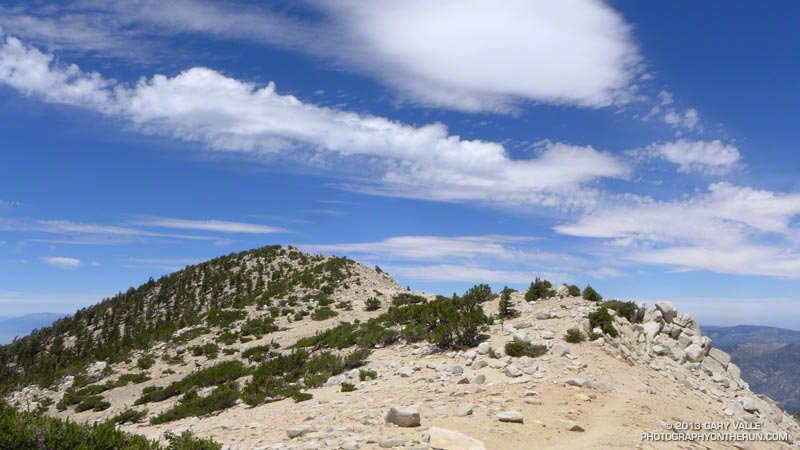
As we worked toward the summit, it was evident the top of the cumulus cloud layer was rising and the clouds in all layers were starting to show more development. On top, I was surprised to see how far the cumulus had pushed up Whitewater Canyon. Everyone on the summit was in good spirits — some more so than others. Now that we were on top we could talk about how spectacular the weather was, rather than how threatening.


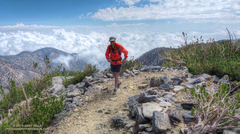
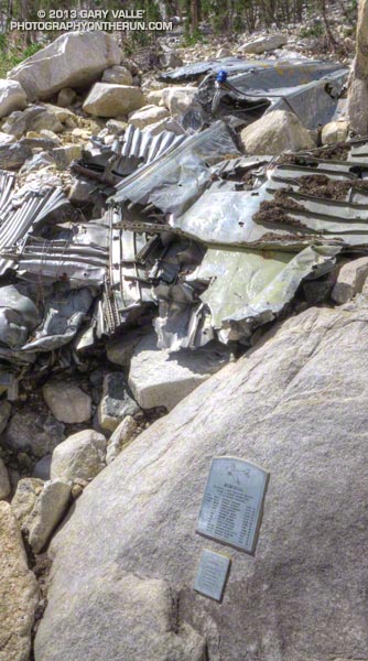
The run down from the peak on the Sky High Trail was absolutely superb — and far less rocky than running down to Dollar Lake Saddle on the Divide Trail. At about 10,600′, and a couple of switchbacks above the C-47 crash memorial, we were suddenly surrounded by clouds. This was a treat for us — we were headed down — but for the people headed up the peak it posed a quandry that has faced mountaineers for millennia: Continue up, or go down?


This time, as this Aqua/MODIS satellite image from 2:15 pm shows, San Gorgonio Mountain was on the margin of the monsoon flow. Although there was a lot of cumulus around and over the mountain, most of the major thunderstorm development was to the east and southeast of the peak. The closest automated weather station I could find with measurable rainfall was the Burns Canyon RAWS, 13 miles to the northeast. It recorded 0.17 inch between 2:00 pm and 4:00 pm. The Yucca Valley RAWS, 22 miles away, recorded 0.18 inch between 1:00 pm and 2:00 pm. In the big storms to the southeast, Fish Creek Mountain recorded nearly one inch in one hour.

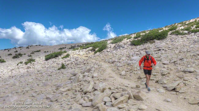
So which direction of the loop was the better trail run? I’d have to give the edge to the counterclockwise loop — up the Dollar Lake and Divide Trails and down the Sky High and Dry Lake Trails. There is still a lot of very rocky, technical trail — particularly on the Dry Lake Trail, but the outstanding running on the Sky High Trail between 11,400′ and 10,000′ more than makes up for it!

Some related posts: San Gorgonio Mountain: Dry Lake – Fish Creek Saddle – Dollar Lake Loop, San Gorgonio Mountain: Falls Creek Loop August 2013

More Highs and Lows on the PCT Between Inspiration Point & Islip Saddle

Young deer on the PCT on Blue Ridge in the San Gabriel Mountains

The trail run from Inspiration Point to Islip Saddle traverses a rolling section of the PCT along Blue Ridge, descends to Vincent Gap (6565′) and then climbs a switchbacking trail to the summit of Mt. Baden-Powell (9399′). The run continues along the crest of the San Gabriels on the PCT past several 9000′ peaks to Little Jimmy Spring and campground. From there it is a couple of miles to the parking lot in the saddle between Mt. Islip and Mt. Williamson.


A longer version of the run continues over the shoulder of Mt. Williamson to Eagles Roost. Many runners stop at Eagles Roost because of the now seven year (!) closure of the 3.5 mile segment of the PCT between Eagles Roost and Cooper Canyon. Continuing past Eagles Roost requires running 2.7 miles on Highway 2 to Buckhorn Campground, picking up the Burkhart Trail and following it down to the PCT in Cooper Canyon.


Today we were looking to do under 20 miles and keep the elevation gain to something sensible. Tim had run this stretch just a couple weeks before while doing the Angeles Crest 100 — his first 100 miler. Craig had crewed and paced a friend in the AC100 and was training for an upcoming 50 miler. Over the past several weeks I’d been doing a series of higher altitude runs and was also training for a 50 miler.

So far the run had been really relaxed and low key. We’d encountered a pair of young deer near Jackson Flat. They’d eyed us curiously before bounding off into the trees and the encounter seemed to have set the tone for the run. From time to time we stopped to enjoy a view point, look at the geology, or take a picture of a big ol’ tree. Rabbitbrush was blooming everywhere, adding a bright yellow accent to the rocks and ridges.


Earlier this year I photographed a bumper crop of cones on bigcone Douglas-fir in the Mt. Wilson area and here on Blue Ridge white firs had produced a huge number of cones. Other plants, such as bush chinquapin, had also produced large crops this year. Currant bushes along the trail had been productive, but because it has been so dry the fruit was smaller than normal.


The demeanor of the run changed part way up Baden-Powell. Mt. Baden-Powell is an immensely popular peak, and on a Summer weekend you’ll find an assortment of youth groups, fitness groups, hikers, runners and on rare occasions even an equestrian or two.

I stuffed another just-discarded nut bar wrapper into the back of my pack. That was a bad sign, and about two-thirds of the way up the peak things got a little crazy. The switchbacks above looked like escalators in a mall during the Holidays. People going up; people going down; people cutting switchbacks. A lot of people cutting switchbacks. At one point it seemed more people were short-cutting the trail than were on the trail.

Request: “Please don’t cut the trail…”

Response: “I figure Indians hiked all over this mountain; it’s my choice where I hike…”


0
The mindset of the people that throw trash on the trail and shortcut the trail is much the same. They just don’t care. They don’t consider that someone else is going to have to clean up their mess. A person that shortcuts a trail doesn’t realize several other people — usually volunteers — are going to have to repair the damage. Cutting switchbacks causes erosion, tramples plants and looks ugly. It tells others that you are unfit and inexperienced.

A couple of switchbacks above the chaos settled, and when two young boys cut a switchback just ahead of me it was heartening to hear their father explain why that was a bad idea.


The summit of the Baden-Powell was not nearly as busy as I thought it might be. Just a few people were enjoying the great view from the summit. We took a short side trip down the south ridge to look at a lodgepole pine whose limbs and bark had been torn off in an ice storm during the Winter of 2010-11. In the same area was a stout limber pine that has a scar from a lightning strike. Later in the run we would pass another lightning tree near Mt. Hawkins.

The last several miles of the run were as relaxed and low key as the first few miles. Recovery continues among the ghost trees in the area burned in the 2002 Curve Fire, and the water and wildflowers at Little Jimmy Spring were as refreshing as ever!

Some related posts: Highs and Lows on the PCT, Inspiration Point to Islip Saddle Trail Run, PCT from Inspiration Point to Islip Saddle

San Gorgonio Mountain: Falls Creek Loop August 2013

Plummer Meadows on the Falls Creek Trail

Sitting on the summit of Gorgonio I shook hands with Cole and said “Hi” to his friends. They had run up Gorgonio from the Fish Creek trailhead and we were comparing notes. He’d asked how far I’d run from Momyer. I told him “about 13” and commented that I was surprised by the amount of water in the creeks. He commented, “There’s no water on the way up from Fish Creek.” I looked down, and in his pack was a gallon jug of water. One gallon of water weighs 8.3 pounds, but put it in your pack and it feels like a hundred!

Other than a Southern Pacific rattlesnake encounter and a finicky UV pen the ascent from Momyer had gone well. Alger Creek had enough water I had to pick my way across the creek, and the small streams below Saxton Camp and at Plummer Meadows had more than adequate water for filtering. The creeks were lined with with ferns and flowers and there was little hint of the past year’s meager snowpack and rainfall.

One reason might be that the on-again, off-again summer monsoon had been on much of the latter part of July. This resulted in 0.04 inch of rainfall in Downtown Los Angeles July 26 — enough for a record — and rainfall totals of over two inches in some mountain areas. The Fawnskin RAWS, at Big Bear Lake recorded 1.3 inches of rain over the period July 20-26.


The encounter with the rattlesnake had been dicey. After an hour of steep climbing on the Momyer Trail I’d turned east onto the Alger Creek Trail and was running at about 7200′ on a more or less level stretch of trail in an area of gray rocks. Earlier the possibility of a rattlesnake had flitted through my mind, but I’d become lost in a reverie of early morning sun, tall pines, cool temperatures and easy terrain.

The dark gray Southern Pacific rattlesnake might as well have been invisible. As I began an elongated stride over a large gray rock, something moved just beyond the rock. My brain registered “SNAKE!” and then a microsecond later “RATTLESNAKE!!” Adrenalin turned my already elongated stride into an awkward leap that carried me just over the moving reptile.

The snake had been sunning itself on the trail and was as startled as I was. In a panicked movement it wriggled onto a flat rock on the side of the trail and stopped. My momentum had carried me a few feet past the snake and I turned as quickly as I could to try and get a photo. Rattlesnake for sure — heavier body, triangular head with BIG venom glands. When I took a couple of steps toward the snake to get a shot, it said “no way” and slithered into an opening in the talus.


The title photo was taken at Plummer Meadows. The spot is a favorite, and the water source has never failed me. It looked no different today than in any other year. Although the stream is small, the flow was good. The area along the stream was lush and green and decorated with yellow sneezeweed, white ranger’s buttons and magenta fireweed. Tracing the path of the stream up the drainage, it lead to High Meadow Springs; about 1000′ higher and just below the divide.

The pine in the foreground of the photo is interesting. The upper part of its trunk was snapped off some years ago, probably by an avalanche in a very big snowpack year. Given the age of the tree, the big winter of 1968-69 (44 years ago) seems like the most likely candidate.

According to the California DWR report “California High Water 1968-69” during the period January 18-27, 1969, Lake Arrowhead recorded 25.66 inches of precipitation. Given the south-facing aspect and the 9000′-10,500′ altitude of the Plummer Meadows drainage, 30-40+ inches precipitation — much of it in the form of snow — is a possibility. The DWR report indicates that Mt. Baldy (village) recorded 41.6 inches of precipitation during the period January 24-27, 1969! Additional heavy precipitation was recorded in February. This could have translated to 25 feet or more of snow.

From Plummer Meadows the trail climbs about 1000′ over 1.5 miles to Dollar Lake Saddle. Much of the climb is on a well-shaded, northwest-facing slope that can be quite cool. There is a stand of limber pines along this section of trail.


The stretch from Dollar Lake Saddle to the summit is outstanding with far ranging views along and to either side of the divide. I had expected to see a pall of smoke from the Silver Fire and while the visibility wasn’t perfect, it could have been much worse. Including stops for photos and a wilderness permit check it took about an hour and a half to get to the summit from Dollar Lake Saddle. This is about normal for me and I was glad to still have some legs after doing the peak from South Fork the previous week.


How do the three trail runs I’ve done on San Gorgonio compare? Outside of the Sierra, I don’t think there is a better mountain run in Southern California that can be done as day trip than the Falls Creek Loop. The South Fork Dry Lake – Dollar Lake loop is also excellent, but the downhill running on the Dollar Lake Trail isn’t quite as good as on the Vivian Creek Trail. The Highline/Divide loop is the most adventurous and includes the most running above 10,000′, but sections of the trail below the divide are usually overgrown and you have to go off the Divide Trail to get water.

San Gorgonio Mountain: Dry Lake – Fish Creek Saddle – Dollar Lake Loop

Sky High Trail on San Gorgonio Mountain

Sky High Trail a Mile from the Top of San Gorgonio Mountain

Time flies when you’re having fun, and except for kayaking the upper Santa Ana River and a ski ascent or two, the last time I’d been on the north side of San Gorgonio was before Poopout Hill closed in 1988. Curious to refresh my memory of the area and compare a South Fork trail run to those on the Forest Falls side of the mountain, I started thinking about what would be an interesting route to do.


Running in shorts and short sleeves, I’d left the South Fork trailhead about 7:30 and was now about a half-hour into the run. Up ahead was the turn-off to Poopout Hill and not far beyond that the wilderness boundary. I’d been doing a mix of fast hiking and running and enjoying the morning. A black-capped chickadee had stopped on a branch to say hi, and a Steller’s jay was complaining loudly from the top of a pine. Earlier I’d passed Horse Meadows, an iconic scene with sunlight filtering through the trees, green meadows and rustic brown cowboy cabins.


About a quarter mile past Poopout Hill my jaw dropped as I rounded a corner and was suddenly in a sizable avalanche path. A tumult of interleaved  firs and pines lay in a hundred yard wide swath that extended thousands of vertical feet up the mountain.

This avalanche likely occurred within a few days of January 23, 2010, following (or during) a multi-day rain and snow event in Southern California. Over the seven day period from January 17 to January 23, the rain gauge at Mill Creek recorded 7.82 inches of precipitation. According to a NWS report, Mt. Baldy recorded 7′ of snow at the 8600′ level. The source area of the avalanche appears to have been in a cirque near peak 10,230.


Working up the hill toward South Fork Meadows I stopped to chat with a Ranger, who checked my wilderness permit and mentioned a group of day hikers had left South Fork very early and were ahead of me.

At the Dry Lake/Dollar Lake fork at South Fork Meadows I turned left onto the Dry Lake Trail. I already heard water, so one question was answered — there was plenty of water at South Fork Meadows. Comments on the Water Info Collector had said Lodgepole Spring was low, but “flowing OK,” so the plan was to top off my water there.


Dry Lake was indeed dry, but the meadow in its place and backdrop of sculptured mountains was still impressive. The next stop was Lodgepole Spring; I just had to find the use trail leading to it. This was one of those situations where it’s important to note the details of the topography. There are two areas that people camp at Dry Lake (noted on a sign) and the use trail is in the drainage above the second, more southerly camp.


After talking to some campers I followed the trail around the east side of Dry Lake and into the primary camping area.  After working up the drainage a couple tenths of a mile I found a small spring flowing out of some willows. Rather than taking the time to use a UV pen, I used a makeshift cup to fill a one liter  collapsible water bottle with a built-in filter. Hopefully that, and what was left in my pack, would get me up to the peak and back down to South Fork Meadows.


The “use” trail from Lodgepole Spring was not too difficult to follow and it took about 30 minutes to get up to Fish Creek Saddle. The trail between Fish Creek Saddle and Mineshaft Saddle more or less follows the 9880′ contour line and was reasonably runnable. It passes through an area of lodgepole pines killed by the mountain pine beetle.


In a few minutes I rejoined the regular Dry Lake route at Mine Shaft Saddle and started up the increasingly scenic Sky High Trail. About a mile up the trail from Mine Shaft Saddle is wreckage and a memorial to the personnel of a Douglas C-47 that crashed in a snowstorm on December 1, 1952. The C-47B “Gooney Bird” was a military version of the venerable DC-3 airliner.

The Sky High Trail earned its name as it switchbacked up to 11,000′, and wrapped around the south side of Gorgonio’s summit. From the  airy trail there are stunning views past The Tarn to Banning Pass and Mt. San Jacinto. The Sky High Trail joined the Divide Trail a little east of the Vivian Creek Trail junction and in a couple of minutes I was jogging east across the summit plateau to the blocky summit of San Gorgonio Mountain.

According to the Trail Mileage Handout (PDF) from the San Gorgonio Wilderness Association the descent from the summit by way of Dollar Lake Saddle and the Dollar Lake Trail is about 10.7 miles — which is a little shorter than the 11.4 miles listed using the regular Dry Lake route. (Mileage doesn’t include the side trip to Lodgepole Spring.) Even so, I think the Dry Lake route is the preferred route from South Fork Meadows. It’s more scenic and aesthetic.


The running was technical, but good down to Dollar Lake Saddle. Below Dollar Lake Saddle the trail was often very rocky. This lightning-scarred pine was on one of the last switchbacks before South Fork Meadows. I was happy to get down to South Fork Meadows, get some water, and get onto a better trail! By about 3:30 pm I was back at the car and enjoying an ice cold bottle of water.

Some related posts: Falls Creek Loop 2012, San Gorgonio High Line 2009