Split Rocks, Squeeze Chimneys and the Steck-Salathé

Split Rock Stoney Point Poster

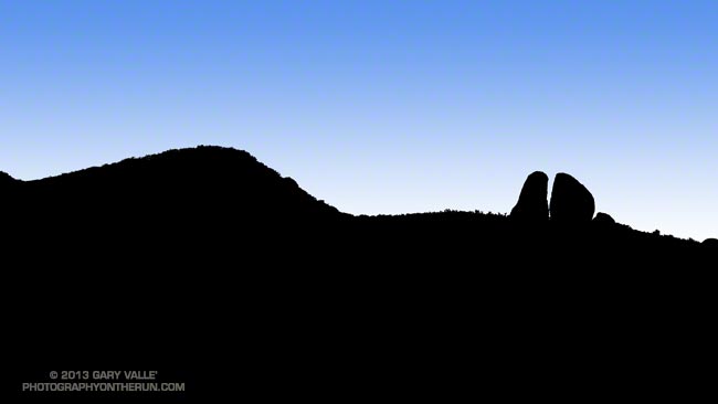
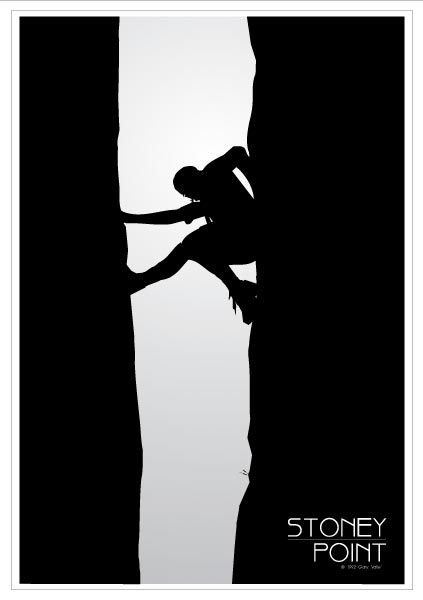
As long as we’re talking about split rocks, the poster above was based on a photo of mine from 1971 of “Split Rock” at Stoney Point, near Los Angeles. Rock climbers of my generation will recognize the Robbins’ “blue boots” that Tom is wearing.

This type of feature is called a “chimney” and the climbing technique being employed is called “chimneying.” Chimneys vary in width from a “squeeze” chimney, in which you can barely fit your body, to chimneys so wide it’s difficult to span their width. One side of Split Rock is average width and the other is a squeeze chimney.

Perhaps the most infamous chimney in the U.S. is the Narrows on the Steck-Salathé route on Sentinel Rock in Yosemite. The chimney abruptly changes from a comfortable width that is easily climbed to an impossibly narrow slot. It’s easy enough to get the top half of your body up into the slot, but the bottom half poses a significant dilemma. How do you make upward progress with your upper body wedged and your legs and feet dangling?

I think my upward progress into the slot might have been measured in millimeters per hour. At least it felt that way. It was so narrow that I could hold myself in place by taking a deep breath! Eventually I was able to get fully into the slot and then it was just a matter of being patient and threading my way through the remainder of the claustrophobic passage. (The photos of the Narrows in Climbing the Steck-Salathé by Guillaume Dargaud illustrate the situation well.)

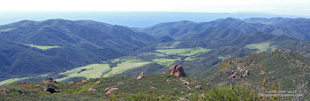
From the top of the Narrows Ron and I still had a few more pitches to climb, and we topped out shortly before sunset. Around us the granite glowed in a rich golden light — the kind of light that seems only to be found on mountains, rivers and other places the sharp edge of adventure dwells.

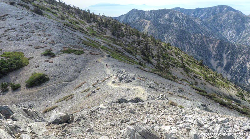
The day had been long and challenging, but we were not done — we still had to get down. By the time we reached the upper section of the descent gully it was starting to get dark. There were still patches of snow in the gully and the temperature was dropping. Rather than risk a fall on frozen snow or meltwater, we opted to bivi.

Skies were clear and the night was going to be cold. We didn’t have much in the way of warm clothes, but we did have matches and started a small fire on the granite ledge that was going to be our lodging for the night. About the time we were settling in, two headlamps came bobbing down from the direction of Sentinel. The climbers had just come off the Chouinard-Herbert route and were more than happy to call it a day. We shared our meager resources, and with the fire we all had enough to get by.

Chamberlain Rock

Chamberlain Rock on the Chamberlain Trail segment of the Backbone Trail

The large split rock on the Chamberlain Trail segment of the Backbone Trail is a familiar landmark to those that run and hike the trail. It marks the half-way point on the 3 mile, 1600′ climb from the Old Boney Trail junction to the Tri Peaks Trail junction.

The rock is volcanic in origin and part of a volcanic sequence known as the Conejo Volcanics. According to the Dibblee geologic map of the area the material of which the rock is composed was probably deposited as a lahar (volcanic debris-flow) about 16.1 to 13.1 m.y. ago.

Here’s a link to a couple of videos of lahars on YouTube. After watching the violently churning rocks and debris in the videos it’s easy to see why the rocks embedded in this volcanic matrix are broken into angular pieces and full of stress fractures.


There is a memorial plaque on the rock in tribute to Henry Chamberlain. A 1991 Los Angeles Times article characterized Chamberlain as a wealthy Los Angeles industrialist and rancher.

Mountain Fire 2013

Mountain Fire perimeter from GEOMAC timestamped 07/28/13 0230

Mountain Fire perimeter from GEOMAC timestamped 07/28/13 0230

Update Wednesday, July 31, 2013 7:00 a.m. As of 6:00 PM yesterday, Inciweb reported the Mountain Fire at 27,531 acres and 100% contained. The fire perimeter has been refined and updated.

Update Saturday, July 27, 2013 3:30 p.m. As of about 2:30 PM today, Inciweb reported the Mountain Fire at 27,531 acres and 98% contained. Full containment is expected by Tuesday, July 30, 2013. The fire perimeter has been refined and updated.

Update Thursday, July 25, 2013 7:00 a.m. As of 6:00 AM today, Inciweb reported the Mountain Fire at 27,531 acres and 92% contained. Full containment is expected by Friday, July 26, 2013. The fire perimeter has been refined and updated.

Update Wednesday, July 24, 2013 8:30 a.m. As of 6:00 AM today, Inciweb reported the Mountain Fire at 27,531 acres and 91% contained. The fire perimeter has been refined and updated.

Update Monday, July 22, 2013 1:15 p.m. Significant rain fell in the area of the Mountain Fire yesterday. The Mt. San Jacinto automated weather station located near Long Valley recorded 2.36 inches of rain. As of 6:00 PM yesterday (July 21), Inciweb reported the Mountain Fire was 68% contained. This morning’s AFMP MODIS fire dectections showed no new detections in the last 24 hours.

Here’s an interactive Cesium browser View the Mountain Fire perimeter from GEOMAC timestamped 07/28/13 0230. This is a 3D view that can be zoomed,rotated and tilted. Placemark locations are approximate. GPS tracks (yellow) of some of the area’s trails have been added. Requires Google Earth plugin.

Previous snapshots (most recent first):

Mountain Fire perimeter from GEOMAC timestamped 07/28/13 0230.

Mountain Fire perimeter from GEOMAC timestamped 07/24/13 1521.

Mountain Fire perimeter from GEOMAC timestamped 07/24/13 0128.

Mountain Fire perimeter from GEOMAC timestamped 07/22/13 2348.

Mountain Fire perimeter from GEOMAC timestamped 07/21/13 2211.

Mountain Fire perimeter from GEOMAC timestamped 07/21/13 0118.

Mountain Fire MODIS fire detections as of 07/21/13 1330 MDT with GEOMAC fire perimeter timestamped 07/21/13 0118.

Mountain Fire MODIS fire detections as of 07/20/13 1430 MDT with GEOMAC fire perimeter timestamped 07/18/13 1402.

Mountain Fire MODIS fire detections as of 07/19/13 1630 MDT with GEOMAC fire perimeter timestamped 07/18/13 1402.

Mountain Fire MODIS fire detections as of 07/19/13 1200 MDT with GEOMAC fire perimeter timestamped 07/18/13 1402.

Mountain Fire MODIS fire detections as of 07/19/13 0730 MDT with GEOMAC fire perimeter timestamped 07/18/13 0000.

Mountain Fire MODIS fire detections as of 07/18/13 2200 MDT with GEOMAC fire perimeter timestamped 07/18/13 0000.

Mountain Fire MODIS fire detections as of 07/18/13 1600 MDT with GEOMAC fire perimeter timestamped 07/18/13 0000.

Mountain Fire MODIS fire detections as of 07/18/13 1430 MDT with GEOMAC fire perimeter timestamped 07/18/13 0000.

MODIS Google Earth fire data is from the USDA Forest Service Remote Sensing Applications Center Active Fire Mapping Program web site. Fire perimeter is the most recently available from the GEOMAC web site at the time this post was updated.

The following additional information was included with the MODIS fire detections KML file:

This KML displays the MODIS fire detections at a spatial resolution of 1km for the past 6 hours, 6-12 hours, 12-24 hours and the previous 6 day period. Each 1km MODIS fire detection is depicted as a point representing the centroid of the 1km pixel where the fire is detected. The 1km footprint of the MODIS pixel for each detection is also displayed.

KML file generated by the USDA Forest Service Active Fire Mapping Program. Please see //activefiremaps.fs.fed.us for additional fire mapping products and information.

Disclaimer: Although these data have been used by the USDA Forest Service, the USDA Forest Service shall not be held liable for improper or incorrect use of the data described and/or contained herein. The information contained in these data is dynamic and is continually updated. This disclaimer applies both to individual use of the data and aggregate use with other data. The USDA Forest Service reserves the right to correct, update or modify this data and related materials without notification.

Mt. Baldy Take Two

Runners on the trail to Telegraph Peak

What better place to be running on a hot July day in LA than the highest point in Los Angeles County — Mt. Baldy! Last Saturday I’d done the Ski Hut loop on Mt. Baldy (officially Mt. San Antonio), and today I was doing another variation of the loop, this time with Skye and Ann.

Note that I use the term “with” here somewhat loosely. They’ve been training for the TransRockies Run this August, and putting in a lot of time and miles on the trails. How much? Today’s run was just part of a 90+ mile, 22,000′ gain week for Ann.

Even though both of them had done hilly 23-24 mile runs the day before, I still had to try and find ways to slow them down:

“You know the route-finding on the next section of trail is a little tricky…”

or

“Let me get a little ahead so I can get a photo of you guys coming up the trail…”

or

“I’m not sure I got that rock out of my shoe. Can you guys hang on for a second…”

or

“Pleaseee slooow dooownn…”


On the way up we did a variation of the Ski Hut/Baldy Bowl Trail that goes to the site where two Grumman F6F-5N Hellcat fighters crashed in a snowstorm March 21, 1949. Seeing the wreckage was a somber reminder of just how unforgiving mountain weather can be. It also brought to mind the image of a similar big-engined, vintage, single-prop fighter doing a spectacular, banked, high speed pass (just) over the summit of Mt. Baldy not long after I’d crossed the Run-to-the-Top finish line a few years ago. Today there wasn’t going to be a problem with the weather, or for that matter, anything else.

After topping out on Baldy we ran over to West Baldy and back, and then continued down the Devil’s Backbone Trail to the Notch. The running from the Baldy-Harwood saddle down to and along the Devil’s Backbone is scenic and technical, and just about as good as mountain trail running gets.

We refilled our hydration packs at the Notch restaurant and then continued on to Thunder Mountain and Telegraph Mountain. The view of Baldy from Telegraph was excellent and it was easy to see Baldy Bowl and the route of the Ski Hut/Baldy Bowl Trail. We’d already done most of the 6000′ of elevation gain we would do today, and about 3000′ of the loss. Now on the 6.5 mile descent from Telegraph to Manker Flat we’d get to do the other 3000′.

Here are few additional photos from the run. Click the image for more info and a larger image.


Near the Top


Descending Baldy


Above Harwood Saddle


Devil’s Backbone


Devil’s Backbone


Baldy Peaks

Mt. Baldy Ski Hut Loop

Hikers on the summit of Mt. Baldy

As might be expected on a holiday weekend, it was busy on Mt. Baldy. Hikers and runners were doing the peak by all the regular routes — the Ski Hut/Baldy Bowl, Devil’s Backbone, Bear Canyon/South Ridge and North Backbone trails.


I did a variation of the Ski Hut loop. This loop starts at Manker Flat (about 6160′) and ascends Mt. Baldy (10,064′) via the Ski Hut/Baldy Bowl Trail and then descends the peak using the Devil’s Backbone Trail and ski area service road. Along the way I also ran over to West Baldy (9988′) and Thunder Mountain (8587′). This variation is about 14.5 miles with 5000′ gain/loss vs 10.5 miles and 3900′ gain/loss for the basic loop. If you throw in Telegraph Peak, it adds another 3.5 miles and 1000′ of gain/loss.

The weather was spectacular with just enough clouds to make the sky interesting. Temps were comfortably cool on top, and although warmer down at the Notch, OK for running over to Thunder.

Some related posts: Back to Baldy, Mt. Baldy Run Over the Top, South Ridge Relic, Up & Down Mt. Baldy’s South Ridge