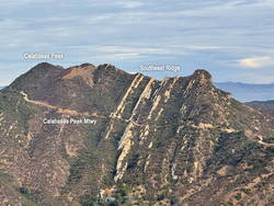
On the way down from Saddle Peak last Sunday, the “knob” at the end of Calabasas Peak’s southeast ridge caught my eye. For some time, I’ve been curious about the ridge and the unique sandstone ribs that form its backbone. The odd knob at the end of the ridge just increased my curiosity.
This morning found me running (and hiking) up Calabasas Peak Mtwy. fire road towards Calabasas Peak. My rough plan was to do Calabasas Peak, explore the rock formations along the peak’s southeast ridge, and then do Topanga Lookout Ridge Loop and Saddle Peak.
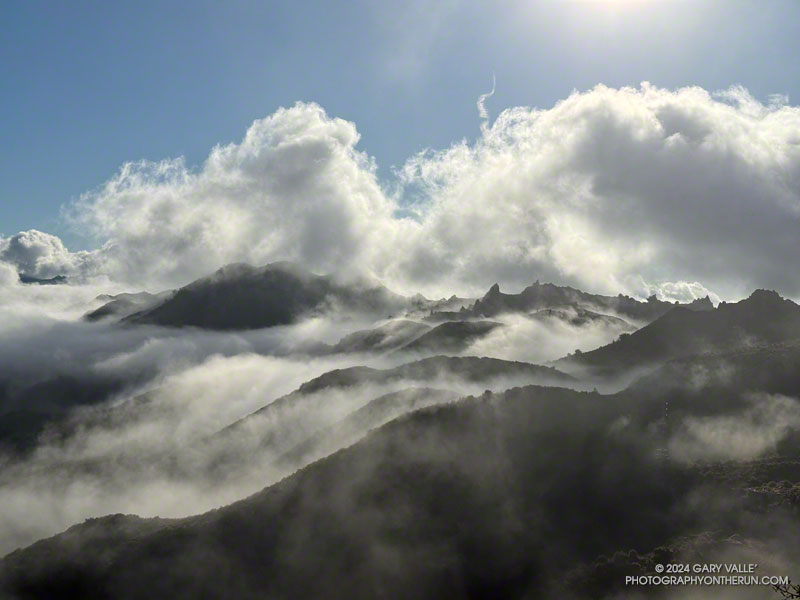
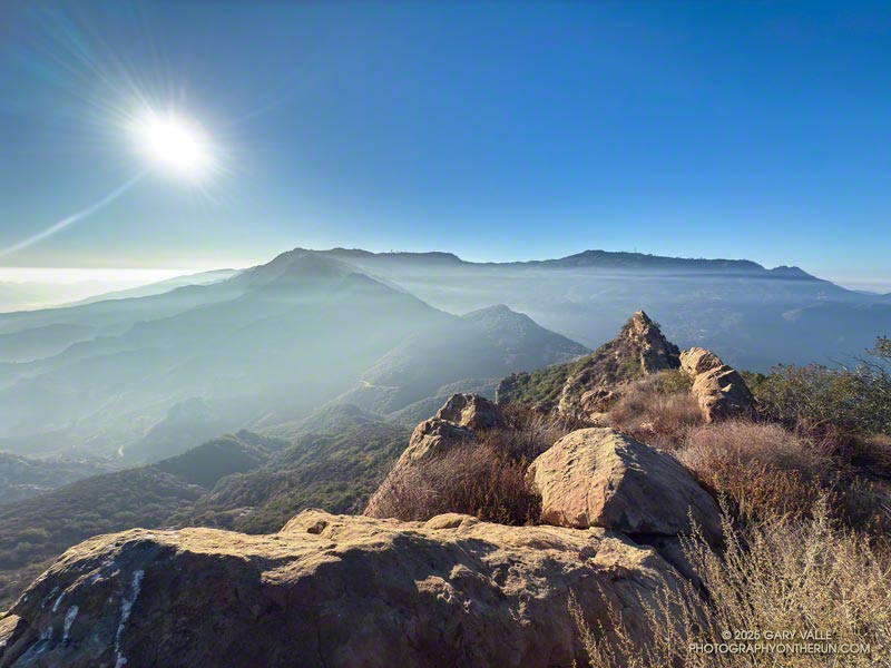
Near the top of the fire road, I stopped to take a photo of the rock formations and rising sun. The marine layer created a peculiar veil of fog and haze that accentuated the rocks and ridges.
After a quick ascent of Calabasas Peak, I returned to the viewpoint at the top of the fire road and started working down the southeast ridge. A steep, brushy, convoluted, little-used path wound down and around the tops of the rock ribs along the ridge to a small clearing at a saddle below the “knob.”
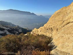
It turned out that it was not a knob but another rocky rib that looked like a knob when viewed head-on. It was relatively easy to access the rib from the clearing. I ascended the rib until I ran out of rock, then descended it to a point below where I had joined it.
I briefly debated continuing down the ridge but decided to retrace my steps and return up the ridge to the viewpoint.
Once back on the fire road, I jogged down to its junction with Red Rock Road and started up Topanga Lookout Ridge. The rib at the end of Calabasas Peak’s southeast ridge doesn’t look anything like a knob from Topanga Lookout Ridge!
Later in the run, when I was on the way down from Saddle Peak, I looked across the canyon at the “knob” on Calabasas Peak and smiled. Checking it out had been an enjoyable adventure.