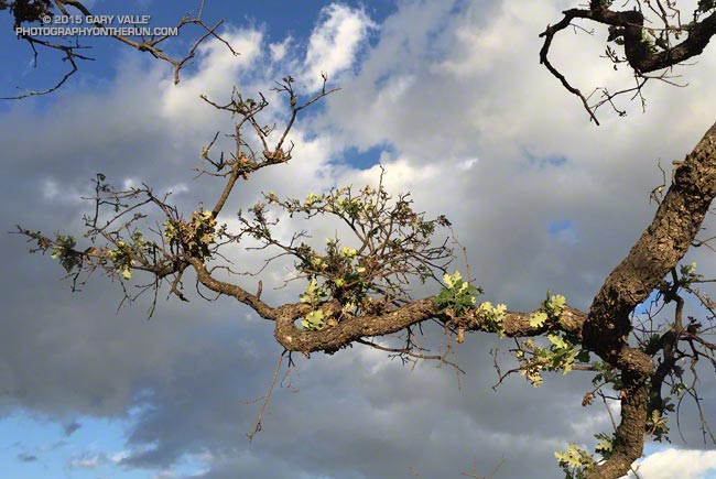
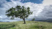
Sprouting new leaves as if recovering from a wildfire, this drought-stressed valley oak at Ahmanson Ranch benefited from the unusual amount of rain in Southern California during July and September.
Valley oak at Ahmanson Ranch
Between July 1 and October 1, the Cheeseboro RAWS, located on a hilltop about two miles away, recorded more than two inches of rain.
Update January 15, 2021. “The Tree” died in the Spring of 2020, when Ahmanson was closed due to COVID-19. Although scorched in the Woolsey Fire, it never recovered from the 2011-2015 drought, and that appears to have been the primary cause of death.
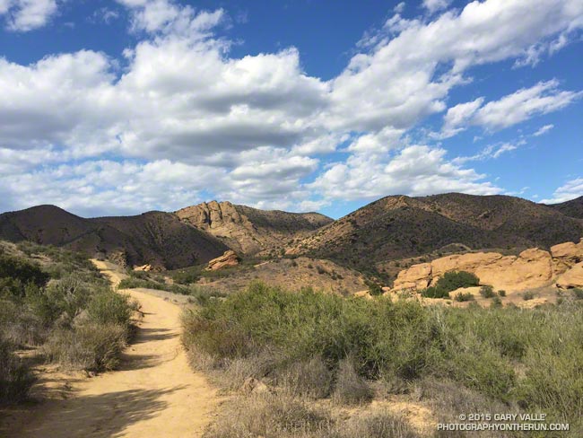
Wow, there have been some spectacular afternoons recently! That’s the Chumash Trail yesterday.
The Chumash Trail is one of Simi Valley’s best trails. It’s tough and technical, and has great views. From bottom to top it’s about 2.6 miles with an elevation gain of about 1150 feet.
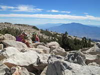
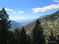
It was a little past noon and Downtown Los Angeles was about to hit a high of 100°F for the second consecutive day. From my vantage point I couldn’t quite make out Downtown; it was 80+ miles away, somewhere in the light haze to the west. Across Banning Pass Mt. San Jacinto loomed, massive and pyramidal, and down the spine of the range stood Mt. Baldy, surrounded by its siblings.
Summit of San Gorgonio Mountain
Ann, Patty and I were enjoying the summit of 11,503′ San Gorgonio Mountain following a 13+ mile run and hike from the Momyer Creek trailhead in Forest Falls. Although it is nearly four miles longer than the Vivian Creek route and gains an additional 1000′ of elevation (6500′ vs 5500′), this superb alternative is a more runnable way up the mountain, with more of backcounty feel and alpine flavor.
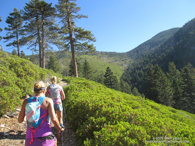
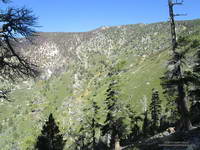
Alpine terrain above Little Charlton – Jepson saddle
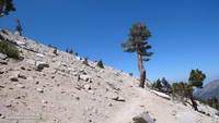
It was cool on the summit, but I was still warm from running what I could of the final couple of miles up the peak. In that last stretch the trail contours around Jepson Peak, passes the Vivian Creek and Sky High Trail junctions, and then works its way up to the blocky summit of Gorgonio — the highest point in Southern California.
Lodgepole and Limber Pine cones.
Despite the record-setting hot weather, the temperature on the way up the mountain had been pleasant. Our pace had been conversational. Among other topics Ann told of her amazing experiences running the UTMB and Patty talked about photography and her trip to Zion. I spoke of lapse rates & compressional heating, Chinquapin nuts, and Lodgepole & Limber pines . At least for me, the miles passed with distracted ease.
The Lake Fire burned over the divide near Shields Peak.
From the switchbacks above Plummer Meadows you could see where the Lake Fire overran San Bernardino Peak Divide in the area of Shields Peak. The 31,359 acre Lake Fire started the afternoon of June 17 near the Forsee Creek trailhead southwest of Jenks Lake and burned a huge swath through the San Gorgonio Wilderness. The fire burned to within 0.4 mile of the summit, near the C-47B “Gooney Bird” crash site on the Sky High Trail. Here is a Google Earth view from the west along the crest of the San Bernardino Peak Divide showing part of the burn area and another view along the divide from the east. Much of the north and east side of Gorgonio is within the Lake Fire Closure Area.
Mill Creek Canyon from the Vivian Creek Trail
After about 15 minutes on the summit it began to get chilly and it was time to head down. The descent of the Vivian Creek Trail is as much of a challenge as the ascent of Falls Creek. Although I’ve run it many times, I conveniently forget just how convoluted, rocky, and technical it is. Part way down a double-fall of huge trees completely blocked the trail. One tree had broken on impact and the route choice was to either squeeze through the fracture or go the long way around.
We had become spread out on the descent, but were now running together on Valley of the Falls Drive. This 1.4 mile stretch on pavement connects the Vivian Creek trailhead to the Momyer Creek trailhead, completing the 24 mile loop. A short distance past the Fire Station we reached the gravel parking area. No longer obscured by trees, the view opened to a panorama of mountains that looked impossibly rugged and tall. Had we really just been up there?
My legs would answer that question following the two hour drive home.
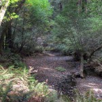
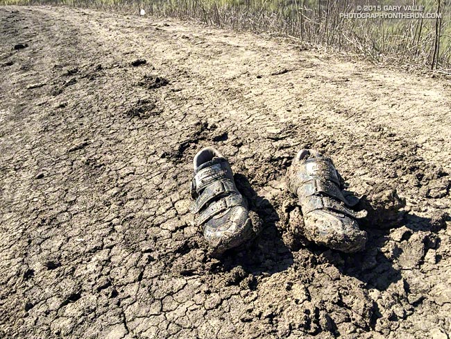
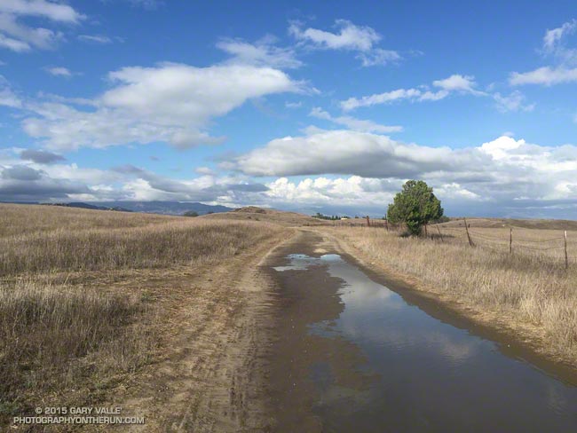
Ahmanson Ranch gets notoriously muddy when it rains, but it is exceptionally rare for it to rain enough in the Summer to do a run in the mud. Due in part to a warm Pacific, El Nino and a little boost from the Madden-Julian Oscillation in early July, it’s been a record two mud run Summer at Ahmanson Ranch!
The first mud run day was on July 18, when the Cheeseboro RAWS recorded 1.32 inches of rain. That day I ran in the San Gabriels, where the main issue was thunderstorms.
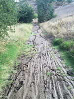
Muddy Upper Las Virgenes Canyon
Tuesday (September 15) was a different story. It rained hard overnight — more than three-quarters of an inch — and in the afternoon I did one of my standard weekday loops from the Victory Blvd. trailhead — out East Las Virgenes Canyon, through Las Virgenes Canyon, and up the Beast to Lasky Mesa. It felt more like November than September. After running through a particularly muddy section in Las Virgenes Canyon, heavy plates of mud had built-up on my shoes. Normally I would curse, but on this run I just laughed. It was great to be out in the wet and muck.
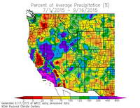
WRCC Percent of Normal Precipitation
Both days set rainfall records at Downtown Los Angeles (USC). July 18 was the wettest day in July and July 2015 the wettest July since recordkeeping began in 1877. September 15 set a new rainfall record for the date and was the second wettest day in September on record. To date, September 2015 is the third wettest September on record. The rain year (July 1 to June 30) is off to a great start in Southern California and the 2015 El Nino has continued to strengthen.
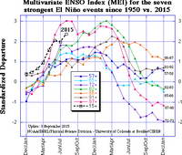
The 2015 El Nino is being compared to the “Super” El Ninos of 1997-98, 1982-83 and 1972-73. It’s too early to tell how the 2015 event will stack up against 1997-98 and 1982-83, but it already has exceeded the strength of the 1972-73 event. How might a Super El Nino affect Southern California rainfall? Historically, they have produced some of the wettest rain years on record. Downtown Los Angeles (USC) recorded 31.01 inches of rain in 1997-98 and 31.25 inches in 1982-83.
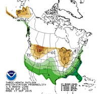
CPC Winter Precipitation Outlook
The climate context is different than it was decades ago, but very strong El Ninos are different beasts and rev up the atmosphere in a way that dominates global weather. Assuming the 2015 El Nino maintains (or increases) its strength into November or December, it should produce above average precipitation in Southern California this rain season, and perhaps result in an above average rain year for the southern half of the state. This is reflected in the Climate Prediction Center’s latest round of 3-Month Seasonal Precipitation Outlooks, including the Winter outlook for December, January & February 2015-16. We’ll see!