Category Archives: nature

A Two Mud Run Summer and Wet Winter Outlook for Southern California

Mud puddles on Lasky Mesa following record rainfall on September 17, 2015.

Ahmanson Ranch gets notoriously muddy when it rains, but it is exceptionally rare for it to rain enough in the Summer to do a run in the mud. Due in part to a warm Pacific, El Nino and a little boost from the Madden-Julian Oscillation in early July, it’s been a record two mud run Summer at Ahmanson Ranch!

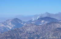
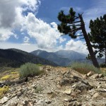
The first mud run day was on July 18, when the Cheeseboro RAWS recorded 1.32 inches of rain. That day I ran in the San Gabriels, where the main issue was thunderstorms.

Mud in upper Las Virgenes Canyon following record rainfall on September 15, 2015.
Muddy Upper Las Virgenes Canyon

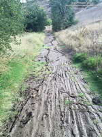
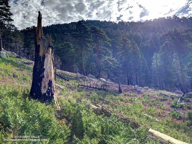
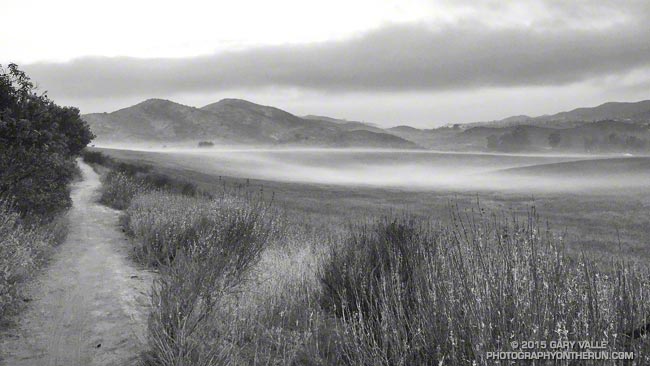
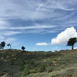
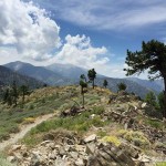
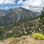
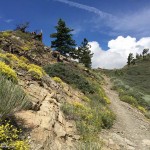
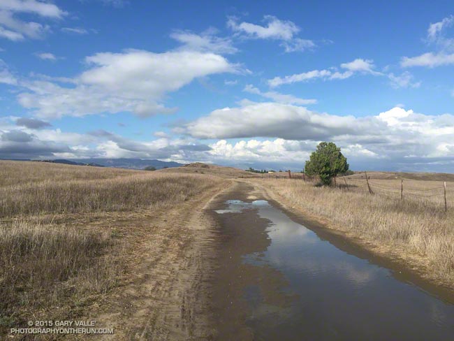
Tuesday (September 15) was a different story. It rained hard overnight — more than three-quarters of an inch — and in the afternoon I did one of my standard weekday loops from the Victory Blvd. trailhead — out East Las Virgenes Canyon, through Las Virgenes Canyon, and up the Beast to Lasky Mesa. It felt more like November than September. After running through a particularly muddy section in Las Virgenes Canyon, heavy plates of mud had built-up on my shoes. Normally I would curse, but on this run I just laughed. It was great to be out in the wet and muck.

Western Regional Climate Center map of the percentage of normal precipitation in the West for the period July 1 to September 16, 2015.
WRCC Percent of Normal Precipitation

Both days set rainfall records at Downtown Los Angeles (USC). July 18 was the wettest day in July and July 2015 the wettest July since recordkeeping began in 1877. September 15 set a new rainfall record for the date and was the second wettest day in September on record. To date, September 2015 is the third wettest September on record. The rain year (July 1 to June 30) is off to a great start in Southern California and the 2015 El Nino has continued to strengthen.

Multivariate ENSO Index (MEI) for the seven strongest El Nino events since 1950 vs. 2015.
MEI for Seven Strongest El Ninos Since 1950

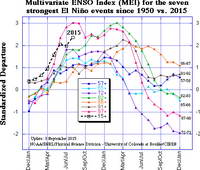
Based on the July-August Multivariate ENSO Index (MEI), for the time of year the 2015 El Nino is one of the three strongest El Ninos since 1950. A survey of dynamical and statistical ENSO models by the IRI & CPC suggests continued warming in the central equatorial Pacific with a peak of the temperature anomaly in the Nino 3.4 region in the OND or NDJ season.

The 2015 El Nino is being compared to the “Super” El Ninos of 1997-98, 1982-83 and 1972-73. It’s too early to tell how the 2015 event will stack up against 1997-98 and 1982-83, but it already has exceeded the strength of the 1972-73 event. How might a Super El Nino affect Southern California rainfall? Historically, they have produced some of the wettest rain years on record. Downtown Los Angeles (USC) recorded 31.01 inches of rain in 1997-98 and 31.25 inches in 1982-83.

Climate Preciction Center's Winter Precipitation Outlook for December-January-February 2015-16
CPC Winter Precipitation Outlook

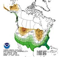
The climate context is different than it was decades ago, but very strong El Ninos are different beasts and rev up the atmosphere in a way that dominates global weather. Assuming the 2015 El Nino maintains (or increases) its strength into November or December, it should produce above average precipitation in Southern California this rain season, and perhaps result in an above average rain year for the southern half of the state. This is reflected in the Climate Prediction Center’s latest round of 3-Month Seasonal Precipitation Outlooks, including the Winter outlook for December, January & February 2015-16. We’ll see!

Related post: July Deluge a Preview of Southern California’s Upcoming Rain Season?

Waterman Mountain: Fallen Trees, Forest and Ferns

Area burned by the Station Fire on Waterman Mountain

The area in the image above was burned by the Station Fire on September 7, 2009. That morning I’d just crossed the peak-top finish line of the Baldy Run to the Top and using a tiny point and shoot camera took this snapshot of the Station Fire burning on Mt. Waterman.

Station Fire burning on Waterman Mountain the morning of September 7, 2009
Station Fire on Mt. Waterman

The image of the fallen trees and ferns is from today’s counterclockwise circuit of Waterman Mountain from Three Points. It was taken at an elevation of about 7100′ about 3.5 miles from Three Points and about 1.5 miles west of the Twin Peaks Trail junction. Here the Station Fire burned swaths of forest, running up steep gullies and ridges on the south slopes of the mountain.

Part of a Burned Area Emergency Response (BAER) image taken of the Station Fire Burn Area by the NASA Ikhana remotely piloted aircraft
Ikhana BAER Burn Intensity

The purple hues in this Burned Area Emergency Response (BAER) image taken by the NASA Ikhana remotely piloted aircraft in 2009 are indicative of the burn severity in the vicinity of Three Points and Mt. Waterman. (Ikhana image courtesy of NASA Dryden and NASA Ames. Composite image created using Google Earth Pro.)

Coulter pines burned in the Station Fire along the Three Points - Mt. Waterman Trail
Pines Burned by the Station Fire

The yellow track in the BAER image is of the Three Points – Mt. Waterman loop. The track includes a side trip to the summit of Mt. Waterman I didn’t do today. About one-third of the approximately 20 mile loop was impacted by the fire. If the loop is done counterclockwise the first couple of miles are the most severely burned and have the most downed trees and Poodle-dog bush. Use trails have developed around the fallen trees, but it seems a new tree or two has fallen each time I do the route. With care the Poodle-dog bush is generally avoidable.

Some related posts: After the Station Fire: After the Station Fire:Three Points – Mt. Waterman Loop, Three Points – Mt. Waterman Loop, Southern Pacific Rattlesnake on the Burkhart Trail, Twin Peaks Trail Run

Inspiration

Pine Mountain and Mt. Baldy from Lightning Ridge

The day before the Angeles Crest 100, after checking in for the race in Wrightwood, I drove over to Inspiration Point to have lunch, go for a short hike, and enjoy being in the mountains. The day was exceptional.


Click an image for more info and to display the image full-size.