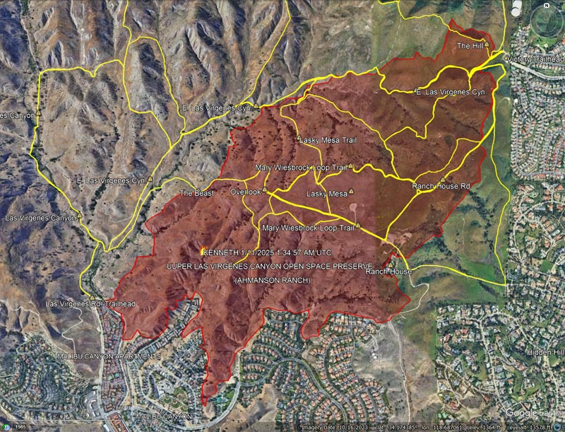
According to the CAL FIRE Kenneth Fire Incident Page, the fire burned 1,052 acres, and was contained on January 12, 2025. The Kenneth Fire is the third significant fire to affect this area in the last 20 years — the other two being the 2005 Topanga Fire and 2018 Woolsey Fire.
At about the time the fire started, a personal weather station near the Victory Trailhead recorded the wind from the ENE at about 11 mph, gusting to 22 mph. At this station, the wind moderated somewhat over the course of the afternoon and early evening, but picked back up overnight.
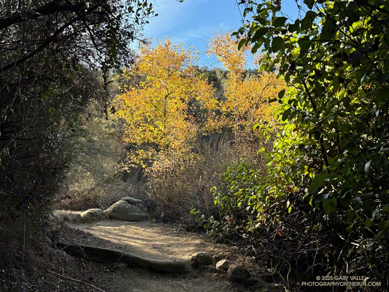
The vegetation within the burn area is oak savanna — a plant community characterized by grassland and scattered oaks. In the case of Ahmanson Ranch the oaks are valley oaks and coast live oaks. The last known blue oak in the Preserve died in the Winter of 2022-23.
Taking into account their respective populations, the percentage of valley oaks destroyed by the Kenneth Fire far exceeded the percentage of coast live oaks. As the climate has warmed, the mortality rate of valley oaks in the southern part of their range has been increasing and their range retreating northward.
Although the wind was not as strong as it was on January 7-8, it was exceptionally dry. Prior to January 2025, Downtown Los Angeles only recorded 0.16 inch or rain for the Rain Year starting July 1 and Water Year beginning October 1. As of January 9, the period July 1, 2024 to January 9, 2025 was tied with 1962-63 as the driest on record.
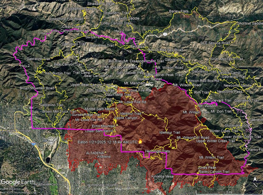
Due to inconsistencies in the CLOSED AREA DESCRIPTION in the order, and the boundary shown on the Forest Service closure maps, the eastern boundary of the closure area could not be determined. For example, the CLOSED AREA DESCRIPTION describes the boundary continuing “south along the Winter Creek Trail” and then “south along the Upper Winter Creek Trail to Chantry Flat Road.” The closure maps published by the Forest Service do not show this.
The Gabrielino Trail in Santa Anita Canyon appears to better match the border depicted in the Forest Service maps. However, because of the low resolution of the Forest Service maps, it is impossible to be sure. There are other inconsistencies as well. For example, in the Forest Service’s overview map of the closure, the Sturtevant Trail is shown as open (green), but in the order, it is one of the trails listed as closed.
It looks like the area that didn’t burn within the Eaton Fire Closure Area may be larger than the area that did burn. When there is a plausible, atypical threat to public safety from the fire, such closures may make sense. However, the trails in these unburned areas often remain part of a long-term closure. Popular trails outside of the Bridge Fire Burn Area, such as the Devil’s Backbone, Ski Hut/Baldy Bowl, South Hawkins, and Hawkins Ridge Trails, are still listed as closed for the remainder of 2025!
The following trails are listed as closed in Forest Order No. 05-01-25-05. Several of these trails are entirely outside of the Eaton Fire Burn Area.
Mount Wilson Trail Winter Creek Trail (Upper)** Winter Creek Trail (Lower)** Idlehour Trail Castle Canyon Trail Sam Merrill Trail (Lower) Sam Merrill Trail (Middle) Sam Merrill Trail (Upper) Echo Mountain Trail Mount Lowe West Trail Mount Lowe Trail (East) Tom Sloane Trail Gabrielino National Recreation Trail** Bear Canyon Trail** Ken Burton Trail** Mount Zion Trail** Sturtevant Trail** Sturtevant Loop**
**Outside of Eaton Fire Burn Area. The Winter Creek Trail above Hoegee’s passes through a 60 yd. stretch of the Burn Area at one point.
Trails aren’t just lines on a map. Each and every trail is a valued resource that shouldn’t be closed for years under the guise of public safety, or because the trail happens to be on the wrong side of a section line, road, or other feature that is convenient to use as a closure border.
Hopefully, the Eaton Fire Closure Order will be modified when the Forest Service determines that the threat from the Eaton Fire has passed.
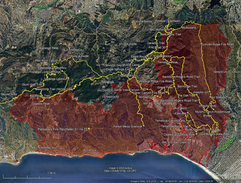
The information in this post may be incorrect or out of date. For official information, see the Kenneth Fire incident page on the CAL FIRE website. The perimeter is from the Wildland Fire Interagency Geospatial Services (WFIGS) Group and National Interagency Fire Center (NIFC) website. The perimeter shown has a poly_DateCurrent of 1/11/2025 1:34:57 AM UTC.
The Kenneth Fire started Thursday afternoon, January 9, 2025, near the Victory Trailhead of Upper Las Virgenes Canyon Open Space Preserve (Ahmanson Ranch).
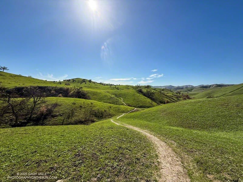
The Sunday before the start of the Palisades Fire, I ran the Trippet Ranch Loop from the Top of Reseda. Yet another weak cold front had brushed Southern California, producing little precipitation. The weather was nearly perfect for the run — breezy at times, with moderate temperatures and some high clouds.
The NWS Los Angeles/Oxnard office was already expressing concern about a potentially dangerous wind event early in the week. In an Area Forecast Discussion midday Sunday, they warned, “..STRONG AND DAMAGING WINDS AND HIGH FIRE DANGER LIKELY FOR PORTIONS OF VENTURA AND LOS ANGELES COUNTIES…” Of course, few of us could envision the staggering devastation that would ensue in the week ahead.
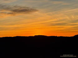
Sunrise from Fire Road #30, near the beginning of the Trippet Ranch Loop from the Top of Reseda.
The eastern horizon glowed orange as I ran down Fire Road #30 from dirt Mulholland. If I could have seen a few days into the future, the road would have been filled with firefighters and equipment battling to halt the Palisades Fire’s westward progress. The road was empty this morning, save the scurrying towhees and raucous scrub jays.
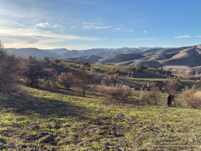
At the Hub, I stopped to take a photo of Eagle Rock. Bush poppy, a prolific fire follower, covered much of the area between the Hub and Eagle Rock. This burned in the 2021 Palisades Fire. The hazy view extended past Eagle Rock to Calabasas Peak and Boney Mountain.
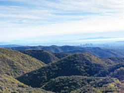
Downtown Los Angeles from Temescal Peak and the chaparral typical of the area.
Before descending to Trippet Ranch on Eagle Springs Fire Road, I turned east on Temescal Ridge Fire Road. I would return to the Hub, but first, I wanted to visit Temescal Peak and Temescal Lookout. These viewpoints have expansive views of the Santa Monica Mountains and beyond. This photo (from a previous run) is a view of downtown Los Angeles from Temescal Peak. The chaparral in the photo is typical of the vegetation in the Santa Monica Mountains. Most of this would have burned in the 2025 Palisades Fire. On a day with good visibility, San Jacinto Peak can be seen from either viewpoint. Despite some haziness, San Jacinto Peak could still be seen from Temescal Lookout this morning.
Returning to the Hub, I ran down Eagle Springs Fire Road and through the footprint of the 2021 Palisades Fire. The bright yellow flowers of bush poppy shone brightly in the morning sun. When the perimeter of the 2021 fire is overlapped with the 2025 fire, it suggests that bush poppy and other transitional vegetation in the 2021 burn area did not burn as readily in the 2025 fire as the usual chaparral species.
Continuing past the information kiosk at the corner of the parking lot, I headed up the paved road and picked up the Musch Trail. Although we haven’t had much rain this Rain Year, the past two Rain Years were very wet. Paradoxically, the vegetation is bone dry, but some small creeks and springs that haven’t run for years — such as Eagle Springs — still have water. Reflecting last year’s rain, a heavy load of red-orange berries cover most of the toyon bushes along the Musch Trail and throughout the Santa Monica Mountains.
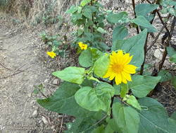
Canyon sunflower along the Garapito Trail
At the top of the Musch Trail, I turned left and worked up Eagle Rock Fire Road, past Eagle Rock, to the top of the Garapito Trail. At times, over the past couple of years, this outstanding trail has been almost impassable. Volunteer trailwork has cleared and repaired the trail multiple times. It’s a good trail for wildflowers, but the lack of rain has reduced the number of early bloomers. Today, canyon sunflower, California everlasting, and California fuchsia were blooming along the trail. This misshapen bush sunflower was blooming along Fire Road #30, near its junction with the Garapito Trail.
The approximate location hypothesized in the Washington Post article of the area where there might have been re-ignition of the New Year’s Eve fire near Skull Rock is also noted.
The locations of placemarks, trails, and other data are approximate and subject to error.