Category Archives: nature|weather

Clouds, But Not Much Rain in Los Angeles

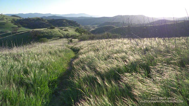
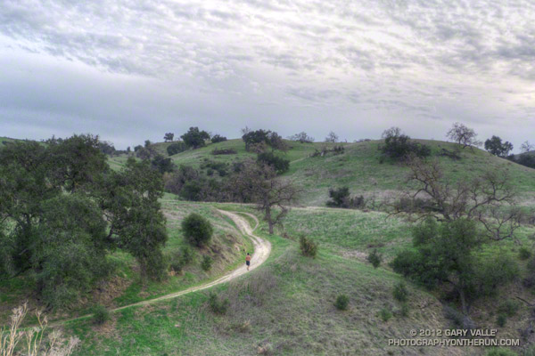
Running up to Lasky Mesa

The Cheeseboro RAWS, a couple of miles west of where this photograph was taken, is usually a good indicator of the weather in the Ahmanson Ranch area. The automated weather station recorded a paltry 0.01 inch of rain Tuesday. While this was enough to dampen the trails and create a little mud, it didn’t help much with our low water year precipitation totals.

Downtown Los Angeles (USC) also recorded 0.01 inch of rain Tuesday, bringing the water year (July 1 to June 30) total to 5.07 inches, or about 60% of normal. Some areas have had a little more rain and some a lot less. According to NWS data the Santa Barbara water year rainfall total stands at about 69% of normal, while Burbank out in the Valley has recorded only about 44% of the normal amount of rain.

Central California isn’t doing any better. Downtown San Francisco has only recorded about 42% of normal rainfall and Sacramento 45% of normal. In the first full Sierra snow survey of the season, basin averages ranged from about 28% to 54% of the normal snowpack, with a statewide weighted average of 35%.

The medium range weather models are forecasting a series of shortwave troughs will move through Southern California over the next 10 days. At the moment the systems aren’t forecast to produce much rain in the Los Angeles, but maybe that will change. We’ll see!

The photograph is from a run last week. The road leads up to Lasky Mesa in Upper Las Virgenes Canyon Open Space Preserve (formerly Ahmanson Ranch).

The Color of Rain III

Rain brings out the richness of the chaparral, enlivening its inhabitants, enhancing its colors, and enriching its fragrances. But in recent weeks rain storms have been few and rainfall far below normal.

The 2011-2012 rain season started out well enough. Thanksgiving Day the water year rainfall total for Downtown Los Angeles (USC) was about an inch above normal. But between Thanksgiving and Christmas the drier weather often associated with La Nina conditions became predominant, and water year totals dropped to about normal.

Northern and Central California were actually much drier than would be expected during a La Nina. Mammoth Mountain recorded no new snow between December 5 and January 19 — about a month and a half! Our dry spell was nearly as long. Downtown Los Angeles recorded no measurable rain between December 17 and January 21.

The storms Saturday and Monday added about 1.3 inches of rain, boosting the water year rainfall total to 5.06 inches. As of yesterday this was 1.87 inches below normal and about 73% of the normal total.

The problem is this time of year we fall behind another 0.12 to 0.15 inch every day that it doesn’t rain. The deficit adds up quickly and if — as the medium range models currently project — we don’t get any rain for the next 10 days we’ll down another inch and at about 64% of normal. We’ll see!

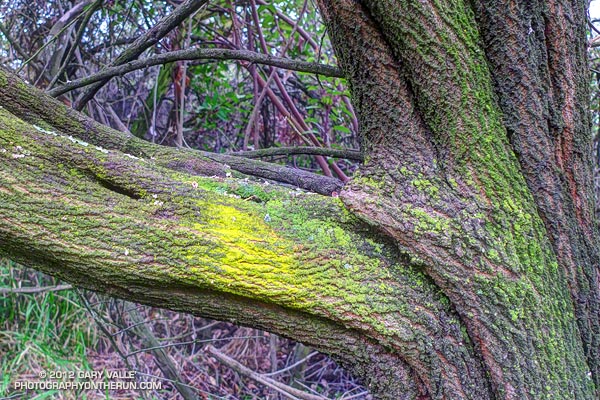
The photograph of the Ceanothus trunk is from last Sunday’s Will Rogers – Temescal loop trail run.

Related posts: The Color of Rain II, The Color of Rain

Winter Oaks, Summer Temps

Valley oaks and clouds near sunset

These valley oaks have dropped their leaves, but if you were to go by the warm temperatures we’ve been having in Southern California, you might think it was Summer.

Including today, the high temperature at Pierce College in Woodland Hills, California has reached into the 80s each of the last six days. High temperature records for December 31 – January 5 have been broken at several locations. Among the records broken, yesterday San Gabriel recorded a high of 91, Camarillo 90, and UCLA 89.

It sounds sweltering, and it can be if you’re in full sun, but it’s not like a 90 degree day in July. Days are short, shadows long, and some north-facing slopes never see the sun. And it does cool down quickly. If you take a look at the overnight lows on those six 80+ days at Pierce College, you’ll see the temperature dropped to around 40-42 degrees.

On my run Tuesday afternoon, when the photograph of the valley oaks was taken, the temperature varied by as much as 20-25 degrees between some high and low points.

It has been great weather for running, but I’m ready for a change in the pattern and a little rain!

A Few Clouds with Isolated Virga Near 20,000 Feet

Round-bottom clouds

Spotted these unusual clouds while running in Upper Las Virgenes Canyon Open Space Preserve today. Better known as Ahmanson Ranch, the open space area is on the western margin of the San Fernando Valley, northwest of Los Angeles.

The clouds were strikingly similar to clouds I’d photographed last January following the development and dissipation of a band of mid-level mammatus clouds over the San Fernando Valley. As before, the clouds were round-bottomed and were ragged with virga.

Upper air charts and model analyses indicated the clouds were at an altitude of about 20K-25K, and were associated with a very small scale upper level disturbance.

Here’s a wider view of the clouds.

Related post: Mammatus Clouds Over the San Fernando Valley, More posts…

La Nina and the 2011-2012 Southern California Precipitation Outlook

What a difference a week makes! Last week an unseasonably deep upper level low, unusually strong 170+ kt Pacific jet, and associated cold front combined to produce record-setting rainfall and cool temperatures in Southern California. This week high pressure and a weak offshore flow produced triple digit temperatures in some areas and set new high temperature records Wednesday in Downtown Los Angeles, Long Beach and Santa Barbara.

Which pattern is more likely this rain season? Will Southern California tend to be drier like this week, or wetter like last week and last year? Despite last year’s wet rain season, wet La Nina Winters are not the norm. Generally, La Nina conditions result in drier than normal rain seasons in Southern California, and El Nino wetter.

Following a Summer respite La Nina conditions have reemerged in the equatorial Pacific, and appear to be consolidating. Equatorial SST anomalies have continued to decrease and now range from -1.5°C at 100°W to -0.5°C at 170°E. Equatorial Pacific temperature cross sections show substantial subsurface cooling from July 11 to September 11. The Multivariate ENSO Index (MEI) has dropped from -0.5 for July/August to -0.8 for the August/September season. This drops the MEI from a rank of 16th for July/August to 13th for August/September since 1950. This is well within La Nina territory but weaker than last year’s rank of 1st for August/September.


A precipitation composite for seven years* since 1950 in which La Nina conditions persisted or reemerged in the year following a first year La Nina indicates that “on average” the coastal Southern California climate division recorded about 5 to 6 inches less precipitation than normal for the period November through March. The percent of normal water year rainfall recorded at Downtown Los Angeles (USC) ranged from a low of 47% (1971, 7.17″), to a high of 106% (1955, 16.00″). The average rainfall for these years was 70.5%, or 10.7″.

We’ll get the official NOAA/CPC outlooks next week around October 20, when CPC’s Three-Month Precipitation Outlooks and NOAA Winter Outlook are expected to be released.

*The years included in the selection were 1950-51, 1955-56, 1962-63, 1971-72, 1974-75, 1999-2000 and 2008-09. The base period was 1971-2000. The selection was based on the MEI.

Inspiration Point to Islip Saddle Trail Run

Mt. Baden-Powell from Inspiration Point

The viewpoint above is a few hundred yards up the Pacific Crest Trail from Angeles Crest Highway at Inspiration Point. Craig and I had paused near the start of our trail run from Inspiration Point to Islip Saddle to check out the view. 


The mountain across the way is Mt. Baden-Powell (9,399′).  Three miles away as the bird flies, our earthbound route along Blue Ridge, down to Vincent Gap, and then up the forty-something switchbacks to the top of the peak would total around nine miles. From the top of the peak it would be about eight miles to Islip Saddle.

Zooming in on the peak, the white arrow marks the location of the Wally Waldron Limber Pine. For more than a millennia this grand tree has stood high on this mountain, resisting the strongest of winds and the most perfect of storms. Not all are so durable. A limber pine feet away from the Wally Waldron tree was toppled in a storm last Winter.

Given the short-sleeve weather, the most unexpected discovery on today’s run was ice under the trees just up the ridge from the Wally Waldron tree. The ice had been deposited on the trees a few days before, when an unseasonably strong storm set a new rainfall record for the date in Los Angeles.

The running on the PCT between Mt. Baden-Powell and Islip Saddle was outstanding and the views superb. Along the way we did the short climb to the top of Throop Peak, checked out the Mt. Hawkins Lightning Tree, and enjoyed the cold spring water at Little Jimmy Spring.

Some related posts: Perils of Winter, Surprises of Summer; Wally Waldron Limber Pine; PCT from Inspiration Point to Islip Saddle