Category Archives: photography|landscape

Owens Peak from Walker Pass

Three climbers pick their way through the rubble on the southwest ridge of Owens Peak.

A good way to think of this adventure is as an excellent 17 mile trail run on the PCT north from Walker Pass (5217′), combined with a three mile scramble up and down the rocky southwest ridge of Owens Peak (8453′).

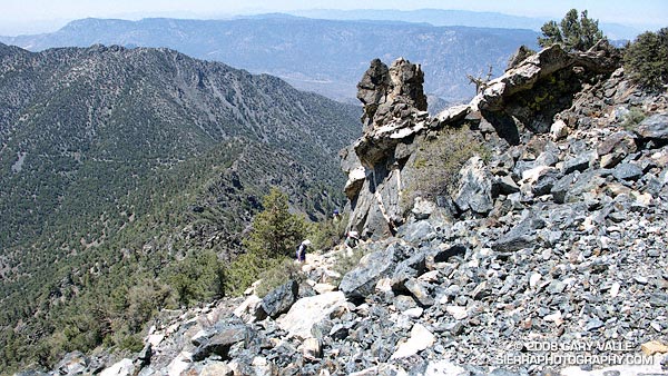
Based on the expanse of granite seen from Hwy 395, I had visualized the southwest ridge of Owens Peak as a somewhat vegetated but relatively clean  ridge. Wrong! The ridge is a geologically complex mix of fractured metamorphic, metavolcanic and gabbro rock capping the granite of Owens Peak. In most areas the rocky sections of the ridge are bounded by dense brush and pinyon pine.

We pretty much stuck to the crest of ridge on the way up, continuing up and over the steep outcrop just below the summit. Although it was an interesting section to climb, the outcrop was quite loose, and we dropped below it on the descent.


Mt. Whitney, Mt. Langley, and Olancha Peak from Owens Peak.
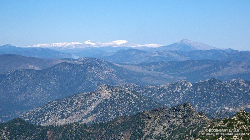
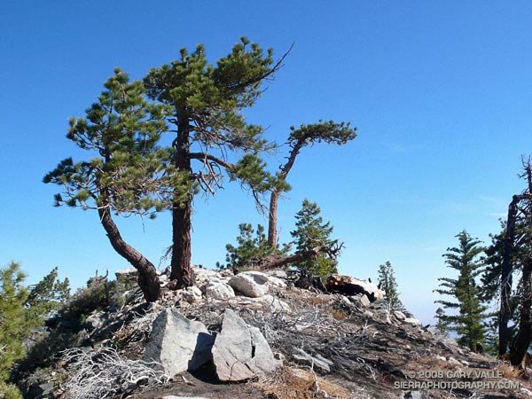
Owens Peak is relatively isolated, and the views from the summit are sweeping. To the north we could see Mt. Whitney, Mt. Langley, Olancha Peak, and the windblown crest of the Sierra between Army and New Army Pass.

Not everyone would see the positive aspects of doing a 10 mile route to a peak that could be done in only 3.5 miles — or enjoy the ups and downs, and somewhat tedious route-finding along a brushy and crumbling ridge. It’s an acquired taste. It was good to share the experience with enthusiastic friends who were still smiling as we jogged down the last yards of trail to the car.

Here’s a Google Earth image and a Google Earth KMZ file of a GPS trace of our route. GPS reception was weak at times on the way up and the track has been edited to remove some of the larger errors.

Note: After the Spring snowmelt, it appears there are no natural water sources on the PCT between Walker Pass and Owens Saddle (mile 8.6), or on the ridge.

Related post: PCT North of Walker Pass

Eagle Rock – Topanga State Park

Eagle Rock in Topanga State Park.

Mammoth Mountain reports more than a foot of snow fell over the Memorial Day weekend but that translated to cool, puffy white clouds and blue sky weather in the Los Angeles area, seldom seen this late in May.

Taking advantage of the great weather on Sunday my son and I ran the Garapito figure-eight course in Topanga State Park.  We did a slight variation that climbs Eagle Rock before descending the Garapito Trail.

Gov. Schwarzenegger’s revised state budget, released May 14, rescinded the funding cuts that would have closed 48 California state parks, including Topanga State Park. For now, it appears these state parks will remain open.

Some related posts: Eagle Rock Silhouette, Eagle Rock and Clouds

Secret Trail to Calabasas Peak

View east from near the summit of Calabasas Peak.

Along with the Chumash Trail to Rocky Peak Rd., the Secret Trail to Calabasas Peak is one of my favorite local short trail runs. The two mile route to the peak is a mix of single track and dirt road that gains about 750′ in elevation.

The trail winds its way through shaded ravines, dense chaparral and sandstone outcrops to Calabasas Peak Motorway. This fire road is followed south about half a mile to a use trail (on the right) that follows a ridge to the summit. It’s also possible to continue higher up the road and access the summit from the south. There is a survey marker (actually two) on the summit.

Here’s a Google Earth image showing the summit area, and a Google Earth KMZ file of a GPS trace of my route.

Calabasas Peak Motorway continues down to Stunt Rd. and connects to the Stunt High Trail and points beyond. Here’s what Calabasas Peak looks like from the Backbone Trail near Saddle Peak.

Related posts: Tapia Bound, A Long Run Kind of Day

San Gabriels High Five

Snow on the Pacific Crest Trail west of Mt. Baden-Powell, May 18, 2008.

When considering where I might run this weekend, the words “snow” and “altitude” had a certain appeal. Record high temperatures had been set in the Los Angeles area on Friday and Saturday, and there was little doubt that more temperature records would fall today.


Angeles Crest Highway and the Islip Saddle parking area from the northwest ridge of Mt. Islip.
A couple of weeks before I had dodged a few remnant snow drifts on Pleasant View Ridge. From that vantage point you could see that there was much more snow on the steep, north facing slopes along the ridge between Mt. Islip and Mt. Baden-Powell. The S-shaped ridge spans a distance of several miles and links five peaks over 8000 ft: Mt. Islip, Mt. Hawkins, Throop Peak, Mt. Burnham, and Mt. Baden-Powell. Two of the peaks, Mt. Baden-Powell and Throop Peak, exceed 9000 ft. Today, the plan was to do these five peaks as part of an approximately 17 mile out and back route from Islip Saddle, enjoy the snow before it melted, and try to escape the triple digit temps of the lowlands.


Cabin on the summit of Mt. Islip.
Logistically, the difficult peak is Mt. Islip. While the other peaks can be done with relatively minor deviations from the trail, Mt. Islip stands alone, more than a mile from the PCT at Windy Gap. This time I opted to climb Mt. Islip from Islip Saddle via the northwest ridge. I’ve been investigating stunted Jeffrey and Sugar pines found along the windswept ridges of the San Gabriels, and this direct approach would give me the opportunity to check out more trees.

That was this morning, now I was on by way back from Mt. Baden-Powell, and about a quarter-mile east of Throop Peak. Hot, thirsty, dispirited, and nearly out of water, I had stopped to dig into the side of a dirty snowbank– attempting to get to snow that at least looked clean. The air temperature was eighty-something, but my fingers were stinging with cold as I scooped the coarse crystals into my Camelbak.

It’s amazing what a few sips of chilled water and an icy cold pack against your back can do for your demeanor. A few minutes before I had been debating whether I should just skip Throop Peak and Mt. Hawkins, and get down to Little Jimmy Spring ASAP. Now I could do these peaks and continue to enjoy a very warm — but beautiful — day in the San Gabriel Mountains.

Here’s a Google Earth image and a Google Earth KMZ file of a GPS trace of my route. GPS reception was poor climbing the ridge to Mt. Islip.

Related post: Snowless San Gabriels