Category Archives: malibu creek state park

The Best Trailhead for Trail Running in Malibu Creek State Park

Talepop Trail - Malibu Creek State Park

In a 2013 post, I suggested that the Cistern/Phantom Trailhead on Mulholland Highway might be the best trailhead to start the Bulldog Loop.

More than 10 years and a lot of trail running miles later, I still prefer to do the Bulldog Loop from that trailhead. More than that, most of the trail runs I do in Malibu Creek State Park are from the Cistern/Phantom Trailhead.

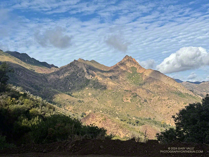
There are two key reasons — the scenery is spectacular and the route options endless. Over the past year, I’ve run from the Cistern/Phantom Trailhead a dozen times, on routes ranging from 2 to 23 miles.

Two of those runs were this March. One was on March 9. I’d done the Bulldog Loop several times recently, so the idea was to do a Bulldog-length run, without doing the Bulldog Loop. It was a “follow my nose” run that included Reagan Ranch, Malibou Lake overlook, Crags Road, Tapia Spur Trail, Grasslands Trail, Talepop Trail, Las Virgenes Trail, Liberty Canyon Trail, and Phantom Trail. It turned out to be about 17 miles, with an elevation gain/loss of about 2400′.

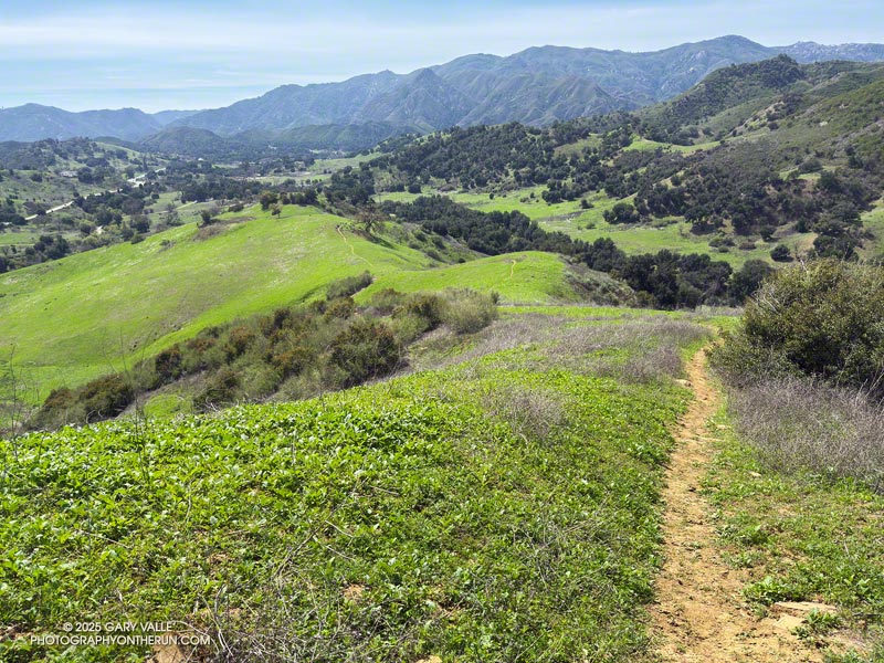
I enjoyed that run so much, I came back a week later and did a similar run. But this time the route included the Bulldog Loop. The idea was to use established trails and do the longest loop I could in Malibu Creek State Park, without repeating any part of the route. The run turned out to be about 23 miles, with around 4200′ gain/loss.

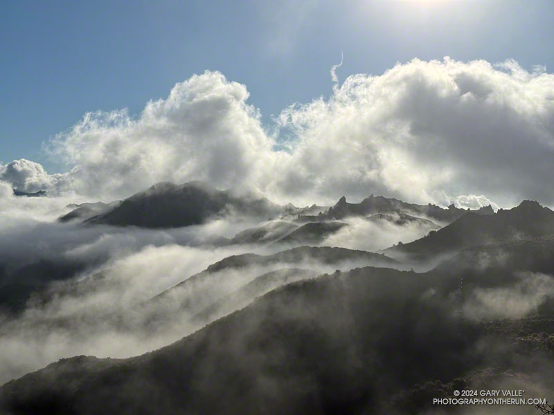
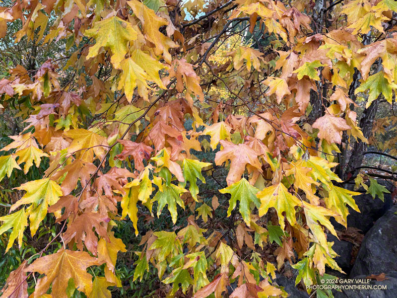
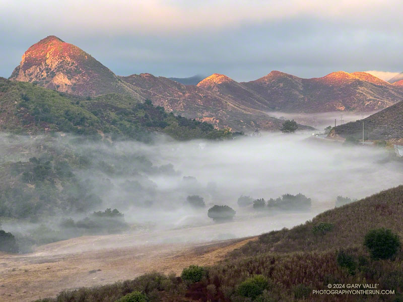
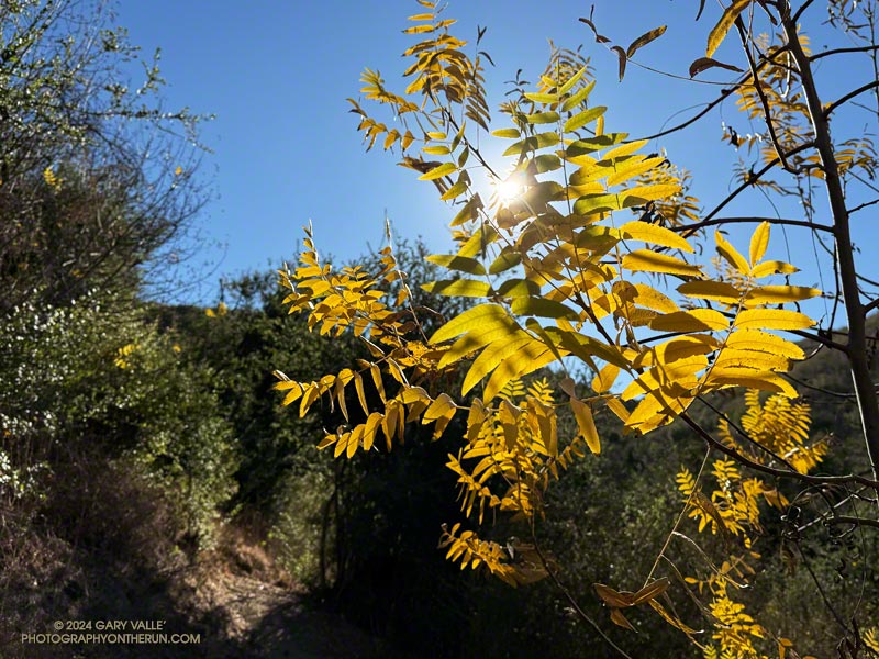
It was an outstanding run, with a delicate creek crossing, eye-catching halo, green hills, Spring wildflowers, and an unusual encounter with a Great Blue Heron (video).

Here’s an interactive, 3-D terrain view of the 23-mile loop in Malibu Creek State Park, and a few photos from the run.

Some related posts:
Best Trailhead to Start the Bulldog Loop?
Bulldog Loop Plus the Phantom Loop
Reagan Ranch at Sunrise
Wandering Around Malibu Creek State Park
Spring Fever Running the Phantom Loop in Malibu Creek State Park
Late Start on the Bulldog Loop

Brent’s Mountain, Malibu Creek State Park

Brent's Mountain, Malibu Creek State Park. Photography by Gary Valle'

Brent’s Mountain from Mesa Peak Mtwy fire road in Malibu Creek State Park.

The peak and several other locations in the area appear to be named after Edwin James Brent, a furniture store owner in Los Angeles.

“Brents Mountain” is noted on the U.S.G.S. 1929 Solstice Canyon topographic map. The rocky peak towered above Brent’s Mountain Crags resort, which was acquired in 1939 by the Salvation Army.

Adventurers driving to the remote resort likely would have stopped at the Shell gas station at Brent’s Junction — the intersection of Ventura Blvd. (Hwy 101) and Las Virgenes Road.

The photograph of Brent’s Mountain was taken on a recent run of a variation of the Bulldog Loop.

Some related posts:
Clearing Clouds, Santa Monica Mountains
Turning California Sycamore Along Malibu Creek
Reagan Ranch at Sunrise

Clearing Clouds, Santa Monica Mountains

Clearing clouds along the crest of the Santa Monica Mountains. Photography by Gary Valle'

Clearing clouds along the crest of the Santa Monica Mountains from Bulldog Mtwy fire road. The photograph was taken on a recent run of a variation of the Bulldog Loop.

Some related posts:
Turning California Sycamore Along Malibu Creek
Reagan Ranch at Sunrise

Turning California Sycamore Along Malibu Creek

Turning California Sycamore Along Malibu Creek. Photography by Gary Valle'

Multihued leaves of a turning California sycamore near the seasonal bridge on Malibu Creek. The photograph was taken on a recent run of a variation of the Bulldog Loop.

Related post: Reagan Ranch at Sunrise

Reagan Ranch at Sunrise

Reagan Ranch at sunrise from the Cistern Trail in Malibu Creek State Park. Photography by Gary Valle'

Reagan Ranch at sunrise from the Cistern Trail in Malibu Creek State Park.

The photograph was taken on a recent run, near the start of an extended version of the Bulldog Loop.

Some related posts:
Late Start on the Bulldog Loop
Exploring Lake Vista Trail and Ridge
A Displaced Bridge, Exceptional Backbone Trail Views, and a Card Table Along the Bulldog Loop

California Black Walnut Along the Phantom Trail

California Black Walnut Along the Phantom Trail

A California black walnut lends a little Fall color to the chaparral on the Phantom Trail in Malibu Creek State Park.

From a run of the Phantom Loop, starting at the Cistern Trailhead on Mulholland Highway. Here’s an interactive 3D-terrain view of the 7-mile route.

Some related posts:
Spring Fever Running the Phantom Loop in Malibu Creek State Park
Ladyface Via the Phantom Trail and Heartbreak Ridge
Bulldog Loop Plus the Phantom Loop