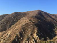
From this afternoon’s run at Ahmanson Ranch.

From this afternoon’s run at Ahmanson Ranch.
There’s magic in the morning, when the owls hoot softly and there is a chill in the air.
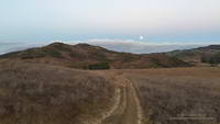
I’d started my run from the Wendy Dr. trailhead when there was just enough light to see the trail. The moon was poised low in the western sky, full and bright. As I passed the frame of the Chumash ‘Ap at the Satwiwa Native American Indian Culture Center I’d thought about the Chumash, and how well they must have known this land. It is one thing to visit a place, and quite another to live there.
Today the plan had been to run to the Ray Miller Trailhead and do a little of the Ray Miller 50K course along the way. At the start of the run I hadn’t decided which route I was going to take to Ray Miller — Hell Hill or Fireline. I’d finally opted for Fireline, since that route would follow the last 5 miles of the 50M/50K course and is much more runnable.
I hadn’t run Fireline since the 2013 Ray Miller 50K. With only 7 miles on my legs (instead of 26) it didn’t seem nearly as steep. Once at the top of Fireline, and after doing a bit more uphill on Overlook fire road, I eventually got to the best part of today’s run — the 2.5 miles of scenic downhill on the Backbone Trail to the Ray Miller trailhead on PCH.
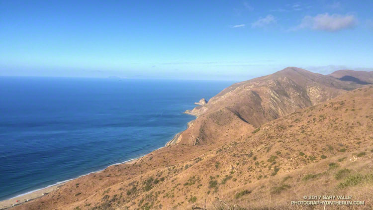
The Pacific was painted in a palette of wide-gamut blues and although it was hazy offshore, there were excellent views along the coast. To the west Anacapa and Santa Cruz Islands could just be seen in the ocean haze and Mugu Peak loomed golden in the morning sun. The Ray Miller Trail is very popular and on the way down I passed several runners in the first miles of their morning run.
At the Ray Miller parking lot my Garmin fenix read 12 miles. Just like climbing a mountain, getting to the turnaround point of a long self-supported run is only part of the adventure. I gulped down some water at the water fountain; checked how much water I had left in my pack; ate a Snickers left over from Halloween; and then started the 1000′ climb back up the Ray Miller Trail to the Overlook fire road.
The run was going well and at the start of the climb I was thinking about following the 50M/50K course up and around Mugu Peak before starting the trek back to Wendy Drive. By the time I’d reached the top of Ray Miller and had climbed up to the high point of Overlook fire road my mileage appetite wasn’t so big. Following a short side trip into La Jolla Valley, I returned to the Overlook fire road, descended Hell Hill and Wood Canyon, and started working my way back up Sycamore Canyon on the Two Foxes Trail.
At the Danielson Multi-use area there was a large group participating in a guided hike. A familiar runner with a distinctive hat was making his way around the group. It was photographer and ultrarunner Larry Gassan. Larry joined me for the remainder of the run and his stories made the run back up Sycamore Canyon and Upper Sycamore much more interesting.
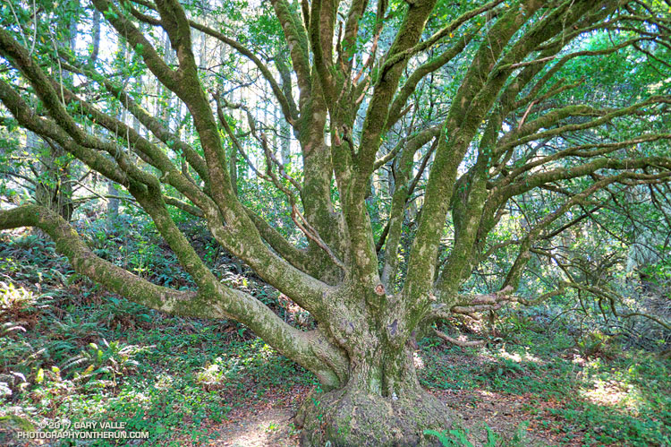
A sprawling coast live oak along the Sky Trail in Point Reyes National Seashore. From the run to Kelham Beach from the Bear Valley Visitor.
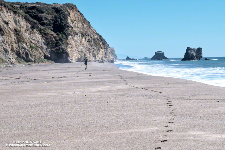
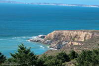
The sand was compact, the breeze cool, the surf up and the running oh so pleasant. Brett and I were running south along Kelham Beach, an idyllic stretch of sand between Point Resistance and Miller’s Point within Point Reyes National Seashore. If the tide was not too high we hoped to reach an area of dramatically folded strata along the 150′ tall sea cliffs.
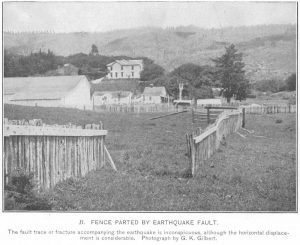
Our adventure had started with a short run from the Bear Valley Visitor Center to a spot on the San Andreas Fault where a fence was reconstructed to illustrate how the Point Reyes Peninsula lurched 16 feet to the northwest during the 1906 San Francisco earthquake. Fences and roads in the Point Reyes area built across the fault trace were offset by as much as 20 feet during the earthquake.
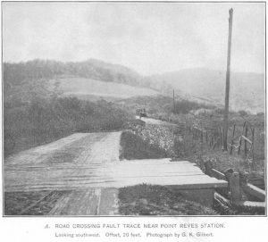
It is the San Andreas Fault that makes the story of the Point Reyes Peninsula so unusual. A glance at a geologic map shows the rocks of the peninsula to be geologically distinct from those on the other side of the San Andreas. Essentially the Point Reyes Peninsula is an island on the margin of the Pacific Plate that is sitting against the North American Plate. The San Andreas Fault is the boundary between the two plates.
The core of the Point Reyes Peninsula is a granite similar to a granite found in Southern California. Over many millions of years the chunk of crust was propelled northward along the San Andreas Fault by the movement of the Pacific Plate. The story is not a simple one, involving a combination of faults. At some point — perhaps near current day Point Lobos — the granite core was overlain by the sedimentary rocks we see on the peninsula today.
It seems likely that at times during its 10 million year journey northward from Monterey, the Point Reyes Peninsula may have been separated from the coast. With more than 80% of its perimeter currently bounded by water, it may once again become an island.
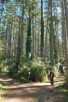
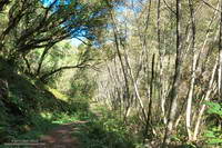
After visiting the fault zone we ran across the Point Reyes Peninsula to the coast using the Bear Valley, Mt. Wittenberg, Sky and Coast Trails. For the most part the trails were duff-covered, tree-lined, shaded and cool. For someone that runs mostly in Southern California this was practically nirvana. The previous Saturday I’d run a 50K race on a rocky, exposed course near Los Angeles in 90 degree temps and gusty Santa Ana winds. In the West San Fernando Valley the temperature this year has reached at least 95 °F every month from March through October. In July, August and September the highest temp each month was over 110 °F!
It was not 110 °F now. It was about 60 ocean-conditioned degrees. Brett and I had reached the first point where the beach narrowed. There was still room to run, but the beach narrowed even more ahead. We watched as a large wave broke and washed up to the rocks. It looked like the tide was going out, but we weren’t sure. Although the surf wasn’t huge, there was a consistent swell of maybe 6′-8′.
In between sets we took a look around the next corner and it looked sketchy. Debating, we watched as more waves washed up to the base of the cliffs. That part of the exploration would have to wait until another day with a lower tide!
Related post: Point Reyes – Sky Trail Keyhole Loop
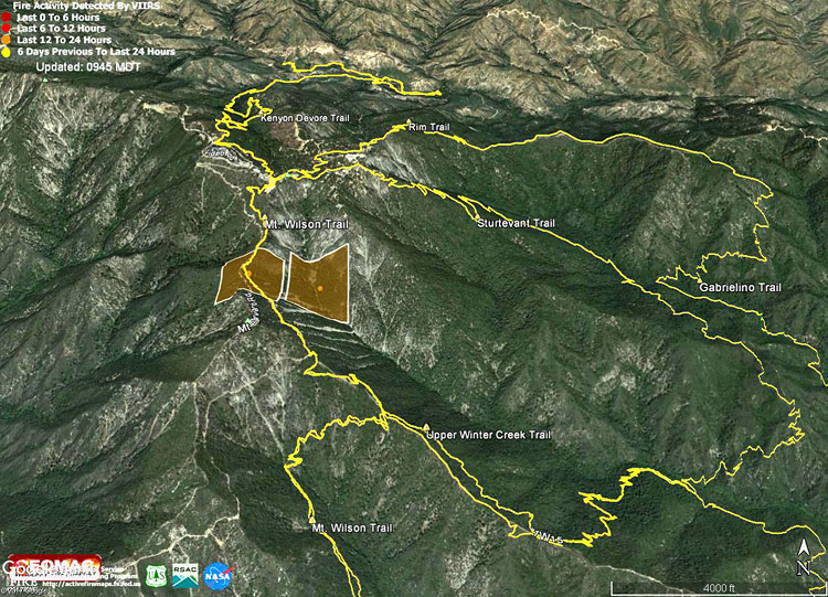
The Google Earth image above shows the VIIRS fire detections from the Wilson Fire. The data is from USDA Forest Service Geospatial Technology and Applications Center Active Fire Mapping Program. The square markers show the approximate location of yesterday’s detected fire activity. The markers do not indicate the areal extent of the fire. This Forest Service Briefing Map shows the completed line and uncontrolled fire line earlier today.
The fire started before dawn yesterday and according to a tweet from @Angeles_NF at 9:31 this morning was 25% contained and at 50 acres.
The yellow traces are GPS-based tracks of trails in the area. The tracks are subject to various errors and should be considered approximate.
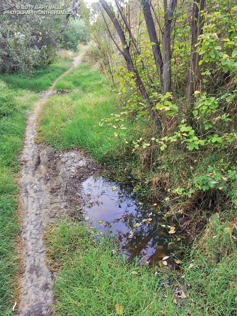
The groundwater in upper Las Virgenes Canyon appears to have been replenished by the above normal rainfall last rain season.
The little spring pictured above has persisted through the dry season and farther up the canyon a tiny stream has trickled defiantly through the Summer. The mainstem creek in upper Las Virgenes Canyon isn’t flowing as it was during the Winter, but the sand at the crossing near the Cheeseboro connector trail remains damp.
It shouldn’t take a huge amount of rain to get the creek flowing again. We’ll see!
Related post: Los Angeles Rainfall Above Normal, But…