Category Archives: upper las virgenes canyon open space preserve

American Kestrel Pair in Upper Las Virgenes Canyon Open Space Preserve

American Kestrel Pair in Upper Las Virgenes Canyon Open Space Preserve

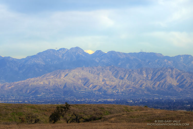
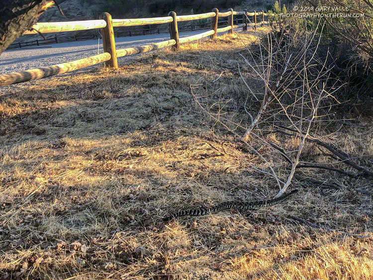
Tuesday is usually a “short run day” for me. On Tuesdays, I usually run a mile or so west on East Las Virgenes Canyon fire road, and then fork left onto another dirt road that descends a short distance, and then climbs steeply up to Lasky Mesa. Once on Lasky Mesa, I check what’s blooming, crawling or flying in the area.

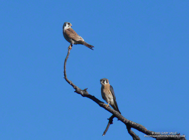
Today, as I was leaving Lasky Mesa, I scanned a grove of valley oaks for a pair of northern harriers I’ve been seeing on the mesa. I didn’t see the harriers, but another pair of much smaller raptors caught my eye.

The male and female American kestrels were perched at the top of a valley oak tree, about 25 yards away. At that distance, they were difficult to positively ID, and nearly beyond the reach of my compact camera.

Usually a kestrel will fly from a perch as soon as it spots me, but this time the pair cooperated. I stopped running, grabbed the camera from my pack, and took a couple of photos. The female kestrel is perched above the male.

Related post: Under a Falcon’s Eye

In the Distance: San Gabriel Mountains From Lasky Mesa

Mt. Baldy and the San Gabriel Mountains from Lasky Mesa.

On Winter days when the sky is clear and the visibility is good, the view of the San Gabriel Mountains from Lasky Mesa can be surprisingly detailed. In those conditions you’ll sometimes see a brilliant patch of white in the distance, through a gap in the mountains.

There are a number of peaks in the San Gabriels that are high enough to be snow-covered. Which one is it?

I suppose I could have used an app to ID the peaks on the skyline, but another way would be to draw a line on a sufficiently detailed map and “connect the dots.” The line would be drawn from Lasky Mesa, through the gap, and then extended to a mountain that would have snow. An easy way to do that is to use the “Measure” tool in Google Earth.

The title photo was taken from what used to be the helipad site on Lasky Mesa. (The work currently occupying that space was the subject of a previous post.) The gap in the mountains is the saddle between San Gabriel Peak (left) and flat-topped Mt. Markham.

Drawing the line in Google Earth reveals that the snow-covered mountain is Mt. San Antonio (10,064′) — generally referred to as Mt. Baldy. The peak is about 60 miles distant. Here’s a closer view with some of the peaks identified.

Lake Lasky Mesa

Lake Lasky Mesa - Photography by Gary Valle'

Hidden away in the central highlands of Lasky Mesa, and not found on current maps, the “lake of the four hills” is shrouded in mystery.

Perhaps the result of earth movement or some other upheaval, the hills and lake seemingly appeared overnight. They are the latest in a series of perplexing formations to suddenly materialize on the site.

Congregating Crows on Lasky Mesa

A few of the crows congregating on Lasky Mesa this Fall (2019)

Crows have been congregating on the west end of Lasky Mesa this Fall, and the number appears to be increasing. On a run earlier this week, a friend and I watched four crows chase a small bird — probably a kestrel — off the west side of the mesa.

Winter gatherings of crows are not uncommon. NPR recently aired a story about the problems created by thousands of Winter-roosting crows in Rochester, Minnesota. Closer to home, and on a smaller scale, in January 2017 I was astonished to see hundreds of crows circling about in Cheeseboro Canyon.

The Cheeseboro Canyon gathering was transient, and I hope the one on Lasky Mesa is temporary as well. Too many of the brash birds could adversely impact the limited number of kestrels and other notable birds that call Lasky Mesa home.

Follow-up on January 15, 2020. On several occasions have seen flocks of crows flying west from Lasky Mesa, toward Las Virgenes Canyon. When conditions permit, the crows use thermals to gain altitude and continue west. I’ve also noticed a general westerly flight trend of small groups of crows flying across Lasky Mesa. It may be that Lasky Mesa is a convenient waypoint on their way to a roosting/breeding location farther to the west.

Follow-up on January 3, 2020. Today, a kestrel was back in the valley oak on the west end of Lasky Mesa. No crows were nearby. Later in the run I came across a small group of crows pestering a pair of northern harriers.

Follow-up on December 24, 2019. Saw about 30 crows flying down the west side of Lasky Mesa and about 20 more in a nearby tree.

Follow-up on December 19, 2019. While I’ve seen some small groups of crows in the Lasky Mesa area this week, the large congregation appears to have dispersed.

Some related posts: Under a Falcon’s Eye, Bird Games, Crows in Cheeseboro Canyon, A Raven Story

Running Into Fall

Colorful sunset at Upper Las Virgenes Canyon Open Space Preserve

This time of year, I’m often “racing the sun” on my afternoon runs. Especially on longer runs, when the additional miles quickly consume any remaining daylight. There are benefits. Colorful sunsets are just one of them.

Tuesday’s run was one of those longer runs — from the Victory Trailhead of Upper Las Virgenes Canyon Open Space Preserve (Ahmanson Ranch) to Cheeseboro Canyon and back. One of the reasons for doing this particular run was to follow up on the reemergence of water in upper Las Virgenes Creek. As Fall has progressed, there has been a notable increase in the size and number of pools, and the amount of water in the creek. I’ve observed this in the Fall before, except during periods of drought.

This comparison shows a crossing of upper Las Virgenes Creek about one-third mile north of the junction of Las Virgenes Canyon and East Las Virgenes Canyon. It shows the intriguing reemergence of water in this reach of the creek, despite a dry Summer, and — as of Tuesday — meager Autumn rainfall. The increase in water in the reach seems to have resulted from seasonal reductions in daylight, temperature, evaporation, plant transpiration, and other factors.

Update October 22, 2019. A run over to upper Las Virgenes Creek supported the 0.46 inch of rain reported by the Cheeseboro RAWS on October 20. The ground appeared to have absorbed more rain in the Las Virgenes Canyon area, compared to the area near the Victory Trailhead. It also looked like the amount of water in the creek bed had increased.

Update October 21, 2019. The Cheeseboro RAWS, on the ridge just west of upper Las Virgenes Creek, recorded 0.46 inch of rain on October 20, the day after this run. Today, I’ll be running out that way again to see  how the rain affected the creek.

Related post: Upper Las Virgenes Creek Still Flowing in Mid-July

Ahmanson Trailhead Rattlesnake

Southern Pacific rattlesnake at the Victory Trailhead of Upper Las Virgenes Canyon Open Space Preserve.

I pressed the START/STOP button on my Garmin watch and started to walk over to the horse/hiker entrance at the Victory Trailhead of Upper Las Virgenes Canyon Open Space Preserve (Ahmanson Ranch). This “end of an Ahmanson run” routine is something that I repeat around 150 times a year. It’s so routine, it’s rote. I’m not thinking about rocks or ruts, or how far I have to go. It’s a time I can relax and reflect on the run, the weather, or whatever.

Continuing toward the trailhead entry, I pulled the water bottle from my pack. Lifting my head to take a drink, and still on auto, I began to step over the first of two large wooden beams forming the entrance.

Some primitive, protective mechanism recognized the threat before I did, and I stopped mid-stride. Then it registered — a sizable Southern Pacific rattlesnake was undulating through the boxed-in area between the two beams of the entryway.

Moving quickly through the entry and into the grass, the snake barely reacted to me. With single-minded resolution, it continued on a beeline toward the brushy area near the trailhead. A single shake of its rattle was all the bother I was worth. Here’s a short video of the Southern Pacific rattlesnake at the Ahmanson Ranch trailhead.

California kingsnake in Upper Las Virgenes Canyon Open Space Preserve, a.k.a. Ahmanson Ranch.
California kingsnake

Surprisingly, this was the first rattlesnake I’ve seen this year at Upper Las Virgenes Canyon Open Space Preserve . I’ve seen numerous gopher snakes, a couple of California kingsnakes, a California whipsnake, and the tracks of many rattlesnakes, but no actual rattlesnakes. Others have described various rattlesnake encounters at Ahmanson — one friend saw three on one ride!

Note: Most of these snakes were old enough to have survived the November 8, 2018, Woolsey Fire.

Some related posts: The First Snakes of Spring, Big Southern Pacific Rattlesnake at Ahmanson Ranch, Southern Pacific Rattlesnake