Category Archives: trails|smmc open space

Missing Snakes at Ahmanson Ranch

Legend has it that St. Patrick chased all the snakes from Ireland, and while there have been no reports of the 5th Century cleric being sighted at Ahmanson Ranch, I don’t recall a Spring and Summer when I’ve seen so few snakes in the 3,000 acre preserve.

I’ve run at Ahmanson Ranch — now Upper Las Virgenes Canyon Open Space Preserve — more than a decade. I generally run at Ahmanson a few times a week and have become very familiar with the area’s plants and wildlife.

So far this year I’ve seen no mature rattlesnakes and only one gopher snake at Ahmanson. I’ve seen a couple of baby rattlesnakes and a handful of tracks, but that’s it. In some years I’ve counted more than a dozen snake tracks during one 7 mile run.

The reduction in the snake population is likely related to back-to back years with low rainfall. This year Downtown Los Angeles has recorded only 2.72 inches of rain since January 1. That’s a deficit of nearly 8 inches and about 25% of the normal amount of rainfall.

The reduced rainfall not only reduces the population of rodents, reptiles and other prey animals sought by snakes, but also increases the likelihood snakes will be preyed upon by animals higher on the food chain. Snakes, including rattlesnakes, are eaten by a long list of birds and mammals, and may also be preyed upon by other snakes. Humans also kill a large number of snakes.

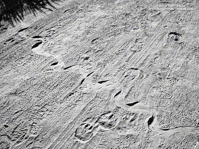
The title photograph is the track of a Southern Pacific rattlesnake.  The snake was moving from the upper left of the photo to the lower right.

Some related posts: Big Southern Pacific Rattlesnake at Ahmanson Ranch, Southern Pacific Rattlesnake

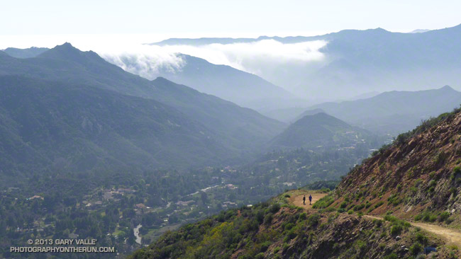
Hikers on Calabasas Peak Motorway

Hikers on Calabasas Peak Motorway

The 1.6 mile hike (one way) from Stunt Road to the rocky overlook at the top of Calabasas Peak Motorway fire road is very popular and has some great views along the way. Some stretches of the road are steep, but there are also some moderate sections and even a short flat stretch to catch your breath.

The route gains about 800 vertical feet to the viewpoint. Although many turnaround here, even better views can be had from the nearby summit of Calabasas Peak. Continuing to the peak adds about a half-mile (round trip) and around 100′ of elevation gain.

From this afternoon’s run on the Secret Trail.

Some related posts: Calabasas Peak From Saddle Peak, Secret Trail Variations

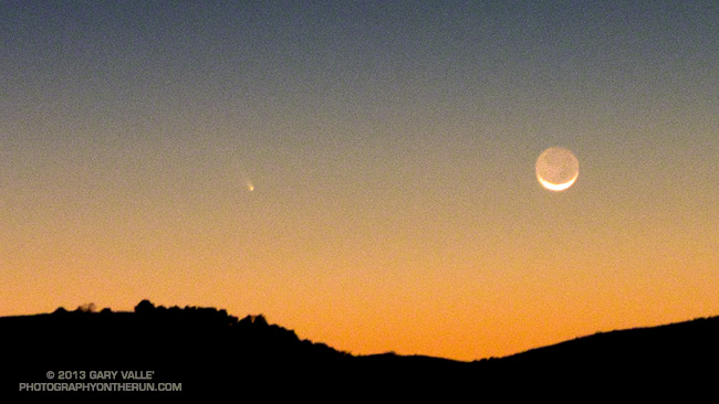
Comet PanSTARRS and the Crescent Moon

Comet PanSTARRS and the crescent moon from the Simi Hills, near Los Angeles

Did a night training run this evening in the Simi Hills, west of the San Fernando Valley, and combined it with photographing Comet PanSTARRS and the crescent moon with my normal running camera — a Panasonic Lumix LX7.

Since the comet is low on the western horizon and not very bright, it is a difficult object to photograph, and even more difficult to see with the naked eye.

I found a convenient pipe to use as a monopod and took some image sequences using the self-timer. This particular photo is from a single RAW format image shot at f/2.3 for 1 sec at ISO800 at the 35mm equivalent of 90mm.

Here’s a larger version of the image. The soft light on the face of the Moon above the crescent is earthsine — diffuse sunlight reflected from Earth.

The run was also fun. Saw and heard more poorwills and also encountered a mule deer. Didn’t see any coyotes, but certainly heard them.

Related post: Comet Holmes 17/P

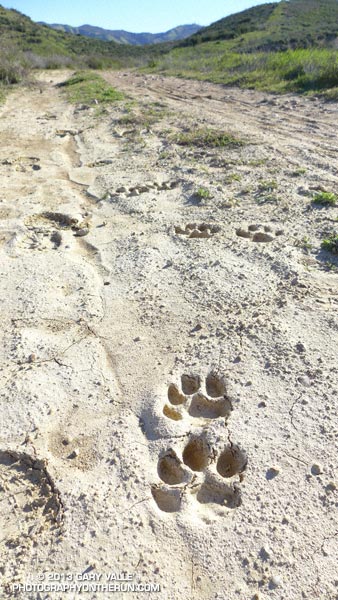
Mountain Lion Tracks on Rocky Peak Road

Mountain Lion Tracks on Rocky Peak Road

Found these mountain lion tracks on Rocky Peak Road while doing the Chumash – Las Llajas loop this morning. The pattern of the tracks suggest the animal was walking.

Based on how soft the ground was at the time the tracks were made I’m going to guess they were probably put down sometime after 1:00 AM Friday morning, while the ground was still saturated from rainfall. This would make them about two days old.

Some related posts: It’s Raining Mountain Lion Tracks!, A Bear on Rocky Peak Road?

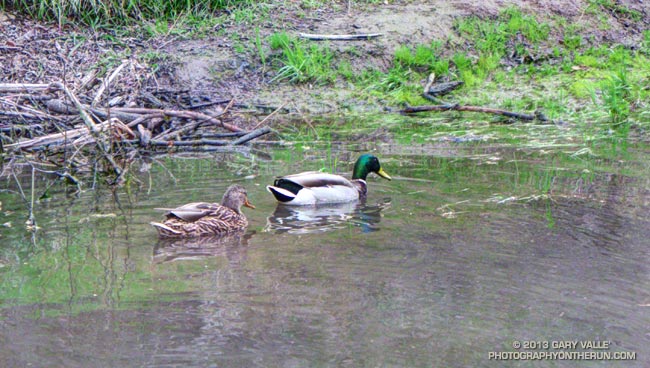
Mallards on Upper Las Virgenes Creek

Mallards on Upper Las Virgenes Creek

This rain season has been another dry one in Southern California with many areas recording about one-third to one-half of the normal amount of rainfall.

I have not seen upper Las Virgenes Creek actually flowing any time this rain season. All the creek crossings in Upper Las Virgenes Canyon north of the Cheeseboro connector have been dry to damp all Winter.

Water is pooled in places along the creek, and one of the larger pools is at the creek crossing south of the Cheeseboro connector. I had to laugh when I ran down the hill and saw this pair of Mallards enjoying the pool.