Category Archives: trails|smmc open space

Big Sycamore Canyon Circuit

Rancho Sierra Vista/Satwiwa and the Conejo Valley with snow on the peaks of the Ventura mountains

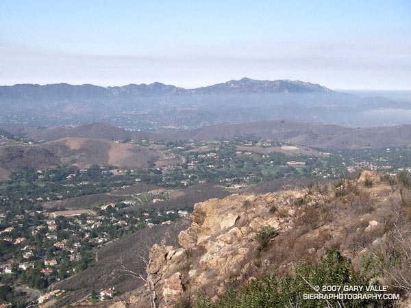
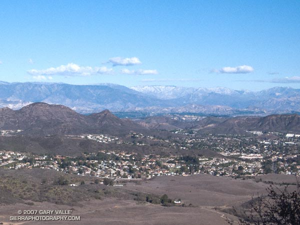
I was about a mile from the Wendy Dr. trailhead on Potrero Rd. in Newbury Park. A cold wind ruffled the chaparral, and to the north snow could be seen on McDonald Peak (6870′) and other peaks of the Ventura mountains. I was nearing the top of a rounded ridge in Rancho Sierra Vista/Satwiwa, and in a few minutes would be descending the sun-warmed Old Boney Trail into the upper reaches of Big Sycamore Canyon.

Big Sycamore Canyon extends from the ocean to within a mile or so of Potrero Rd. It forms the main trunk of an extensive network of trails in Pt. Mugu State Park. Of the many possible trail combinations, my loosely defined plan was to link some of the trails on the XTERRA Boney Mountain Trail Run course into a longer run.

The general idea was to start on the Old Boney and Blue Canyon Trails, and return via the Hidden Pond and Upper Sycamore Canyon Trails. I was looking to do about 20 miles, and wasn’t sure how far down Big Sycamore I would run, or what other trails I would do.

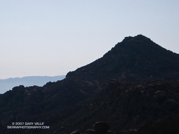
The run up and over the shoulder of Boney Mountain was brisk and blustery. On the way I checked out the waterfall spur trail and the Danielson cabin site and monument. At one point, several miles into the run, the trail rounded a ridge and descended into a bowl at the head of a broad canyon. Here, the character was unmistakably that of the wilderness — isolated and wild with the chaotic western escarpment of Boney Mountain towering above.

About two hours into the run I pulled into the Danielson multi-use area in Big Sycamore Canyon. There’s a water spigot here, adjacent to a fireplace in a low-walled picnic area. While topping off my Camelbak, I noticed a runner on nearby Big Sycamore Canyon road, then another, and another. A continuous stream of runners was passing by — I had forgotten that the Lasse Viren 20K was this weekend!

Down in the canyon the weather was perfect for the race. Swept along by the wave of runners, I missed my connection with the Two Foxes trail, and it wasn’t until the aid station at Wood Canyon road that I turned off the race course. Within a couple hundred yards I happened upon the southern end of the Two Foxes trail and worked my way back up the canyon about half a mile to the bottom of the Coyote Trail.

The previous evening I had taken a look at the Tom Harrison Santa Monica Mountains West Trail Map and noted that the Coyote Trail, Hidden Pond Trail, and Upper Sycamore Trail could all be linked together in one long single track extravaganza.

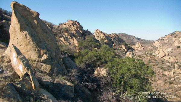
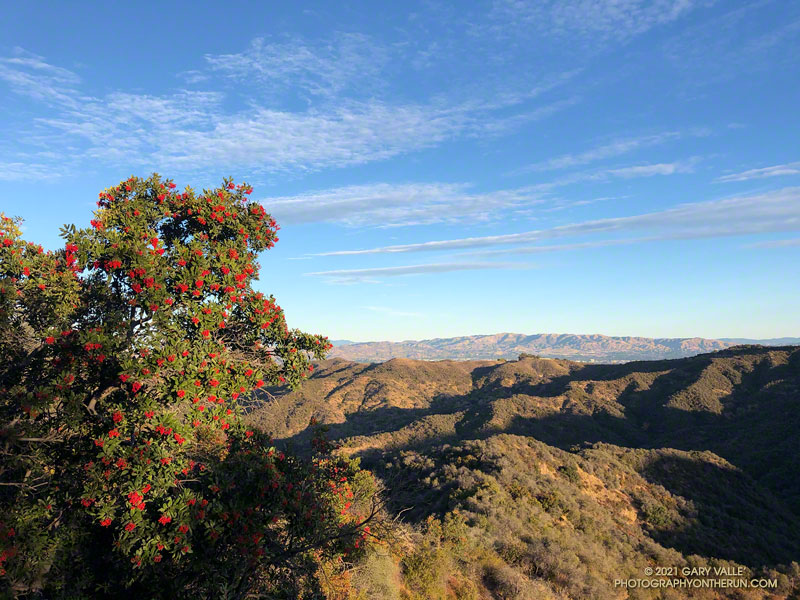
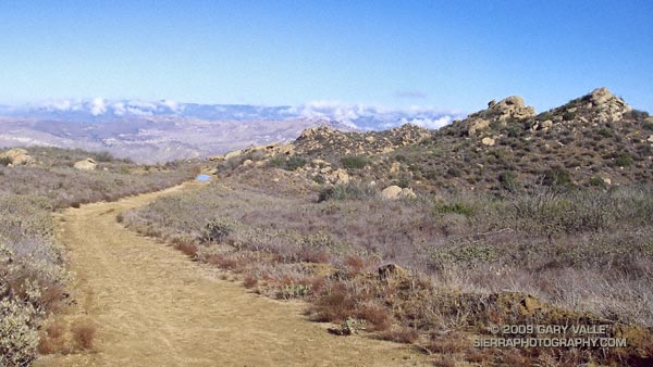
I had not done these three trails and enjoyed the exploratory feel. The Coyote Trail and Hidden Pond trails were outstanding, with excellent running and highline views. The Upper Sycamore trail is classically riparian, winding its way among white-barked sycamores and stream rubble, in a stream eroded canyon to its junction with the Old Boney Trail about 1.5 miles from the Wendy Drive trailhead.

Here’s a Google Earth image of a GPS trace of the approximately 19 mile route.

Upper Las Virgenes Canyon Backcountry

Sandstone formations on trail run in the Simi Hills

One of the most scenic and isolated areas of Upper Las Virgenes Canyon is traversed by a single track trail that links the Upper Las Virgenes Canyon fire road, northwest of Bell Canyon, to the northern extension of the Cheeseboro Ridge power line service road. The trail, shown on this Park Service map, follows an old road bed through improbable terrain.

I like to do the trail east to west. Once the power line service road is reached the most straightforward option is to turn left, and follow the road up and over the ridge and down to the 4-way junction east of Shepherds Flat. Another option is to turn right on the road and follow it a short distance to another single track that branches left from the road and leads to the Albertson Mtwy. This (dirt) road leads west to a signed intersection near China Flat. From here it is possible to work back to Shepherds Flat at the the top of Cheeseboro.

Many variations are possible, but starting at the Victory Trailhead of Upper Las Virgenes Open Space Preserve, and following the course indicated in this Google Earth image, the first route (up and over the ridge) is about 17.5 miles long. According to my GPS, an alternate route through China Flat is about 19.25 miles long. Both are interesting and challenging trail runs.

Garapito Trail Runs

Red -orange berries of toyon along the Garapito Trail

First published October 14, 2007. Updated February 4, 2021.

The numerous interconnecting roads and trails of the eastern Santa Monica Mountains can be combined to create trail runs ranging from a few miles to marathon length or more.

One of my favorite trails in this area is the Garapito Trail — a winding, up and down trail through dense, old growth chaparral. The trail connects Fire Road #30, near dirt Mulholland, to the Eagle Rock Fire road segment of the Backbone Trail, near Eagle Rock. Because it’s such a enjoyable trail, I include it in most of the runs I do from Marvin Braude Mulholland Gateway Park (Top of Reseda). The trailhead is at the southern end of Reseda Blvd., on the San Fernando Valley side of the Santa Monica Mountains.

Each run in the series starts the same way, going up to Mulholland using the single track trail that forks right off the fire road near the Reseda trailhead, and then heading southwest a short distance on Mulholland to Fire Road 30, which works south, up to the Hub.

The shortest run in the Garapito series is the 7.5 mile Garapito Loop. Somewhat longer and more strenuous is the 12+ mile Trippet Ranch Loop. A very demanding run in the series is an approximately 26 mile route out to Saddle Peak and back. The popular run out to Parker Mesa Overlook and back tacks on about 6 miles to any of these routes.

Below are links to 3D, interactive views of GPS tracks of some of the Garapito Series trail runs from the Top of Reseda. The scene can be zoomed, tilted, rotated and panned. Placemark and track locations are approximate and subject to errors.

Garapito Loop Plus Eagle Rock (8 miles)
Trippet Ranch Loop (12.3 miles)
Trippet Ranch Loop Plus Temescal Peak (14 miles)
Trippet Ranch Loop Plus Parker Mesa Overlook (18.6 miles)
Trailer Canyon – Trippet Ranch Loop (17.2 miles)

These are just a few of the many variations that are possible.

Some related posts: Trippet Ranch Loop Plus Temescal Peak; Trail Run to Trippet Ranch, Hondo Canyon and Saddle PeakGo Figure

September Storm

Rocky Peak road 

Los Angeles sometimes gets rain in September, but usually it is the result of tropical moisture from a dissipating hurricane, or perhaps the passage of the tail end of a weakening front. It is rare to see a low as cold, deep and energetic as the upper level low that deluged many areas of Los Angeles county Friday afternoon into Saturday.

Thunderstorms raked the San Fernando Valley Friday night, and several locations in and around the Valley recorded more than an inch of rain over the course of the storm. Los Angeles set a new rainfall record on Saturday, recording 0.40 inch of rain, and rainfall records were broken across the area.

In Southern California the first rain of the season often doesn’t occur until October or November and is always savored. Especially this year, when Los Angeles has recorded only 3.21 inches of rain in the last 15 or 16 months, and a developing La Nina threatens to put the kibosh on Winter rain.

I celebrated the rain by doing an out and back run to “Fossil Point” on Rocky Peak fire road. Based on the size of the mud puddles on the dirt road, this unseasonable storm appeared to be wetter than any in last year’s record dry rain season. Here’s a panorama of the view northwest from the fire road to Oak Ridge, the Santa Susana Mountains and beyond.

Some related posts: San Fernando Valley from Rocky Peak, Rainy Morning on Rocky Peak Road.

Simi Peak Out & Back

Sandstone Peak and Boney Mountain from Simi Peak.
Sandstone Peak and Boney Mountain from Simi Peak

I hadn’t done this course in midsummer, but a long run close to home, and an early morning ascent of Simi Peak sounded like a nice change of pace. A dawn start from El Scorpion Park put me on the peak and back to the car before temps got out of hand.

On the way out to Simi Peak I usually run up Las Virgenes Canyon and then follow a single track popular with mountain-bikers to Shepherds’ Flat. From here the Sheep Corral Trail leads west to the Palo Comado Canyon fire road, which can be followed up to China Flat. On the way back, from Shepherds’ Flat I run down the Cheeseboro Canyon trail to a connector that can be followed east back to Las Virgenes Canyon. Done this way, and tacking on a short scenic tour of China Flat, the route works out to be about 22.5 miles, with an elevation gain and loss of about 2200 ft. Here’s a Google Earth image and Google Earth KMZ file of a GPS trace of the run.

There is an extensive network of trails in Upper Las Virgenes Canyon Open Space Preserve (trail map) and Cheeseboro/Palo Comado Canyons (trail map) , and many routes to Simi Peak are possible. El Scorpion Park is the most distant trailhead from Simi Peak. Starting at the Victory trailhead will decrease the round-trip mileage by about 2.5 miles, and from the Las Virgenes trailhead by about 6 miles. Simi Peak can also be accessed from the Cheeseboro Canyon, Lindero Canyon, Lang Ranch, and Long Canyon trailheads.