Well, actually you could see some snow on Mt. Baldy and the higher peaks of the San Gabriel Mountains, but that snow was 50 miles away. So far there had been a little frost in the shadows and mud in the low spots of the fire roads of Topanga State Park, but not a patch of snow in sight.
Lynn & Frank were heading back to the land of rain and snow for Christmas and there WAS snow on their local trails. More snow and bone-chilling temps were in the forecast, and a long snow-free run in the Santa Monica Mountains was a great way to celebrate the holidays!
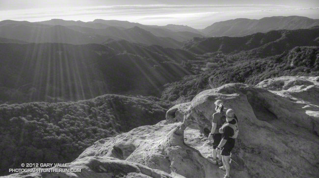
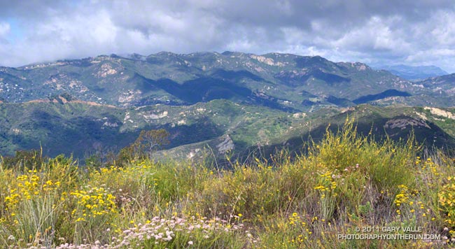
We had taken a detour from the Backbone Trail to the top of Eagle Rock. After enjoying the view we would extend the detour down the Musch Trail and pick up the Backbone Trail at Trippet Ranch. From Trippet we would follow the Backbone Trail down into Topanga Canyon, up Hondo Canyon, over to Saddle Peak and then down to Malibu Canyon.
With a couple of short side trips the distance from the End of Reseda (Marvin Braude Mulholland Gateway Park) worked out to about 21 miles. The distance and elevation gain were about the same as last Saturday’s run — also on the Backbone Trail.
Although we didn’t have the deluge they experienced in Central and Northern California, Southern California did get some rain. From Tuesday night (11/27) to Monday morning (12/3) Downtown Los Angeles (USC) recorded 1.03 inches, bringing the water year total to 1.36 inches. As of today that’s 1.08 inch below normal.
Some foothill and mountain stations were able to wring out much more rain from the moist tropical flow. Opids Camp recorded 3.02 inches, White Ledge Peak 4.09 inches, Refugio Pass 4.61 inches, and Rocky Butte 8.51 inches. For some storm totals from up north and more info about the “atmospheric rivers” that relayed the moisture up from the tropics, see my December 8 post on Southern California Weather Notes.
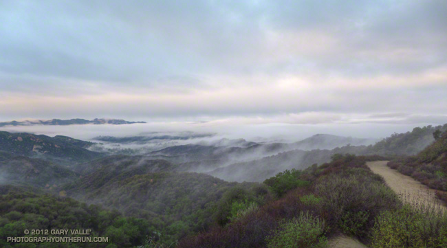
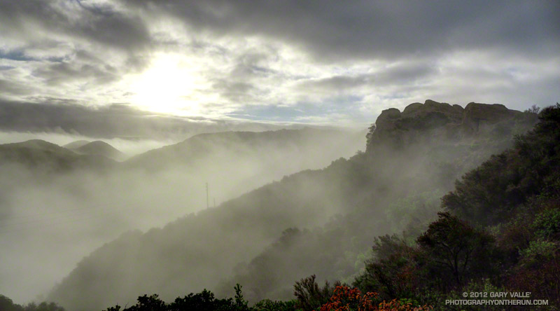
The photo above was taken between “storms” early Sunday morning, December 2, on a run in Topanga State Park. It started to rain shortly after I finished the run.
It looks like we might get a little more rain this next week, with a chance of rain on Wednesday and then maybe again on the weekend. We’ll see!
Southern California doesn’t get much rain in May. On any given day in the middle of May the chance of measurable rain in Los Angeles is around 4 in 100. Overnight we’d beat those odds, and this morning the weather looked more like March than May.
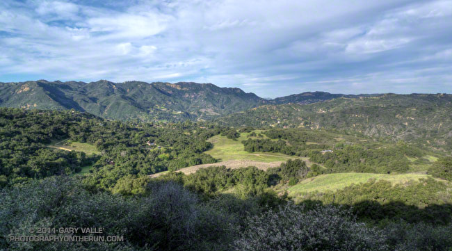
The view above, across Topanga Canyon to Saddle Peak, is from a popular viewpoint off the Temescal Ridge Trail (Fire Road #30), about 4 miles into the Trailer Canyon – Trippet Ranch Loop. This 17 mile route is one of several excellent trail runs that start at Marvin Braude Mulholland Gateway Park in the San Fernando Valley. It crosses the Santa Monica Mountains on the Temescal Ridge and Trailer Canyon fire roads, dropping down to Pacific Palisades, and then returns by way of Santa Ynez Canyon, Trippet Ranch, and the Musch & Garapito Trails.
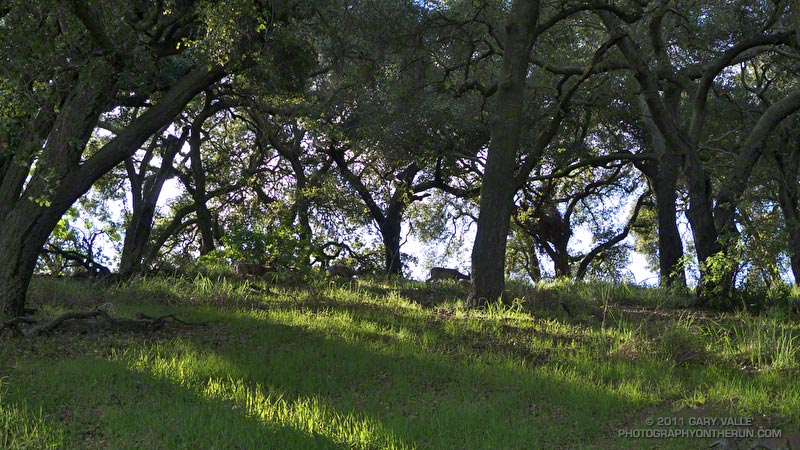
At one time the homestead of a beekeeper, and later the getaway home of US Judge Oscar A. Trippet, Sr., Trippet Ranch was one of the land purchases associated with the creation of Topanga State Park in the early seventies. Apparently Judge Trippet’s son enjoyed the natural setting of this ranch in the hills, and when he inherited the property, gave it the name “Rancho Las Lomas Celestiales.”
Running through the oaks in the early morning with sunlight filtering through the trees, and mule deer grazing quietly feet from the trail, it’s easy to see how he might have been inspired to give Trippet Ranch such a name.
Today’s run to Trippet Ranch is one of several trail runs I enjoy doing that start at Marvin Braude Mulholland Gateway Park, and end by running the Garapito and Bent Arrow trails. This particular run is a 12.2 mile serpentine route that takes fire roads out to Trippet Ranch, and then single track trails back to Mulholland near the top of Reseda. Here’s an interactive Cesium browser View of a GPS trace of the route.
For more information about the history of Trippet Ranch and Topanga State Park, see the Park History page on the Topanga Canyon Docents web site.