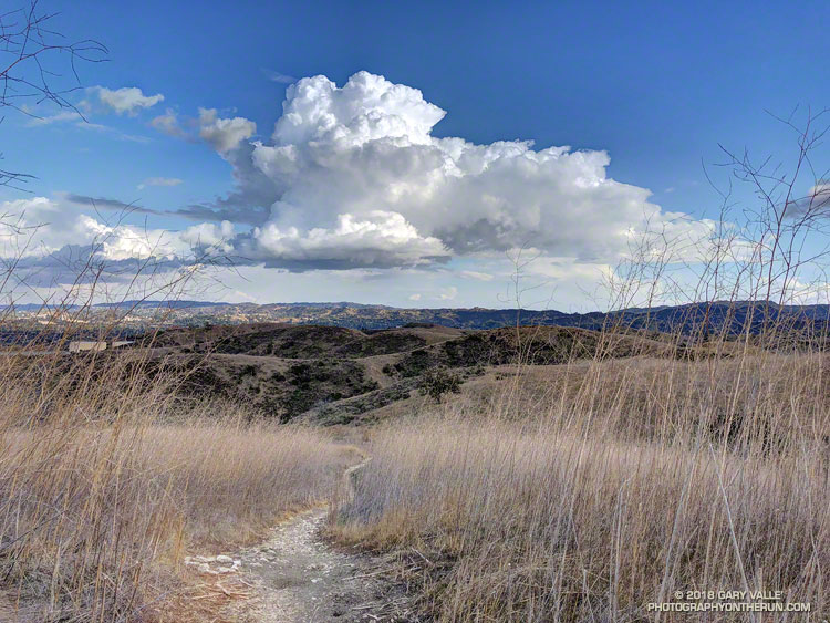
Chasing a cumulus cloud on a trail run in El Escorpion Park.

Chasing a cumulus cloud on a trail run in El Escorpion Park.
Once again Southern California is facing another very dry rain year. Since July 1, Downtown Los Angeles (USC) has recorded only 1.97 inches of rain. This is more than 8.5 inches below normal.
At this point it appears likely the rainfall recorded at Los Angeles from July 1 – February 28 will be the second driest for that period on record. If we don’t see some significant rain in March, we could be contending with 2006-2007 for the driest rain year on record.
Several weather models have been advertising a change to a wetter weather pattern for the West Coast and Southern California. At one point the ECMWF was forecasting several inches of rain in the Los Angeles area around March 1-2. This morning’s ECMWF run was far more stingy with the wet stuff, and precipitation completely disappeared from the GFS forecast for that period.
Never fear, these forecasts will likely change again. Model skill more than a few days out is very poor. Next week we should have a better idea if the pattern change is real, or just more model hype.
Update March 1, 2018. With only 1.99 inch of rain from July 1 to February 28, Downtown Los Angeles (USC) did end February with the second driest rain year to date. Depending on whether 1911-1912 is included in the ranking, the water year to-date, beginning October 1, is either the second or third most dry on record. Now all eyes turn to the storm that is forecast to move into the Los Angeles area this evening. This morning the CNRFC 72 hr. QPF for the Los Angeles area ranges from around 0.75 – 1.0 inch in the basin and valleys to around 1.5 – 1.75 inches in the mountains. Higher totals are forecast in the Ventura and Santa Barbara areas. Check with the NWS Forecast Office Los Angeles for the latest weather forecasts, advisories and warnings.
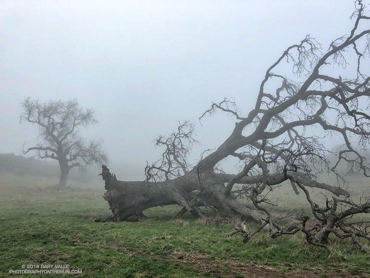
The fallen oak pictured above — one of the larger valley oaks along Rocky Peak fire road — toppled over in the summer of 2016 following five years of drought. Fire and drought are a natural part of the valley oak’s habitat and the trees have evolved to withstand ordinary variations in their environment. However, severe fires or extended droughts, or fire in combination with drought can overcome the tree’s defenses. The drought may have been the culminating factor in the felling of this oak, but fire and other factors may have also played a role.
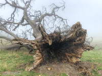
According to the Fire Effects Information System (FEIS), the heart-rot fungus Armillaria mellea is usually present in valley oaks and larger oaks tend to be hollow or rotten in the center. The toppled oak was hollow near its base and its interior appears to have been blackened by fire. The FEIS describes instances where the decaying wood in the interior of older valley oaks could ignite in a fire, but leave the exterior bark uncharred.
What fire might have burned the tree? There are two possibilities: the 2008 Sesnon Fire and the 2003 Simi Fire. It probably wasn’t the Sesnon Fire — this photo of the tree, taken about a month after the Sesnon fire, shows little impact. I couldn’t find a photo of the tree following the Simi Fire, but photos taken nearby show a severely burned landscape. Ultimately, it appears fire and drought weakened the tree, accelerating its heart rot and weakening its roots to the point it could no longer support itself.
Photos of the fallen oak are from this morning’s foggy run along Rocky Peak fire road.
Related post: Ahmanson Blue Oak Succumbs to Climate Change, Chumash Trail – Sesnon & Simi Fires
I looked at the mileage on my Garmin watch — 11.93 miles. I was at Kanan Dume Road and debating whether to make Kanan my turnaround point. My run had started at Malibu Canyon Rd. & Piuma Rd., where I’d picked up the Sean O’Brien Trail Runs course at around mile 2. After crossing Malibu Creek, the 100K, 50M, 50K and Marathon courses all follow the Backbone Trail westbound from Malibu Canyon.
The ground had been spotted with raindrops as I started the nearly 3 mile, 1500′ climb out of Malibu canyon. Subtropical moisture was streaming in from the southwest and there was a broad swath of clouds over Southern California. There were scattered showers, but most of the rain was evaporating before it reached the ground. The last time it had rained was more than a month ago, and the smell of rain was intoxicating.
Two weeks ago I’d done this climb as part of a “reverse” Bulldog loop. It hadn’t become any less steep. Most of the climb is on a fire road and some of it is runnable — just how runnable depends on your VO2max, determination and inclination. It was a relief to reach the top and start running downhill, even if another climb loomed just ahead.
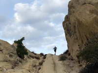
Once to the top of this next climb, it is about a mile and a half to Corral Canyon. There are a couple of short ups and downs along the way and the rock formations become increasingly dramatic. Just east of Corral Canyon the Backbone Trail winds through a wonderland of rocks and pinnacles, climbing a steep sandstone ramp and passing through a rock gateway.
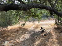
From Corral Canyon the Backbone Trail drops into Upper Solstice Canyon. Today, the 16 crossings of the small creek in the canyon were all dry. Someone had provided log seats under a sprawling oak at “heart” meadow. I had to stop for a moment just to enjoy its tranquility. On a run here in January several years ago, the area was covered in ladybugs.
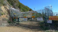
The high point of the 50K course follows the climb out of Upper Solstice Canyon and is near the saddle at Newton Mtwy. Back in the day the Bulldog 50K used to climb up and over the shoulder of Castro Peak from the top of Bulldog; then descend to this saddle and continue to Corral Canyon on the Upper Solstice Canyon Trail. This 2004 Los Angeles times article describes why the road is now gated and private.
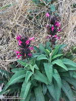
The day was a little warmer than expected and the shaded sections of trail in Newton Canyon were refreshingly cool. The dried out stalks of last year’s hummingbird sage were common along the trail and given the lack of rain, I was very surprised to find a plant that was blooming.
The Sean O’Brien Marathon turns around at Kanan Dume Road, which is what I should have done. That would have resulted in a pleasant 24 mile training run with a bit over 5000′ of gain. Instead I decided to continue west on the Backbone Trail and “just run down to the bridge” to see if there was any water in Zuma Creek. There wasn’t. The bridge also would have been a perfectly good turnaround point that would have netted a 26 mile run.
But it was one of those rare, long run kind of days where the mind and legs are in sync and the miles almost didn’t matter. I reasoned that the Sean O’Brien 50K turnaround was “only” another mile and a half away, so why not continue. That way I’d have an even better idea of what to expect on race day.
I did continue, and with the exception of running low on water, everything went well. At Latigo Canyon several runners had just returned to their cars and I was able to fill up my Camelbak(R). Thanks Lou! And thanks to the other runners at the trailhead for their offers of gels, beer and salt!
I’ve run that section of the Backbone Trail several times, but never as an out and back. I now understand why the times for the Sean O’ Brien 50K are a little longer than the typical 50K. For one thing the course is about 1.5 mile longer than a 50K. For another, it has a TON of elevation gain. Using the elevation profile from my fenix 3 and a 1/3 arc-sec DEM from the USGS, the hand-calculated elevation gain worked out to be around 6000′. Tack on another 500′ of gain to account for the Tapia Spur Trail and the total gain for the Sean O’Brien 50K works out to a stout 6500′, give or take.
While much of the country shivers in the cold climes of Winter, the muted colors of the changing season have finally reached the lower elevation areas of Southern California.
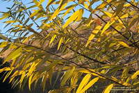
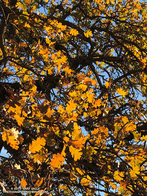
In this area, the leaves of Valley Oaks usually begin to turn around mid-December and the trees lose their leaves around the beginning of the new year. About a month and a half later trees begin to sprout new leaves, usually in mid to late February. From year to year, the time frame can vary by as much as 2-3 weeks.
The photo of Valley Oak leaves was taken December 28, 2017, in Upper Las Virgenes Canyon Open Space Preserve (formerly Ahmanson Ranch). This willow in East Las Virgenes Canyon was also showing some nice color.
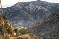
The sunlit hills are on the west side of the New Millennium Loop in Calabasas. The rocky peak in the background is Saddle Peak. The 68 mile Backbone Trail, which traverses the length of the Santa Monica Mountains, passes near the summit of Saddle Peak.
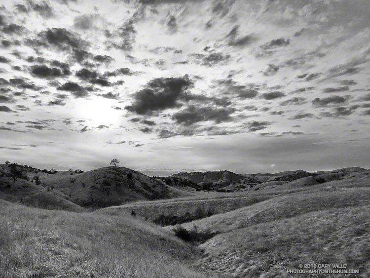
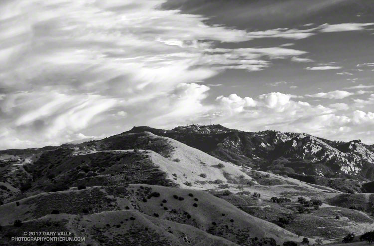
From a recent run on Cheeseboro Ridge.