Category Archives: weather|la nina

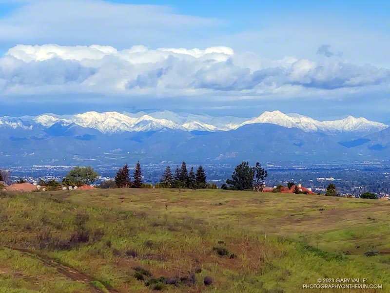
Snow-Covered San Gabriel Mountains From Lasky Mesa

Snow-covered San Gabriel Mountains from Lasky Mesa in Upper Las Virgenes Canyon Open Space Preserve (Ahmanson Ranch)

It had rained another inch overnight, and my shoes were soaked from the wet grass along the trail. Seeking some relief from the 20 mph northwest wind, I descended a single-track trail to an old paved road east of the ranch house on Lasky Mesa.

Motivated more by staying out of the wind than anything else, I did two sets of hill repeats on different sections of the road. Then, on tired legs, I jogged up to Lasky Mesa and was greeted by an Arctic blast. The temperature had dropped to the mid-40s, and the wind was blowing a steady 20 mph, gusting to around 30 mph. I didn’t need a wind chill chart to tell me the effective temperature was in the 30s.

I was so focused on dealing with the cold I wasn’t paying much attention to my surroundings. Deciding to do one more hill, I rounded a corner, and the brilliantly sunlit, snow-covered San Gabriel Mountains came into full view. It was just jaw-dropping!

Here is a wider view of most of the Front Range of the San Gabriels, white with snow.

Some related posts: Chasing Rainbows at Ahmanson Ranch, Looking for Snow on Topanga Lookout and Saddle Peak

Dowsing for Rain: The 2013-14 Southern California Winter Precipitation Outlook

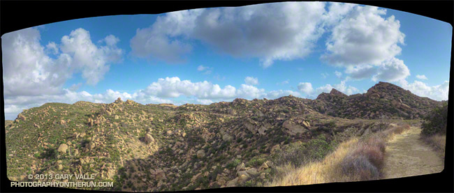
Rocky Peak Road near its junction with the Chumash Trail

Updated October 17, 2013.

As I started up the Chumash Trail, a patchwork of clouds filled the sky, and the fresh smell of a recent shower filled my lungs. A strong and unseasonably cold low pressure system was producing the first widespread rainfall of Southern California’s 2013-14 rain season.

I hoped there would be another shower during my run. The plants and animals needed it and I needed it. It had been many months since I had run in the rain on a local trail.

As I worked up the trail I thought about how dry it had been. Downtown Los Angeles’ 2012-13 water year (Jul 1 – Jun 30) was the sixth driest on record. Rainfall in Los Angeles since January 1 has been about 25% of normal. The 2012-13 Sierra snowpack was one of the worst on record.

Will this rain and snow season be any better? For months I’ve been monitoring climate data and forecasts looking for something on which to base a 2013-14 Winter Outlook. Historically, ENSO has been the big dog in Southern California rain season weather with El Nino conditions generally producing wetter weather and La Nina conditions generally drier.

But ENSO conditions are currently Neutral and are expected to remain so through the end of the year. Most climate models forecast there will be slow warming of SSTs in the equatorial Pacific (NINO 3.4 region) over the next several months, but at this time of the year it would be very unusual to have substantial warming. The CPC/IRI ENSO Forecasts from IRI’s October Quick Look indicate the probability of an El Nino developing before the end of the year is less than 20% — and 20% seems high.

One computer model that at times has been forecasting above average precipitation this Winter in Southern California is the Climate Forecast System version 2 (CFSv2). The CFSv2 is fully coupled ocean-atmosphere-land-sea ice model used to forecast parameters such as sea surface temperature, temperature and precipitation rate. While skillful at predicting tropical SSTs, the CFSv2 generally performs very poorly when forecasting precipitation over land, so forecasts such as this one for Dec-Jan-Feb must be viewed somewhat skeptically.

Another glass half-full observation is that the Madden-Julian Oscillation (MJO) has been relatively active this year and if this activity continues it provides recurring opportunities for enhanced U.S. West Coast precipitation. The downside is that it can result in periods of dry weather as well.

With the ocean and atmosphere neutral there’s just not much on which to base a rain season forecast. According to the Climate Prediction Center, the current winter precipitation outlook for most of Southern California calls for an equal chance of below average, average, or above average rainfall. I know — that’s no help at all — you might as well flip a three-sided coin!

Update October 17, 2013. The Climate Prediction Center released its updated U.S. Dec-Jan-Feb Precipitation Outlook today. The outlook now indicates an equal chance of below average, average, or above average precipitation for all of Southern California. The October CPC outlook is usually the basis for the initial official NOAA U.S. Winter Outlook.

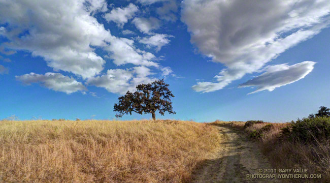
The title photo is of Rocky Peak Road, near its junction with the Chumash Trail. Here’s a larger version of the panorama.

Angeles National Forest Reforestation, the Natural Way

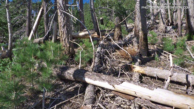
Area near Mt. Islip burned in the 2002 Curve Fire

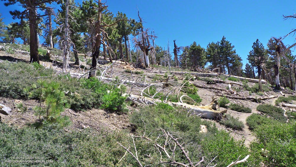
The photograph above is of an area on the Pacific Crest Trail near Mt. Islip that was burned ten years ago in the 2002 Curve Fire. Here’s another photograph of an area along the PCT near Throop Peak that was also burned in the Curve Fire. These are from last weekend’s trail run.

The forest conditions are quite a bit different in each case. The Mt. Islip trees are on a cooler northeast-facing slope that was densely forested, and the Throop Peak trees are on a warmer, more open, south-facing slope. But in both cases you can see numerous pines, from small seedlings to young trees two to three feet tall.


Reforestation doesn’t happen overnight, but nature is remarkably resilient, and as long as an area is not burned too frequently, many forests are able to recover from fire with minimal intervention.

However, the process of recovery is multi-faceted and complex. It may involve varying degrees of regrowth and succession. In some cases, such as in the blast zone of Mt. St. Helens, the ecosystem has to be effectively bootstrapped, and seemingly restored from scratch.

Ultimately the mature forest that results from these processes will be comprised of an ecosystem — and vegetation — suitable for the array of climatic and other factors present at the time.

Attempts to shortcut this process are not often successful — such as the recent attempt to plant nearly one million seedlings in the Station Fire burn area. An Angeles National Forest official is quoted in an April 7, 2012 Los Angeles Times story as saying, “When we planted seedlings, conditions were ideal in terms of soil composition and temperature, rainfall and weather trends.” Beyond the criticisms outlined in the story did anyone in the Forest Service consider that La Nina conditions were present, and there was a good chance La Nina conditions would be present during the 2011-2012 rain season — along with a likelihood of below normal precipitation?

The Color of Rain III

Rain brings out the richness of the chaparral, enlivening its inhabitants, enhancing its colors, and enriching its fragrances. But in recent weeks rain storms have been few and rainfall far below normal.

The 2011-2012 rain season started out well enough. Thanksgiving Day the water year rainfall total for Downtown Los Angeles (USC) was about an inch above normal. But between Thanksgiving and Christmas the drier weather often associated with La Nina conditions became predominant, and water year totals dropped to about normal.

Northern and Central California were actually much drier than would be expected during a La Nina. Mammoth Mountain recorded no new snow between December 5 and January 19 — about a month and a half! Our dry spell was nearly as long. Downtown Los Angeles recorded no measurable rain between December 17 and January 21.

The storms Saturday and Monday added about 1.3 inches of rain, boosting the water year rainfall total to 5.06 inches. As of yesterday this was 1.87 inches below normal and about 73% of the normal total.

The problem is this time of year we fall behind another 0.12 to 0.15 inch every day that it doesn’t rain. The deficit adds up quickly and if — as the medium range models currently project — we don’t get any rain for the next 10 days we’ll down another inch and at about 64% of normal. We’ll see!

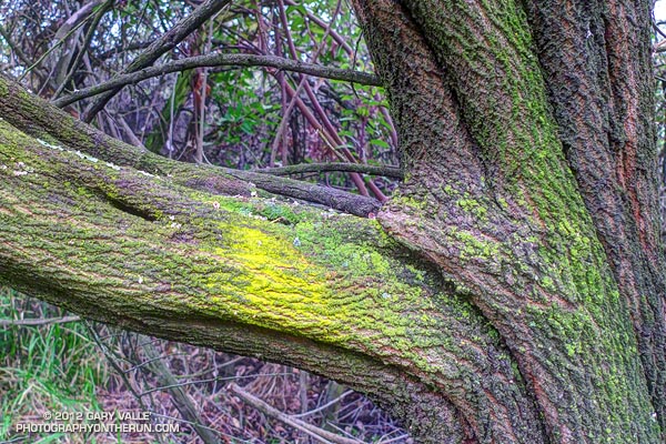
The photograph of the Ceanothus trunk is from last Sunday’s Will Rogers – Temescal loop trail run.

Related posts: The Color of Rain II, The Color of Rain

La Nina and the 2011-2012 Southern California Precipitation Outlook

What a difference a week makes! Last week an unseasonably deep upper level low, unusually strong 170+ kt Pacific jet, and associated cold front combined to produce record-setting rainfall and cool temperatures in Southern California. This week high pressure and a weak offshore flow produced triple digit temperatures in some areas and set new high temperature records Wednesday in Downtown Los Angeles, Long Beach and Santa Barbara.

Which pattern is more likely this rain season? Will Southern California tend to be drier like this week, or wetter like last week and last year? Despite last year’s wet rain season, wet La Nina Winters are not the norm. Generally, La Nina conditions result in drier than normal rain seasons in Southern California, and El Nino wetter.

Following a Summer respite La Nina conditions have reemerged in the equatorial Pacific, and appear to be consolidating. Equatorial SST anomalies have continued to decrease and now range from -1.5°C at 100°W to -0.5°C at 170°E. Equatorial Pacific temperature cross sections show substantial subsurface cooling from July 11 to September 11. The Multivariate ENSO Index (MEI) has dropped from -0.5 for July/August to -0.8 for the August/September season. This drops the MEI from a rank of 16th for July/August to 13th for August/September since 1950. This is well within La Nina territory but weaker than last year’s rank of 1st for August/September.


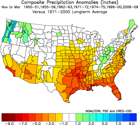
A precipitation composite for seven years* since 1950 in which La Nina conditions persisted or reemerged in the year following a first year La Nina indicates that “on average” the coastal Southern California climate division recorded about 5 to 6 inches less precipitation than normal for the period November through March. The percent of normal water year rainfall recorded at Downtown Los Angeles (USC) ranged from a low of 47% (1971, 7.17″), to a high of 106% (1955, 16.00″). The average rainfall for these years was 70.5%, or 10.7″.

We’ll get the official NOAA/CPC outlooks next week around October 20, when CPC’s Three-Month Precipitation Outlooks and NOAA Winter Outlook are expected to be released.

*The years included in the selection were 1950-51, 1955-56, 1962-63, 1971-72, 1974-75, 1999-2000 and 2008-09. The base period was 1971-2000. The selection was based on the MEI.

Most Rain in Los Angeles During a La Nina in the Last 60 Years

Between storms at Ahmanson Ranch

It has been a remarkable rain season in Southern California. December 2010 was the wettest December in Los Angeles in 121 years. Then Sunday, an exceptionally strong system produced record-setting rainfall in Los Angeles, Ventura, Santa Barbara, and San Luis Obispo counties with some locations recording as much as one-third of a year’s normal rainfall in 24 hours!

Runners in the Los Angeles Marathon had to contend with rain, wind and cool temperatures. Of 19,763 runners, more than 10,000 were on the course for longer than 5 hours. According to a report in the Los Angeles Times sports blog, The Fabulous Forum, thousands of runners were evaluated for hypothermia, but only 25 runners were hospitalized.

Sunday evening rain rates in excess of an inch an hour were recorded in several areas, and a flash flood was reported in Woodland Hills with “mud and debris flowing down the street” and “at least four to five vehicles stuck in flowing water.” Downtown Los Angeles (USC) recorded 2.42 inches of rain Sunday, breaking a record set in 1943. Santa Barbara Airport had its wettest day on record, recording 5.23 inches of rain. Here’s an archived copy of the NWS Record Report for March 20, listing some of the rainfall records for the day.

Some phenomenal rainfall amounts were recorded over the course of the storm. Van Nuys recorded 6.74 inches of rainfall, Northridge 6.08 inches, Newhall 7.20 inches, Camarillo 5.58 inches, Rose Valley 10.99 inches, Montecito Hills 7.70 inches, San Marcos Pass 10.72 inches, and Gibraltar Dam 11.73 inches. Here’s an archived copy of a NWS report with some rainfall and snowfall totals for the storm.

Downtown Los Angeles increased its water year rainfall total to 18.55 inches, or about 123% of normal. This makes the 2010-2011 water year the wettest in Los Angeles during a La Nina over the last 60 years, surpassing the totals recorded during the strong La Ninas of 1955-56 (99% of normal) and 1973-74 (106% of normal), and weak La Ninas of 1967-68 (110%) and 2000-01 (118%).

Update March 25, 2011. Since Tuesday, two more frontal systems have swept through Southern California,increasing the water year total at Downtown Los Angeles (USC) to 19.55 inches, or 129% of normal!

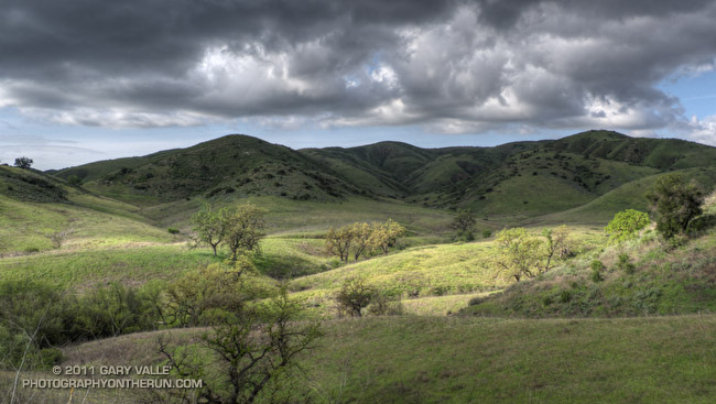
The title photograph is from a very wet and muddy run this afternoon through Upper Las Virgenes Canyon Open Space Preserve (Ahmanson Ranch), in eastern Ventura County.