Category Archives: weather|southern california

Department of Coyote Comportment

Coyote path at Ahmanson Ranch.

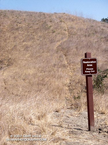
With little new growth this Spring and Summer, coyote paths at Ahmanson Ranch have become so well worn that several have recently been posted with “Restoration Area – Please Keep Out” signs. Whether the canny coyotes will choose to cooperate remains to be seen.

Note: Ahmanson Ranch was acquired as open space in part to protect several sensitive species and their habitats. Some (human) use trails have evolved and “Restoration Area – Please Keep Out” signs are a reminder that the area is a preserve.

From a recent run at Upper Las Virgenes Canyon Open Space Preserve (formerly Ahmanson Ranch).

Related post: Trickster

Snowless San Gabriels

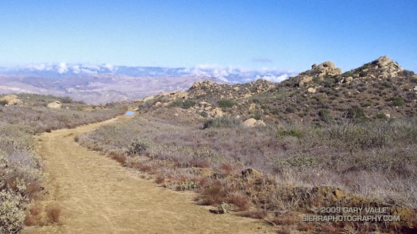
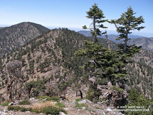
Ridge between Mt. Baden-Powell and Mt. Burnham in the San Gabriel Mountains. 
Ridge between Mt. Baden-Powell and Mt. Burnham

Standing on the summit of Mt. Baden-Powell (9399′), I squinted through the haze at Mt. Baldy (10,064′). Nope, no snow.

It’s not often that the highest elevations of the San Gabriel Mountains are snowless on Memorial Day weekend. If nowhere else, there will usually be a patch of white on the north side of Mt. Baldy. Two years ago there were 10-15 ft. drifts on Baden-Powell that persisted into July. Not this year.

This year, usually dependable water sources might not make it through the Summer. On the way to Baden-Powell I  stopped at Little Jimmy Springs. Descending to the spring, I didn’t hear the usual splitter-splatter of water streaming onto the rocks. For a worried moment I wondered if the spring could already dry.

It wasn’t dry, but the spring was nearly as low as it was in August 2002, following the driest water year ever recorded in Los Angeles. Whether Little Jimmy Spring will last through this Summer, after what is likely to be an even drier year, we’ll just have to see. To date, Los Angeles has received only 3.21 inches of rain since July 1, 2006, and will very likely break the record set in 2001-2002.

When on the trail between Islip Saddle and Mt. Baden-Powell, I almost always visit Little Jimmy Spring. The area surrounding the spring is lush and green, and in midsummer is accentuated with the yellows and reds of wildflowers. There are several impressive Incense Cedars nearby, and one huge tree must have enjoyed the idyllic setting and refreshing waters for at least a few centuries. The tree was threatened by the 2002 Curve Fire, but fortunately only a part of its fire-resistant trunk was burned.

At the spring, I filled my Camelbak to the brim. On the way back from Mt. Baden-Powell, I was planning to climb Mt. Burnham, Throop Peak, Mt. Hawkins and Mt. Islip. Most of these peaks are relatively easy ascents requiring short detours from the main trail. Mt. Islip requires a little more effort, and is about a mile by trail from Windy Gap.

According to my Forerunner 205, the distance from Islip Saddle to Mt. Baden-Powell is about 8.1 miles. Depending on how Islip is done, the total mileage including the five peaks is in the neighborhood of 17-18 miles, with an elevation gain and loss of about 4700′.

Note: Angeles Crest Highway (SR2) was open to Islip Saddle.

Related post: PCT Above Windy Gap.
Ahmanson Blue Oak

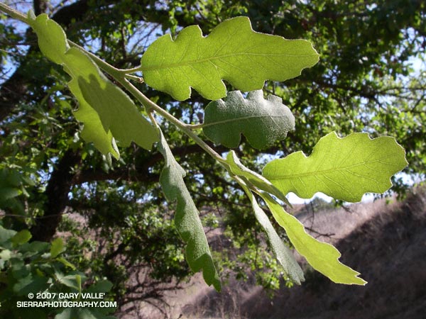
Photograph of leaves of blue oak in East Las Virgenes Canyon.

Update April 14, 2023. The Ahmanson Blue Oak has died. Please see the post Ahmanson Blue Oak Succumbs to Climate Change.

Blue oak (Quercus douglasii) is a characteristic oak of the lower elevations of the Sierra foothills and coastal mountains, its range essentially encircling California’s Central Valley.

Based on its reported range, Upper Las Virgenes Canyon Open Space Preserve (formerly Ahmanson Ranch) contains one of the southernmost populations of blue oak within its range. However, the predominate deciduous oak in the area is valley oak (Quercus lobata), and occurrences of blue oak appear to be rare. Regional climate modeling suggests that over the next century the range of blue oak could shift northward and diminish to nearly 60% of its current range.

Blue oak is reported to hybridize with valley oak, however a 2005 study suggests hybrids of these species may be more rare than generally accepted.

The photograph of the leaves of a blue oak was taken on a run along East Las Virgenes Canyon to Lasky Mesa on April 24, 2007. A valley oak immediately adjacent to this blue oak was killed in the 2005 Topanga Fire.

Related posts: Ahmanson Blue Oak Succumbs to Climate Change, Valley Oak Savanna, Laskey Mesa Oak

Technical papers:

Modeled regional climate change and California endemic oak ranges.
Kueppers, L.M., M.A. Snyder, L.C. Sloan, E.S. Zavaleta, and Brian Fulfrost. 2005.
Proceedings of the National Academy of Sciences of the United States of America, 102(45): 16281 – 16286.

Limited hybridization between Quercus lobata and Quercus douglasii (Fagaceae) in a mixed stand in central coastal California.
Kathleen J. Craft, Mary V. Ashley and Walter D. Koenig.
American Journal of Botany. 2002;89:1792-1798.

Dealing With Drought

Goldfields (Lasthenia spp.) on Lasky Mesa in Upper Las Virgenes Canyon Open Space Preserve.

This photograph of goldfields (Lasthenia spp.) was taken on a run on Lasky Mesa in Upper Las Virgenes Canyon Open Space Preserve (formerly Ahmanson Ranch) almost exactly one year ago.

This April I haven’t seen any goldfields on Lasky Mesa. The soil is too dry for the seeds to germinate. The drought in Southern California has suppressed or delayed the growth of these, and many other species of wildflowers. This is one of the ways that annuals deal with drought — if the growing conditions aren’t appropriate, they don’t grow.

Black mustard, an invasive annual from Europe, is a hardy plant that is a good indicator of Winter rainfall. In 2005 and 2006 the mustard at Ahmanson Ranch was 6′ to 8′ tall and very widespread. This year its growth has been very limited, and the plants are diminutive in comparison.

Plants deal with drought in many other ways, such as dropping leaves, changing the leaf distribution, reducing the size of the leaf, changing the leaf orientation, modifying the shape of the leaf, or changing the leaf color. Flowering may be suppressed, or the flowering time shortened. In some cases the flower may be reduced, or viable fruit may not be produced. Branchlets or stems may be lost. Any life prolonging tactic may be employed when survival is at stake.

According to the NWS, if Los Angeles (USC) receives less than 1.95 inches of rain between now and June 30th, this water year (July 1, 2006 to June 30, 2007) will become the driest since recordkeeping began in 1877. At this point in the season, a new record seems more likely than not.

It was only 5 years ago (2001-2002) that Los Angeles experienced its driest water year so far, recording only 4.42 inches.

Related post: A Little Rain in Los Angeles

A Little Rain in Los Angeles

Droplets of rain on the funnel shaped web of the western grass spider, Agelenopsis aperta.

We received a little rain in the Los Angeles area earlier this week. There was just enough light rain to dampen my shirt, muddy my running shoes, and ornament this web with droplets of water. Refreshing as it was, the precipitation did little to relieve our ongoing drought.

To date, according to NWS data,  this is the driest water year in Los Angeles since recordkeeping began in 1877. From July 1, 2006 to March 22, 2007 Downtown Los Angeles (USC) has recorded only 2.47 inches of rain. This is 10.79 inches below normal. Checking back through NWS records, 2.47 inches is the total amount of rain recorded in Downtown Los Angeles from May 23, 2006 through today — a period of 10 months!

In the past few years Los Angeles has experienced a number of weather extremes. The driest water year on record for Los Angeles was just set in 2001-2002, when 4.42 inches were recorded. Then in 2004-2005, Los Angeles was deluged with 37.25 inches of rain — the second wettest on record. During that period, Opids Camp in the San Gabriel Mountains recorded over 100 inches of precipitation! In July of last year Pierce College in Woodland Hills recorded a new all time high temperature for that station of 119°F. This may have been the highest temperature ever recorded in Los Angeles County. In mid January of this year many new record low temperatures for the date were set in the Southern California area. Pierce College plunged to a record low of 20°F (-6.7°C) and a temperature of 10.4°F (-12°C) was recorded at a research site in the Santa Monica Mountains. 

Computer models are indicating another chance of rain early next week. At the moment, the system looks like it could produce rainfall amounts similar to Tuesday’s system, perhaps a little more. But with the equatorial Pacific and atmosphere looking more and more La Nina like, significant rain is looking less likely, and we may be talking about record drought in Southern California for many months to come.  We’ll see!

The photo of the wet spider web was taken near Lasky Mesa in Upper Las Virgenes Canyon Open Space Preserve (formerly Ahmanson Ranch) on Tuesday, March 20, 2007. The funnel shaped web is probably that of the western grass spider, Agelenopsis aperta.

Related posts: Chaparral Freeze, The Color of Rain, El Nino Drought, Sunset Snow Shower, Rainy Morning on Rocky Peak Road.

Cheeseboro Bound

Two runners climb up the last yards of a hill before descending into Las Virgenes Canyon in Upper Las Virgenes Canyon Open Space Preserve.

Two runners climb up the last yards of a hill before descending into Las Virgenes Canyon in Upper Las Virgenes Canyon Open Space Preserve.

The trail is a connector that joins East Las Virgenes Canyon with upper Las Virgenes Canyon. Our 15 mile loop started at the Victory trailhead, following the El Scorpion Trail to another long-used trail that climbs up to the ridge along the northern boundary of the preserve. From here we descended to Las Virgenes Canyon and worked over to Shepherd’s Flat and down Cheeseboro Canyon, eventually returning to the Victory trailhead by way of the main drag.

The area seen in the photograph is a small portion of the 24,000 acres that was burned in the Topanga Fire in late September 2005.

Although an undercoat of green is apparent, the drought in Southern California continues. According to NWS climate data, as of today, Downtown Los Angeles (USC) has recorded only 2.42 inches of rain since the water year began on July 1, 2006. This total is nearly 9 inches less than normal.