Bulldog Loop or Saddle Peak Out & Back?

Which to do? Both courses start at the intersection of Malibu Canyon Rd. and Piuma Rd., are 13-14 miles in length, and have about 2600-2700′ of elevation gain/loss — but they are very different trail runs.


Much of the Bulldog Loop is on fire roads, while the Saddle Peak Out & Back is 99.9% single track — much of it rough and technical. A comparison of the elevation profiles shows that the main climb on the Saddle Peak run is steeper than the Bulldog climb, and gains an additional 300 ft. in elevation. The Bulldog Loop has longer stretches of more or less level running.

Either course is a good choice for a strenuous run with great views and scenery. On a long run day, the runs can also be combined to create a difficult 27.5 mile course with your car as the main aid station. The Bulldog 50K used to follow much of this combined course, as well as loop through upper Solstice Canyon on the Backbone Trail. Problems with a property owner on Castro Peak necessitated a change to the current 50K course.

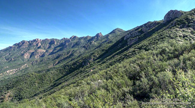
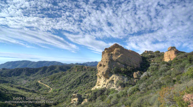
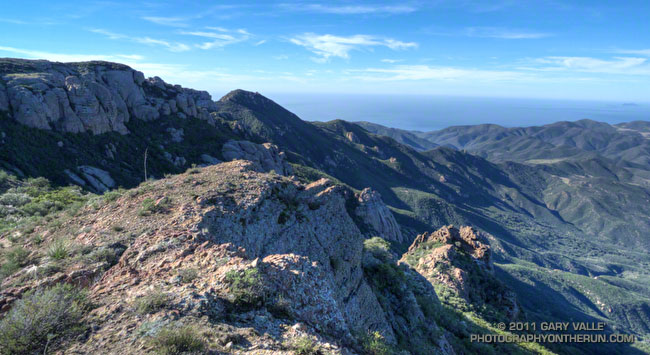
Today I opted for the Saddle Peak Out & Back run. The title photograph is Saddle Peak from the Backbone Trail. The trail switchbacks up the steep sunlit face on the center-left of the photo.

Here are interactive Cesium browser Views of the Saddle Peak Out & Back, and the Bulldog Loop.

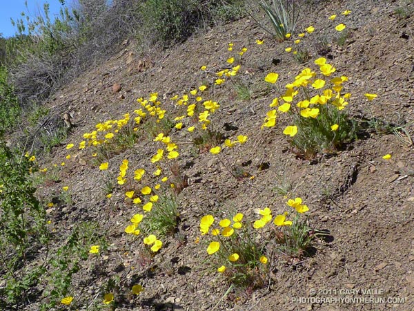
Chumash Trail Green

Chumash Trail in Simi Valley

It’s now been 17 days since there’s been measurable rain at Downtown Los Angeles (USC). A trace of rain was recorded on a couple of days, but for the time being a big blocking ridge has shut the door on Pacific precipitation.

So far this January, only 0.58 of rain has been recorded, which is a little less than one-third of normal for the month. However, because of our frequent December storms the water year total at Los Angeles is currently about double the normal amount — and why open space areas of Southern California have turned so lush and green.

Short Days, Long Shadows

Short days, long shadows at Ahmanson Ranch

One of the circumstances of running in the afternoon during the Winter is that most of my runs end after sunset. That may or may not be a perk depending on the day and the weather, but here in Southern California it’s usually a great time to be out and about.

In the Los Angeles area the days with the earliest sunset extend from roughly November 29 to December 10, when the sun sets at about 4:44 p.m. Civil twilight ends about 27-28 minutes later, at around 5:11 p.m.

After that (and until mid July) the sun sets a little later each day. Through most of January each afternoon is about a minute longer. But those minutes add up. On January 31 sunset occurs around 5:23 p.m., nearly 40 minutes later than on December 10.

The title photograph was taken at about 4:47 p.m. on January 5, about 11 minutes before sunset, on a trail run at Ahmanson Ranch. I was nearing the top of a long hill, affectionately referred to as “The Beast.” The peak across the canyon is the high point of Ahmanson Ranch. On topos you’ll see it marked with the elevation 1842 ft.

Bandit Training

Top of the Wildlife Corridor Trail

What a difference 5 days makes! In the cold morning shadows before the start of the Boney Mountain race last Sunday, the dew on the fences was frozen and frost was everywhere. This morning in Corriganville Park the temperature was a balmy 65 or so, and the high was expected to be around eighty.

Today I was running the Bandit 30K course as part of a training run organized by Bandit 15K/30K/50K R.D. Randy Shoemaker. Good thing too. Even though these are my backyard trails, it reminded me just how tough these courses are. The numbers — about 3300 ft. of gain/loss over 19.5 miles for the 30K — don’t tell the whole story.


The title photograph is of runners at the top of the Wildlife Corridor Trail. This gnarly trail links Corriganville Park to Rocky Peak Road, and it is just one of the special treats you’ll encounter on the 15K, 30K and 50K courses. I don’t know if it tougher going up, when your legs are fresh; or going down, when your legs are worked. From personal experience I know it is really easy to push too hard on this climb, and mutter to yourself, “Why did I do that?” for the remainder of the race.

Today, the conditions could not have been better. Well, if we’re going to nitpick, maybe a little less wind. But who can complain on a January day when skies are blue, the hills are green, and the temperature is in the seventies?

Mammatus Clouds Over the San Fernando Valley

Mammatus Clouds Over the San Fernando Valley

These rare clouds — a mid-level form of mammatus — were over the western San Fernando Valley last Thursday afternoon, January 6, 2011. They were produced by the moisture and dynamics associated with a closed upper level low that was about 390 miles WSW of Los Angeles, and moving ENE at about 17 mph.

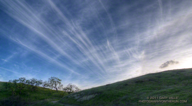
I first noticed the mammatus clouds around 3:30 p.m. About 30 minutes later, when I started my trail run in the Simi Hills, the cloud band had shifted a couple of miles to the WNW, but the mammatus was still present. The title photograph was taken just a few minutes into the run, at about 4:07. This uncropped version of the image shows the clouds in relation to the terrain.


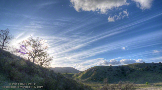
The mammatus was in the leading band of a series of cloud bands slowly moving from the ESE to the WNW. Over the next 30 minutes the mammatus mostly dissipated, as the cloud band became disrupted by shear. During this period the bands evolved into a wave-like sequence of bulbous clouds that had some of the characteristics of mammatus, but were not multi-lobed. The bases of these clouds were ragged — an indication that snow showers were sublimating in the dry air below. The photograph of the cloud sequence was taken at about 4:37 p.m. Some remnants of mammatus could still be seen in the sheared leading band.

The circumstances in which mammatus is observed and some possible mechanisms for its formation are discussed in the 2006 paper, The Mysteries of Mammatus Clouds: Observations and Formation Mechanisms by David M. Schultz, et al.

Based on a NAM analysis for Van Nuys and NKX (San Diego, CA) sounding, the atmospheric profile was consistent with real-time soundings when mammatus is present. A BUFKIT model sounding based on NAM data for 4:00 p.m., shows a moist layer from about 14,000 ft. to 23,000 ft., with a dry subcloud layer. The freezing level was indicated at about 8500 ft. A plot of vorticity from NAM data indicated a vorticity lobe in the area at the time the clouds were observed. As can be seen in both photographs, there was also strong shear between 20,000 ft. and 25,000 ft. A superadiabatic subcloud layer is not present in the soundings, but cooling from subcloud evaporation or sublimation might create one.

The photograph in the post Simi Hills to the San Gabriel Mountains was also taken on this trail run.

Photography and inspiration from running and other adventures in the Open Space and Wilderness areas of California, and beyond. No ads. All content, including photography, is Copyright © 2006-2024 Gary Valle. All Rights Reserved.