San Joaquin Ridge

San Joaquin Ridge, near Mammoth Mountain.

Located near Mammoth Mountain, San Joaquin Ridge extends from Minaret Summit (9265′) north about six miles to San Joaquin Mountain (11,601′). Views from this ridge are legend, with broad vistas that include Mt. Morrison, Red Slate, Mammoth Mountain, the Minarets and Ritter & Banner, Mono Lake, and much more. In good weather it is an awe inspiring locale in which to hike, ski or run.


he Minarets, and Mts. Ritter and Banner from San Joaquin Ridge. May 21, 2007.
This day, the conditions for running the ridge are ideal. In the wake of a weak weather system, skies are mostly clear, and a cool breeze reduces the heat of the harsh sun, producing a welcome warmth. Winter snow is already receding from the ridge crest, allowing a choice of routes over, or around, remnant drifts and cornices.

Returning from a high point a few miles distant, bounding strides lengthen, and I seem to soar down the ridge, weaving among the stunted pines, glissading across bands of snow, caressing the wind and flying up or down slopes with equal ease. It has become a run that defines the root experience of trail running and the rewards of being in the mountains. There is freedom of motion — and emotion — in every stride.

Ahead of me, a pair of ravens turn and the Sun glistens from back to wing. Individual feathers ruffle as wings are adjusted to increase lift, and turns are tightened. Soon we are soaring high above the Sierra, and all things seem possible.

Blazing Star

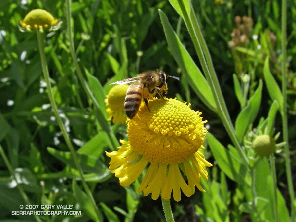
Blazing Star (Mentzelia laevicaulis)

Blazing star,
Dancing shadows,
It looms above…

The Baldy Peaks 50K (currently in hiatus) is without a doubt the most challenging 50K I’ve done. This race climbs to the summit of Mt. Baldy twice, once from the village and once from Manker Flats. And after climbing Baldy twice, you get to amble over to Thunder Mountain as well. The total elevation gain (and loss) is reported to be 10,775 ft.

Race organizers asked endorphin influenced runners to write a poem on the second ascent of the peak.

This particular Blazing Star (Mentzelia laevicaulis) was on the Manzanita Trail, between South Fork Campground and Vincent Gap. In the Baldy Peaks race they were along the service road between the Notch and Manker Flats.

Google search: $g(poetry), $g(Mt. Baldy)

Three Points – Mt. Waterman Loop

Trail sign on the Mt. Waterman Trail in the San Gabriel Mountains.

Five miles of (mostly) downhill to go. Running through an old growth forest of Jeffrey Pine, Sugar Pine and Incense Cedar, I relished being on a pine needle covered trail at 7000 ft. in the San Gabriel Mountains.

In a record dry water year, I had been curious to see how the mountains were faring. Although creeks were very low and grasses dry, my impression was that groundwater resources were not quite as bad. The usual springs and seeps still muddied the trail. In 2005 the San Gabriel Mountains were deluged with rain, and in the 2006 the rainfall was nearly normal, so some carryover would be expected.

Update May 27, 2007. My impression of groundwater resources may have been overly optimistic. On a run to Mt. Baden-Powell from Islip Saddle, I stopped by Little Jimmy Spring. It was nearly as low as in late August 2002, when Los Angeles had just experienced its driest water year on record. This year will likely break the 2001-2002 record.

Even so, it was obviously much drier than normal. There were fewer wildflowers, and some young Incense Cedars looked as if they might be stressed. On the plus side, manzanita and currant were blooming in profusion, and perhaps 30-35 scarlet red stalks of snow plant were seen on the loop.

About three miles from Three Points I happened upon another Jeffrey Pine that had been struck by lightning. This strike appeared to more energetic than the bolt that struck the tree on the Baldy North Backbone Trail. The spiral scar was wider and braided at some points, and the strike ignited the tree. Where the Baldy tree was on a sharp ridge crest, this tree was several hundred feet below the main crest in an area where the trail started to work around a projecting ridge.

More about this loop and a Google Earth image of the course can be found in the post Manzanita Morning.

Ahmanson Blue Oak

Photograph of leaves of blue oak in East Las Virgenes Canyon.

Update April 14, 2023. The Ahmanson Blue Oak has died. Please see the post Ahmanson Blue Oak Succumbs to Climate Change.

Blue oak (Quercus douglasii) is a characteristic oak of the lower elevations of the Sierra foothills and coastal mountains, its range essentially encircling California’s Central Valley.

Based on its reported range, Upper Las Virgenes Canyon Open Space Preserve (formerly Ahmanson Ranch) contains one of the southernmost populations of blue oak within its range. However, the predominate deciduous oak in the area is valley oak (Quercus lobata), and occurrences of blue oak appear to be rare. Regional climate modeling suggests that over the next century the range of blue oak could shift northward and diminish to nearly 60% of its current range.

Blue oak is reported to hybridize with valley oak, however a 2005 study suggests hybrids of these species may be more rare than generally accepted.

The photograph of the leaves of a blue oak was taken on a run along East Las Virgenes Canyon to Lasky Mesa on April 24, 2007. A valley oak immediately adjacent to this blue oak was killed in the 2005 Topanga Fire.

Related posts: Ahmanson Blue Oak Succumbs to Climate Change, Valley Oak Savanna, Laskey Mesa Oak

Technical papers:

Modeled regional climate change and California endemic oak ranges.
Kueppers, L.M., M.A. Snyder, L.C. Sloan, E.S. Zavaleta, and Brian Fulfrost. 2005.
Proceedings of the National Academy of Sciences of the United States of America, 102(45): 16281 – 16286.

Limited hybridization between Quercus lobata and Quercus douglasii (Fagaceae) in a mixed stand in central coastal California.
Kathleen J. Craft, Mary V. Ashley and Walter D. Koenig.
American Journal of Botany. 2002;89:1792-1798.

Rain Gauge

The stalk height of Elegant Clarkia (Clarkia unguiculata) is a good indicator of seasonal rainfall.

One of the best indicators of seasonal rainfall I’ve found in the oak woodland and chaparral areas of Southern California in which I run is Elegant Clarkia (Clarkia unguiculata). In a wet year it can grow more than 6 ft. tall. This year it is the shortest I’ve ever observed — about 5 inches in this photo taken near Lasky Mesa.

Related posts: Elegant Clarkia, Dealing With Drought

Photography and inspiration from running and other adventures in the Open Space and Wilderness areas of California, and beyond. No ads. All content, including photography, is Copyright © 2006-2024 Gary Valle. All Rights Reserved.