Old Boney to Serrano Valley, Plus Fireline and Overlook

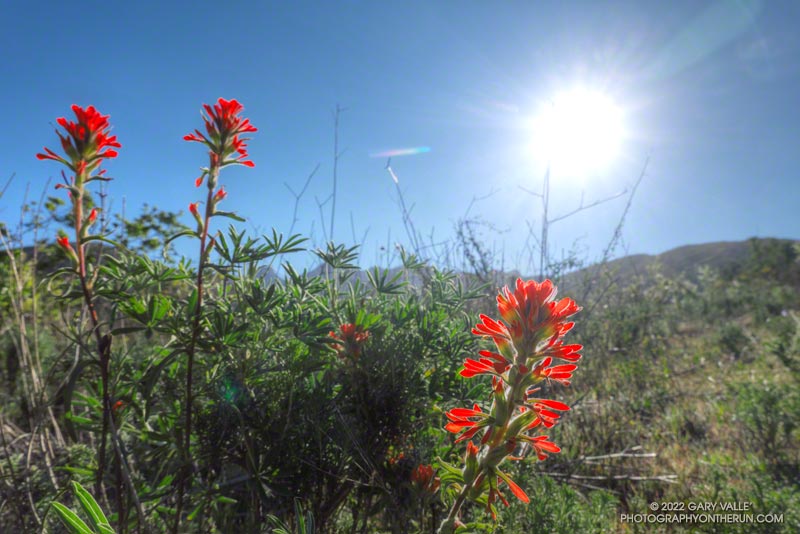
Paintbrush along the Old Boney Trail in Pt. Mugu State Park

Serrano Valley and Canyon had been on my run list for a few weeks. I was curious to see how December’s rainfall had affected Serrano Canyon. Runoff from those storms had (once again) washed out sections pf the Blue Canyon Trail and Upper Sycamore Trail. Had the Serrano Canyon Trail also been damaged?
Greenbark Ceanothus along the Old Boney Trail

It was a good day to visit Serrano — I was looking to do a longer run; the weather was perfect; the meadows green; and many wildflowers were in bloom.

There are a couple of ways I like to run to Serrano Valley from the Wendy Drive Trailhead. Both do the initial 1.6 mile, 900′ climb up the Old Boney Trail from Danielson Road. At the top of the climb, one route goes up and over Boney Mountain’s western ridge to the Backbone Trail, and the other continues on the Old Boney Trail. Both routes join at the Chamberlain junction of the Backbone and Old Boney Trails. I’d done the western ridge of Boney Mountain recently, so opted for the Old Boney route.
Prickly phlox along Overlook Fire Road

Wildflowers were everywhere. The December rain and February heat wave seems to have encouraged many plants to bloom — among them blue dics, Encelia, clematis, California poppy, greenbark Ceanothus, shooting star, nightshade, paintbrush, poison oak, milkmaids, prickly phlox, hummingbird sage, and larkspur.

Serrano Valley was Spring-green and spectacular. Serrano Creek was gurgling away, and the Serrano Canyon Trail had survived December’s storms. After a pleasant run down Serrano Canyon, I stopped to get some water from the faucet at the junction of the Serrano Canyon Trail and Sycamore Canyon.

A right turn here — up Sycamore Canyon — produces a run of about 20 miles. Today I was looking to do a little more than that, so turned south and ran about a quarter-mile down Sycamore Canyon and picked up the Fireline Trail. This trail gains about 700′ in elevation on its way up to Overlook Fire Road.
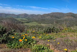
California poppies along Overlook Fire Road, above La Jolla Valley
La Jolla Valley from Overlook Fire Road

Overlook Fire Road leads northwest to the top of the Ray Miller Trail. I was feeling good and briefly debated descending to the Ray Miller Trailhead. I did a quick estimate of the mileage. I was at about mile 14. Descending Ray Miller would add about 2.5 miles, and then the run back from the trailhead to Wendy would add another 12 miles. Hmmmm… nearly 29 miles. My legs were way ahead of my brain, and were already continuing up Overlook Fire Road.

I followed the usual route back — Overlook -> Hell Hill -> Wood Canyon -> Two Foxes -> Sycamore Canyon -> Upper Sycamore -> Danielson Road -> Satwiwa. The paved part of Sycamore can be a bit tedious and it helped when I happened upon a couple of friends.

Here is an interactive, 3D terrain view of the GPS track of my route. The map can be zoomed, tilted, rotated, and panned. To change the view, use the control on the upper right side of the screen. Track and placename locations are approximate and subject to errors. Poor weather, and other conditions may make this route unsuitable for this activity.

Some related posts: Over Boney Mountain to Sandstone Peak and Serrano Valley, Serrano Valley from Wendy Drive, Pt. Mugu State Park Debris Flows and Flash Floods

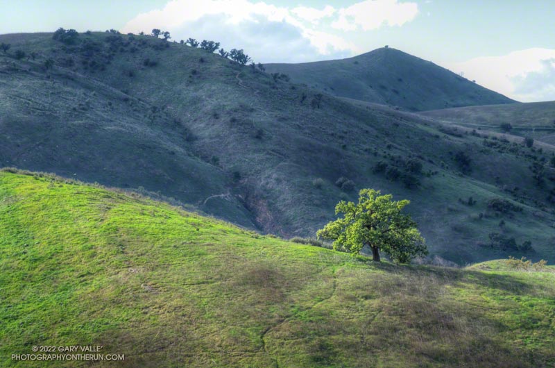
Revitalized Valley Oak at Ahmanson Ranch

Sunlit valley oak in Upper Las Virgenes Canyon Open Space Preserve (Ahmanson Ranch)

Revitalized by December’s copious rainfall and temperatures in the mid-80s in February, this valley oak at Ahmanson Ranch has produced a lush crown of new leaves.

(Officially named Upper Las Virgenes Canyon Open Space Preserve, most users refer to the open space area as Ahmanson Ranch, or simply, Ahmanson.)

A Lot of Bluster, But Not Much Rain

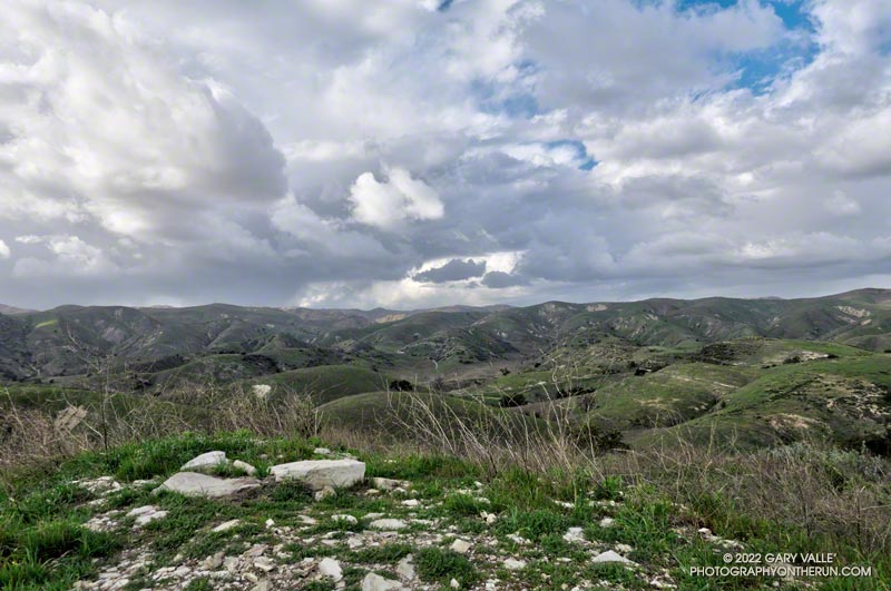
Clouds associated with an upper level low north of Los Angeles

Yep, that was a rumble of thunder. It was a blustery, Spring-like afternoon and a storm cell had developed a few miles to the WNW of Lasky Mesa.

Before driving over to Ahmanson I’d checked the weather radar and seen cells circulating counterclockwise around a cold upper level low. Most were dissipating as they moved north to south, out over the Valley. The wildcard was that the upper low was moving southward, and the cells might strengthen.

Convective cell WNW of Lasky Mesa associated with a cold upper low north of Los Angeles
Storm cell WNW of Lasky Mesa.

Again there was a low rumble. The cell didn’t seem any closer, but now I could see additional development to the north and northeast of Ahmanson. I picked up the pace.

There’s nothing like the threat and energy of a thunderstorm to incentivize a runner. All the way back to the trailhead it looked like heck might break loose at any moment.

But it didn’t. It was just starting to rain when I got back to the car, and on the way home the streets were wet. The Cheeseboro RAWS recorded 0.06 inch of rain, as did Downtown Los Angeles (USC).

Even though the Rain and Water Year rainfall totals for Los Angeles are about normal for the date, January and February have seen little rain. Precipitation records for Los Angeles indicate the period January 1 to February 28 will be the fourth driest on record.

The precipitation outlooks for Southern California this March don’t look especially promising, with a typical La Nina precipitation pattern expected for the West Coast.

Some related posts: Clearing Skies at Ahmanson Ranch, Thunderstorm

Is This the Future of Trail Use?

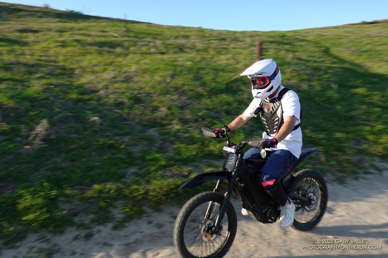
e-dirt bike in Upper Las Virgenes Canyon Open Space Preserve (aka Ahmanson Ranch)

The photo above is of a rider on an e-dirt bike in Upper Las Virgenes Canyon Open Space Preserve (aka Ahmanson Ranch). Based on a sequence of photos, no pedaling was required.

With the explosion of e-bikes, encounters such as this are inevitable. I’ve seen e-bikes and tracks in the most remote corners of the local mountains. Earlier this year, while running on a wilderness trail, I was passed by a motorcade of ten e-bikes.

Poaching of trails is commonplace. In one bike forum the question was asked, “Has anyone here actually received a ticket for riding an e-bike on a trail?” At that time — 2018 — the consensus was a resounding no. More recent posts suggest that not much has changed.

Malibu Creek December 2021 Floods

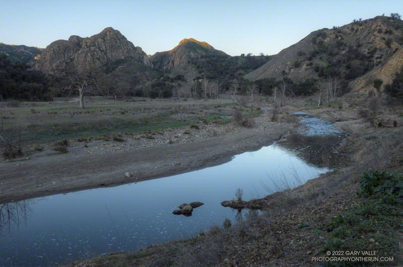
Malibu Creek and Goat Buttes before sunrise
Malibu Creek and Goat Buttes before sunrise. February 6, 2022.

If you’ve done the Bulldog Loop since the first of the year, you’ve no doubt noticed there’s water in Malibu Creek again, and a lot of flood debris along the creek between Century Lake and the M.A.S.H. site. That’s all thanks to the extraordinary amount of rain we had in December. This pile of flood debris is near the old concrete bridge that washed out in the February 2017 flash flood.

This morning it was chilly along this section of creek, so it was worth a little effort to find a way across the creek with a high probability of staying dry. This sketchy log wasn’t one of them, but I found a fairly easy crossing a little upstream. Another runner mentioned there were a couple of planks across the creek just downstream of the old bridge.

Although stream gage data suggests that the peak flow was higher in February 2017, that was the result of one period of very heavy rainfall. In December 2021 there were peaks on three days, corresponding to three periods of rain.

Here’s a photo that shows the height of a debris pile along the Crags Road Trail, compared to a passing runner.

Related post: Malibu Creek Flooding

Photography and inspiration from running and other adventures in the Open Space and Wilderness areas of California, and beyond. No ads. All content, including photography, is Copyright © 2006-2024 Gary Valle. All Rights Reserved.