Chumash – Las Llajas Loop Plus

Coquina Mine Trail/Marr Ranch Trail Connector

In this case the “Plus” is an alternate finish to the counterclockwise Chumash – Las Llajas Loop.

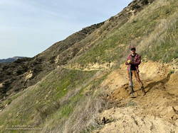
Working on the trail that connects the Coquina Mine Trail and Las Llajas Canyon to the Marr Ranch Trail. (Thumbnail)
Working on the trail that connects the Coquina Mine Trail (and Las Llajas Canyon) to the Marr Ranch Trail.

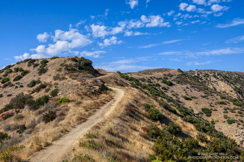
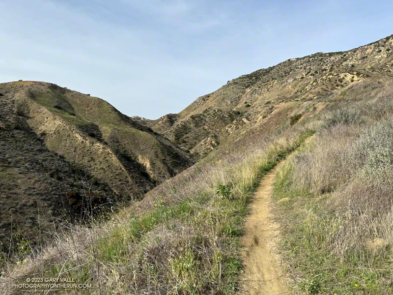
This variation bypasses the last couple of miles of Las Lajas Canyon by using a relatively new trail that splits off the Coquina Mine Trail and connects to the Marr Ranch Trail.

It adds about 1.5 miles and a few hundred feet of elevation gain to the Chumash – Las Llajas Loop but gets you up and out of the canyon and on a ridgeline with excellent views of the surrounding terrain.

I’ve always wondered who maintains the connector trail and happened upon that person on this morning’s run.

Some related posts:
Chumash-Las Llajas Loop
Not So Flat Las Llajas Canyon
Exploring Las Llajas

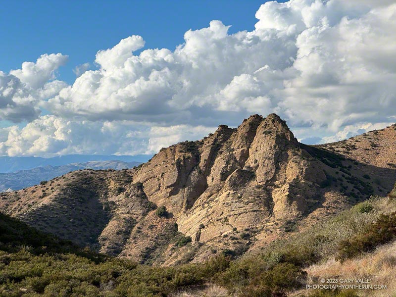
Chumash Rock and Clouds

Chumash Rock and Clouds - Photography by Gary Valle'
Chumash Rock and Clouds

“Chumash Rock” is prominent rock formation seen from the Chumash Trail in the eastern Simi Valley.

As I discovered in a January 2006 adventure, it is not an easy rock formation to reach.

The title photo was taken in mid-November while doing the Chumash – Las Llajas Loop. The clouds over the Ventura County foothills and mountains from the Las Llajas Canyon – Rocky Peak Road connector were just as beautiful.

Chumash-Las Llajas Loop

Rocky Peak Fire Road between the Chumash Trail and Fossil Point

Update of a post from December 30, 2006.

The Chumash-Las Llajas Loop is a scenic 9.3 mile trail run in the eastern Simi Valley. Run counterclockwise, it combines a  strenuous climb on a single-track trail and fire road with a fast-paced 4-mile downhill on a dirt road. The cumulative elevation gain/loss on the loop is about 1600′.

View of Oat Mountain from near the top of the Chumash Trail.
Nearing the top of the Chumash Trail

I like to do the loop starting at the Las Llajas Canyon trailhead on Evening Sky Drive. A short jog up Evening Sky Dr., then across a field, and you’re on your way up the Chumash Trail. From this point, it’s an approximately 1000′ climb over 2.7 miles of rocky trail to Rocky Peak fire road.

After turning left (north) on Rocky Peak fire road, a short downhill is followed by three-quarters of a mile of climbing to “Fossil Point.” A short detour off the main fire road leads to a cairn marking the high point. From here there is a panoramic view of Oat Mountain, San Fernando Valley, San Gabriel Mountains, Santa Monica Mountains, Simi Valley, Boney Mountain, Channel Islands, and Ventura Mountains.

Exposures of fossil shells are found near the high point. According to the area’s Dibblee geology map, these may have been deposited in shallow marine lagoons a couple million years ago.

From the high point, the loop continues north on Rocky Peak Road. At first, it descends steeply, then climbs to a hilltop with a few valley oaks. Partway up the hill, a roadcut reveals the long roots of the chamise plants on the hillside.

Road connecting Rocky Peak Road to Las Llajas Canyon.

Following a short downhill, the road continues past a fallen valley oak that was killed by the 2011-2015 drought. There is a fork in the road here. The road connecting to Las Llajas Canyon goes up a short hill to an overlook of the canyon. From the top of the hill, there are more than 4 miles of downhill through the winding canyon. There used to be oil field equipment on the connector between Rocky Peak Rd. and Las Llajas Canyon, but it has been removed.

If the creek in the canyon is flowing, there are several places where the (usually) small stream crosses the road. In the Spring and early Summer, many species of wildflowers can be found in the canyon.

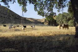
Cattle on the Las Llajas Loop

Some of the wildlife, and not-so-wild animals, I’ve encountered on the loop include rattlesnakes and other snakes, deer, longhorn cattle, roadrunners, and a kangaroo rat. Although others have seen mountain lions in the area, I’ve only photographed their tracks.

The loop ends with a short, steep climb up a paved road. At the top of the hill, turn left to return to the trailhead.

Explore the scenery and terrain on the Chumash-Las Llajas Loop trail run using our high resolution,  interactive, 3D viewer. The imagery is so detailed, it’s almost like being there! To change the view, use the control on the upper right side of the screen, the CTRL key and your mouse, or touch gestures. Track and placename locations are approximate and subject to errors. Poor weather, and other conditions may make this route unsuitable for this activity. (It is also possible to start the loop at the Chumash Trail trailhead at the end of Flanagan Dr.)

The title photo is a section of Rocky Peak fire road between the top of the Chumash Trail and Fossil Point. It is from a run on October 6, 2020.

Some related posts: Chumash Trail Rocks & Snow, Exploring Las Llajas, Marr Ranch WildflowersThings Found on the Chumash Trail

Chumash Astronomy: Reaching into the Upper World

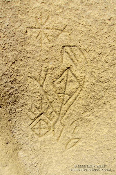
Chumash astronomical petroglyph.

There is nothing quite so compelling as an unanswered question.

Several years ago, in the middle of a trail run, an unusually shaped rock formation caught my eye. After a little bushwhacking and exploration, I found a way to climb the formation, and on its summit found a small pictograph. I wondered if there might be other pictographs in the area, and on the way back to the trail found the inscription pictured above.

Later, I took a friend with more ethnographic experience to the top of the rock, and it was his opinion that the pictograph, as well as the nearby inscription, were not of modern origin. He also mentioned that the rock likely marked the point on the southeastern horizon where the sun rises on the Winter Solstice, as seen from a Chumash shrine several miles away.
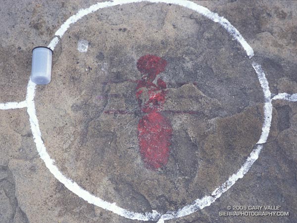

Chumash pictograph
The pictograph on the solstice rock appears to have been painted using an ochre pigment, which may have been mixed in an adjacent cupule. It is in a harsh environment, fully exposed to the sun, wind and rain. It’s my guess that the white “alignment” reticule surrounding the pictograph is an unfortunate recent addition.

The petroglyph is in a concavity on the north side of a large boulder, and is better protected. That the drawing appears to be astronomical in nature, and is adjacent to a rock possibly used to mark the Winter solstice is probably not a coincidence.

To speculate on the purpose and meaning of such a drawing is to travel in time, and through the thoughts and eyes of another, visit a world far different than our own.

In this case that someone was probably an ‘alchuklash — an astronomer-priest-shaman who was a part of a religious-spiritual cult known as the ‘antap — a pervasive power elite within Chumash society.

The ‘alchuklash were adept astronomers, not only observing the Winter and Summer Solstices, but the moon, individual stars, asterisms, constellations, planets, Milky Way, eclipses and more. The observation and interpretation of the Upper World were an integral part of the Chumash cultural and world view.

But the Upper World did not exist on its own. The Chumash appreciated and celebrated the interdependency of Nature, and events in the Upper and Lower Worlds were inexorably tied to those in the Middle World of everyday existence. Using their specialized knowledge, the ‘antap facilitated communication and interaction between these worlds to the benefit, or peril, of the People.

It is in this context that in the drawing I see the powerful personage of an ‘alchuklash, who has reached into the Upper World. Perhaps the drawing is a commemoration of the power of the place. Perhaps it is a kind of owner’s manual, a premodern PDF, illustrating the purpose of the solstice rock. Or, perhaps it is something we cannot know.

Note: The contrast of the lines in the image has been increased to make them easier to see. In the ten years since I first photographed the etching, some detail has been lost in the lower right corner of the drawing. This image is from April 21, 2009.

Reference: Crystals in the Sky: An Intellectual Odyssey Involving Chumash Astronomy, Cosmology, and Rock Art. Travis Hudson and Ernest Underhay (Foreword by Anthony F. Aveni and illustrated by Campbell Grant). Socorro, New Mexico: Ballena Press Anthropological Papers No. 10, 1978, 163 pp.

Google search: $g(Chumash), $g(petroglyph), $g(pictograph), $g(rock art), $g(solstice), $g(astronomy), $g(ethnography), $g(shaman)
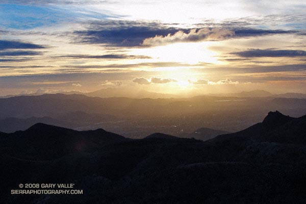
Chumash Clouds

Sunset view of Simi Valley, with Boney Mountain and Conejo Mountain in the distance.

Clouds moving onshore ahead of a low pressure system that is expected to produce rain in Southern California Christmas Eve into Christmas Day. Track of the low is now projected to be a little more to the west, so the heaviest rain may occur just offshore.

From an out and back run yesterday to “fossil point” via the Chumash Trail and Rocky Peak fire road. View is of Simi Valley, with Boney Mountain and Conejo Mountain in the distance.

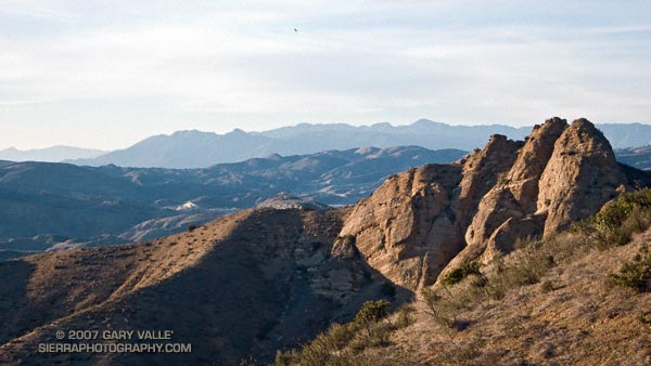
Chumash View II

View northwest to the Ventura Mountains from the Chumash Trail.

View northwest to the Ventura Mountains from the Chumash Trail. The highest peak on the skyline is Hines Peak (6716′), about 28 miles distant. Here’s a larger version of the 16:9 format image. Note the hawk soaring high above the terrain.

I run the Chumash Trail frequently, but had not seen the bulldozed track on the steep slope near the start of the trail. The trail hasn’t been re-routed. Apparently on the 13th a 4WD truck that was part of a fire department response to a cycling accident got stuck, and a bulldozer was called in to extricate the vehicle. I’ve been told the Park District and Mountains Conservancy are considering next steps.