With vaccinations on the increase and Covid on the decline, it was wonderful to once again be able to visit family.
As we always try to do, Brett and I got in a couple of runs. We usually do at least one run that is new to me, and there are certainly plenty from which to choose in the Bay Area.
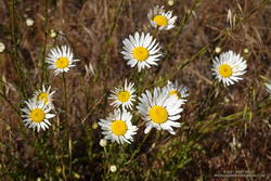
Our first run was on San Bruno Mountain. We’d previously done the Ridge Trail, so this time opted to do a variation of the Summit Loop. The parking lot at the base was was closed, so we started the run using the Old Ranch Road Trail. This was a plus because it added a little mileage and there were a lot of wildflowers along the trail, including monkeyflower, iris, lupine, yellow paintbrush, daisy, and foxglove.
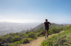
It was an excellent run on single-track trail. As is the rule on San Bruno, it was a bit breezy, with hazy views of the surrounding communities and the Pacific. An island of open space in an urban sea, San Bruno Mountain is a miracle of land conservation, and an area to be relished. Here is a map of trails in the area.
The next day, after watching a spirited youth soccer match, we headed south on 280. On the way, Brett filled me in on the runs he likes to do in Windy Hill Open Space Preserve and Huddart Park. We couldn’t go wrong with either choice but finally decided to save Huddart Park for another day.
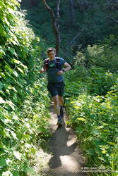
Windy Hill Open Space Preserve is on the northeast-facing slopes of the Santa Cruz Mountains above Portola Valley. We parked near the Alpine Trailhead and ran up the road to the Eagle Trail. Corte Madera Creek was running, but low. Although the grasses along the trail were green and the undergrowth was relatively lush, I suspect the conditions were more like July than May. Open hillsides looked mid-Summer dry and the lichen on the trees was drab and desiccated.
Like the rest of California, the Santa Cruz Mountains have seen well below average precipitation this rain season. One station near Windy Hill, Woodside 3.4 S, recorded only about 28% (12″) of normal precipitation from October 1 to May 19. Another station, Skyline Ridge Preserve, recorded about 41% of normal (16.5″) from October 1 to May 3.
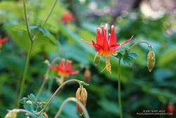
From the Eagle Trail/Private Road we turned onto the Razorback Ridge Trail. According to my Garmin track, the Razorback Ridge Trail gains 1000′ or so over 2.4 miles to its junction with the Lost Trail. It’s all runnable, switch-backing up a thimbleberry and fern-lined trail, shaded by California bay trees.
While the Razorback Ridge Trail continues up another 0.4 miles to Skyline Blvd., we turned right onto the Lost Trail. This trail parallels Skyline as it works in and out of the tributary ravines of Jones Gulch, on its way over to the Hamms Gulch Trail. Along the way there were views across the valley to Mt. Diablo, some 40 miles distant. Western columbine was blooming along the trail, its bright red color complimenting the green theme.
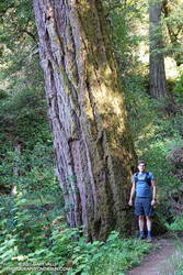
At the top of Jones Gulch, there is an impressive, old-growth Douglas-fir. At chest height, it is about as wide as Brett is tall. This would put its diameter at over 72″ and its circumference at over 220″, suggesting an age in the neighborhood of 350 years.
The run down the Hamms Gulch Trail was as good as the run up Razorback Ridge. Given the weather was nearly perfect for a hike or run, we were surprised to see only a dozen or so people on the trail.
From where we were parked the run worked out to about 8 miles, with about 1500′ of gain/loss. Here is a trail map of the area, and here is an interactive, 3D terrain view of my GPS track of the loop. The interactive map can be zoomed, tilted, rotated, and panned. To change the view, use the control on the upper right side of the screen.
Some related posts: Breezy San Bruno Mountain Ridge, San Francisco Sights Trail Run, Miwok Wanderings
