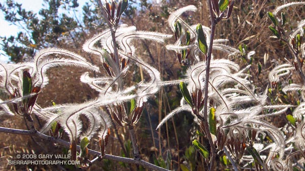
Plumed achenes of curl-leaf mountain mahogany (Cercocarpus ledifolius) on the Chumash Trail. From Tuesday’s run.

Plumed achenes of curl-leaf mountain mahogany (Cercocarpus ledifolius) on the Chumash Trail. From Tuesday’s run.
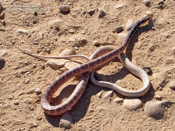
Encountered this red coachwhip/racer (Masticophis flagellum piceus) as I was running down the Chumash Trail today. It was a long snake — at least 5′.
In June 2005, I found a California striped racer (Masticophis lateralis lateralis) on the Chumash Trail that appeared to have suffered some sort of fatal trauma. It was a much smaller snake than the red racer.
Note: There was a handwritten notice posted at the Chumash trailhead warning of a mountain lion sighting on July 18, 2008. I haven’t been able to obtain any additional details.
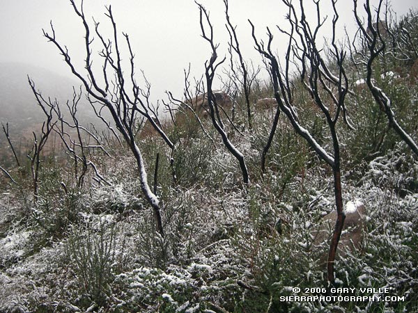
Snow highlights skeletal fingers of burned chaparral along the Chumash Trail in eastern Simi Valley. The chaparral was burned in the 2003 Simi Fire. More info and a couple of additional photos can be found in my Coyote Oak Journal entry Chaparral Snow.
Related post: Chumash Trail Rocks & Snow (December 2008)
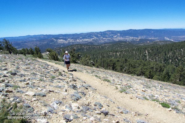
The out and back trail run from the Chula Vista parking lot on Mt. Pinos to the top of Mt. Abel is one of the best “short” mountain runs in Southern California. Most of the run is on the Vincent Tumamait Trail — a technical single track trail in the Chumash Wilderness in Los Padres National Forest.
 Ranging in elevation from about 7700′ to 8800′, the run packs a lot into its 15 mile length, combining great scenery with demanding uphills and superb downhills through old growth pine and fir forest. The summit area of Mt. Pinos is open and alpine with views that can range from the ocean to the Sierra.
 About 4 miles from the parking lot is the North Fork Trail junction. A short side trip on this trail leads to the seeps, spring and wildflowers at Sheep Camp. The Vincent Tumamait Trail ends at Cerro Noroeste (Mt. Abel) road, but it is not difficult to work up through the pines about 1/3 of a mile to the campground on Mt. Abel’s summit.
Usually about 20-30 degrees cooler than lowland hot spots such as the San Fernando Valley, the run is a great way to beat the heat on a hot summer day. See the post Vincent Tumamait Trail for more info and additional trail running options.
The title photo is of Lynn Longan, running up the switchbacks near the Condor Observation Site on Mt. Pinos.
In this case the “Plus” is an alternate finish to the counterclockwise Chumash – Las Llajas Loop.
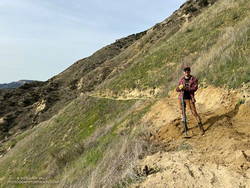
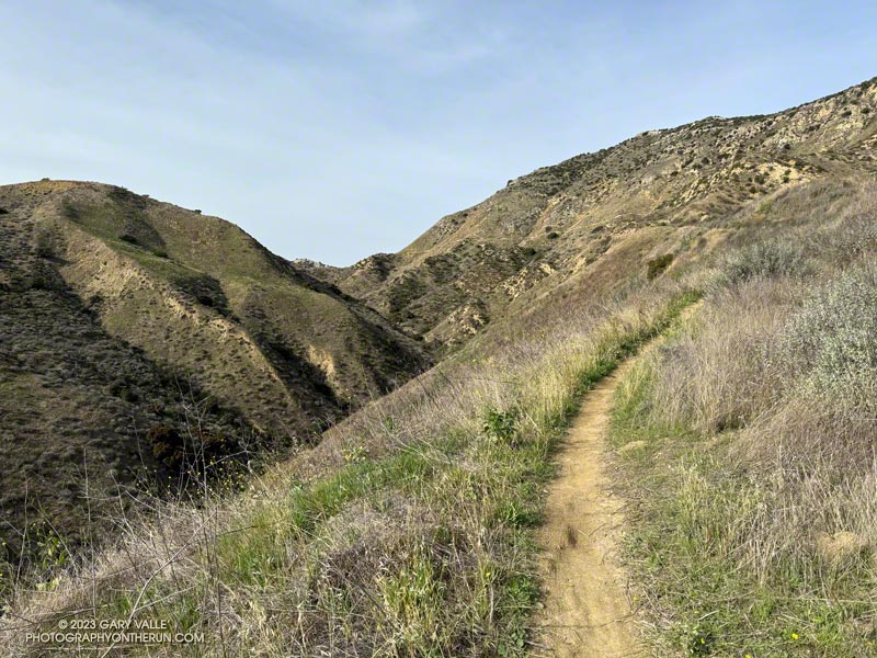
This variation bypasses the last couple of miles of Las Lajas Canyon by using a relatively new trail that splits off the Coquina Mine Trail and connects to the Marr Ranch Trail.
It adds about 1.5 miles and a few hundred feet of elevation gain to the Chumash – Las Llajas Loop but gets you up and out of the canyon and on a ridgeline with excellent views of the surrounding terrain.
I’ve always wondered who maintains the connector trail and happened upon that person on this morning’s run.
Some related posts:
– Chumash-Las Llajas Loop
– Not So Flat Las Llajas Canyon
– Exploring Las Llajas
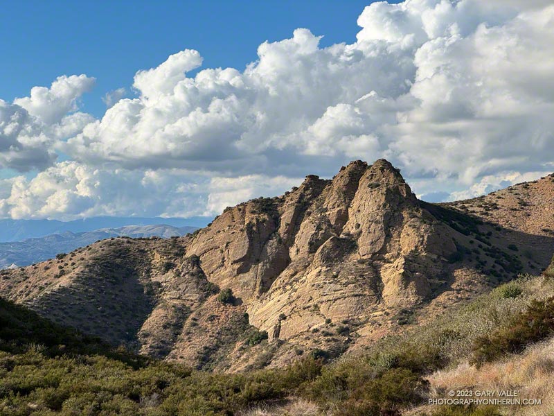
“Chumash Rock” is prominent rock formation seen from the Chumash Trail in the eastern Simi Valley.
As I discovered in a January 2006 adventure, it is not an easy rock formation to reach.
The title photo was taken in mid-November while doing the Chumash – Las Llajas Loop. The clouds over the Ventura County foothills and mountains from the Las Llajas Canyon – Rocky Peak Road connector were just as beautiful.