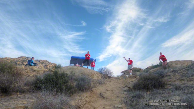
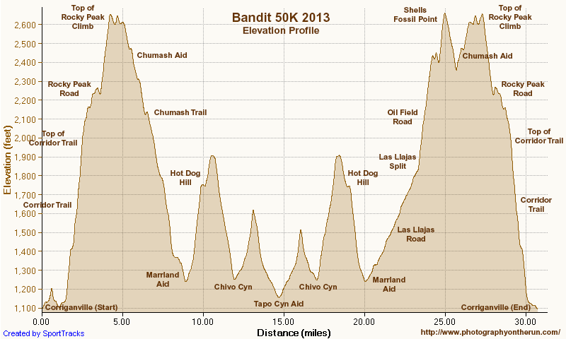
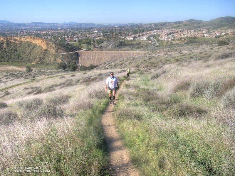
As I worked up the hill toward “Fossil Point” I drank the last mouthful of water from my bottle. I wasn’t surprised that I had run out. The morning temperature had been the warmest in the six year history of the event, and the midday temp in the sun felt like it was in the mid-80’s — maybe higher.
In Southern California it has been the kind of Winter that those in northern climes can only dream about: Day after day with fair skies and the temperature in the 70’s and 80’s. Great for trail running, but with the trade-off that we had had the least amount of rain in over a century.
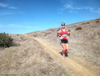
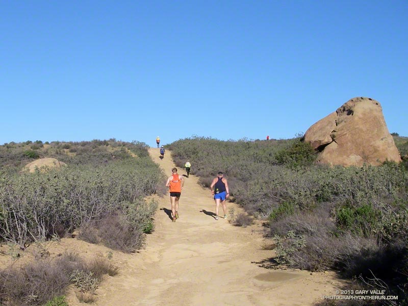
Running down Hot Dog Hill
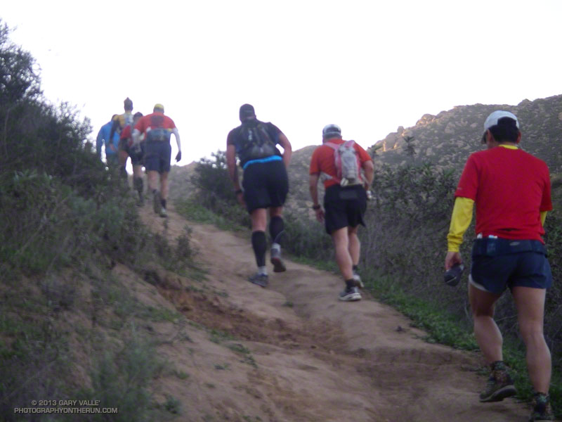
Chugging up the steep hill I thought about how the run had gone so far. Even if it was a little warm, it was still a pretty good day for a trail run! I hadn’t tried to push the pace on the initial steep climb from Corriganville, and had (mostly) resisted the temptation to pound down the Chumash Trail. The crazy-steep section of Hot Dog Hill on the out and back section of the course felt just as steep and insane as it did last year and the downhill to the Open Space aid station just as pleasant.
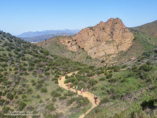
It was awe-inspiring to see the faster runners as they returned from Tapo Canyon. As I started the descent into Chivo Canyon Jay Bonthius, the eventual winner of the 50K, had flashed past. The youngest runner in the race, the 19 year old went on to finish his first 50K in 4:05:52 — setting a new course record. His average pace was a remarkable 7:55 min/mile! He ran up the hills faster than many of us ran down them!
I was very happy to get to the top of the climb at Fossil Point. Although it wasn’t the end of the running, or the hills, it was a key point in the 50K. It marked the end of a grueling 5 mile climb from the Las Llajas aid station — the last major climb on the course. It also had water.
I had carried two bottles and that was still not quite enough. There is only so much time during a race available for hydration, and I had made the mistake of not drinking water early, BEFORE I was thirsty. At this point I was dehydrated and that could not be completely remedied until sometime after I crossed the finish line.
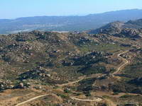
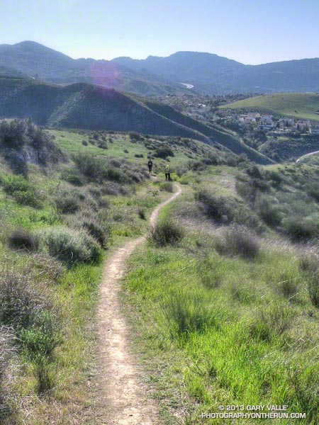
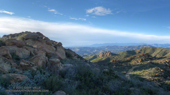
Rocky Peak Road
Another four miles would find me at the top of the Corridor Trail, which on tired legs might as well be the edge of the earth. This steep one mile descent is the most technical on the course and as challenging as any of the hills. I am always happy to get to the bottom. From here the finish is a little more than a half-mile away and I smiled as I heard the cheers as another runner crossed the finish line.
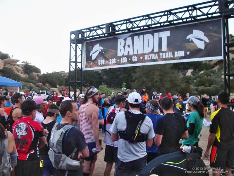
More than 500 runners participated in the 6th edition of the Bandit Trail Runs, competing at distances that ranged from 6K up to 50K. Many thanks to Bandit Race Committee – RD Randy Shoemaker, Sarita Shoemaker, Eric Cartier, Tommi Diaz, Mat Diaz and Josh Lewis. Each year they find a way to make an outstanding event even better!
Once again the aid station volunteers were phenomenal! Thank you Nancy Shura-Dervin and the Ultraladies, the Encino Trail Heads, Sue Apostolof, Diane Treptows, and all the volunteers! There was not an aid station where I wasn’t greeted with a smile and all the help I needed. Also many thanks to those that worked registration, parking, the finish line, timing, finish line food, photography, safety, communications, and all the other work needed to put on an event like the Bandit.
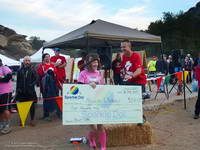
Alison Chavez and RD Randy Shoemaker
Reflecting the dedication and character of its organizers, each year the Bandit gives back by supporting an important cause. Last year Bandit raised funds for a local high school running program. This year Bandit is rallying behind runner Alison Chavez in her battle against cancer.
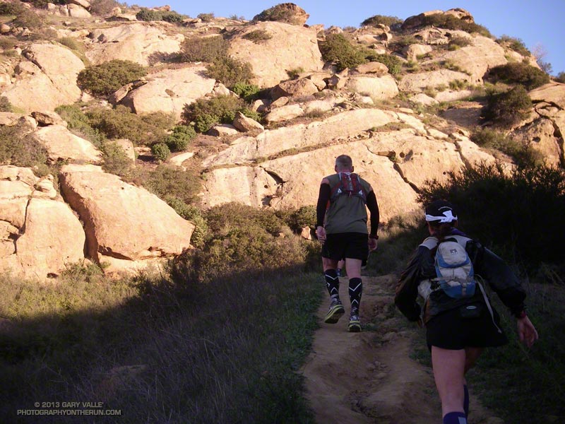
As I started up the Chumash Trail, a patchwork of clouds filled the sky, and the fresh smell of a recent shower filled my lungs. A strong and unseasonably cold low pressure system was producing the first widespread rainfall of Southern California’s 2013-14 rain season.
I hoped there would be another shower during my run. The plants and animals needed it and I needed it. It had been many months since I had run in the rain on a local trail.
As I worked up the trail I thought about how dry it had been. Downtown Los Angeles’ 2012-13 water year (Jul 1 – Jun 30) was the sixth driest on record. Rainfall in Los Angeles since January 1 has been about 25% of normal. The 2012-13 Sierra snowpack was one of the worst on record.
Will this rain and snow season be any better? For months I’ve been monitoring climate data and forecasts looking for something on which to base a 2013-14 Winter Outlook. Historically, ENSO has been the big dog in Southern California rain season weather with El Nino conditions generally producing wetter weather and La Nina conditions generally drier.
But ENSO conditions are currently Neutral and are expected to remain so through the end of the year. Most climate models forecast there will be slow warming of SSTs in the equatorial Pacific (NINO 3.4 region) over the next several months, but at this time of the year it would be very unusual to have substantial warming. The CPC/IRI ENSO Forecasts from IRI’s October Quick Look indicate the probability of an El Nino developing before the end of the year is less than 20% — and 20% seems high.
One computer model that at times has been forecasting above average precipitation this Winter in Southern California is the Climate Forecast System version 2 (CFSv2). The CFSv2 is fully coupled ocean-atmosphere-land-sea ice model used to forecast parameters such as sea surface temperature, temperature and precipitation rate. While skillful at predicting tropical SSTs, the CFSv2 generally performs very poorly when forecasting precipitation over land, so forecasts such as this one for Dec-Jan-Feb must be viewed somewhat skeptically.
Another glass half-full observation is that the Madden-Julian Oscillation (MJO) has been relatively active this year and if this activity continues it provides recurring opportunities for enhanced U.S. West Coast precipitation. The downside is that it can result in periods of dry weather as well.
With the ocean and atmosphere neutral there’s just not much on which to base a rain season forecast. According to the Climate Prediction Center, the current winter precipitation outlook for most of Southern California calls for an equal chance of below average, average, or above average rainfall. I know — that’s no help at all — you might as well flip a three-sided coin!
Update October 17, 2013. The Climate Prediction Center released its updated U.S. Dec-Jan-Feb Precipitation Outlook today. The outlook now indicates an equal chance of below average, average, or above average precipitation for all of Southern California. The October CPC outlook is usually the basis for the initial official NOAA U.S. Winter Outlook.
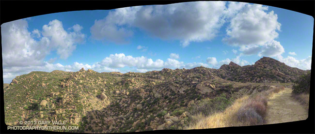
The title photo is of Rocky Peak Road, near its junction with the Chumash Trail. Here’s a larger version of the panorama.
If my training goal was to be running on spent legs, I had achieved that goal. I was at mile 22 of the Bandit 50K and trying to run up Las Llajas Canyon. On paper (or LCD display) Las Llajas is a gradual climb, gaining a modest 600 feet in a little more than 3 miles. But on dirt and in reality it is an onerous climb that numbs the mind and makes you mumble to yourself, “Why can’t I run up this thing any faster?”
Since early December I’d been doing extra training to prepare for the Coyote Backbone Trail Ultra at the end of March. Part of the training plan was to combine the Ray Miller 50K and Bandit 50K with other runs to increase the mileage. I had been following the usual training tenants and trying to vary the types of workouts, the mileage and intensity. So far it had all gone well, but the miles were adding up.
Early in the race I’d taken it easy — especially up the insanely steep “Corridor Trail.” But some trail running temptations can’t be resisted and I had pushed the pace going down the Chumash Trail — one of my favorite trails. Even if that was one of the reasons I was struggling a bit going up Las Llajas, it was worth it.
The new out and back from Las Llajas Canyon to Tapo Canyon was so much better than doing the Chumash-Las Llajas loop twice! The running was varied and challenging; plus we were able to marvel at the race leaders, and share the experience with many more runners! Chris Price and several other runners looked strong cranking it up out of Chivo Canyon. Averaging just a little over 8 minute miles, Chris went on to break the Bandit 50K record he set in 2011, doing the new (and longer) course in an amazing 4:10:23!
The weather forecast had looked a bit iffy earlier in the week — iffy hot in this case. But temps had cooled by about 10 degrees in 24 hours, and today the weather was excellent. It was on the warm side on a couple of the climbs, but nowhere near what it can sometimes be on a warm Winter’s day in Southern California.
After an indeterminate time I made it up Las Llajas Canyon to the split and started climbing up the steep oilfield road that connects to Rocky Peak Road. Part way up I was extremely disappointed to see that my Hill Climbing Helper® wasn’t where I left it. This made me even slower going up the hill.
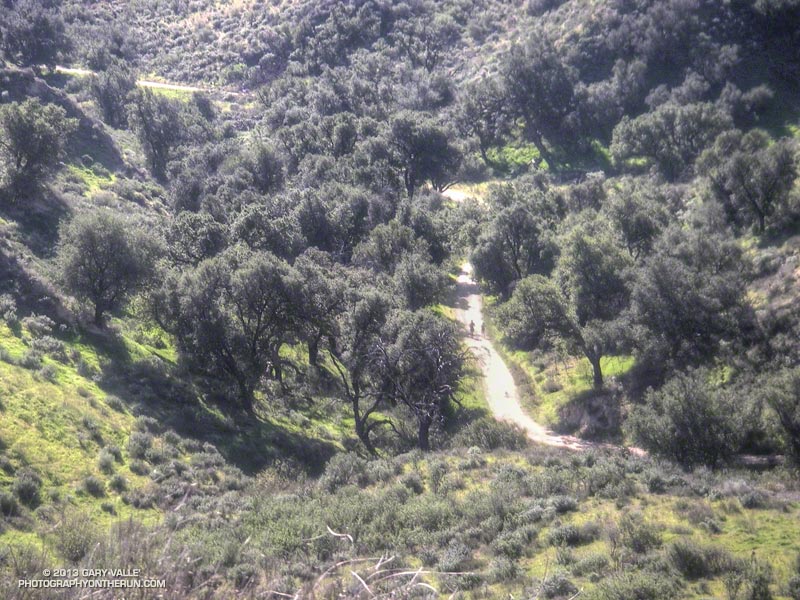
Once the last hard climb to Fossil Point is done it doesn’t take long to get to the Chumash Aid Station. Rolling terrain leads from there to the top of the Rocky Peak grade at about mile 27. From there it is nearly all downhill to the Finish.
More than 450 runners participated in the 5th edition of the Bandit Trail Runs, competing at distances that ranged from 6K up to 50K. Many thanks to the Bandit race committee — Randy, Sarita, Larry, Tommi, Mat and Eric — and all the Bandit volunteers, sponsors and runners.
According to my GPS tracks the 2013 50K course was about 3/4 of a mile longer than the 2011-12 course and had slightly more elevation gain/loss. Here’s an interactive Google Earth Flyover and Elevation Profile of the new 50K course. The flyover is interactive and can be paused and restarted at any point. You can rotate, zoom, and tilt the view. Mileages and locations are approximate and based on my 50K GPS track. The Google Earth plugin is available for most desktop browsers.
Originally posted November 25, 2006. Updated November 11, 2020.
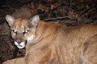
Nature isn’t necessarily nice. Behavior and interactions among animals are often violent. So it is with mountain lions. But the mountain lions of the Santa Monica Mountains also have to cope with the additional problems of living on an island of lion habitat in the middle of an ocean of urban sprawl.
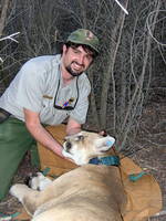
National Park Service Biologist Seth Riley and P1, the patriarch lion of the Santa Monica Mountains National Recreation Area lion study. NPS photo.
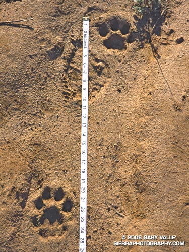
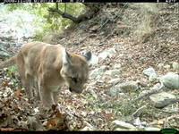
The mountain lion tracks above were photographed on a run at Sage Ranch Park in late January 2000. They might have been made by a young male mountain lion designated P3, whose territory encompassed this area. There is also a possibility there were from an older female lion, P4 that frequented the Rocky Peak area. Unfortunately, both these animals were killed in late 2004 by eating prey (coyote) that had eaten rodents that had consumed anticoagulant-based poisons. These poisons are used by parks, schools, golf courses, and housing developments for rodent control.
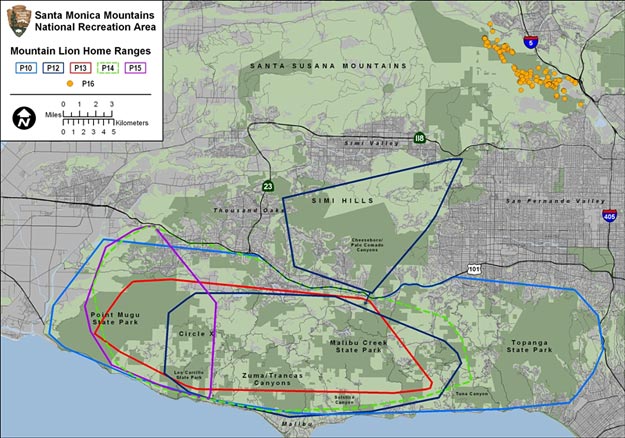
The P3 and P4 pumas were tracked as part of an ongoing study started by the National Park Service in 2002 to learn more about mountain lions in the Santa Monica Mountains National Recreation Area. As of May 2012, twenty-six mountain lions, P1 to P26, have been tracked, and their history has been quite a saga.
The patriarch of the lions in the study is P1. He was the first lion captured and collared in 2002, and at that time was estimated to be 5-6 years old. In his prime, P1 was a large, 140+ lb. male whose territory was essentially all of the Santa Monica Mountains. In August of 2004, P1 and P2 – the only female lion known to be in P1’s range – produced a litter of four cubs — two males (P5 and P8) and two females (P6 and P7).
Despite high hopes for the lions and their new litter, things turned ugly in August of 2005, when P1 killed his mate P2. A few months later, in June of 2006, P1 also killed one of the 22-month-old females from the litter, P7. According to biologists these were not the actions of a lion run amuck but were most likely related to conflicts over kills, or in the case of P2, a mother protecting her offspring.
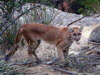
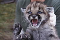
Mountain lion P13. NPS photo.
As might be expected, the young males from the litter, P5 and P8, headed for opposite ends of P1’s territory. However, urbanization and limited linkages essentially prevented their escape to other wildland areas.
In early September 2006, P5 was likely killed by P1, and in a development that surprised researchers, P8 appeared to have been killed by an unknown lion, probably male, inside of P1’s territory. The “unknown lion” was the male P9, who was killed by a vehicle on Las Virgenes road in July 2007.
One other female lion was collared and designated P13. DNA testing indicated that P13 was a daughter of P6. At that time P6 was the only surviving lion from P1 and P2’s 2004 litter.
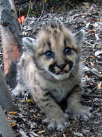
One of three mountain lion kittens found in May 2010. NPS photo.
P1 appears to have been injured in a battle for dominance in March 2009. A bloody radio collar and tufts of hair were found in a tree in Hidden Valley, near Thousand Oaks. P1’s opponent was suspected to be P12, a lion collared in December 2008, and the first lion to be tracked crossing the 101 Freeway. Scat found three weeks after the fight was genotyped, and found to be P1’s.
In May 2010 P13 had a litter of three kittens — P17 (female), P18 (male), and P19 (female). The father was P12. Since P12 originated from an area other than the Santa Monica Mountains, this increased the genetic diversity of the mountain lion population in the study. P18 was killed August 30, 2011, attempting to cross the 405 freeway.
It is unclear how many male lions now inhabit P1’s original territory. P12’s collar is no longer functioning. P18 was killed August 30, 2011, attempting to cross the 405 freeway. P15 was found deceased on September 11, 2011. Reportedly another male lion has been photographed in the area.
In May 2010 a male lion living in the Santa Susana Mountains west of I-5 was collared and given the designation P16. This is the first lion to be followed in the Santa Susana Mountains since P3 and P4 died in 2004, after eating contaminated prey. P21, an adult male, is also being tracked in the Santa Susana Mountains. Both P16 and P21 have made excursions into Angeles National Forest, and P16 remains there.
Johanna Turner of CougarMagic.com has captured breathtaking stills and videos of the area’s mountain lions and other wildlife.
Following are some previous updates to this post, with links to additional articles and information.
Update October 24, 2012. The remains of P-25, an approximately one-year-old female mountain lion were discovered by hikers in Point Mugu State Park on Sunday. P-25 and P-26 (male) are the offspring of P-12 (male) and P-13. The death did not appear to be the result of a conflict with another lion. A necropsy is pending.
One of the kittens of P19. NPS photo.
Update October 18, 2012. This summer NPS biologists discovered two mountain lion kittens, P-23 (female) & P-24 (male), east of Circle X Ranch in the Santa Monica Mountains. They are the offspring of P-12 (male) and P-19, a daughter of P-12. The kittens were outfitted with tracking devices.
Update June 18, 2012. Analysis of the DNA of the mountain lion killed by authorities in downtown Santa Monica on May 22 revealed it is related to lions that reside north of the 101 Freeway. One possibility is that the approximately three-year-old lion was the offspring of mountain lion P-12. P-12 has been documented crossing the 101 Freeway in Agoura and is the only lion known to have done so.
Mountain lion P22. NPS photo.
Update May 26, 2012. Earlier this Spring biologists from Santa Monica Mountains National Recreation Area (SMMNRA) captured an adult male mountain lion in the Griffith Park area. Designated P-22, the approximately three-year-old lion is the first to have been photographed east of Cahuenga Pass and within the Santa Monica Mountains eco-region. The lion was fitted with a GPS collar and released where it was captured. According to Kate Kuykendall, Public Affairs Officer for the SMMNRA, preliminary genetic analysis by UCLA indicates that P22 is likely from the Santa Monica Mountains, which would mean he crossed both the 405 and the 101 Freeways.
Mountain lion P15. NPS photo.
Update November 21, 2011. On October 4, 2011, the National Park Service announced that male mountain lion P-15 has been killed. It was the first documented intentional human-caused death of a mountain lion in the Santa Monica Mountains. P-15’s collar stopped transmitting on August 25, 2011. P-15 was discovered on September 11, 2011, following a report of a dead mountain lion. The California Department of Fish and Game and the National Park Service are seeking information related to the death of P-15 and the parties responsible. With the addition of $5000 from the City of Malibu, the reward being offered for information leading to the arrest and conviction of the poachers currently stands at $16,700. The DFG Cal Tip Hotline is 1-888-334-2258.
Update August 7, 2009. According to Where the Mountain Lions Live in the Santa Monica Mountains in laist.com, P1 may have survived the fight with another mountain lion back in March. DNA from scat collected about two weeks after the fight matched P1!
Update March 28, 2009. There was sad news earlier this month. According to an article in the Daily News, mountain lion P1, the long-standing patriarch of the Santa Monica Mountains, appears to have lost a battle for dominance with another mountain lion. A bloody radio collar and tufts of hair were found in a tree in Hidden Valley, near Thousand Oaks. P1’s opponent is suspected to have been P12, a lion collared in December, and the first lion to be tracked crossing the 101 Freeway.
Update October 6, 2008. The Ventura County Star reported that a young male lion was found dead on October 2 on the 118 freeway, just west of Rocky Peak Road. A wildlife passageway crosses under the freeway nearby and has been used by at least one other lion. On July 18 a mountain lion was reported in the area of the Chumash Trail.
Update May 1, 2008. NPS wildlife biologists are currently aware of 4 lions in the Santa Monica Mountains — 2 recently radio-collared young males designated P10 and P11, and P1 and P6. There is probably at least one more female, the mother of P10 and P11. A remote camera picture has also been taken of a lion in the Simi Hills.
Update January 25, 2008. An article in the Simi Valley Acorn reported that on January 13, 2008, a mountain lion was discovered in an abandoned building near Chatsworth Reservoir. Two days later there was another mountain lion sighting in the nearby Simi Hills by employees at the Santa Susana Field Laboratory.
Update August 7, 2007. According to an article in the Malibu Times, on July 31 a five or six-year-old mountain lion was hit by a car near the tunnel on Malibu Canyon Road and died shortly thereafter. The mountain lion, designated P9, was recently collared, and along with P1 and P6 was one of three mountain lions being tracked by the NPS. There is speculation that P9 may have been the unknown lion that killed P8.
Foretelling the approach of a system forecast to bring wet weather to some areas north of Pt. Conception New Year’s Day, and Los Angeles Sunday, this thick cirrus cloud shield is associated with the circulation around a low a few hundred miles off the Pacific Northwest coast.
Wednesday’s cold front, the latest in a series of surprisingly frequent December weather systems, increased the water year rainfall total at Downtown Los Angeles (USC) to 11.70 inches. As of today, L.A.’s rainfall total is about 8 inches above normal, and more than three times the normal amount of rainfall for the water year to date. For the first six months of the 2010-11 water year, the rainfall total for Downtown Los Angeles is the fourth wettest in the 133 years that records have been kept. The water year starts on July 1 and ends June 30.
The photograph is from today’s run on the Chumash Trail and Rocky Peak Road, northwest of Los Angeles. It was cold on the north facing sections of trail that don’t see the sun this time of year. Inch long needle ice crystals had formed along the margins of the trail in several places.
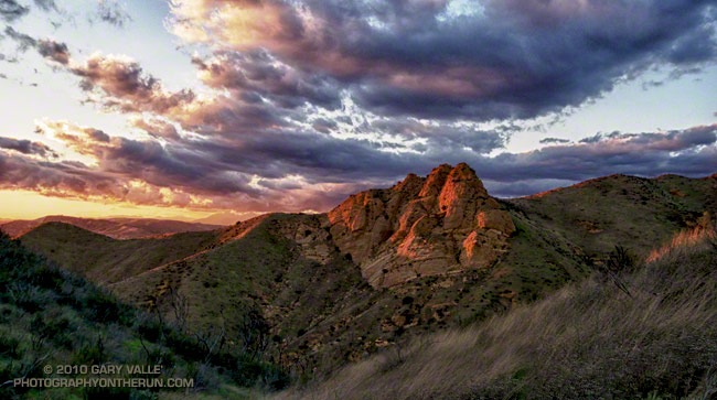
The temperature was in the low fifties, but with a 20 mph wind it was cold. I had just run up the Chumash trail, and was on my way down. The sun was nearing the horizon and hidden by a band of clouds. It had been like that since I topped out at Rocky Peak road. I hoped by the time I reached a vantage point of Chumash Rocks the setting sun would break underneath the clouds and illuminate the formation.
Nope. When I reached the viewpoint, the rocks were still in shadow. And the wind was even stronger. Squeezed between two hills, it rushed through the little col in cold, turbulent gusts. Buffeted by the wind, and chilled to the bone, I waited for the sun.
And waited. It was too cold to just stand there. I took a few photos, but the sun and clouds were not cooperating. At some point, minutes away, the sun would set, and that would be that. The photo just wasn’t going to happen. I returned to the trail and began to run down the hill.
In the lee of the hills the wind lessened, and it was not so cold. It was still a few minutes before sunset, and as I rounded a corner I could see a bright glow at the edge of the clouds.
I was several hundred yards down the trail when the first hint of sunlight appeared on a distant hill. It was veiled and muted, but it was sun. Maybe there was time. I turned and hurried back up the trail.