An End of Year Boney Mountain Adventure

Runners on Boney Mountain's western ridge

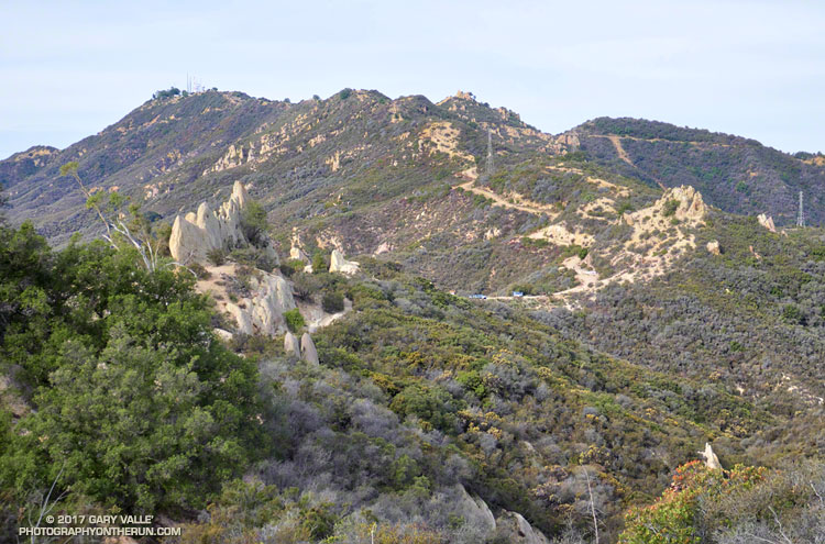
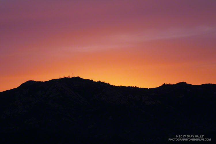
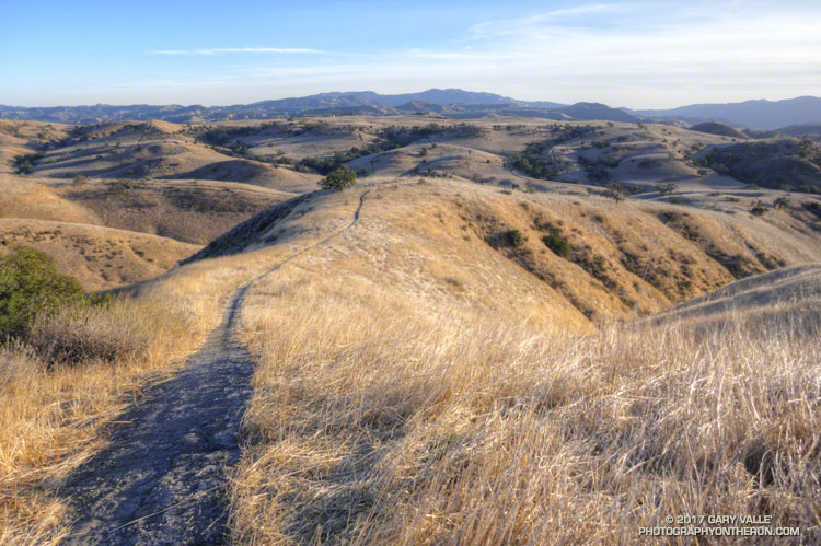
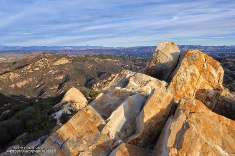
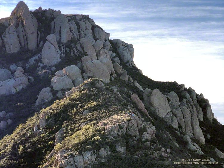
The last day of 2017 had been a near perfect day for a trail run. I’d started my adventure with an ascent of Boney Mountain’s western ridge, joining the Trail Runners Club for part of the climb. After reaching the top of Boney Mountain’s western ridge, I continued to Tri Peaks and Sandstone Peak, the highest peak in the Santa Monica Mountains. From Sandstone Peak, a few scenic miles were added by completing the Mishe Mokwa loop. This brought me back to the Chamberlain segment of the Backbone Trail, headed west.

About a half-mile past the Backbone Trail’s western junction with the Tri Peaks Trail, the Backbone Trail begins a 4.7 mile, 2400′ descent to Sycamore Canyon. I had started this descent and was nearly down to Chamberlain Rock, when I heard voices on the trail ahead. They sounded like they were just around the next switchback. Slowing to a walk, I rounded the sharp corner. Three smiling hikers said hello, and I wished them a Happy New Year.

It’s a little unusual to see a group of hikers on this section and for a moment I wondered if they might be doing the full length of the 68 mile Backbone Trail. I asked how they were doing and one of them casually replied, “Doing great — we’re just headed down to the Sandstone Peak parking lot…”

Surprised by the answer, I asked, “The trailhead on Yerba Buena?” They were miles from where they thought they were and headed in the opposite direction they should be. Every step down the trail was taking them farther and farther away from their intended destination. They looked fit, experienced and well-prepared, but somewhere along the way, they had taken a very wrong turn.

From what I could determine they had intended to do the Mishe Mokwa – Sandstone Peak loop counterclockwise, or a variation that involved Tri Peaks. Apparently, at the top of the Mishe Mokwa Trail instead of continuing toward Sandstone Peak on the Backbone Trail, the hikers decided to take the Tri Peaks Trail. They followed the Tri Peaks Trail until it ended at the Chamberlain/Backbone Trail, about two miles west of Sandstone Peak.

At this point, to get back to Sandstone Peak (and their car), they needed to turn left (east). Instead, they turned right and headed down the Chamberlain Trail. One of the three hikers suspected they had gone in the wrong direction, but wasn’t able to convince the others.

The good news is they only had gone about a mile down Chamberlain from the Tri Peaks Trail junction. This put them about 2.5 miles from Sandstone Peak and about 4 miles from their car. It was around noon and the weather was good. If they had no route-finding issues on the way back they would probably still have time to do Sandstone Peak. They just would be doing more of an End of the Year adventure than they planned.

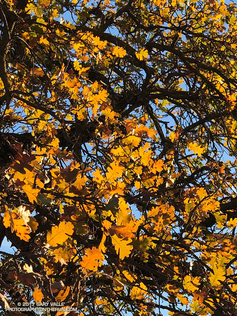
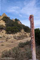
Here are a few photos taken along the way.

Some related posts: Boney Mountain Western Ridge & Loop, Balance Rock, Misplaced on Mt. Wilson

Some Fall Color to Bring in the New Year

Some Fall Color to Bring in the New Year. Photography by Gary Valle'.

While much of the country shivers in the cold climes of Winter, the muted colors of the changing season have finally reached the lower elevation areas of Southern California.

Turning leaves of a willow in East Las Virgenes Canyon. December 28, 2017.
Willow in East Las Virgenes Canyon

In this area, the leaves of Valley Oaks usually begin to turn around mid-December and the trees lose their leaves around the beginning of the new year. About a month and a half later trees begin to sprout new leaves, usually in mid to late February. From year to year, the time frame can vary by as much as 2-3 weeks.

The photo of Valley Oak leaves was taken December 28, 2017, in Upper Las Virgenes Canyon Open Space Preserve (formerly Ahmanson Ranch). This willow in East Las Virgenes Canyon was also showing some nice color.

Bulldog Loop Near Corral Canyon

Backbone Trail near Corral Canyon.

The high point of the 14+ mile Bulldog Loop in Malibu Creek State Park is near the center of the skyline in the photo above. The Bulldog fire road can be seen cutting across the peaks on the right. Bulldog tops out at the Castro Peak fire road, which is the fire road leading up from the Corral Canyon Road parking area. Castro Peak (privately owned) is the peak on the left with the antennae.

Top of the Bulldog climb in Malibu Creek State Park.

From Crags Road to Castro Peak fire road, the Bulldog fire road gains about 1727 feet in 3.4 miles. The steepest mile starts at mile 2.0 of the climb and gains about 732 feet.

Today I was running the loop clockwise, so got to run down Bulldog for a change!

Some related posts: Best Trailhead to Start the Bulldog Loop?, Malibu Creek State Park Scenic Loop, Vertical Relief, M*A*S*H Sunrise

July Through December in Los Angeles Likely to be Second Driest on Record

Very dry first six months of the rain year in Southern California

Assuming Downtown Los Angeles (USC) doesn’t get more than 0.02 inch of rain before the end of the year, the first 6 months of the 2017-18 Rain Year will be the second driest since recordkeeping began in July 1877. Los Angeles has recorded a paltry 0.19 inch of rain since July 1. Only 1962 recorded less rainfall over the six month period. November and December have been particularly dry, with only 0.01 inch being recorded at Los Angeles during each of these months.

What has happened in the past when there has been such a slow start to the July 1 – June 30 Rain Year?

If we look at the 10 driest July-Decembers in Los Angeles, the average Rain Year rainfall for those years is only 9.4 inches, or about 63% of normal. And in all 10 years, the Rain Year rainfall turned out to be below normal. Even if we take the 20 driest July-Decembers the Rain Year average rainfall is about the same — 9.6 inches — and only 2 of the 20 years had above average rainfall.

So, historically, when the first six months of the Rain Year have been very dry, the amount of rain for the entire Rain Year has almost always been below average. We’ll see if that’s the case this time!

Topanga Lookout Loop, Plus Saddle Peak

Topanga Lookout Ridge

A run doesn’t have to be long or difficult to be interesting. I’d done the Ray Miller 50K the week before, so was looking to do something not too long or strenuous. That didn’t mean it couldn’t be a run with an adventurous edge. After considering several options, I finally settled on the Topanga Lookout Ridge Loop, plus a short side trip to the summit of Saddle Peak.

This 8.5 mile route combines a fun run, hike and scramble up a mile and a half long ridge to the Topanga Lookout with a scenic run on a segment of the Backbone Trail. The return to the Cold Canyon trailhead on Stunt Road is accomplished by descending the Stunt High Trail from its junction with the Backbone Trail.

The Backbone Trail climbs to its second highest point near Saddle Peak and it takes only a few minutes to run over to the summit of the peak. Despite rumors to the contrary the West peak (with all the antennae) is the higher peak. That’s where the benchmark is, and 1/9th arc-sec DEM data puts its elevation about 18′ higher than the East peak.

Related post: Topanga Lookout Ridge Loop