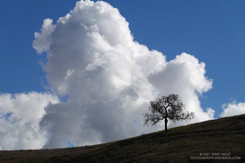
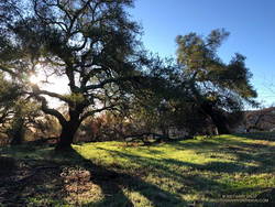
The cumulus cloud towered overhead, its size accentuated by a lone oak on the skyline. An extraordinary series of December rainstorms were finally over. The year 2021 would end with Downtown Los Angeles (USC) having recorded the third highest amount of December rainfall on record.
I was running from the Victory Trailhead of Upper Las Virgenes Canyon Open Space Preserve (aka Ahmanson) to Las Virgenes Canyon. With about 5 inches of rain in the area over the past two days, I was curious to see how upper Las Virgenes Creek was flowing.
Update January 4, 2022. Did the Garapito Trail again this weekend as part of a longer run through Santa Ynez Canyon. The debris from the fallen oak tree was much easier to get through this time. Some people coming down the trail after me had a small saw, and said they were planning to work on it.
Update December 31, 2021. It turns out that a lot more rain was on the way! Los Angeles recorded 9.46 inches of rain this month, making it the third wettest December on record, going back to 1877. This puts Los Angeles at 10.40 inches for the Rain Year to date, which is about 237% of the normal.
It had rained the past three days, including Christmas. Today was the 26th, and Downtown Los Angeles (USC) had recorded nearly 150% of the rainfall normally recorded in December. And more was on the way.
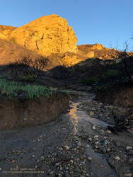
Early morning light on Eagle Rock.
I clicked START on my Garmin as I passed the gate at the Top of Reseda. It was about twenty minutes before sunrise. The temperature was around 40 and the eastern sky was brightening with the advancing sun. As I worked up the initial trail to dirt Mulholland, thousands of lights twinkled across the San Fernando Valley.
The chaparral was soaked with overnight rain; and befitting the Holiday season, was ornamented with thousands of silvery water drops.
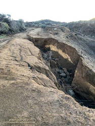
I took my usual route, turning off Mulholland onto Fire Road #30, and then following it to the Hub. From the Hub, Eagle Springs Fire Road led down to Eagle Springs, then beneath the sunlit face of Eagle Rock to Eagle Rock Fire Road and the top of the Musch Trail. In the Palisades Fire burn area there was some significant erosion along the fire road where the runoff wasn’t controlled.
I’d be doing the Musch Trail later in the run, but for now continued down Eagle Springs Fire Road toward Trippet Ranch.
Erosion along Eagle Springs Fire Road.
Mud — slippery, cake-on-your-shoes mud — isn’t normally much of an issue until past the Musch Trail and on the steeper downhill that leads to the top of the Santa Ynez Trail and Trippet Ranch. Today there were some slippery spots, but it wasn’t too bad. Remarkably, I didn’t see anyone until I reached the Trippet Ranch parking lot.
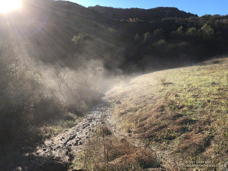
My return route from Trippet Ranch was mostly on trails, beginning with the Musch Trail. There are usually a few muddy sections on the Musch Trail after a good rainstorm. Today, one wet, muddy section of trail was steaming in the morning sun. Once I was on the steep climb up to Eagle Rock Fire Road, most of the significant mud was left behind.
Oaks along Eagle Springs Fire Road, above Trippet Ranch.
At the top of the Musch Trail, I turned left on Eagle Rock Fire Road and worked up past Eagle Rock and over to the top of the Garapito Trail. I run this trail often, and know it well. Winding down through decades-old chaparral, I became lost in thought, immersed in the outdoor experience, and enjoying every aspect of the trail.
That couldn’t be. Had I somehow turned onto a use trail? Nope, I was on the right trail.
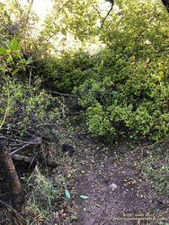
Garapito Trail blocked by fallen oak.
That’s when I noticed the “brush” was the top branches of a large oak. The fallen tree had COMPLETELY blocked the trail. I took a quick look around for an alternate route and didn’t see anything obvious. Working through the mishmash of foliage and branches was a bit like bushwhacking through dense manzanita. With some effort, and some rock climbing moves, I eventually emerged on the other side of the mass. The fallen tree was part of an old, multi-trunked oak that has been collapsing over a period of weeks.
The remainder of the run was uneventful, but enjoyable. Continuing up the Garapito trail to Fire road #30, I crossed the fire road and picked up the Bent Arrow Trail. This connects to dirt Mulholland, which leads west to the Top of Reseda.
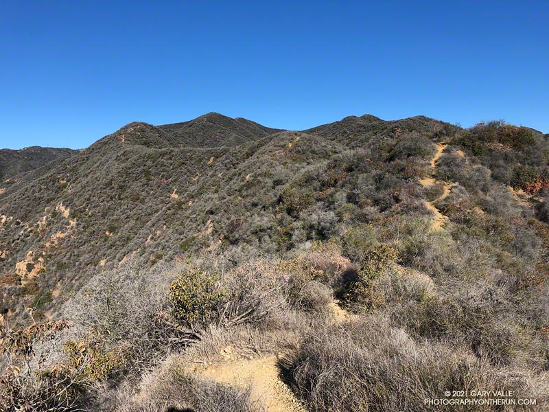
Like many that enjoy our local mountains, I’m always on the lookout for new trails, new peaks, and interesting loops. A couple of months ago, after running to “The Oak Tree” on the Rogers Road segment of the Backbone Trail, I checked out the upper part of the High Point Trail.
This 2-mile long unofficial, unmaintained, use trail connects the Backbone Trail to the Rivas Canyon Trail. My thought was that I could use the trail to do a variation of the Will Rogers – Temescal Canyon Loop. Instead of running down the lower half of Rogers Road Trail to Will Rogers SHP, I could descend the High Point Trail, pick up the Rivas Canyon Trail, and then finish the loop by the usual route. On paper it made perfect sense.
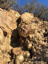
Steep step in Cretaceous-age cobble on the High Point Trail
As sometimes happens, it wasn’t quite as straightforward as it looked on the map. Blame the dinosaurs. The trail has several steep sections where eroding Cretaceous-age cobble does its best to take you for a ride. Plus, I happened to be using shoes worn smooth by nearly 500 miles of running.
More than one hiker going up the trail commented about my choice to descend the trail. Being careful not to do anything stoopid, the descent — and the rest of the loop — worked out OK.
Since doing the High Point Trail in the wrong direction and with worn-out shoes, I’ve wanted to go back and do a different loop that climbs UP the trail. That’s what I was doing this morning.
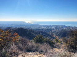
Santa Monica Bay from the High Point Trail
The first half of the run was the same as the Will Rogers – Temescal Canyon Loop. However, instead of continuing to Temescal Canyon on the Rivas Canyon Trail, I picked up the High Point Trail at the “cactus garden.” This is about 11.5 miles into the run. (The start of the High Point Trail has closely-spaced steps that have been eroded by runoff.)
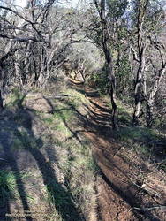
As you might expect, going up the High Point Trail was much better than going down. Care was still required, but it was a far more enjoyable experience. Between the steep sections there was a surprising amount of runnable trail.
Running through chaparral on the High Point Trail.
This time my shoe choice was the HOKA Speedgoat. These have a full-length, sticky-rubber outsole. I’ve had many pairs, and it’s my trail running shoe of choice for more difficult terrain.
From the top of Reseda, the Goat Peak High Point Trail keyhole loop worked out to about 20 miles, with about 3300′ of elevation gain. Here’s an interactive, 3D terrain view of a GPS track of the route, zoomed in on the keyhole part of the loop. The map can be zoomed, tilted, rotated, and panned. To change the view, use the control on the upper right side of the screen. Track and placename locations are approximate and subject to errors. Poor weather, and other conditions may make this route unsuitable for this activity.