Category Archives: drought

Kanan to Mishe Mokwa and Back

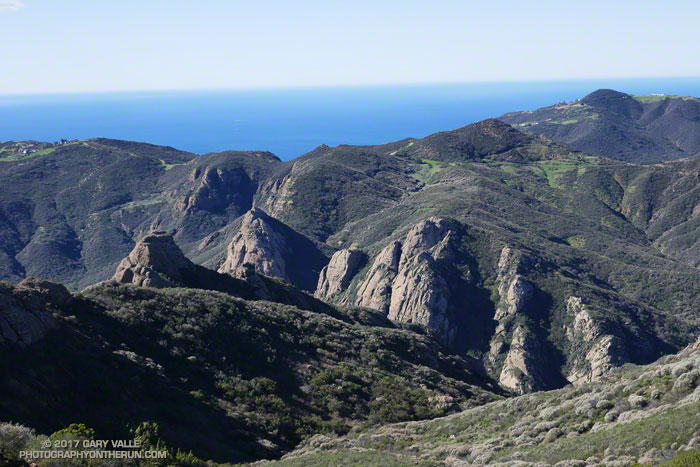
Rock formations along the West Fork Arroyo Sequit near the Grotto

As I rounded the rib extending down from Peak 2658 — the site of the old Triunfo Lookout — I peered down into the deep canyon of the West Fork Arroyo Sequit and the towering rock formations above the Grotto. As is the case along many sections of the Backbone Trail the view was superb.

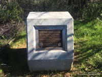
Marker recognizing the significant contributions from Governor Arnold Schwarzenegger and Betty Weider in the creation of the Backbone Trail
Marker recognizing the significant contributions from Governor Arnold Schwarzenegger and Betty Weider in the creation of the Backbone Trail.

Earlier, from the Etz Meloy fire road, Anacapa and Santa Cruz Islands had seemed to be magnified by the ocean haze — the lighter-colored rocks of San Pedro Point clearly visible on the east end of Santa Cruz. To the south, Santa Barbara Island, the smallest of the Channel Islands, had been visible near the horizon.

I was doing an out and back run on the Backbone Trail from the Kanan Road trailhead, and wondering if I had enough water to go to Mishe Mokwa and then the 15 miles back to Kanan. The irony was that, following several years of drought, this Winter it had rained and rained. Water was everywhere, but I had not thought to bring a UV pen or filter.

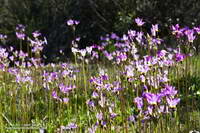
Padre's shooting star (Primula clevelandii) along the Backbone Trail below the Mishe Mokwa Trailhead.
Shooting stars near the Mishe Mokwa Trailhead.

Reaching the point where the trail turns to the north and has a great view of Sandstone Peak, Circle X and the Mishe Mokwa trailhead I again debated turning around. Across the canyon, sunlight gleamed from the cars parked at the Mishe Mokwa Trailhead. The rocky knolls below the trailhead were green with rain and though I couldn’t see them from here, would be covered with a spectacular patchwork of purple and yellow shooting stars.

Hmm… I’d run a little over 13 miles, so Mishe Mokwa was less than two trail miles away. Going there would add about 3.5 miles to my run.  I lifted my pack to see how much water I had left, and then continued down the trail.

Between January Storms

Upper Las Virgenes Canyon Open Space Preserve

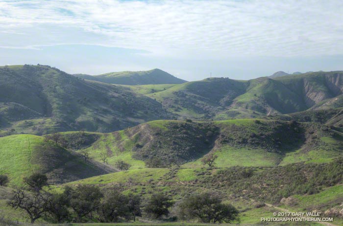
From Saturday afternoon’s rain-free run to check out upper Las Virgenes Creek. The nearby Cheeseboro Remote Automated Weather Station (RAWS) had recorded about 2.0 inches of rain the previous three days and would record another 2.4 inches on the following two. The weather station is on top of the prominent hill in the distance. January was the wettest at Downtown Los Angeles (USC) since January 2005.

Los Angeles Rainfall Above Normal, But…

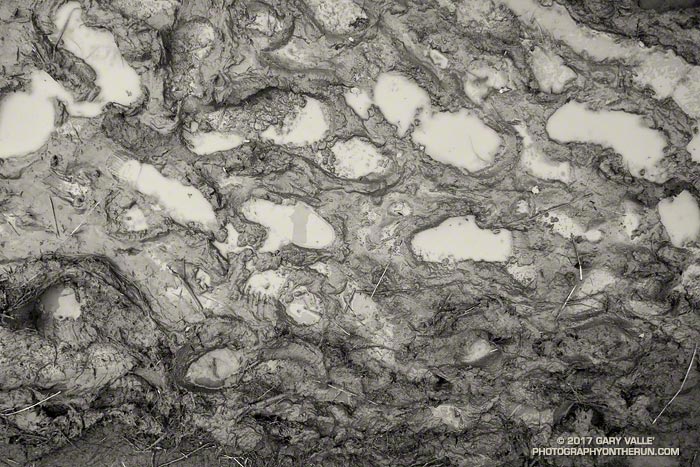
Study of mud on the Musch Trail in Southern California

As of yesterday Downtown Los Angeles (USC) has recorded 8.80 inches of rainfall for both the Rainfall Year (July 1 – June 30) and Water Year (October 1 – September 30). By either measure Los Angeles rainfall is well above normal, and with three well-advertised storms in the forecast it looks like Los Angeles rainfall could remain above normal for at least a few weeks.

Even if it has been a bit wet — and muddy — it’s been great to have a more normal rain season. The rain has been very beneficial and has impacted the drought, at least in the short term. Just how much a continued wet rain season would impact the drought in the long term is a question that has to wait for future analysis.

There has been a five year precipitation deficit of nearly 36 inches at Downtown Los Angeles (USC). It’s hard to appreciate the size of this deficit while running in the rain, splashing through puddles, and trying not to slip in the mud. One tangible indicator of this deficit is that despite above average rainfall, many creeks in the Santa Monica Mountains and Simi Hills have remained dry or are barely flowing. Some have been dry for years.

Update Wednesday, March 1, 2017. The atmospheric river event on February 17 produced high flows on many local streams and many of these streams continue to flow. Rainfall totals in Los Angeles, Ventura and Santa Barbara Counties for the storm generally ranged from 4 to 8 inches with some higher totals recorded. On subsequent trail runs flooding, debris flows and erosion were noted in Upper Sycamore and Blue Canyons in Pt. Mugu State Park. Remarkably, some groundwater monitoring stations in Santa Barbara and San Bernardino Counties remain well below normal.

As of February 28, 2017, Downtown Los Angeles (USC) had recorded 18.50 inches of rain for the Rain Year and Water Year. This is 165% of the normal amount of 11.24 inches for the date, and 124% of the normal amount of rainfall for an entire year. This is the wettest Rain Year (July 1 – June 30) and Water Year (October 1 to September 30) to date since the very wet year of 2004-2005.

Update Tuesday, January 24, 2017. From Wednesday, January 18 through Monday, January 23, Downtown Los Angeles (USC) recorded 5.53 inches of rain, bringing the Rain Year and Water Year precipitation totals to 14.33 inches. This is 217% of the normal amount of 6.65 inches for the date, and 97% of the normal amount of rainfall for the entire Rain Year. It has been the wettest start to the Rain Year (July 1 – June 30) and Water Year (October 1 to September 30) since the very wet year of 2004-2005. There were high rain rates on Sunday, January 22, and Upper Las Virgenes Creek did finally flow for a period of time.

Update Saturday, January 21, 2017. From Wednesday, January 18 through Friday, January 20, Downtown Los Angeles (USC) recorded 2.53 inches of rain, bringing the Rain Year and Water Year precipitation totals to 11.33 inches. The average annual rainfall for Downtown Los Angeles is 14.93 inches. The rain, which was heavy at times on Friday, produced some flooding, rockslides and debris flows. Both branches of upper Garapito Creek are flowing as a result, but Saturday afternoon Upper Las Virgenes Creek was still not flowing.

Upper Las Virgenes Creek – February 22 the flow on Upper Las Virgenes Creek near the Cheeseboro connector and the two downstream crossings was enough that you couldn’t cross without getting your shoes wet. Previously, on January 24, there was no flow near the connector and only a slight trickle downstream. On January 21 the creek was not flowing and there was no evidence it had flowed during a recent storm.

Garapito Creek – On Saturday, January 21, 2017, both branches of upper Garapito Creek were nice burbling brooks. Previously, on January 15, the north branch was just starting to flow, but the south branch was dry.

Upper Sycamore Creek – Flash flooding, debris flows and erosion occurred on this creek following the heavy rain on February 17-18. Nearly 6 inches of rain was recorded at Circle X Ranch, which is also in the western Santa Monica Mountains. Previously, was flowing on February 4, but not on January 1, 2017.

Serrano Creek – Was flowing on February 4, but not on January 1, 2017.

If the wet forecast holds will these streams start to flow? We’ll see!
Rainy December for Los Angeles

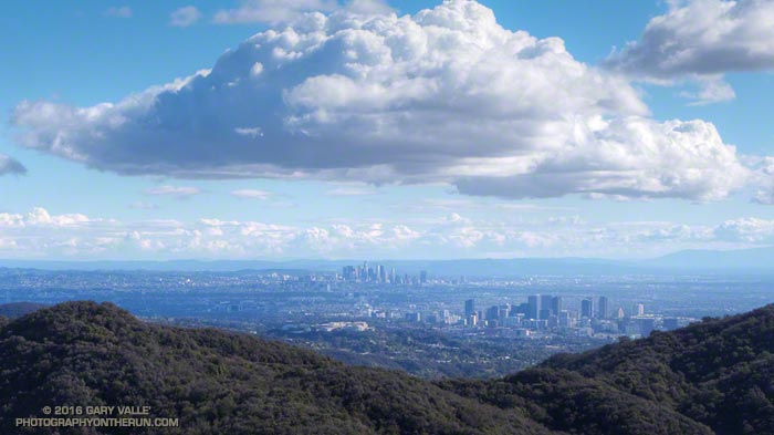
Century City and Downtown Los Angeles

Updated January 4, 2017.

Not since the beginning of the drought has Downtown Los Angeles experienced such a wet December. As of December 31, 2016:

• December rainfall was 2.22 inches above the monthly normal of 2.33 inches.

• The 4.55 inches of rain recorded was the wettest December since December 2010 and the most for any month since January 2010.

Since the Rain Year began July 1, 5.95 inches of rain has fallen at Downtown Los Angeles (USC). This is 1.63 inches above the normal July-December rainfall of 4.32 inches. It is the best start to the Rain Year (Jul 1-Jun 30) and Water Year (Oct 1-Sep 30) since 2010.

The photograph of Century City and Downtown was taken from Temescal Ridge while doing the Will Rogers – Temescal Canyon loop from the End of Reseda Saturday (December 24). According to NWS records Downtown Los Angeles recorded 2.32 inches of rain from December 21 to December 24..

After the Station Fire: Strawberry Peak Summit Regrowth

Chaparral regrowth near the summit of Strawberry Peak

Did the Colby Canyon – Strawberry Peak – Red Box loop again over the Thanksgiving holidays. While taking some photos near Strawberry’s summit I was struck by the regrowth that has occurred since the 2009 Station Fire. What caught my eye were the bare limbs of the old growth, burned in the fire, projecting from the new, dense, green growth.

The growth of the chaparral over the seven years since the fire does not appear to have been noticeably impaired by the 2011-2015 drought in Southern California. (In the photograph above note the height of the regrowth compared to my friend near the summit.)

This conclusion is based in part on the observation of chaparral regrowth following other fires, such as the 2005 Topanga Fire, but is also supported by comparing the amount of new growth to the pre-Station Fire growth. This can be inferred by the length of the burned limbs and the approximate age of the chaparral when burned by the Station Fire.

According to the FRAP California geodatabase of fire perimeters, the last fire to burn the summit of Strawberry Peak was the 1979 Sage Fire, which burned approximately 30,000 acres. Before that you have to go back to 1896 to find another fire in the database that burned Strawberry’s summit.

In the absence of fire, it appears that in another 23 years the chaparral in the title photo could reach a similar height and extent to the old growth.

Excursion to Ross Mountain

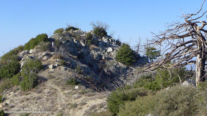
Ross Mountain on South Ridge of Mt. Baden-Powell.
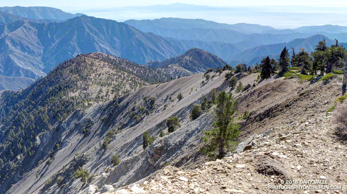
South Ridge of Mt. Baden-Powell, with Ross Mountain at its end.

Nearly every time I’ve climbed Mt. Baden-Powell I’ve wondered about the long ridge extending south from its summit. And nearly every time I’ve summited Baden-Powell I’ve been in the middle of another running adventure, and unable to explore more than a few hundred yards down the ridge. But today I wasn’t running to Eagles Roost or doing a long loop from Islip Saddle. Today the plan was to climb Ross Mountain, a peak far down on Mt. Baden Powell’s south ridge.

Ross Mountain
Ross Mountain

Major mountain ridges are often isolated, aesthetic and adventurous — characteristics that are magnets to mountaineers. While not technically difficult, the excursion to Ross Mountain is demanding. The first step is to climb Baden-Powell — a four mile trek with 2800′ of gain, that tops out at an elevation of about 9400′. From the top of Baden-Powell a use trail then leads down the south ridge three miles over varied terrain to Ross Mountain.

For the most part the use trail is relatively distinct and follows the anticipated route down the ridge. Even so, it is usually not as easy to follow a use trail as it is a conventional trail. It had rained a few days before, and the tracks of the last group to do Ross were vague. The most distinct tracks on the trail were from the recent passage of a bighorn sheep.

Bench on Mt. Baden-Powell's South Ridge.
Bench on Mt. Baden-Powell’s South Ridge.

The route to Ross drops 2100′ in 2.5 miles, then ascends 200′ over the remaining half-mile to the peak. The descent is not continuous. About a mile from Baden-Powell the ridge is interrupted by a large bench, and there are other ups and downs along the way. The ridge can be seen in profile in this image or the PhotographyontheRun masthead.

Pine Mountain, Dawson Peak, Mt. Baldy, Ontario Peak, Iron Mountain and Santiago Peak.

The ridge projects into one of the more rugged areas of the San Gabriel Mountains — the Sheep Mountain Wilderness. To the west is the deep canyon of the East Fork, with Pine Mountain, Dawson Peak, Mt. Baldy and Iron Mountain towering above. To the west is the very remote canyon of the Iron Fork, sweeping up to form the 9000′ crest between Throop Peak and Mt. Burnham.

The ridge hosts a wide variety of conifers — limber pine, lodgepole pine, white fir, sugar pine, Jeffrey pine and even a few incense cedars. Life on the ridge is tough, and many of the trees are contorted, broken or stunted. It appears to have been a good year for the sugar pines, and some were heavily laden with cones. Overall the health of the trees on the ridge appeared to be good, with surprisingly few trees in obvious distress from the drought.

Mt. Baden-Powell from Ross Mountain.

A little more than three hours after leaving Vincent Gap I zig-zagged up the final few steep steps to the 7402′ summit of Ross Mountain. Not unlike other vantage points along the ridge, the summit was a pretty spot under a sugar pine tree, but in this case with a small cairn and rain-soaked summit register.

After procrastinating a bit and checking out the south side of Ross Mountain’s elongated summit, I began the journey back to Baden-Powell.

Complex geology at head of Mine Gulch on Mt. Baden-Powell.
Complex geology at head of Mine Gulch.

Surprisingly, considering my plodding pace coming back up the ridge, it took almost exactly the same amount of time to get back to Vincent Gap as it had to go to Ross Mountain. As it worked out, the time lost on the climb back up the ridge was offset by the superb run down the Baden-Powell Trail.

According to my Garmin fenix 3’s barometric altimeter the total gain/loss on this adventure was about 5100′. If the gain/loss is calculated from the GPS track using 1/3 arc-sec DEMs it works out to about 5400′. The round trip distance was 14 miles.

Related post: Return to Ross Mountain