Category Archives: nature|trees

Some Fall Color to Bring in the New Year

Some Fall Color to Bring in the New Year. Photography by Gary Valle'.

While much of the country shivers in the cold climes of Winter, the muted colors of the changing season have finally reached the lower elevation areas of Southern California.

Turning leaves of a willow in East Las Virgenes Canyon. December 28, 2017.
Willow in East Las Virgenes Canyon

In this area, the leaves of Valley Oaks usually begin to turn around mid-December and the trees lose their leaves around the beginning of the new year. About a month and a half later trees begin to sprout new leaves, usually in mid to late February. From year to year, the time frame can vary by as much as 2-3 weeks.

The photo of Valley Oak leaves was taken December 28, 2017, in Upper Las Virgenes Canyon Open Space Preserve (formerly Ahmanson Ranch). This willow in East Las Virgenes Canyon was also showing some nice color.

Point Reyes Peninsula – A Hidden Island

Running on Kelham Beach, Point Reyes National Seashore

The sand was compact, the breeze cool, the surf up and the running oh so pleasant. Brett and I were running south along Kelham Beach, an idyllic stretch of sand between Point Resistance and Miller’s Point within Point Reyes National Seashore. If the tide was not too high we hoped to reach an area of dramatically folded strata along the 150′ tall sea cliffs.

Our adventure had started with a short run from the Bear Valley Visitor Center to a spot on the San Andreas Fault where a fence was reconstructed to illustrate how the Point Reyes Peninsula lurched 16 feet to the northwest during the 1906 San Francisco earthquake. Fences and roads in the Point Reyes area built across the fault trace were offset by as much as 20 feet during the earthquake.

It is the San Andreas Fault that makes the story of the Point Reyes Peninsula so unusual. A glance at a geologic map shows the rocks of the peninsula to be geologically distinct from those on the other side of the San Andreas. Essentially the Point Reyes Peninsula is an island on the margin of the Pacific Plate that is sitting against the North American Plate. The San Andreas Fault is the boundary between the two plates.

Towering Douglas firs at the junction of the Old Pine Trail and Sky Trail.

The core of the Point Reyes Peninsula is a granite similar to a granite found in Southern California. Over many millions of years the chunk of crust was propelled northward along the San Andreas Fault by the movement of the Pacific Plate. The story is not a simple one, involving a combination of faults. At some point — perhaps near current day Point Lobos — the granite core was overlain by the sedimentary rocks we see on the peninsula today.

It seems likely that at times during its 10 million year journey northward from Monterey, the Point Reyes Peninsula may have been separated from the coast. With more than 80% of its perimeter currently bounded by water, it may once again become an island.

Point Resistance and Drakes Bay from the Sky Trail in Point Reyes National Seashore.

After visiting the fault zone we ran across the Point Reyes Peninsula to the coast using the Bear Valley, Mt. Wittenberg, Sky and Coast Trails. For the most part the trails were duff-covered, tree-lined, shaded and cool. For someone that runs mostly in Southern California this was practically nirvana. The previous Saturday I’d run a 50K race on a rocky, exposed course near Los Angeles in 90 degree temps and gusty Santa Ana winds. In the West San Fernando Valley the temperature this year has reached at least 95 °F every month from March through October. In July, August and September the highest temp each month was over 110 °F!

Alders along the Bear Valley Trail in Point Reyes National Seashore.

It was not 110 °F now. It was about 60 ocean-conditioned degrees. Brett and I had reached the first point where the beach narrowed. There was still room to run, but the beach narrowed even more ahead. We watched as a large wave broke and washed up to the rocks. It looked like the tide was going out, but we weren’t sure. Although the surf wasn’t huge, there was a consistent swell of maybe 6′-8′.

In between sets we took a look around the next corner and it looked sketchy. Debating, we watched as more waves washed up to the base of the cliffs. That part of the exploration would have to wait until another day with a lower tide!

Related post: Point Reyes – Sky Trail Keyhole Loop

After the Lake Fire: The Dollar Lake – Dry Lake Loop on San Gorgonio Mountain

Dry Lake in the San Gorgonio Wilderness

The north side of San Gorgonio Mountain was closed in June 2015 when the Lake Fire burned approximately 31,359 acres of forest, chaparral, sage, pinyon and Joshua tree habitat at elevations ranging from about 10,700′ to 5350′. As a result of the determined efforts of firefighters, only one residence and some remote outbuildings were lost.

Of the 30,487 acres reviewed by the Burned Area Emergency Response (BAER) team 4,327 acres (14%) were categorized as Unburned; 17,100 acres (56%) as having Low soil burn severity; 8,420 acres (28%) as having Moderate soil burn severity; and 640 acres (2%)with High soil burn severity. (Note that soil burn severity isn’t necessarily synonymous with fire intensity and fire effects such as tree loss.)

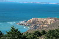
I’d been keeping an eye on the Alerts & Notices section of the San Bernardino National Forest web site to see if the Lake Fire closure order would be renewed. I was curious to see the extent and impacts of the Lake Fire and how the area was recovering. Plus, the Dollar Lake – Dry Lake keyhole loop is an outstanding trail run — one of the best in Southern California. In addition to climbing San Gorgonio Mountain (11,499′), it encompasses some of the most scenic areas on the peak.

The area’s trails reopened July 20. The weekend prior to the reopening San Gorgonio Wilderness Association volunteers worked on the South Fork and Dry Lake Trails, clearing a number of large trees, removing debris and other hazards and improving the trail tread.

A week and a half after the opening I pulled into the South Fork parking lot on Jenks Lake Road, excited to get on the trail. There was a slight chance of thunderstorms in the forecast, and I hoped to be off the summit and on my way down by 10:30 or 11:00.

Most of the run is in the San Gorgonio Wilderness and a wilderness permit is required. Check a map, but the general sequence of trails is the South Fork Trail, Dollar Lake Trail, Divide Trail, Summit Trail, Sky High Trail, Dry Lake Trail and then back down the South Fork Trail to the trailhead. This Google Earth image shows the western part of the Lake Fire burn area in relation to San Gorgonio Mountain and some of the area’s trails.

On this particular run I also wanted to check out the Fish Creek Trail and the “use trail” down to Lodgepole Springs and Dry Lake, so rather than continuing down the Dry Lake Trail from Mineshaft Saddle, I turned right (east) and followed the Fish Creek Trail to Fish Creek Saddle.

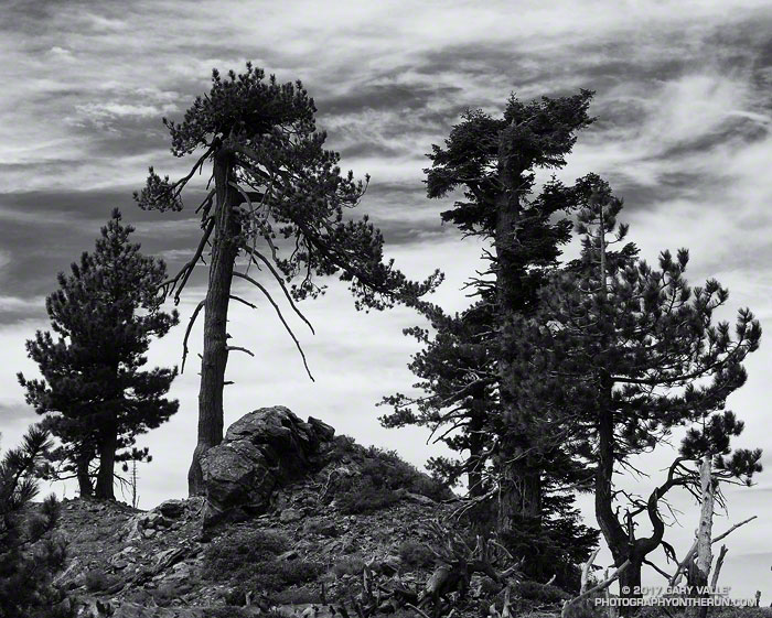
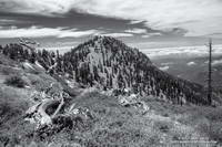
There were some downed trees and a lot of fire debris on the Fish Creek Trail. Extra care was required and I probably hiked as much of it as I ran. As I worked toward Fish Creek Saddle I could not tell how much of the canyon leading down to Lodgepole Spring had burned. The slopes on the southwest side of Grinnell Mountain had burned and some areas along the Fish Creek Trail had burned as well. Whether I descended to Lodgepole Spring from Fish Creek Saddle or returned to Mineshaft Saddle would be a judgment call.

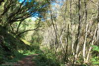
Arriving at Fish Creek Saddle I was glad to see the forest was intact. The path down to Lodgepole Spring looked promising, but had not been used in some time. As it turned out most of the trees along the path had not burned. In places, runoff from the burned slopes above had resulted in some erosion and small flows of sandy soil. There were also the usual downed trees, but other than being a little challenging to follow, the path was generally OK.

I was nearly off the trail when the “chance of thunderstorms” forecast materialized into threatening gray clouds, a few sprinkles, and a couple of rumbles of thunder.

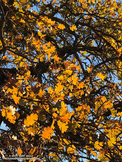
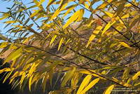
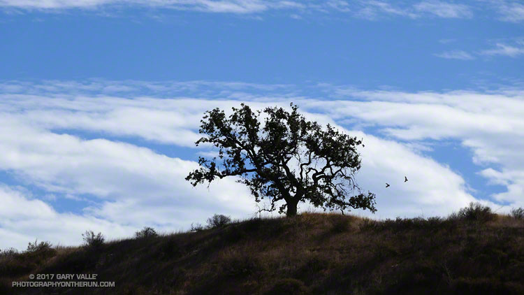
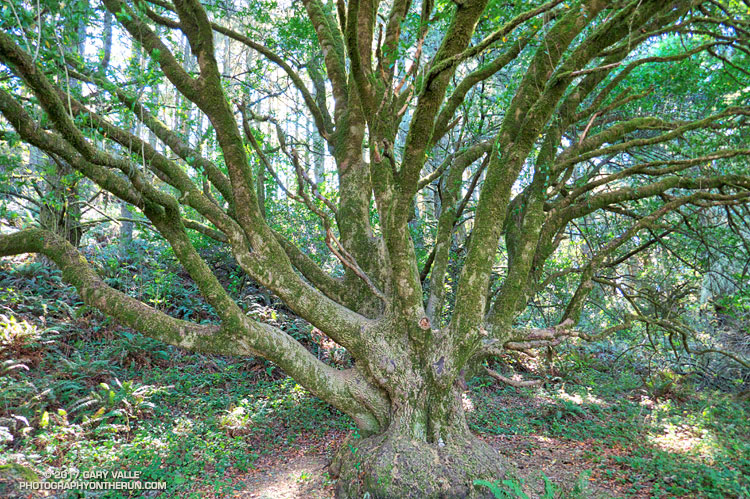
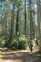
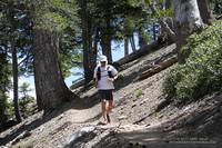
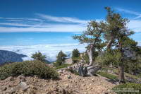
Here are a few photos taken during the run.

Some related posts: Running San Gorgonio: Dollar Lake – Dry Lake Variation, San Gorgonio Mountain: Dollar Lake – Dry Lake Trail RunLake Fire MODIS Fire Detections

Along the Crest

Trees and clouds along the crest of the San Gabriel Mountains. Photography by Gary Valle.

I rounded the corner, driving from deep shade into the golden glare of the rising sun. There was almost no traffic on Angeles Crest Highway. Up ahead, in the shade of some trees, there was something in the road. Was it a rock or a pine cone? Driving into the sun it was hard to tell. At this time of the morning — before the CalTrans truck has swept the road — one small rock can ruin your whole day. Getting to the trailhead unscathed is always the first challenge of the day.

Middle Hawkins from the Pacific Crest Trail. Photography by Gary Valle.
Middle Hawkins from the Pacific Crest Trail.

Today, Craig and I were planning to do a point to point run from Inspiration Point to Islip Saddle — one of the best stretches of trail in the San Gabriel Mountains.

PCTA volunteer Ray Drasher often takes care of clearing the trees from this section of the Pacific Crest Trail. It’s quite an undertaking to get the required stock and equipment to the trailhead and then cut trees spread over several miles of trail. Because of conflicting reports, Ray wasn’t sure whether there were trees still on the trail or not. We’d let him know after the run.

On the drive up you could see it was going to be a spectacular day in the Angeles high country. A low pressure trough moving through central California had pulled in the marine layer and a tumultuous ocean of cloud reached from the south-facing canyons far out over the Pacific.

Trail runner descending the PCT near Mt. Burnham.
Craig descending the PCT near Mt. Burnham.

I drove through the double tunnels at Mt. Williamson and then around a left-hand curve. Up ahead I could see the northwest ridge of Mt. Islip dropping down to Islip Saddle. What the heck? Orange cones? The gate is closed? The HIGHWAY is closed? That didn’t make sense; the Winter closure had ended weeks before.

After parking, I talked to a hiker who said it was closed for “road work.” I assumed there must have been a rock slide in one of the problematic areas between Islip Saddle and Vincent Gap. Later I learned the problem was a “sink hole” west of the Grassy Hollow Visitor Center.

After Craig arrived we discussed route options to Mt. Baden-Powell. Either we did the South Fork loop, which I’d done a couple weeks before, or we did an out and back on the PCT. We opted for the out and back.

Weather-beaten limber pine near the summit of Mt. Baden-Powell. Photography by Gary Valle.
Weather-beaten limber pine near the summit of Mt. Baden-Powell.

The run was as spectacular as expected. The visibility above the deck of stratus was at least 100 miles. San Bernardino Peak, San Gorgonio Mountain and San Jacinto were easy marks to the east and Owens Peak and the Southern Sierra could be seen to the north. Before it was immersed in a tide of cloud, the summit of Santiago Peak (Saddleback) had been visible to the south. High clouds and a gusty westerly wind kept the temperatures moderate. Only one very small patch of snow remained on the trail.

I’d hoped to be able to tell Ray the trees had been cleared from the trail, but no — they were still there. He said the next time I ran there, they would be gone. Thanks Ray!