Category Archives: photography

Three Points – Mt. Waterman Loop

Trail sign on the Mt. Waterman Trail in the San Gabriel Mountains.

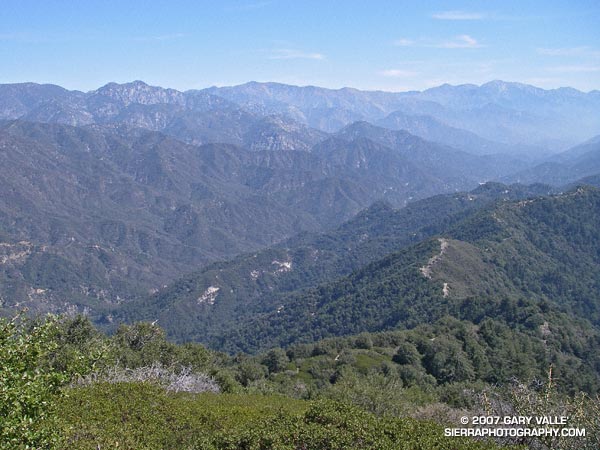
Five miles of (mostly) downhill to go. Running through an old growth forest of Jeffrey Pine, Sugar Pine and Incense Cedar, I relished being on a pine needle covered trail at 7000 ft. in the San Gabriel Mountains.

In a record dry water year, I had been curious to see how the mountains were faring. Although creeks were very low and grasses dry, my impression was that groundwater resources were not quite as bad. The usual springs and seeps still muddied the trail. In 2005 the San Gabriel Mountains were deluged with rain, and in the 2006 the rainfall was nearly normal, so some carryover would be expected.

Update May 27, 2007. My impression of groundwater resources may have been overly optimistic. On a run to Mt. Baden-Powell from Islip Saddle, I stopped by Little Jimmy Spring. It was nearly as low as in late August 2002, when Los Angeles had just experienced its driest water year on record. This year will likely break the 2001-2002 record.

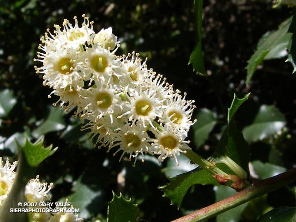
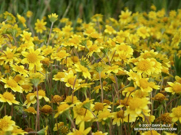
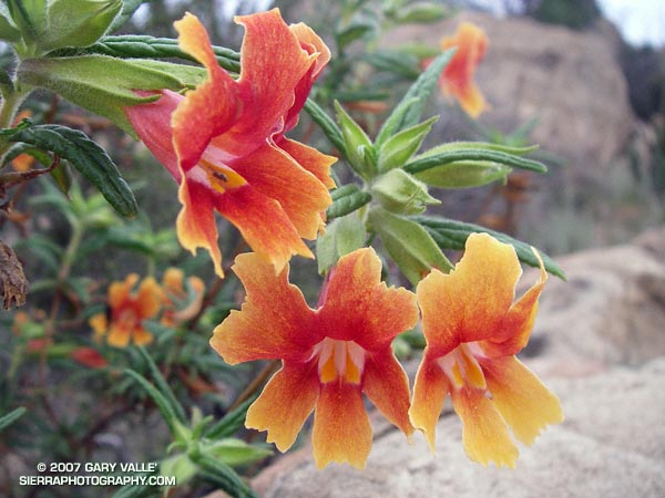
Even so, it was obviously much drier than normal. There were fewer wildflowers, and some young Incense Cedars looked as if they might be stressed. On the plus side, manzanita and currant were blooming in profusion, and perhaps 30-35 scarlet red stalks of snow plant were seen on the loop.

About three miles from Three Points I happened upon another Jeffrey Pine that had been struck by lightning. This strike appeared to more energetic than the bolt that struck the tree on the Baldy North Backbone Trail. The spiral scar was wider and braided at some points, and the strike ignited the tree. Where the Baldy tree was on a sharp ridge crest, this tree was several hundred feet below the main crest in an area where the trail started to work around a projecting ridge.

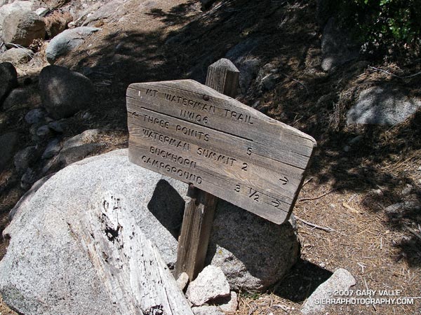
More about this loop and a Google Earth image of the course can be found in the post Manzanita Morning.

Southern California Creeking

Gary Gunder paddling Upper Matilija Creek.

Running down the Silver Moccasin Trail from Shortcut Saddle to West Fork a couple of weeks ago, I mentioned to my running partner that a few years before, I had carried my whitewater kayak down the trail.

Around 1995, Gary Gunder and I started exploring the creeks and rivers of Southern California, looking for hidden gems that rarely – if ever – had been paddled. Kayaking these streams has been an incredible experience, and has enabled us to see some of the wildest and most beautiful places in the mountains of Southern California.

 Creeking in Southern California is an “iffy” activity. Iffy in the sense that it usually takes a lot of rain for a stream to flow, and there is a very narrow window in which the flow will be ideal for paddling. In addition the canyons are steep and isolated, logistics are usually complicated, and more often than not it is necessary to carry your boat to the point on the stream where you put in. Paddling a stream can involve a hike of several miles, and a very long car shuttle. Several times we have gone to a creek, only to discover that it was too low to paddle.


One solution for carrying a kayak a few miles upstream.
Plastic kayaks may look light, but kayaks made for paddling creeks typically weigh around 45-50 lbs. Add to this the weight of paddling gear, rescue equipment, food and water and the total weight might be 65 lbs. or more. If food and overnight gear for a multi-day adventure are added to the mix, the total weight can top a beastly 90 lbs.

There is no good way to carry a heavily loaded kayak and you can be certain that obstacles such as downed trees, swollen creeks, and washed out trails will have to be negotiated. Picture yourself carrying a kayak (as a backpack) across a steep snow slope, slipping and falling, and then going for the sled ride of your life, flailing like an upside down turtle with a 90 lb. shell!

In 2003, when we paddled the West Fork San Gabriel River, it rained very heavily the night before. The storm set a new rainfall record for the date, and I was sure the river would be too high. But what a day, and what a river! Skies were partly cloudy and shafts of sunlight filtered through the firs, glistening off the water, and highlighting the saturated greens of mosses, ferns, grasses along the river. Ephemeral waterfalls cascaded and fell from cliffs at several points. It was a wilderness paddler’s dream day.

It would be difficult to pick a favorite among the creeks and streams we’ve paddled. Each one has its unique character, scenery and challenge. The best multi-day runs would probably be a 47 mile reach of the Wild & Scenic Sisquoc River near Santa Maria, and a wilderness section of the Wild & Scenic Kern River from Grasshopper Flat, past Kern Falls, to the Forks of the Kern. The most technical would probably be the upper Santa Ana River downstream of Filaree Flats, Arroyo Seco below Switzers, and upper Matilija Creek above Old Man Creek. The most scenic might be Middle Piru Creek or Upper Piru Creek. The wildest might be Yucca Creek, a tributary of the N.F. Kaweah.

The best my legs have ever felt running trails is following a wet rain season with a lot of kayak hiking!

Note: The title photograph is from a March 5, 2005 descent of upper Matilija Creek, near Ventura, California.

Holly-leaved Cherry

The feathery blossoms of the holly-leaved cherry (Prunus ilicifolia) reveal a peculiar flower whose many stamens resemble the tentacles of a sea anemone.

A closer look at the feathery blossoms of the holly-leaved cherry (Prunus ilicifolia) reveal a peculiar flower whose many stamens resemble the tentacles of a sea anemone.

Holly-leaved cherry is a member of the genus Prunus — the same as apricots, peaches, plums and cherries. As is the case with other species in this genus, the seed and leaves may contain hydrogen cyanide. It produces a small, thin-fleshed fruit favored by coyotes.

The photograph was taken on the slopes of Rivas Canyon near Will Rogers State Historic Park, while doing the route described in the post Will Rogers – Temescal Loop. Once again the weather for this (approximately) 21.5 mile loop was post-card perfect. A Google Earth image of a GPS trace of the route is available in the earlier post.

Dealing With Drought

Goldfields (Lasthenia spp.) on Lasky Mesa in Upper Las Virgenes Canyon Open Space Preserve.

This photograph of goldfields (Lasthenia spp.) was taken on a run on Lasky Mesa in Upper Las Virgenes Canyon Open Space Preserve (formerly Ahmanson Ranch) almost exactly one year ago.

This April I haven’t seen any goldfields on Lasky Mesa. The soil is too dry for the seeds to germinate. The drought in Southern California has suppressed or delayed the growth of these, and many other species of wildflowers. This is one of the ways that annuals deal with drought — if the growing conditions aren’t appropriate, they don’t grow.

Black mustard, an invasive annual from Europe, is a hardy plant that is a good indicator of Winter rainfall. In 2005 and 2006 the mustard at Ahmanson Ranch was 6′ to 8′ tall and very widespread. This year its growth has been very limited, and the plants are diminutive in comparison.

Plants deal with drought in many other ways, such as dropping leaves, changing the leaf distribution, reducing the size of the leaf, changing the leaf orientation, modifying the shape of the leaf, or changing the leaf color. Flowering may be suppressed, or the flowering time shortened. In some cases the flower may be reduced, or viable fruit may not be produced. Branchlets or stems may be lost. Any life prolonging tactic may be employed when survival is at stake.

According to the NWS, if Los Angeles (USC) receives less than 1.95 inches of rain between now and June 30th, this water year (July 1, 2006 to June 30, 2007) will become the driest since recordkeeping began in 1877. At this point in the season, a new record seems more likely than not.

It was only 5 years ago (2001-2002) that Los Angeles experienced its driest water year so far, recording only 4.42 inches.

Related post: A Little Rain in Los Angeles

Bush Monkeyflower

Bush monkeyflower (Mimulus aurantiacus) readily hybridizes, producing a myriad of forms and colors.

Bush monkeyflower (Mimulus aurantiacus) readily hybridizes, producing a myriad of forms and colors, and some interesting work for botanists. This plant pictured above may be a hybrid of local salmon and scarlet colored forms.

Update June 10, 2011. The Diplacus section of Mimulus has been the source of much taxonomic turmoil, with the number of species varying from two to 13. Research by Tulig & Clarke found that most named taxa in this group can be distinguished based on morphological characteristics. Accordingly, the monkeyflower pictured above would correspond to a variety of Diplacus longiflorus (Southern bush monkeyflower).

The scarlet variety is sometimes referred to as Diplacus rutilus (Santa Susana bush monkeyflower).

From a run near Sage Ranch on March 26, 2007.

Angeles High Country

Angeles High Country

Of all the faces of Los Angeles perhaps the least well known is the Angeles High Country. Entirely within the County of Los Angeles, the lofty peaks and chiseled canyons extend from Mt. Waterman on the west to 10,064′ Mt. Baldy on the east. It is rugged and wild — the home of ancient trees, bighorn sheep, black bears and mountain lions.

This view of the crest is from the Rim Trail, on the steep eastern shoulder of Mt. Wilson. From left to right the prominent peaks are Mt. Waterman (8,038′), Twin Peaks (7761′), Mt. Baden-Powell (9,399′), and Mt. Baldy (10,064′). The lack of snow is indicative of the meager amount of precipitation we’ve had this Winter.

We were running the Rim Trail as part of an approximately 22-mile loop from Shortcut Saddle on Angeles Crest Highway to Mt. Wilson and back. The loop incorporates several segments of the new 50-mile course that is part of the Angeles National Forest Trail Race (formerly Mt. Disappointment).

The segments of the loop that are on the 50-mile course are the Silver Moccasin Trail, Gabrielino Trail, Kenyon DeVore Trail, and the Rincon-Edison Road. Here are a Google Earth image and Google Earth KMZ file of a GPS trace of the route.

Much of the winding 5.6 mile climb out from the W.F. San Gabriel River on the Rincon-Edison Road is steep and shadeless. Rincon-Edison Road is also used (under permit) by off-road vehicles — we encountered two dirt bikes and a jeep.