Category Archives: photography|quirky

Mushrooms and Mud on the Backbone Trail

Santa Monica Mountains near Circle X

The temp was in the 40s and the chaparral wet with rain when we started the run. We were doing a two part trail run. The first part would be the 15 mile segment of the Backbone Trail from Kanan Rd. to the Mishe Mokwa trailhead on Yerba Buena Rd. The second would be the 6 mile Mishe Mokwa – Sandstone Peak loop.

The weak front that produced the overnight rain had marched on, and now skies were clear and it was a little breezy. As has been the case with many weather systems this year, there hadn’t been a lot of rain. Though muddy in spots, the Backbone Trail was in surprisingly good shape, and the running excellent.

In addition to the greening of the hills and the sprouting of many annuals, the frequent, light rains had also created perfect conditions for the growth of a  variety of mushrooms and other fungi. Fortunately I was running with a sharp-eyed mushroom collector from the PNW that could pick out partially buried earth stars and other mushrooms among the leaves, twigs and other debris in the deep shade along the trail.

Here are three of the more peculiar fungi. Click the image for more info and a larger image.


Orange Jelly


Comb Tooth


Earth Star

Some related posts: Circle X Crags and the Channel Islands, Mishe Mokwa – Sandstone Peak – Grotto Trail Run

Confused Coot

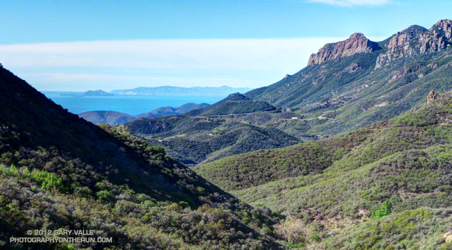
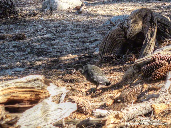
Usually found around marshes, ponds, lakes and reservoirs — often in large flocks — this solitary coot was in a conifer forest at 7300′ on Twin Peaks in the San Gabriel Mountains, near Los Angeles.

It was only a few feet in front of me when it flushed. Far too large to be a quail, at first I assumed it was a grouse, and was surprised it allowed me to approach so close.

Its wings beating furiously the bird managed to scurry downhill a few yards — perhaps briefly becoming airborne — and stop. Preening this feather and that, the bird seemed annoyed to have made such an effort, and more concerned about its feathers than me. 

Its wing beats were symmetric and strong and the bird appeared to be healthy, but it was my impression its primaries were not fully formed. American coots (Fulica americana) molt in late summer and it takes about a month for them to return to flight. Maybe this bird was nearing the end of a molt and not quite ready to fly.

But why should the coot be so far from water? I think the closest lake to Twin Peaks is Cogswell Reservoir — about 5000′ lower in elevation and 5.5 miles away.

From last Sunday’s trail run to Twin Peaks.

SpotTheShuttle Trail Run – A Long (3 mile) Shot with a Short (90mm) Lens

Space Shuttle Endeavour on NASA's 747 Shuttle Carrier Aircraft over the Pacific near Malibu

I’d run up from Cold Creek on the Stunt High Trail and Backbone Trail and hadn’t seen a soul until on the service road that connects Saddle Peak’s twin summits. Usually you’d only see telecommunication workers, hikers and trail runners on the peak. Not this morning!

Cars where I’d never seen cars before — parked on the eastern summit of Saddle Peak, parked on the western summit of Saddle Peak. Parked in every turnout on the roads below the peak. People were perched on every rock outcrop and vantage point from which they could see the Malibu coastline. Everyone was waiting for the Shuttle Endeavour flyover of Malibu!

I’d debated other vantage points including Sandstone Peak,  Mugu Peak, and Will Rogers near the bridge. I’d finally opted for Saddle Peak, hoping that the flyover of Malibu would be over Malibu and not off the coast.

As it turned out the Shuttle transport’s flight path was well offshore. This combined with Saddle Peak’s 2.5 mile distance to the coast made for an impossible shot with the 90mm max focal length of my Lumix LX7.

No matter; it was still fun to do the run, spot the Shuttle, and try to get a shot with my normal running camera!