Category Archives: photography|trail running

New Army Pass – Cottonwood Pass Loop

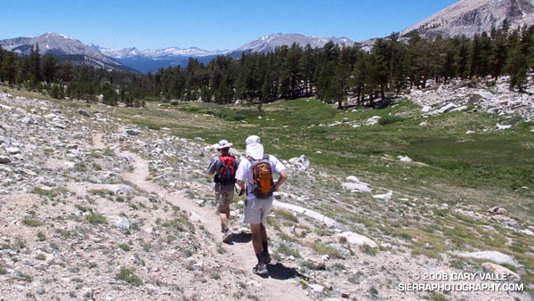
Outstanding trail running down the Rock Creek trail on the Cottonwood loop.

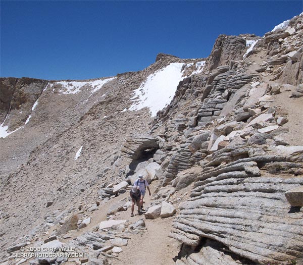
It isn’t unusual for snow to persist on New Army Pass (12,300′) well into July. Strong northwest winds, following in the wake of blustery Winter storms, blow freshly fallen snow over the crest and into this cirque, forming cornices along its lip, and dense slabs of wind-ground snow in it’s lee.

That’s why the July 1 Sequoia & Kings Canyon National Park Trail Conditions report for New Army Pass seemed plausible. It read, “The top of the pass has an 30 foot snow wall – ice axe recommended.”

The reported trail conditions are a compilation of reports from the field, and are not always up-to-date. Having been over the pass a number of times, and in a variety of conditions, I thought that we would probably be able to bypass any remaining patches of snow without needing an ice axe. Worst case, if the pass looked dicey, we could use Cirque Peak or some other alternative route to attain the crest.


New Army Pass
We need not have worried. While there was snow in the cirque, and in a couple of places along the trail near the top of the pass, the trail was completely clear. Even so, it was a good excuse to do the 21 mile Cottonwood loop counterclockwise — the reverse of my usual circuit — climbing up New Army Pass from the Cottonwood Lakes side, and then running down into Rock Creek basin.

Now that I’ve done the loop in both directions, I think I prefer the clockwise circuit. The 9 miles of running from New Army Pass down through the Cottonwood Lakes basin is generally better than the running down from Chicken Spring Lake and Cottonwood Pass. Also, there’s more downhill on some sandy sections of trail between Chicken Spring Lake and Rock Creek. The tradeoff is you give up the nice downhill into Rock Creek basin, and near the end of the loop have a mile or so of annoying uphill.

Here’s a Google Earth image, Google Earth KMZ file, and an elevation profile of a GPS trace of the route. (The elevation profile was generated using SportTracks.)

Related posts: Cottonwood – New Army Pass Loop, Mt. Langley in a Day from L.A.

Return to Hidden Pond

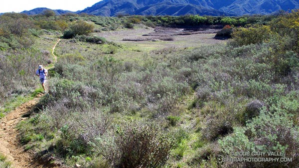
A trail runner on the Hidden Pond Trail in Pt. Mugu State Park.

Southern California can have inclement Winter weather. This January downtown Los Angeles experienced a streak with 8 days of measurable rain, and last year temperatures in the suburbs plunged to a frigid 20°F. Maybe this doesn’t compare to Seattle’s 2005-2006 rain streak of 27 days, or International Falls’ recent record low of 40° below zero, but it qualifies as rainy and cold none the less.

Today it was not rainy and cold. It was just about as pleasant as a day could be. Skies were blue, winds were light, and the temperature was in the mid-seventies. Starting at the Wendy Dr. trailhead on Potrero Rd., we enjoyed the perfect weather by doing a 14.5 mile variant of the Boney Mountain Half Marathon Course.

The photograph above is of the Hidden Pond Trail near Hidden Pond — recently restored by Winter rains.

Related posts: Boney Mountain Half Marathon, Big Sycamore Canyon Circuit, Boney Mountain – Big Sycamore Canyon Circuit

Condor Peak Trail Run

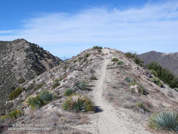
Trail runner on the Condor Peak Trail as it nears Condor Peak.

The temp was in the 30’s and it took a couple of minutes for my car’s engine to warm enough to thaw the coating of ice on the windshield. I was headed for a run in the San Gabriel Mountains and was wondering how cold it might be.

In a November in which 29 days had been bone dry, it had rained on the 30th, and temps had cooled dramatically. That was day before yesterday. This morning the sky was still a storm-cleansed blue, and except for a few passing high clouds, promised to stay that way. If the winds were not too brisk, it could be one of those invigoratingly crisp late Autumn days — cold in the shadows, but warm and pleasant in the sun.

About an hour later Miklos and I were working our way up the Condor Peak Trail (13W05), not far from the trailhead on Big Tujunga Canyon Road. At the parking area I had shed some extra layers and was now running in shorts and a light long-sleeve top. In the pack were an ultralight shell, gloves, and a headband.

About a 1/4 mile from the parking area we caught up to some hikers and their dogs. They asked us if we were headed “to the top.” I replied that we were doing Fox Mountain and Condor Peak, and would continue on to the Trail Canyon Trail.

“Do you have a car at the Trail Canyon trailhead?”

“Yep…”

“You know it’s 17 miles, right?”

“Yep…”

Twenty minutes into the run, we reached the point where the old trail jumps up from Big T and joins the main trail. From here we turned north, away from the highway, and began a long, winding, uphill course that would eventually reach the divide between Fox Mountain (5033′) and Condor Peak (5440’+). This meandering approach resulted in a very runnable section of trail that gains about 2500′ in 5.5 miles — an average 8.6% grade.

As the trail wound in and out of canyons, and from shadowed to sunny slopes, the temperature contrasts were startling. Within a few feet, we would stride from balmy, solar heated granite alcoves into frosty, refrigerated nooks near freezing. We estimated the difference in temperature to be 30-40 degrees.

Gradually we gained elevation, and in about an hour and a half we crested the broad divide at the base of Fox Mountain. From this point a short — but steep — path leads directly to Fox’s summit. 

Deep in morning shadow, the east side of the peak was cold! The ground was frozen, and heavy frost covered fallen leaves of chaparral. A few strenuous minutes and we were atop the peak, relishing the warmth of the sun and the panoramic view. Mt. Lukens, Josephine Peak, Strawberry Peak and Mt. Wilson loomed nearby. Further to the east, beyond Mt. Waterman and Twin Peaks, Mt. Baldy glistened white with a new coat of snow. Dressed for running, and damp from the climb, chill breezes hurried us from the summit.

Peak to peak the distance from Fox to Condor is over two miles. That’s what the map says, but on the ground Condor looks deceptively close. Several false summits amplify the deception, and many a hiker has been deceived. Even having viewed the route from Fox and climbed the peak before, I still did not fully appreciate the distance.

The scramble up Condor was a little longer than the hike up Fox. The peak has twin summits at very nearly the same elevation. We were curious which summit would have the register and found it on the more westerly summit. To do both Fox and Condor only added about an hour to our run.

Once down from Condor Peak it took about twenty minutes to hoof it over to the Trail Canyon Trail (13W03) junction. From here the trail drops about 3110 ft. in six miles. The grade of the trail is steeper than the Condor Peak trail, and a little more rocky and technical. Where the Condor Peak trail seeks the high lines, the Trail Canyon trail follows a creek and plunges into a deep riparian canyon.

Back at the car we marveled at what an enjoyable run it had been. The perfect weather and nearly ideal grade of the trails seemed to make the run almost effortless. It isn’t always that way.

Here’s a Google Earth image and Google Earth KMZ file of a GPS trace of the route.

Note: Although the Trail Canyon drainage is relatively small, it appears to have generated some sizable flash floods and debris flows. The canyon forms a huge southwest facing “rain catcher.” During Winter storms, the canyon wrings water from moisture laden wind as it is funneled into and up its slopes.
Whiskey Flat Trail

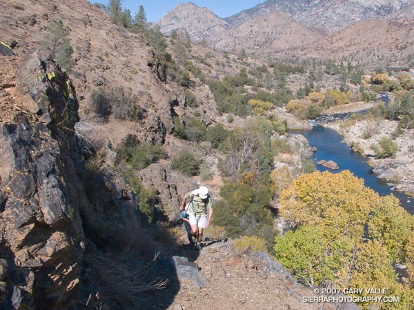
Whiskey Flat Trail near Kernville, California.

Due to fire concerns, Los Padres, Angeles, Cleveland and San Bernardino National Forests remained closed this weekend, so I headed back up to Kernville to meet some friends and run the Whiskey Flat Trail — a sizzling trail in the summertime that has been on my running to-do list for years.

Tucked away in a corner of the Southern Sierra on the banks of the Kern River, and only about a 3 hour drive from Los Angeles, Kernville usually brings to mind images of rafts, kayaks and exciting whitewater, but more than great paddling adventures can be had here.

Sequoia National Forest and the Golden Trout Wilderness afford an extensive array of hiking, mountain biking, climbing, fishing, trail running, and other recreational opportunities. Lower elevation adventures are generally within about a 30 minute drive of Kernville, and higher elevation adventures about an hour’s drive.

We did the approximately 15 mile Whiskey Flat Trail north to south, starting at McNally’s Restaurant and Resort, about 15-20 minutes north of Kernville on highway Mountain 99. The trail is accessed using the Fairview footbridge and is on the opposite side of the river from the highway. It is a gnarly up and down trail, best done in cool weather, with pleasant views of the river and the surrounding mountains.

On it’s way downstream to Burlando Road in Kernville, the trail crosses several creeks and canyons, gaining about 1000 ft. and losing about 1500 ft. Sometimes the trail is yards from the river and at other times so distant as to be taunting. As is the case when paddling this part of the river, the triangular form of peak 6047, near Corral Creek, is a distinctive landmark, that soberly marks progress down the river.

It is a trail that is long for its length and modest elevation gain. There are sandy stretches, rocky sections, stretches with V-ruts, steep uphill sections, and long stretches of perfectly graded downhill. About 8.5 miles into the run a striking section of trail traverses a cliff above Sock’em Dog, a class V rapid on a reach of the river named the Thunder Run.

All in all it was a enjoyable run that would be brutal in hot weather and a high sun. Even with the temperature topping out at only about 80 degrees, I was glad I took extra water!

Here’s a Google Earth image and Google Earth KMZ file of a GPS trace of our route. Near the end of the run, after crossing Bull Run Creek, various use trails have evolved. The main trail forks right and does not cross private property. The various routes can be checked out on Google Earth.

Update 08/17/10. About half of the Whiskey Flat Trail appears to have been within the area burned by the Bull Fire. Here’s a Google Earth interactive browser view of a GPS trace of the Whiskey Flat Trail (from last year’s Burger Run), and the area burned by the Bull Fire based on the most recent GEOMAC fire perimeter (dated 08/01/10). Also included is a GPS trace of the Cannell Plunge route from MountainbikeBill.com.

Mt. Baldy Run to the Top 2007

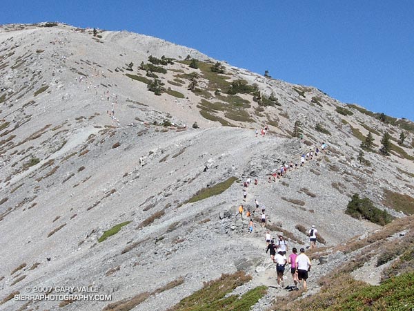
Runners winding their way up the final steep climb to the summit of 10,064 ft. Mt. Baldy during the 2007 Run to the Top race.

Despite an ongoing heat wave and excessive heat warnings, temps were surprisingly moderate for the 42nd running of the Mt. Baldy Run to the Top race. This year the men’s overall winner was Eric Martin in a time of 1:10:04, and the women’s overall winner was Brigid Freyne in a time of 1:30:41. For all of the results see the Run to the Top web site. Many thanks to the race organizers, volunteers, USFS, Mt Baldy Ski Lifts and the Mt. Baldy Fire Department for a great race!

Here are a few images from the race (Flash 8 required), a Google Earth image and Google Earth KMZ file (updated) of a GPS trace of the route.

Related post: Mt. Baldy Runner