Category Archives: san gabriel mountains

Two Sides of Strawberry Peak

Strawberry Peak's Northwest Ridge
Northwest ridge of Strawberry Peak.

Update March 28, 2021. The use trail between Josephine Saddle and the rock climbing segment of the northwest ridge is in somewhat better condition this Spring.

Where did the trail go? Rejuvenated by substantial Winter rains, the whitethorn on Strawberry Peak was not only impinging on the trail, but also my arms. I took my running sleeves out of a pocket of my pack and pulled them on. That helped, and I was able to push through some thorny limbs to the next clear section of the path.

Chaparral whitethorn blocking the use trail along Strawberry Peak's northwest ridge.
Chaparral whitethorn blocking the use trail along Strawberry Peak’s northwest ridge. Click for larger image.

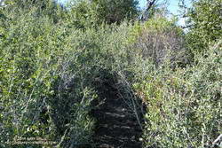
When following an overgrown trail I’ve learned to trust the “sense” of the trail. Even if it doesn’t look like there is a route forward, if you just take a few steps a seemingly impassible trail often becomes passable. I sometimes look at the trail behind me to confirm I’ve really been following a trail, and am continuing its path. If it doesn’t open up, I backtrack to see where I went wrong.

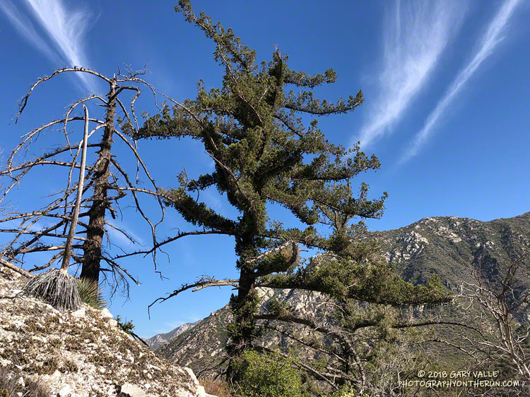
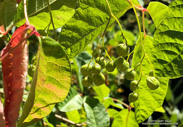
Winding through the thick brush along Strawberry Peak’s northwest ridge, I was happy to see that all of the Poodle-dog bush along the route had finally withered and died. Poodle-dog bush is fire-follower that causes dermatitis in many people. It became very widespread in the San Gabriel Mountains following the 2009 Station Fire. Reported reactions varied from a very mild rash to a severe rash with blistering. The troublesome plant must serve some role in the fire recovery process, but I’m glad its cycle is near its end.

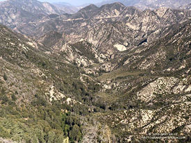
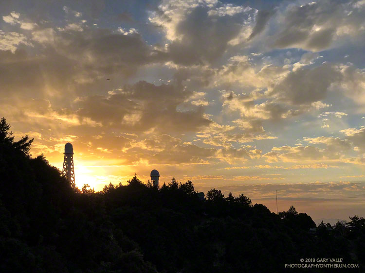
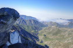
It seemed like it was going to be a quiet day on Strawberry. The loop I was doing began at the Colby Canyon trailhead and I’d been the first to park there. The few tracks on the trail were old and the only people I’d seen were a group of mountain bikers at Josephine Saddle. The view from the mountain was spectacular. A sea of low clouds lapped at the mountain slopes and washed into the canyons, bringing with it a feeling of wanderlust and vitality.

Colby Canyon from near the top of Strawberry Peak's northwest ridge.
Colby Canyon from near the top of Strawberry Peak’s northwest ridge. Click for larger image.

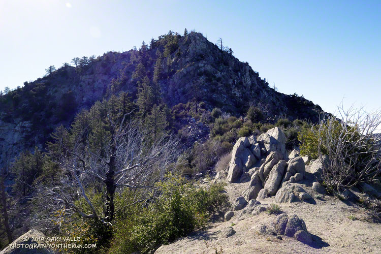
Finally reaching the steeper part of Strawberry’s fragmented northwest ridge I climbed up the initial sandy ledges to an area of somewhat better rock, taking care not to slip on the ball-bearing grains of decomposing granite. Generally, the rock improves somewhat with height. Higher on the ridge, I enjoyed doing a couple of optional boulder moves that were a little more technical. (I’d done these before and knew they were not a dead-end.)

Reaching the top of the ridge, I could hear conversation and laughter above me. From the summit ridge I could see there were people on and near the summit. I threaded my way to the summit, greeting the hikers along the way. On the summit, a small dog said hi, and I treated my new friend to an obligatory neck scratch.

In nearly five decades of doing the peak, I’d never seen so many people on the peak. I had forgotten that Angeles Crest Highway was closed at Red Box due to a rock slide. With snow in the high country and the great Spring weather, Strawberry Peak was a very popular place.

Running down to Red Box I’d encountered many more hikers, some smiling, some not, but most were enjoying being on the trail. That’s the thing about the outdoors, it just feels good to be out there.

Related post: Strawberry Peak, Switzer’s and the Old Colby Trail

Autumn on the Kenyon Devore Trail

Autumn on the Kenyon Devore Trail in the San Gabriel Mountains near Los Angeles.

Did the Rim Trail – Devore Camp – West Fork – Kenyon Devore loop with Lynn this morning. In town to visit relatives, she hadn’t been on the Kenyon Devore Trail since flying past me on that climb in the 2009 Mt. Disappointment 50K!

Wore my brightest “CalTrans green” Mt. Disappointment shirt and an orange cap, but didn’t see a single deer hunter!

Here are a few photos taken along the way.

Some related posts: GSU Mt. Wilson CHARA Telescope Array, Why Won’t My Smart Key Work?

After the Station Fire: Back to Bear Canyon

Bigcone Douglas-fir burned in the 2009 Station Fire. September 1, 2018.

It’s been nine years since the Station Fire burned 160,577 acres in Angeles National Forest. The Red Box – Bear Canyon – Gabrielino loop is a long time favorite adventure run that I’ve enjoyed doing many years before and after that 2009 fire.

The loop was the first I did when the area reopened in May 2011. The trails were in poor shape — overgrown and damaged from flash floods. The notorious fire-follower Poodle-dog bush had flourished in the wake of the fire and was particularly bad along the Gabrielino Trail between Switzer’s and Red Box. Thinking I was “immune” to the plant, I brazenly plowed through it, and as a result spent several inflamed nights trying to sleep in a reclining chair.

Each year Bear Canyon and upper Arroyo Seco recover a little more. Poodle-dog bush is in decline and in many areas nearing the end of its life-cycle. The chaparral, bay trees and oaks are all recovering; and the bigcone Douglas-firs that survived the fire have become more fully-foliaged.

Bear Canyon from the upper Bear Canyon Trail.
Bear Canyon from the upper Bear Canyon Trail. Click for larger image.

This year Bear Canyon was a little drier than last. The creek was a trickle, disappearing in the sand in some areas and creating small pools in others. The path in the upper part of the canyon, above Bear Canyon Camp, was better defined, but still tricky to follow in some spots.

With the dry conditions, most of the poison oak had already turned red. It was easy to spot, but difficult to avoid. The “stinging nettle” creek crossing higher in the canyon wasn’t as overgrown as last year, but I still managed to brush against a plant or two.

Bear Canyon ends at Arroyo Seco, downstream of Switzer Falls. After turning upstream on the Bear Canyon Trail, I hadn’t run far when I encountered a couple of mountain bikers. They asked me, “is this the trail to JPL?”

This wasn’t the first time that I’d encountered misplaced riders or hikers on this section of trail. Some get misplaced looking for the falls and others mistakenly follow the Bear Canyon Trail down into Arroyo Seco instead of continuing high in the canyon on the Gabrielino Trail. Because of the completion of the restoration of the Gabrielino Trail there were a few more riders on the trail than usual.

Here are a few photos taken along the way.

Some related posts: Bear Canyon Loop: If the Poison Oak Doesn’t Get You, the Stinging Nettle Will; After the Station Fire: Red Box – Bear Canyon – Gabrieleno Loop; After the Station Fire: Contact Dermatitis from Turricula parryi – Poodle-dog Bush

Lemon Lilies, Tree Rings and More Heat Training on the Three Points Loop

Lemon lily and sneezeweed at Waterman Meadow in the San Gabriel Mountains.

There seems to have been some carryover from the wet rainy season we had in 2016-17 to this year. The 2017-18 rain season was very dry — the third driest on record at Downtown Los Angeles — but seeps at Waterman Meadow, along the Burkhart Trail below Buckhorn were still wet. In general plant growth along trails has been more than I expected in such a dry year.

Old growth Jeffrey pine on Waterman Mountain killed in the 2009 Station Fire.
Old growth Jeffrey pine killed in the 2009 Station Fire. Click for a closer view.

Wet and dry periods can be seen in the growth rings of the large Jeffrey pine along the Three Points – Mt. Waterman Trail just west of the Twin Peaks Trail junction. A more careful count of its rings totaled about 500. No matter how careful the count, because of the various anomalies that occur with tree rings, some form of crossdating is usually required to confidently assess the age of a tree. Even so, it is clear this was an old tree.

The first few miles of the loop were gloriously cool, but by the time I reached Cooper Canyon and was working up to Cloudburst Summit on the PCT, the sun beat down on me in a familiar refrain.

Here are a few photos taken on the loop.

Related post: Cool Weather, Old Trees, Grape Soda Lupine and a Restored Trail

Another Scorching Angeles National Forest/Mt. Disappointment Trail Race

Sunrise on Mt. Wilson prior to the start of the 2018 Angeles National Forest/Mt. Disappointment Trail Race

It was “déjà vu all over again” for the 12th running of the Angeles National Forest Trail Race on Saturday. When the sun rose over Mt. Wilson Saturday morning, the temperature was already in the 80s and monsoon clouds were scattered across the eastern sky. We all knew it was going to be a hot day. The only question was how hot?

Following weeks of seasonable — and often cool — weather, temps began to ramp up Thursday. On Friday many daily and some all-time record high temps were set around the Los Angeles area. Van Nuys set an all-time record high of 115°F. Downtown Los Angeles set a new daily record of 108°F and Woodland Hills set a new daily record of 117°F.

The high temperature recorded at Clear Creek for each of the ANFTR/Mt. Disappointment races. Click for a larger image.

The record-breaking heatwave continued race day with temps on the ANFTR course surpassing the torrid temps of 2017. The Clear Creek RAWS recorded hourly temperatures as high as 100°F and hourly fuel temps as high as 123°F. The highest temperature measured at Clear Creek was 105°F — five degrees higher than last year’s race.

Once again, despite the heat, there were some AMAZING performances. In the 60K, first and second place in both the Mens and Womens division finished only a couple minutes apart. Mario Martinez’s 6:41:25 just edged Rupert Romero’s 6:43:27, and Katie Asmuth’s 7:29:11 was just ahead of Teresa Kaiser’s 7:32:21. Chase Coffey ran the 50K in 4:25:26, which I believe is the fastest time for the normal 50K course. (In 2009 we ran all the way to Red Box on Mt. Wilson road.) Ana Suchey was the top woman in the 50K with a time of 6:04:30. In the 25K Victor Martinez bested the record he set last year, running the course in 2:07:27. Jennifer Sunahara was first among the women, with a time of 2:58:29. Not all the great performances were from the fastest runners. Sa Il Hong, age 80, completed the 50K in fine form.

Many thanks to Gary and Pam Hilliard and all the ANFTR staff and volunteers! It wasn’t just hot for the runners! And those setting up the event and marking the course had to endure Friday’s record-setting temps, spend a warm night on the mountain, and then work in the heat again on Saturday!

See the ANFTR web site, Facebook page and Facebook group for more info. The Angeles National Forest Trail Race is the new name for the Mt. Disappointment Endurance Run. Only the name changed. All the results for the ANFTR/Mt. Disappointment races since 2005 can be found on Ultrasignup.com.

Note: The temperature in a commercial weather station is measured inside a white, ventilated instrument housing, several feet off the ground. Mid-day temperatures in the sun, in the summer, with a cloudless sky will be much warmer than this. Some stations, such as Clear Creek, also measure the fuel temperature — the temperature of a pine dowel in direct sun about a foot off the ground. According to the NWS (and common sense) exposure to full sunshine can increase heat index values by up to 15°F. In my experience the fuel temp gives a better indication of the actual temperature a runner can experience in the sun, especially on exposed mountain slopes facing the sun.

Related post: Record Heat for the 2017 Mt. Disappointment 50K & 25K