Category Archives: trails|smmc open space

Las Llajas Longhorns

Longhorn or Corriente bull and heifer on the Las Llajas loop.

Part of the appeal of trail running is that even on a short weekday run, close to home, on a familiar trail, stuff happens.

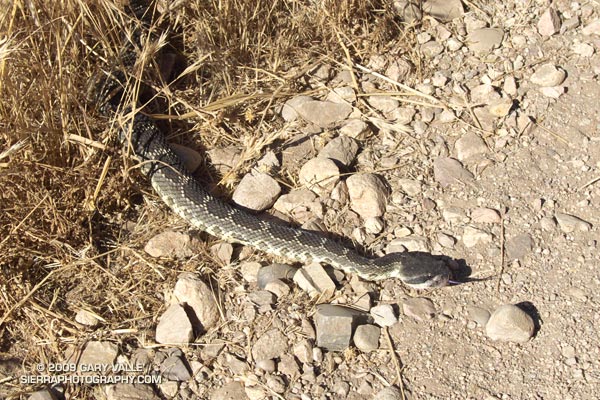
The plan for today’s trail run was a simple one — run up and down the Chumash Trail in Rocky Peak Park. By the time we were done, a 5 mile run would morph into a loop of nearly 10 miles. We would encounter a rattlesnake and a longhorn bull, and we would run short on water. But we would also have a great run!


Southern Pacific rattlesnake on the Chumash Trail
I’ve run in the Rocky Peak area for decades, and from time to time have encountered cattle near the end of Rocky Peak road. In recent years, the herd has been hanging out in the oil field and oaks between Las Llajas Canyon (near Poe Ranch) and a small mesa east of Rocky Peak road.

Seems to me most of the stock used to be Brahman, but these days there are many longhorns in the mix and according to an expert, these could be Longhorn, Corriente, or a Longhorn/Corriente cross.

When they heard us coming down the road most of the cattle just moved to another area — except for the big guy in the title photo. He made it very clear that no one should be messing with his heifers. He was a little agitated. While he didn’t charge us, it seemed possible he might. Avoiding any appearance of confrontation, we kept moving, and after a few moments were well away from the herd.

Here’s a Cesium browser View of a GPS trace of the Chumash – Las Llajas loop.

Some related posts: Chumash – Las Llajas Loop, Las Llajas Hill 2484, Exploring Las Llajas

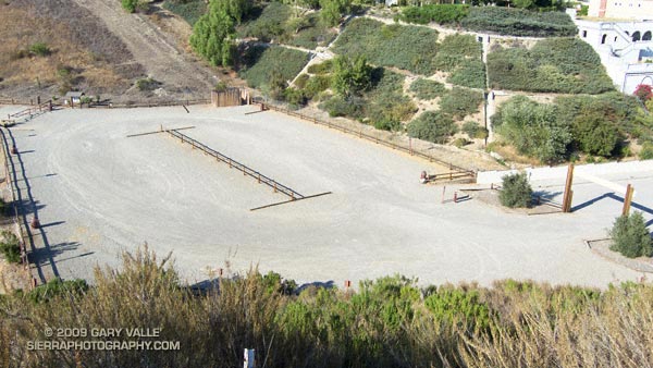
Nice Parking Lot

Empty parking lot at the Victory trailhead of Upper Las Virgenes Canyon Open Space Preserve (formerly Ahmanson Ranch)

I about fell out of my chair when I went to renew my Mountain Recreation Conservation Authority (MRCA) annual weekday parking permit and found that the 5-day multi-park fee had increased from $60 to $300 a year! The 7-day annual permit had increased to $450 a year. No can do!

The Victory Trailhead at Upper Las Virgenes Canyon Open Space Preserve (formerly Ahmanson Ranch) is one of several trailheads considered to be in an “impacted neighborhood.” Doing my part to support the parks and reduce neighborhood impacts, I’ve purchased an annual parking permit the past two years.

This year I expected a fee increase for the annual permit — but not a 500% increase! What’s more, MRCA only offers a single park annual permit for one park — Wilacre Park. Why not offer a sensibly priced single park permit for all the parks in impacted neighborhoods?

Until MRCA offers a viable and realistic alternative, I will be parking on the street!

Born to Run

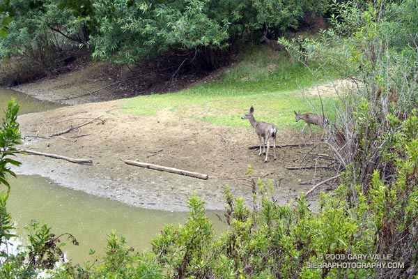
Mule deer at Trippet Ranch in Topanga State Park

Deer seem to be plentiful in the Trippet Ranch area, and are frequently seen at this pond near the parking lot, or grazing among the oaks.

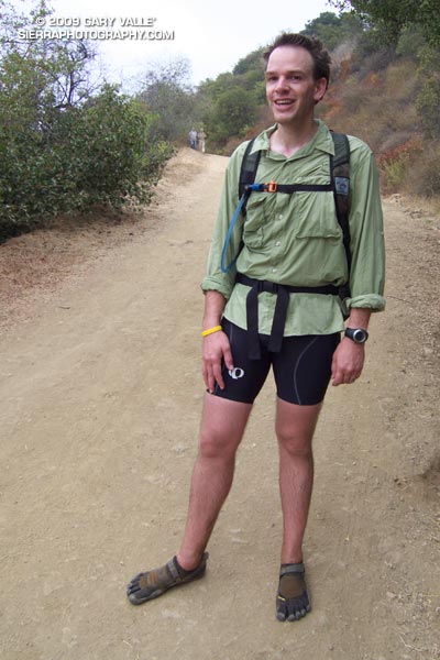
Barefoot trail runnerRunning the Trippet Ranch Loop in Topanga State Park was a pleasant way to unwind after doing the Mt. Disappointment 50K last weekend. This 12.5 mile trail run from the End of Reseda is on a mix of fire roads and single track trail in chaparral and live oak woodland. I like to do the fire roads out to Trippet Ranch, and single track Musch and Garapito trails back. The elevation gain/loss on the loop is about 1800′.

Running up the hill to the Hub on the way out to Trippet Ranch we noticed some barefoot prints mixed in with the mountain bike and running shoe tracks. Based on the gait, the tracks were from a runner — and from the speed they worked up the hill, the runner was feeling pretty good.

At the Hub the bare feet continued on our route, down Eagle Springs fire road, and about 10 minutes later they ended — at a smiling runner wearing Vibram Five Fingers. Returning to running after a year and a half hiatus to start a family, Chris had recently read Christopher McDougall’s Born to Run, and been inspired to try barefoot running.

Here’s a Cesium browser View of a GPS trace of the Trippet Ranch loop from Marvin Braude Mulholland Gateway Park at the southern end of Reseda Blvd., in the San Fernando Valley.

Some related posts: Ferns Along the Garapito Trail, Musch Trail Mule Deer, Garapito Trail Green

Ramping Down for Mt. Disappointment

Live oaks at Sage Ranch Park.

Note: The Mt. Disappointment Endurance Run is now the Angeles National Forest Trail Race.

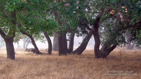
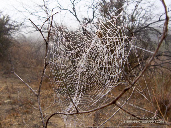
Or should that be ramping UP for Mt. Disappointment? Anyway, started tapering for the Mt. Disappointment run next Saturday. Did the 13 mile Cheeseboro Canyon keyhole loop from the Victory Trailhead of Ahmanson Ranch yesterday, and then stretched the legs at Sage Ranch today. Both mornings were cool, with low clouds and fog — very pleasant!


Spider web
Here’s hoping for “not too hot” weather for the race. At the moment, the GFS and ECMWF weather models show a weak upper level trough moving through California in the Friday-Saturday timeframe. Such a scenario should increase the chances of “seasonable” temps for the race — which would still be quite warm, but maybe not crazy hot.

Update Friday Morning 8/07/09. Broad upper level trough over California this morning is keeping things cool. Yesterday the high recorded at Mt. Wilson was 70, and the low overnight was 48! Southern part of the trough is forecast to hang back over Southern California through Saturday, which could result in temps a little BELOW normal for the Mt. Disappointment race. We’ll see!

Related post: Mt. Disappointment 50K 2008 Notes

Summer Returns

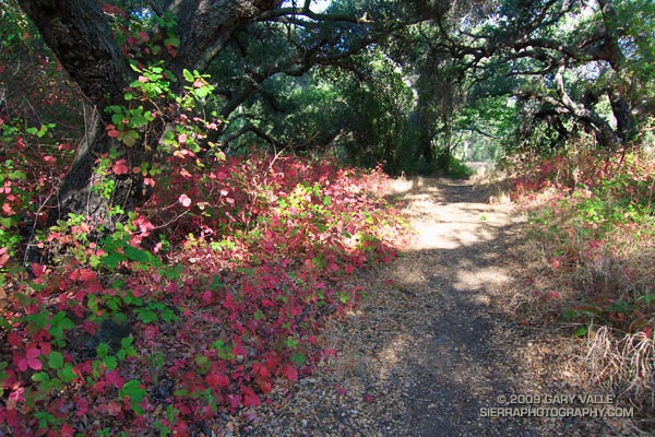
Poison Oak along the Blue Canyon Trail.

Poison Oak Along the Blue Canyon Trail.

Since nearly all my weekday runs are in the afternoon, on Summer weekends I usually like to escape the heat and do a run in the mountains — the higher, the better. But today even the mountains were going to be hot. Hot enough that the National Weather Service had issued an Excessive Heat Warning for a combination of heat and humidity that would “create a dangerous situation in which heat illnesses are likely.”

It would be cooler at the higher elevations of the Sierra, but there was good chance of thunderstorms developing along the crest of the Sierra, as well as most of the higher mountains of Southern California. Considering the options, I finally decided to do an early morning run in Pt. Mugu State Park. If I was going to run in the heat, it might as well be a scenic run close to home. Maybe the weather in the mountains would be better next weekend.
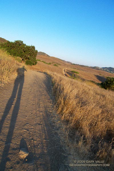

Sunrise on the Satwiwa loop trail.
There are many excellent courses at Pt. Mugu State Park. The course I was doing today is a “backward” variant of the Boney Mountain Half Marathon Course — up the Old Boney Trail, down to the Danielson Multi-use area, up Ranch Center fire road to the Hidden Pond Trail, and then back on the Upper Sycamore Trail. Water is normally available at Danielson Multi-use area and at the start of the Upper Sycamore Trail.

I should have started the run at dawn, but instead ambled along a section of the Satwiwa Loop trail at sunrise. The light was muted and golden, stretching my shadow well out on the trail ahead. Cool trickles of air filled each dip and gully and I wondered how long the temperate conditions would last. Ironically, the last time I had done this course it had been blustery and cold, and there had been snow on the mountains above Ventura. Not today…
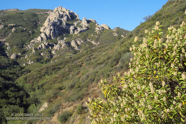

Crags above the Danielson cabin site on Boney Mountain.
It was warm running up the east facing section of the Old Boney Trail, but not yet hot. The crags to the west of the Danielson cabin site, gleamed in the morning sun, and for a brief instant I debated climbing the ridge. The impulse passed, and once over the shoulder of Boney Mountain, I thoroughly enjoyed the (mostly) downhill running through the Boney Mountain Wilderness to the Blue Canyon Trail junction. Cool air draining from the shaded slopes of Boney Mountain kept temps reasonable in the canyon, and the running was good all the way to the Danielson Multi-use area.
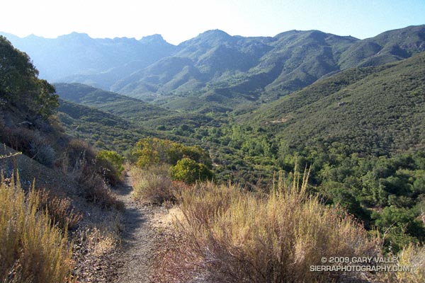

Descending to the Old Boney and Blue Canyon trail junction.
At the Multi-use area there is a choice. The coolest and most direct route to the Upper Sycamore Trail is up shaded (and paved) Sycamore Canyon road. But with the Mt Disappointment race looming, I wanted to get in more time and elevation gain, so opted for the longer, more exposed route up the Ranch Center fire road, and then along the ridge on the Hidden Pond Trail. Yes it was hot, and the humidity was up a bit, but it was still scenic and enjoyable in a “I’m not going to let the heat get to me” kind of way. And I knew a water faucet was waiting for me at the point where the Hidden Pond Trail rejoins Sycamore Canyon road, and the Upper Sycamore Trail continues eastward.

Maybe it was the heat, or maybe the coyote had learned to scavenge food from hikers — whatever the case the coyote ahead of me on the Upper Sycamore trail didn’t seem to be in any particular hurry to get off the trail. Coyotes are an odd sort, very intelligent and adaptable, but in my experience not normally any kind of threat.

Usually they will scurry away from a runner. This coyote wasn’t scurrying anywhere. I picked up the pace and clapped my hands, and eventually the animal grudgingly took cover to the side of the trail. But, as it turns out, only about 4 feet off the trail. This was odd, brazen behavior, and I kept a wary eye as I passed.

The final challenge of the morning was the hot climb up to Satwiwa on the Danielson road from the end of the Upper Sycamore Trail. The hill isn’t long or particularly steep, but it faces directly into the sun. With the heat of the day building, it wasn’t easy.

Overall it was an excellent run that would have been even better with an earlier start. Here’s a Cesium browser View of a GPS trace of the approximately 14.5 mile route.

Related post: Big Sycamore Canyon Circuit
Jon Sutherland’s 40 Year Running Streak

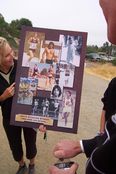
A collection of Jon photos put together by Vickie (Cook) Chapus.

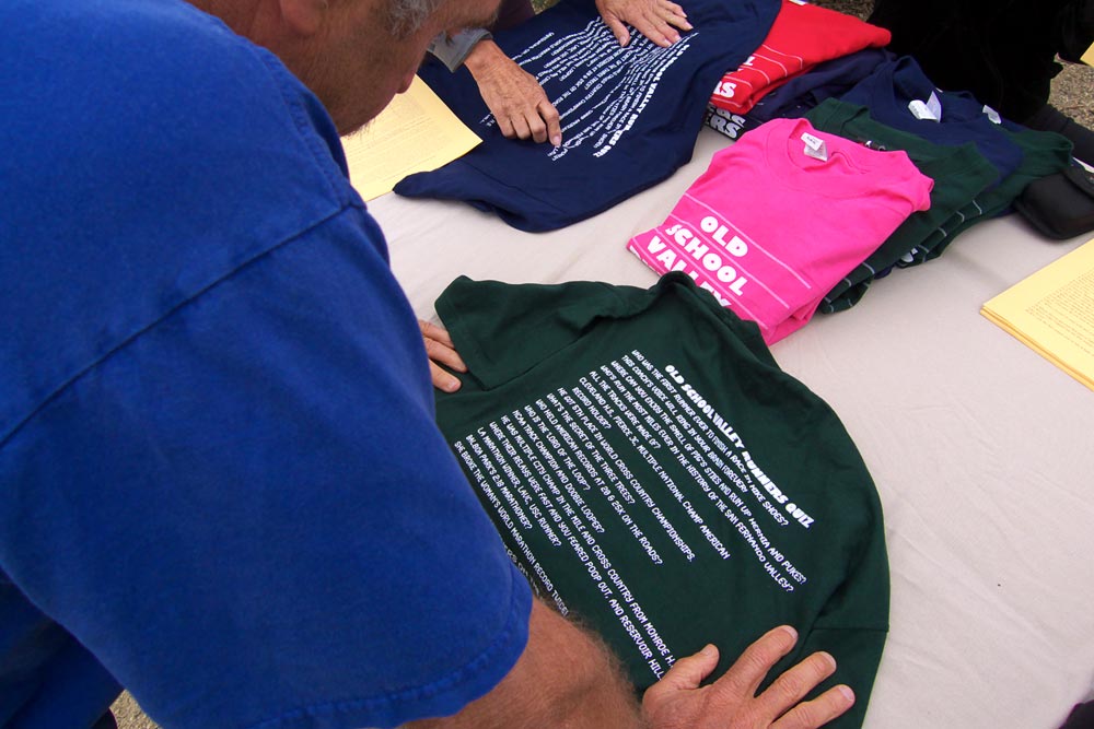
 Are you an Old School Valley Runner? Read over Mark Covert’s shoulder and take the quiz. Start with the fourth question from the top:


Mark Covert takes the Old School Valley Runners Quiz.
“Whose run the most miles ever in the history of the San Fernando Valley?”

Then try,

“Which Valley runner drilled running trophies on his car hood as an ornament?”

The answer to both questions is Jon Sutherland.


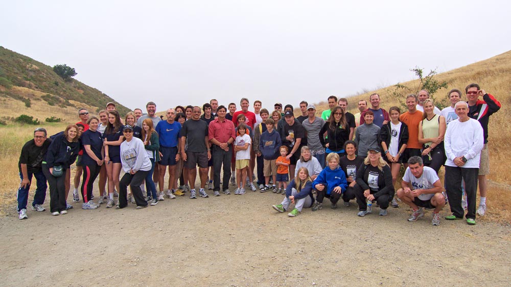
Today, Jon and a bunch of his friends (not all old school) got together at Ahmanson Ranch to celebrate an amazing benchmark: 40 years of running without missing a day.

Jon’s streak began on May 26, 1969, and since then, through injuries, illness, operations and other obstacles, he has run 14,600+ days, and more than 179,000 miles! The United States Running Streak Association maintains a Streak List with up-to-date stats of the top 350 active runners.

Among those gathered to celebrate Jon’s streak were runners that set high school, collegiate, and world records. Yep, I was the only person out there wearing trail running shoes, and a water bottle waist pack! And probably the only person out there that does the majority of their running at 10 min/mile.


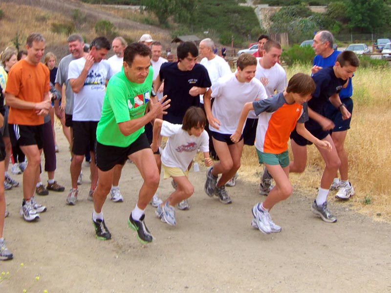
The start of the 5.2 mile Beast loop fun run.
For those that wanted to stretch their legs, Jon had set up a variety of courses for celebrants to walk or run. The long run was a tough 5.2 mile course that went up the Beast, a mile long hill that climbs more than 350′. That run was competitive from the word go!

Richard Lucas and Jon put together this short video with some highlights of the party.

Congrats Jon! I’ve enjoyed the runs, and the stories, and look forward to many more!