Simi Valley Open Space

View northwest from Rocky Peak road in Rocky Peak Park.

The view is northwest from Rocky Peak road in Rocky Peak Park. In the distance is Marr Ranch Open Space, Tapo Canyon Regional Park, and Whiteface Open Space. The Ventura Mountains are shrouded in clouds.

From today’s out and back run from Chatsworth Oaks Park, near Chatsworth Reservoir, to “fossil point” on Rocky Peak road.

La Nina and the 2010-2011 Southern California Precipitation Outlook

Clouds on Rocky Peak road

The second of two vigorous upper level lows to batter Southern California this Autumn has pushed the water year rainfall totals for many stations around the area to above normal.  Does that mean we’re likely to see the wet weather continue through the 2010-2011 rain season?


Probably not. Since last Winter, ENSO conditions in the equatorial Pacific have flip-flopped. The Multivariate ENSO Index (MEI) has plunged from the fifth strongest El Nino for Feb/Mar to the strongest La Nina for Aug/Sep. The Aug/Sep value of the MEI is the lowest since Jul/Aug of 1955. Generally, El Nino conditions result in wetter weather in Southern California, and La Nina drier.

A precipitation composite for eight years in which ENSO was transitioning from El Nino or Neutral conditions to La Nina indicates that “on average” the coastal Southern California climate division recorded about 4 to 5 inches less precipitation than normal for the period November through March. The percent of normal water year rainfall recorded at Downtown Los Angeles (USC) ranged from a low of 53% (1988, 8.08″), to a high of 99% (1973, 14.92″). The average rainfall for these years was 77%, or 11.7″.

Maps generated using the ESRL/PSD page Risk of Seasonal Climate Extremes in the U.S. Related to ENSO do not indicate a higher than normal risk for an extremely dry rain season in Southern California when La Nina conditions are present.


0

La Nina composites from CPC’s ENSO Temperature & Precipitation Composites page suggest the period Jan-Feb-Mar may be particularly dry, but this is not reflected in CPC’s official seasonal precipitation forecasts.

CPC’s Three-Month Precipitation Outlooks and NOAA Winter Outlook were updated yesterday. The precipitation outlook for Nov-Dec-Feb in the Coastal Southern California climate division shows equal chances of above average, near average, or below average precipitation. As the rain season progresses, these probabilities become only slightly skewed toward below normal precipitation. The skew becomes more pronounced in Feb-Mar-Apr when the probability of below normal precipitation increases to 45%.

The title photograph is from Sunday’s out and back run from Chatsworth Reservoir to Rocky Peak.

Rocky Peak Heat

Simi Valley from Rocky Peak

Simi Valley and the Pacific Coast from Rocky Peak Road

What better way to recover from the Bulldog 50K than running Ahmanson and Rocky Peak on two of the hottest days of the year?

Yesterday, Pierce College in Woodland Hills hit a scorching 111°F, and then today 109°F. At the start of today’s run it was still over 100°F on Rocky Peak, but extra (ice) water, and a bit of a breeze kept things mostly reasonable.

No matter the weather, you’ll always see someone else on Rocky Peak!

Some related posts: Rocky Peak Rainstorm, Snow on Oat Mountain

Rocky Peak Rainstorm

Rocky Peak Rainstorm

Clouds swirled around me as I worked up the steep trail toward an overlook near Rocky Peak. I stopped and listened to the patter of the rain against the rocks, its intensity rising and falling with the gusts of wind.

The wind-driven rain trickled down my face, tasting cool and clean. It didn’t matter that my running clothes were soaked and that with each gust I could feel a chill. It was raining!

In the same manner that a color will sometimes appear especially pure and vibrant, there was an unusual liveliness to this rain.

Bandit 30K 2009

Steep climb up Rocky Peak Road on the Bandit 30K and 14K Courses. Photo is from November 2007.

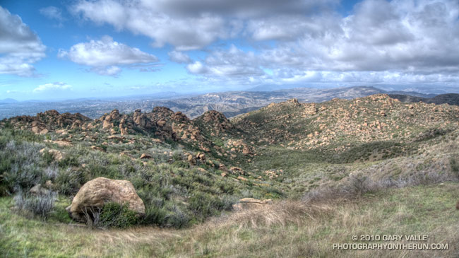
Steep climb on the Bandit 30K and 14K Courses.

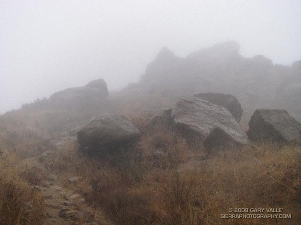
Low clouds cling to the slopes of Rocky Peak, and a cool downslope breeze stirs through the runners gathered at the start line in Corriganville Park. Three… A race organizer holding a “turn on your Garmin” sign is counting us down. Two… Runners anxious to get on the course collectively take a deep breath. One…  Go! The first steep climb is just minutes away…

You never know what you’re going to get in the first edition of a race, but in this case the Bandit 30K/14K organizers appeared to have considered every detail. Check-in went smoothly, the race started precisely at 8:00 a.m., the course was challenging and well-marked, aid & water was where it was needed, volunteers were great, and the finish line had an assortment of tasty treats!

Overall, elite mountain runner Jon Clark edged Kevin Gillotti and Jason Perez, winning the 30K in 2:22:29 — averaging 8 minute miles over the demanding course. Among the women, Lisa Fink placed first, finishing in a time of 3:08:28. In the 14K, women took two out of the top three places, finishing first and third. Jen Todd was first in 1:15:22, followed by Karl Bowers and Meredith Davidson. Results and photos are available on the Bandit 30K/14K web site.

Many thanks to the Bandit Race Committee — Randy & Sarita Shoemaker, Larry Lee, and Todd Baker — and all the volunteers and sponsors for a great race! Also, thanks to Tommi Diaz for her photos of the 30K.

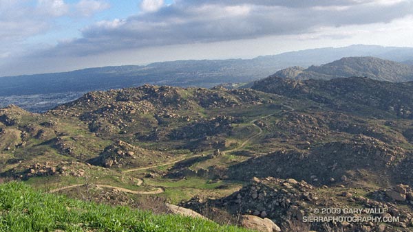
Here’s a Google Earth image, Google Earth KMZ file, and Cesium browser view  of my GPS trace of the course.

Update 12/09/10. The date of the 2011 Bandit 15K/30K is Sunday, February 20th. A 50K distance has been added!

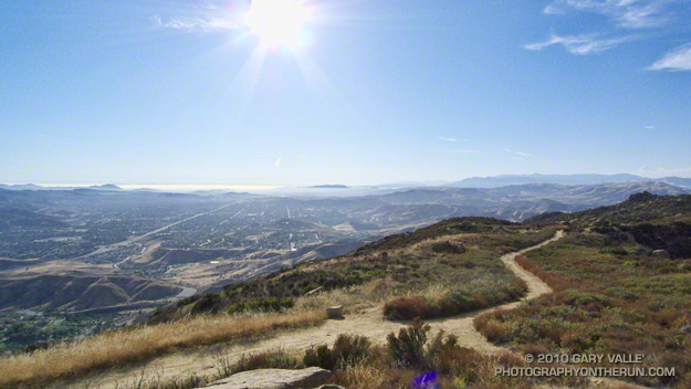
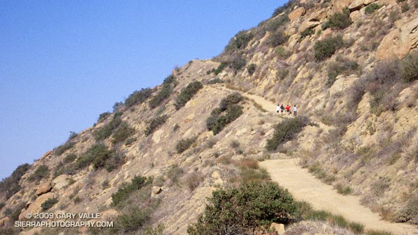
The photo of runners on Rocky Peak Road is from a run in November 2007.

Some related posts: Bandit 30K Course Preview, Las Llajas Hill 2484, Running Rocky Peak Road, Chumash Trail Rocks & Snow

Running Rocky Peak Road

Stretch of Rocky Peak Road about 1.5 miles from the trailhead at the 118 freeway.

I was surprised how good my legs felt on the steeps on Rocky Peak. Apparently skiing San Jacinto was a great way to knock my legs out of the doldrums — and make them happy to be using shoes that weigh only 22 ounces/pair!

This stretch of Rocky Peak Road is about 1.5 miles from the trailhead at the 118 freeway. It is also about 2.7 miles into the Bandit 30K and 14K courses.

Related posts: Bandit 30K Course Preview, Rainy Morning on Rocky Peak Road