Chilly Rocky Peak

Rocky Peak following a cold Christmas storm in 2019.
Rocky Peak

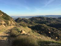
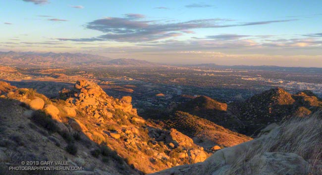
Rocky Peak Road is one of my go-to wet weather running spots. The sandy soil — thanks to the Chatsworth Formation sandstone — doesn’t cake on your shoes when it’s wet. It isn’t entirely mud-free, but as long as you don’t mind a few steep hills, it’s a good choice when the weather turns wet.

According to preliminary rainfall totals tabulated by the NWS, Rocky Peak recorded 1.22 inches of rain during the Christmas storm. The snow level had been forecast to drop to 2000′-2500′ in some areas, so as the storm was breaking up I headed over to Rocky Peak to get in a run, and see what I could see.

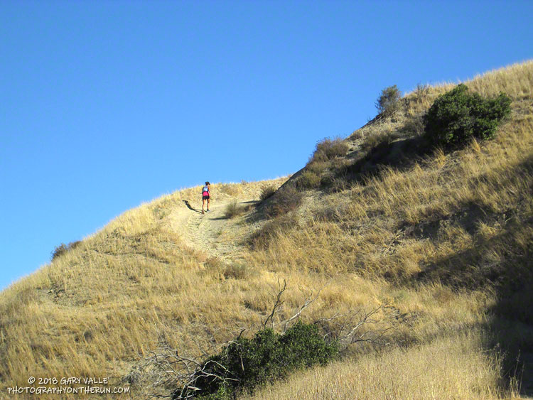
I’d dressed for a cool and breezy run, and was comfortable as I worked up the first steep hill. But I hadn’t run half a mile when I stopped and put on some gloves and a pair of stretch shorts. That helped, but the higher I went the colder it got. Up top, a little past Rocky Peak, my thermometer registered a chilly 38 degrees and the wind was gusting 10-15 mph. According to the NWS Wind Chill chart, that put the effective temperature at around 30 degrees.

And that’s what it felt like. Part of the problem was that I was running into the wind, which increased the chill. I had a wind shell in my pack, but once I’d reached my turnaround point and had the wind at my back, it wasn’t needed.

San Gabriel Mountains following a cold Christmas 2019 storm.
Mt. Lukens, Mt. Disappointment, San Gabriel Peak and Mt. Lowe.

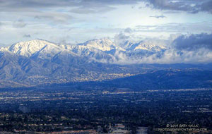
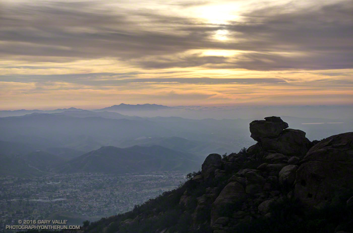
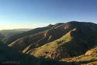
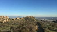
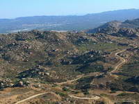
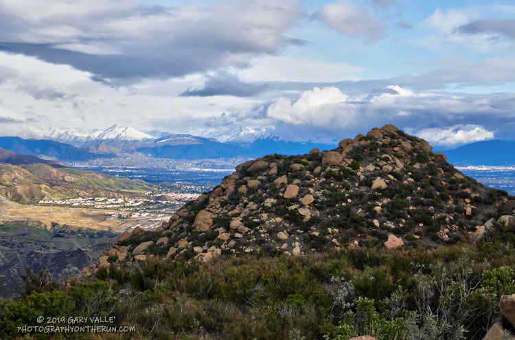
There was no snow on Rocky Peak Road or Oat Mountain, but from time to time the setting sun broke through the clouds and highlighted the snow on the nearby mountains. It was a far different scene than on the usual Rocky Peak run.

December has been wet in the Los Angeles area. As of December 27, Downtown Los Angeles (USC) has recorded 4.84 inches of rain this December, which is nearly three inches above normal. Rain year and water year precipitation totals are also well above normal, and at the moment, ahead of last year. We’ll see what the new year brings!

Update January 24, 2020. Well, the new year hasn’t brought us much in the way of precipitation. January in Downtown Los Angeles has been about as dry as December was wet. So far, Downtown Los Angeles has recorded only 0.32 inch of rain this January, well below the climate normal for the date. If there is no additional rain this month, Los Angeles will end the month with about normal rainfall to date for the Rain Year (Jul 1 – Jun 30) and Water Year (Oct 1 – Sep 30). Then we’ll have to see if there is a pattern change in February, or if it is also drier than normal, as most guidance suggests.

Related post: Snow on Oat Mountain (2008)

Rocky Peak 50K 2018

Runner ascending Hot Dog Hill during the 2018 Rocky Peak 50K.

I had the date wrong! I thought the Rocky Peak 50K was the Saturday following the Skyline to the Sea trail marathon and had decided I wouldn’t be able to run it. When I got back from Santa Cruz, I checked some upcoming races on UltraSignup and discovered Rocky Peak was on October 20th, rather than the 13th. That meant there would be 12 days between the races, instead of 5.

Five days or 12, my legs weren’t quite on board with the idea, and they had a point. With about 6000′ of elevation gain/loss, steep ups and downs, and rocky roads and trails, Rocky Peak is not an easy 50K. I had a few more days to convince them, and hoped my legs would come around.

It did help that the Start line is about 10 minutes from my front door. I’ve hiked, run and explored the Rocky Peak area for more years than I care to admit, and was very excited when Randy & Sarita Shoemaker organized the first Bandit Trail Run in 2009. The 50K was added in 2011 — the additional mileage gained by doing the Chumash – Las Llajas loop twice! The out and back to Tapo Canyon was substituted for the second loop in 2013. The Rocky Peak 50K course is essentially the same as the 2013 – 2016 Bandit 50K courses.

The week before the race, I still had to go through the pretense of not knowing if I was going to enter. My legs continued to complain during training runs, and it looked like yet another heatwave was going to peak on Friday or Saturday. None of that really mattered because I’d already decided I was going to run. Thursday, I signed up; and at dawn on Saturday, I toed the Start line in Corriganville, hoping that Rin Tin Tin might come to my rescue.

I encountered no valiant German Shepherds on the “warm-up loop” around Corriganville, and much to my leg’s chagrin soon faced the mile-long, 860 foot climb up the Corridor Trail to Rocky Peak Road. One of my main takeaways from doing this course many times is that you can go up the Corridor Trail climb too fast, but it’s almost impossible to do it too slow. At least that’s what my legs tell me. It’s been my experience that going a little slower on this first steep climb pays significant dividends later in the run. That seemed to be the case again this year.

The weather was nearly identical to last year’s race with moderate Santa Ana winds and warm temps. (The high at the bottom of the Chumash Trail was 88 °F.) Like last year, the low humidity and wind kept the “feels like” temperature relatively comfortable for most of the race. But somewhere around mile 27, near Rocky Peak, the wind stopped and things got toasty. Maybe not middle of the summer hot, but warm enough to notice it.

All in all, the run went well. For sure, my legs were a little tired from Skyline to the Sea. I was a bit slower running back up the canyon from the Tapo turnaround and also going up Las Llajas Canyon. But I can’t complain. I had no cramping (yahoo!) and felt good nearly all of the run.

Many thanks to Trail Run Events, LLC and New Basin Blues Running Club who co-managed the race, all the volunteers, and to Ventura County SAR. For more information see the Trail Run Events web site and Facebook page. All the 50K and 30K results are posted on UltraSignup.

Here are a few photos taken along the way.

Some related posts: Bandit 50K 2014, Bandit 50K 2013, Bandit 50K 2011, Bandit 30K 2009

Races, Ravens and Running in Rocky Peak Park

Simi Valley with Boney Mountain in the distance

Been enjoying the views from Rocky Peak Road a lot this past month. That’s Simi Valley, with Boney Mountain in the distance. On a clear day the view extends to the Channel Islands.

That viewpoint is at about mile 4.5 of the Bandit 50K/30K/15K and there are many other superb views along the way. This year, as a result of the L.A. Marathon date change, the Bandit races were moved from President’s Day weekend to January 30. El Nino or not, we had near perfect running weather for the event. Thanks to Randy, Sarita & crew and all the volunteers for all the work putting together the eight edition of the Bandit Ultra Trail Run!

Rocky Peak Road
Rocky Peak Road

The Tuesday following Bandit I’d run farther than planned, so on Wednesday the plan had been to drive over to Simi Valley and do a short recovery run/hike up the Chumash Trail. As I parked on Flanagan Drive, it occurred to me it would be a good day to see if the linkup from the Chumash trailhead to the Hummingbird trailhead was once again possible. The 9.3 mile Hummingbird-Chumash loop used to be a favorite, but because of construction I had not done the loop since 2010. An out and back to check out the first couple of miles of the loop would be the perfect recovery run!

I was happy to discover the trails east of Chumash Park and behind the cemetery had not changed. Construction of the extension of Mt. Sinai Drive appears to be mostly complete, but residential construction along the street is ongoing. The work day was ending, so running the quarter-mile stretch of Mt. Sinai Drive to get to Kuehner didn’t seem to be an issue.

Once on Kuehner my thought was, “What now?” The run was going to be too short if I turned around, so I decided to go just “15 minutes up the Hummingbird Trail.”

Greening hills along the Chumash Trail

Right… I soon found myself most of the way up the trail and estimating what time I needed to get to the top of Hummingbird in order to make it to the Chumash Trail and complete the loop before dark. I’m sure my pace was not too far off what it had been in the 50K, just a few days before. At some point an official trail is supposed to link the bottom of the Chumash and Hummingbird Trails, and I hope that is in the not too distant future.

The single track trails in Rocky Peak Park — and even Rocky Peak Road — tend to be technical. It’s excellent training and I try to run there at least once a week. A run I’ve been doing frequently is an out and back from the Chumash trailhead to an airy overlook near Rocky Peak. (This run also passes the point on Rocky Peak Road where the title photo was taken.) Today, as I approached the overlook I saw that it was occupied by a pair of large ravens.

Often seen in pairs, ravens are perceptive, intelligent birds. Depending on the situation, they can be somewhat tolerant of humans. Sometimes it is possible to pass within a few feet of them and not make them fly. They really don’t want to waste the energy if they don’t have to.

Overlook near Rocky Peak

As I worked up the path to the overlook I could see that the birds were watching me intently and trying to decide if I posed a threat. Knowing they are curious birds, I clucked my tongue in an attempt to mimic one of their more simple calls. Perhaps they were perplexed by the garbled raven-talk coming from the troublesome, large, bipedal, wingless creature. In any case they didn’t fly and continued to watch me. As “politely” as I could, I moved up and about four feet to their left, sharing the high point. For seconds I stood by them on the overlook, enjoying the view.

I’d flown a hang glider from a point such as this and understood why it was so special to the birds. With care, I turned away from them and walked down an alternate path. Slowly turning my head, I could see they had not flown.

Note: The Bandit Trail Runs event is now Rocky Peak Trails.

Bandit 50K 2014 Notes

Approaching the top of the first steep climb in the 2014 Bandit 50K

As I worked up the hill toward “Fossil Point” I drank the last mouthful of water from my bottle. I wasn’t surprised that I had run out. The morning temperature had been the warmest in the six year history of the event, and the midday temp in the sun felt like it was in the mid-80’s — maybe higher.

In Southern California it has been the kind of Winter that those in northern climes can only dream about: Day after day with fair skies and the temperature in the 70’s and 80’s. Great for trail running, but with the trade-off that we had had the least amount of rain in over a century.

Running down Hot Dog Hill

Chugging up the steep hill I thought about how the run had gone so far. Even if it was a little warm, it was still a pretty good day for a trail run! I hadn’t tried to push the pace on the initial steep climb from Corriganville, and had (mostly) resisted the temptation to pound down the Chumash Trail. The crazy-steep section of Hot Dog Hill on the out and back section of the course felt just as steep and insane as it did last year and the downhill to the Open Space aid station just as pleasant.

It was awe-inspiring to see the faster runners as they returned from Tapo Canyon. As I started the descent into Chivo Canyon Jay Bonthius, the eventual winner of the 50K, had flashed past. The youngest runner in the race, the 19 year old went on to finish his first 50K in 4:05:52 — setting a new course record. His average pace was a remarkable 7:55 min/mile! He ran up the hills faster than many of us ran down them!

I was very happy to get to the top of the climb at Fossil Point. Although it wasn’t the end of the running, or the hills, it was a key point in the 50K. It marked the end of a grueling 5 mile climb from the Las Llajas aid station — the last major climb on the course. It also had water.

I had carried two bottles and that was still not quite enough. There is only so much time during a race available for hydration, and I had made the mistake of not drinking water early, BEFORE I was thirsty. At this point I was dehydrated and that could not be completely remedied until sometime after I crossed the finish line.

Rocky Peak Road
Rocky Peak Road

Another four miles would find me at the top of the Corridor Trail, which on tired legs might as well be the edge of the earth. This steep one mile descent is the most technical on the course and as challenging as any of the hills. I am always happy to get to the bottom. From here the finish is a little more than a half-mile away and I smiled as I heard the cheers as another runner crossed the finish line.

More than 500 runners participated in the 6th edition of the Bandit Trail Runs, competing at distances that ranged from 6K up to 50K. Many thanks to Bandit Race Committee – RD Randy Shoemaker, Sarita Shoemaker, Eric Cartier, Tommi Diaz, Mat Diaz and Josh Lewis. Each year they find a way to make an outstanding event even better!

Once again the aid station volunteers were phenomenal! Thank you Nancy Shura-Dervin and the Ultraladies, the Encino Trail Heads, Sue Apostolof, Diane Treptows, and all the volunteers! There was not an aid station where I wasn’t greeted with a smile and all the help I needed. Also many thanks to those that worked registration, parking, the finish line, timing, finish line food, photography, safety, communications, and all the other work needed to put on an event like the Bandit.

Alison Chavez receives check from RD Randy Shoemaker
Alison Chavez and RD Randy Shoemaker

Reflecting the dedication and character of its organizers, each year the Bandit gives back by supporting an important cause. Last year Bandit raised funds for a local high school running program. This year Bandit is rallying behind runner Alison Chavez in her battle against cancer.

Here is a slideshow with a few images from this year’s 50K.

(The Bandit Trail Runs are now the Rocky Peak Trails races.)

San Fernando Valley from Near Rocky Peak

San Fernando Valley from Near Rocky Peak

In short sleeves and shorts it was cold. The wind gusts were so strong that I could not hold the camera steady. Dropping down on one knee helped, but I still had to time the shots for the 10-15 mph “calm” between the 20-30 mph gusts.

After generating some rain and snow in Southern California, a blustery upper level low was finally exiting the area. Had I not known it had rained a couple days before, I’m not sure I would have been able to tell. The dessicated soil had quickly absorbed most of the moisture and the chaparral plants still looked drought stricken.

From today’s late afternoon run on Rocky Peak.

Mountain Lion Tracks on Rocky Peak Road

Mountain Lion Tracks on Rocky Peak Road

Found these mountain lion tracks on Rocky Peak Road while doing the Chumash – Las Llajas loop this morning. The pattern of the tracks suggest the animal was walking.

Based on how soft the ground was at the time the tracks were made I’m going to guess they were probably put down sometime after 1:00 AM Friday morning, while the ground was still saturated from rainfall. This would make them about two days old.

Some related posts: It’s Raining Mountain Lion Tracks!, A Bear on Rocky Peak Road?