Southern California Rainy Season Isn’t Over Until It’s Over

Chumash Trail Clouds

I heard a news report the other day that Southern California’s rain season would end in two weeks. While Southern California typically receives the bulk of its precipitation in the months of November through April, the rain season doesn’t turn off like a switch on May 1. There certainly can be significant rain in May, and even June.

The water year for Downtown Los Angeles (USC) is from July 1 to June 30 of the following year. So far, Downtown Los Angeles (USC) has recorded 16.17 inches of rain during the current water year. This is more than an inch above the 1971-2000 annual climate norm for Los Angeles of 15.14 inches.

Our Sunday-Monday storm put Downtown Los Angeles at 1.51 inches of rain for the month of April — well above the climate normal of 0.83 inches. The normal amount of precipitation for May is 0.31 inches, and for June is 0.06 inches. But those are just averages. On occasion we receive much more than this, and sometimes much less. On the up side, according to NWS data, in April 1965 Los Angeles recorded a total of 6.02 inches of rain. In May 1921, 3.57 inches was measured; and in June 1999 0.98 inch was recorded.

Although the current El Niño has weakened, convection is still somewhat enhanced in a broad region of the equatorial Pacific, and the MEI, ONI, and GWO indicate the continued presence of El Niño. This could result in more active Spring weather than usual, and more opportunities for rain in Southern California.

At the moment, the next opportunity for some Southern California rain looks to be next week, around Tuesday or Wednesday. We’ll see!

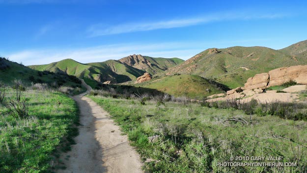
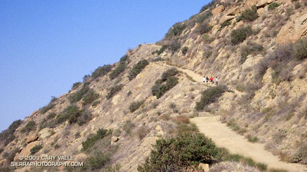
The title photo is from a run on the Chumash Trail at the end of March.

Bandit Country

The Chumash Trail, Simi Valley, California

The 2.5 mile run down the Chumash Trail is my favorite section of the Bandit 30K course. Mike Kuhn and the Rancho Simi Trail Blazers work hard to keep this single track trail in top shape. Th trail is technical, but fast, and the views are superb.

The Bandit course has a character all its own, with a great mix of spectacular scenery, challenging terrain, technical single track trails, and wide open fire roads. This year, the 14K course has been extended to 15K, turning around at the junction of the Chumash Trail and Rocky Peak Road.

The Bandit trail runs are coming up in two weeks — Saturday, March 13. For all the details see the Bandit 30K/15K web site.

Update 12/09/10. The date of the 2011 Bandit 15K/30K is Sunday, February 20th. A 50K distance has been added! Here’s a Google Earth flyover of the Bandit 30K course, created from a GPS trace of the 2010 race.

Photos are from today’s run on the Chumash Trail.

Related post: Bandit 30K 2009

Residual Showers

Got caught in some showers this afternoon on Rocky Peak, returning from a rambling trail run from the San Fernando Valley over into Simi Valley.

This was one of those “not sure where I’m going” runs that unfolded as it progressed. It started near Chatsworth Reservoir at Chatsworth Oaks Park, worked over to Santa Susana State Historic Park, then up the Old Stagecoach Road. At the top of the old Stagecoach Road, I picked up the Upper Stagecoach Trail and followed that to Santa Susana Pass and the 118 Frwy. From there it was a short distance down the west side of Santa Susana Pass Rd. to the Lower Stagecoach Trail, which took me to Corriganville.

Once down in Simi Valley there are four trails that ascend to Rocky Peak road, and my return route. From the shortest to the longest, they are the Wildlife Corridor trail, Hummingbird Trail, Chumash Trail and the Marrland/Las Llajas trail. Not sure how long it would take to get back to the SFV, I finally decided on the Chumash Trail.

Running up the Chumash Trail, the wind picked up, the clouds began to lower and thicken, and the temperature dropped. Minutes after turning right onto Rocky Peak road the showers began, and it wasn’t long before the sleeves came out of the pack.

The return trip, with a net elevation loss, went a little quicker than expected. Next time I’ll have to give the Las Llajas option a try. That would extend the run from about 17 miles, to something over 20. The approximate elevation gain/loss on the 17 mile version was a little under 3000 ft.

Related post: Old Santa Susana Stage Road

Afternoon Run

View west from Rocky Peak road, past Simi Valley to Boney Mountain.

Started the weekend with an exhilarating Morning Run in the Santa Monica Mountains near Saddle Peak, and wrapped it up with another enjoyable run, the Chumash – Hummingbird loop in the Santa Susana Mountains.


Prior to the start of a controversial condo development near Happy Face Hill, the Chumash – Hummingbird loop was a favorite of mountain bikers and trail runners. According to an article in the Simi Valley Acorn, the original developer abandoned the project in 2008, and the land was recently purchased by a new developer.

Hopefully any new construction plans will continue to include a trail connection from the Chumash trailhead on Flanagan Dr. to the Hummingbird trailhead on Kuehner Dr.

The title photo is a view west from Rocky Peak road, past Simi Valley to Boney Mountain.

Related post: Chumash-Hummingbird Loop

Las Llajas Longhorns

Longhorn or Corriente bull and heifer on the Las Llajas loop.

Part of the appeal of trail running is that even on a short weekday run, close to home, on a familiar trail, stuff happens.

The plan for today’s trail run was a simple one — run up and down the Chumash Trail in Rocky Peak Park. By the time we were done, a 5 mile run would morph into a loop of nearly 10 miles. We would encounter a rattlesnake and a longhorn bull, and we would run short on water. But we would also have a great run!


Southern Pacific rattlesnake on the Chumash Trail
I’ve run in the Rocky Peak area for decades, and from time to time have encountered cattle near the end of Rocky Peak road. In recent years, the herd has been hanging out in the oil field and oaks between Las Llajas Canyon (near Poe Ranch) and a small mesa east of Rocky Peak road.

Seems to me most of the stock used to be Brahman, but these days there are many longhorns in the mix and according to an expert, these could be Longhorn, Corriente, or a Longhorn/Corriente cross.

When they heard us coming down the road most of the cattle just moved to another area — except for the big guy in the title photo. He made it very clear that no one should be messing with his heifers. He was a little agitated. While he didn’t charge us, it seemed possible he might. Avoiding any appearance of confrontation, we kept moving, and after a few moments were well away from the herd.

Here’s a Cesium browser View of a GPS trace of the Chumash – Las Llajas loop.

Some related posts: Chumash – Las Llajas Loop, Las Llajas Hill 2484, Exploring Las Llajas

Bandit 30K 2009

Steep climb up Rocky Peak Road on the Bandit 30K and 14K Courses. Photo is from November 2007.

Steep climb on the Bandit 30K and 14K Courses.

Low clouds cling to the slopes of Rocky Peak, and a cool downslope breeze stirs through the runners gathered at the start line in Corriganville Park. Three… A race organizer holding a “turn on your Garmin” sign is counting us down. Two… Runners anxious to get on the course collectively take a deep breath. One…  Go! The first steep climb is just minutes away…

You never know what you’re going to get in the first edition of a race, but in this case the Bandit 30K/14K organizers appeared to have considered every detail. Check-in went smoothly, the race started precisely at 8:00 a.m., the course was challenging and well-marked, aid & water was where it was needed, volunteers were great, and the finish line had an assortment of tasty treats!

Overall, elite mountain runner Jon Clark edged Kevin Gillotti and Jason Perez, winning the 30K in 2:22:29 — averaging 8 minute miles over the demanding course. Among the women, Lisa Fink placed first, finishing in a time of 3:08:28. In the 14K, women took two out of the top three places, finishing first and third. Jen Todd was first in 1:15:22, followed by Karl Bowers and Meredith Davidson. Results and photos are available on the Bandit 30K/14K web site.

Many thanks to the Bandit Race Committee — Randy & Sarita Shoemaker, Larry Lee, and Todd Baker — and all the volunteers and sponsors for a great race! Also, thanks to Tommi Diaz for her photos of the 30K.

Here’s a Google Earth image, Google Earth KMZ file, and Cesium browser view  of my GPS trace of the course.

Update 12/09/10. The date of the 2011 Bandit 15K/30K is Sunday, February 20th. A 50K distance has been added!

The photo of runners on Rocky Peak Road is from a run in November 2007.

Some related posts: Bandit 30K Course Preview, Las Llajas Hill 2484, Running Rocky Peak Road, Chumash Trail Rocks & Snow