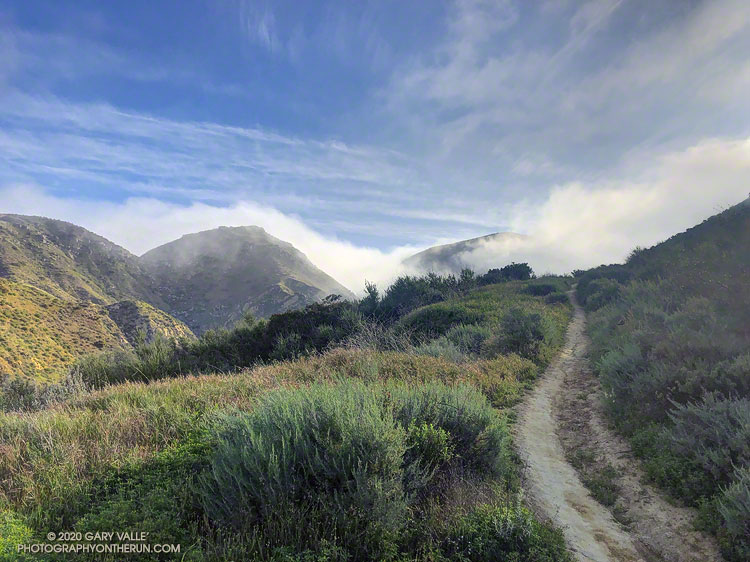
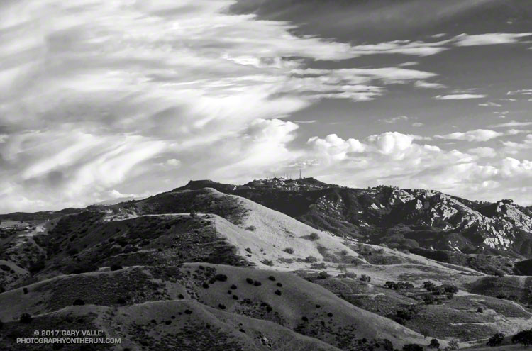
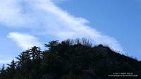
From an out and back run between Tapo Canyon and Las Llajas Canyon.
Like the Las Llajas Canyon Trail, this segment of the Chivo Canyon Trail is part of the Rocky Peak 50K course.

From an out and back run between Tapo Canyon and Las Llajas Canyon.
Like the Las Llajas Canyon Trail, this segment of the Chivo Canyon Trail is part of the Rocky Peak 50K course.
First published May 12, 2007.
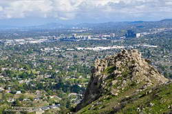
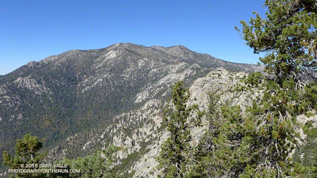
From the rocky summit of Castle Peak I traced the course of Bell Creek into the San Fernando Valley, imagining the broad valley as it might have been a few hundred years before. Bell Creek would have joined Chatsworth and El Scorpion Creeks to form the Los Angeles River. Unconfined, the river would have been a riparian ribbon of willow green, winding its way across the valley and through a patchwork of grassland and sage scrub. Areas of the valley would have been punctuated with oaks, wetlands, and scattered chaparral.
A wall of marine haze would likely be seen near Kaweenga, and threads of smoke might mark the location of other communities. Later in the year, the grasslands would be set afire, promoting next year’s growth, and protecting and enhancing the health of the oaks. As they do today, the San Gabriel Mountains would beckon in the east — but would be antenna free.
There would have been little noise… No distant horns, freeway drone, or roar of airplanes. Occasionally, a broken voice might have wafted up from the community below. The wind would rustle between the summit rocks, and the loudest noise might be the song of the canyon wren, or screech of the scrub jay.
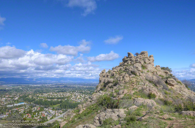
Known by the Ventureño name Kas’élewun, Castle Peak is a landmark of spiritual significance to the Chumash and Gabrielino. Perched at the end of a tongue-like ridge, the peak stood over the multi-cultural community of Huwam, where Chumash, Tongva and Tataviam people lived.
Kas’élewun and the nearby Cave of Munits were places of power and ceremony. Stories would be told of the sorcerer Munits and his death upon the mountain, and of a gruesome creature inhabiting its caves. Some would tremble at the thought, and an angry parent might caution a child to behave, or risk angering the beast on the mountain.
It is a haunting night, and torn clouds race past a silvery moon. From the margin of the village I glance up to Kas’élewun to see a solitary figure briefly silhouetted on its summit. I rub my eyes and only the clouds remain…
Note: Like so many placenames in the Valley, “Castle” appears to be a corruption of the Chumash name for the peak, Kas’élewun. Rather than alluding to a castle, it can be translated as “tongue,” perhaps because the formation sits at the end of a long ridge that extends out into the valley . The title photograph of Castle Peak is from a run on March 19, 2020.
The range of temperatures had been remarkable. At the Secret Trail trailhead in Calabasas, where I left my car, it had been a balmy 60 degrees. Near the start of my run from the Tapia Trailhead in Malibu Canyon, it had been a very chilly 32 °F. Near the end of the run, the temp topped out at 79 °F. That’s SoCal Winter running!
On the way to Saddle Peak, I was surprised to see how wet it was on some sections of the Backbone Trail. There has been very little rain this January, but marine layer dew, the trail’s north-facing aspect, the low sun angle, the canopy of bays and oaks, and relatively cool temps have kept the trail damp. In places it looked like it had just rained yesterday.
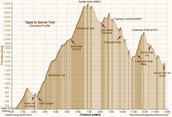
Because there’s about 1000′ less elevation gain, I usually do this run in the opposite direction, starting on the Secret Trail and ending at Tapia. This is the route described in the venerable guidebook, 50 Trail Runs in Southern California. But I’d run it in that direction a bunch of times — so here I was, chugging up the Backbone Trail, nearing the end of a 2600′, seven-mile climb from Tapia to Saddle Peak.
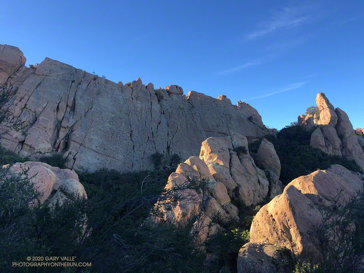
The area around Saddle Peak is yet another spectacular section of the Backbone Trail. (There are so many!) Just west of the peak, the trail winds through a narrow passage with massive sandstone rocks on either side. As the trail levels out, there is a short spur trail to the peak’s antennae-infested summit.
Even if a little obstructed, views from the top extend to Catalina, Boney Mountain, Mt. Pinos, and Mt. Baldy. Sometimes San Gorgonio Mountain and San Jacinto Peak can be seen beyond Mt. Baldy. The round trip to the summit of Saddle Peak adds about 0.8 mile. The eastern summit is slightly lower, but no antennae obstruct the view.
Getting to Saddle Peak from the Tapia trailhead is relatively straightforward, if a bit strenuous. Getting to Calabasas Peak and the Secret Trail from Saddle Peak is not as simple.
The “normal” way to get from Saddle Peak to Calabasas Peak would be to run back down the Backbone Trail to the Stunt High Trail and then follow that trail to the parking area on Stunt Road. Calabasas Peak Mtwy is across the highway and slightly downhill (west) of the parking area and leads to Calabasas Peak and the Secret Trail.
If doing the regular route, note that the Stunt High Trail crosses Stunt Road twice on the way down. In each case turn right and follow the road east about 100 yards to pick up the trail on the other side of the road. There are also various side trails to avoid.
I had been planning to do the regular route, but as I was returning to the Backbone Trail from Saddle Peak, it occurred to me there was a way to avoid backtracking. Instead of turning left on the Backbone Trail and descending to the Stunt High Trail, I turned right and continued east, past the water tank, to the Lois Ewen Overlook. From there, I ran over to the Topanga Lookout and then scrambled down Topanga Lookout Ridge to Calabasas Peak Mtwy.
This option is more adventurous, but requires good route-finding skills and being comfortable clambering down a rocky ridge. This 3D Cesium interactive view shows a GPS track of my route. The yellow track is today’s route. The red track is the usual route between the Backbone Trail and Calabasas Peak Mtwy. The view can be zoomed, tilted, rotated and panned. Placemark and track locations are approximate and subject to errors.
Scrambling down the ridge put me at “The Bench,” at the junction of Calabasas Peak Mtwy and Red Rock Road. This is a little more than a mile from Calabasas Peak. Once on Calabasas Peak, it was only about 0.6 mile to the top of the Secret Trail, and from there about 1.3 miles of mostly downhill running to the trailhead.
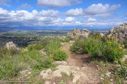
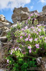
With about 4000′ of gain over 14 miles, it was a demanding route, with challenging route-finding and a fun scramble down a rocky ridge. Here are a few photos taken along the way.
Some related posts: Topanga Lookout Loop, Plus Saddle Peak; Secret Trail Variations; Secret Trail to Calabasas Peak
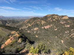
The sunlit hills are on the west side of the New Millennium Loop in Calabasas. The rocky peak in the background is Saddle Peak. The 68 mile Backbone Trail, which traverses the length of the Santa Monica Mountains, passes near the summit of Saddle Peak.
From a recent run on Cheeseboro Ridge.
The two highest peaks in the front range of the San Gabriels, Strawberry Peak (6164′) and San Gabriel Peak (6161′) are about three miles apart as the raven flies and about 6 miles apart by trail. If you don’t mind running/hiking a third of a mile on Mt. Wilson Road, you can do both of them from Red Box as a 12 mile run/hike with a total gain of about 3000′.
Earlier this morning, I’d done San Gabriel Peak. It’s the shorter of the two ascents — from Red Box it’s about 2.4 miles to the summit. While the elevation gain is nearly the same as climbing Strawberry, it is a less strenuous and more straightforward peak. Except for a short stint on the service road below Mt. Disappointment, the grade of the San Gabriel Peak Trail is relatively constant — and the trail goes all the way to the summit.
The route up Strawberry Peak is distinctly different. The initial 2.5 miles follows the Strawberry Peak Trail to Lawlor Saddle, gaining a moderate 500′ along the way. From there a steep, rough and sometimes rocky use trail ascends 950′ in a little over a mile to Strawberry’s summit.
That’s where I was now — nearly at the end of that brutal mile-long climb. My heart was racing and my legs felt like Jello. Reaching the crest of Strawberry’s final false summit, I jogged across the shoulder of the peak and on uncooperative legs climbed the final few feet to the summit.
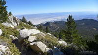
To the southeast, San Gabriel Peak and Mt. Disappointment stood across the canyon and further to the east, indistinct in the morning haze was snow-capped Mt. Baldy. To the west, the view extended past Josephine Peak and Mt. Lukins to the San Fernando Valley, Santa Monica Mountains and Santa Susana Mountains.
Recovery from the devastating 2009 Station Fire continues on both peaks. The amount, extent and size of Poodle-dog bush (Eriodictyon parryi) in the burn area is slowly diminishing. Some plants have died, but there are still viable plants of which to be wary. These plants were on the San Gabriel Peak Trail, above the notch, on the final climb to the summit of the peak. I don’t recall seeing any Poodle-dog bush on the ascent of Strawberry from Red Box, but it is still present on the west side of the peak.
Some related posts: Strawberry Peak, Switzer’s and the Old Colby Trail, Bear Canyon Loop Plus Strawberry Peak, After the Station Fire: Ten Miles – Four Peaks
Summits that can be accessed by trail are usually busy places, especially in good weather. That was certainly the case this morning. Each of us had encountered someone we knew on or near San Jacinto’s rocky summit.
It seemed everyone on the peak was doing a different adventure. One hiker mentioned he had run out of food at Wellman Divide. That seemed strange until he explained he was doing the “8000 Meter Challenge” — ascending Baldy, Gorgonio and San Jacinto consecutively in 24 hours. The 8000 meters refers to the (approximate) cumulative gain and loss when doing the three peaks. In round numbers Baldy via the Ski Hut would be about 2375 meters of gain+loss, Gorgonio via Vivian Creek 3350 meters and San Jacinto via the Tram about 1500 meters. If you skip the Tram and do San Jacinto from Idyllwild the gain+loss is about 2680 meters.
An ultrarunning friend that reached the summit shortly after we did was doing Cactus to Clouds to Cactus (C2C2C). This arduous route starts in Palm Springs at an elevation of about 460 feet and climbs all the way to the summit of San Jacinto at about 10,834 feet. Including a couple of short downhills along the way, the total elevation gain is around 10,800 feet. Round trip that works out to about 6600 meters of gain+loss.
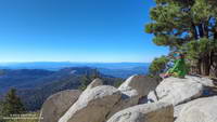
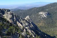
Ann, Telma and I were doing a route I’ve enjoyed for many years — ascending San Jacinto from the Tram and then running down to the fire lookout on Tahquitz Peak. The route has excellent running and (on a clear day) hundred-mile vistas. The views of Tahquitz and Suicide Rocks bring to mind many fine days spent with friends at these superb rock climbing areas.
When we got our wilderness permit at the Long Valley Ranger Station the ranger had warned us about 45 mph winds and cold temps on the summit. The strong winds had been forecast to moderate before sunrise and the forecast was spot on. The weather on the summit was near perfect — warm in the sun and cool in the shade with light winds.
After ascending San Jacinto we returned to Wellman Divide and then descended the Wellman Divide Trail and PCT to Saddle Junction. From Saddle Junction it is only a couple of (mostly uphill) miles to Tahquitz Peak. This Google Earth image shows my GPS track from Wellman Divide to Tahquitz Peak and back.
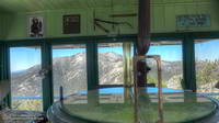
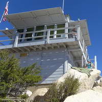
A dozen or so hikers were enjoying the warm sun and great weather at the lookout. As always, the fire lookout host was friendly and informative, answering questions about the lookout’s equipment and surrounding landmarks. Want to become a volunteer host? Check this page.
My usual return route from Tahquitz Peak is to go back to Saddle Junction and then follow the Willow Springs Trail to Hidden Lake Divide. With the Willow Springs Trail closed due to the 2013 Mountain Fire it’s necessary to climb back up to Wellman Divide and then descend to the Tram from there. This adds about a mile and 800′ of gain to the usual route. Although we had descended it earlier in the day, the trail going up to Wellman Divide had a different feel to it, and the out and back wasn’t nearly as onerous as I thought it might be.
About an hour after topping out at Wellman Divide we were back at the Long Valley Ranger Station and not long after that on the Tram and headed down the mountain. I smiled as the decades-old recording in the tram car began, “You’ve had a great day…”
Some related posts: Summery San Jacinto; Smoky Tahquitz Peak, Room With a View, Mountain Weather, Hitting the (Big) Hills of Southern California