Tag Archives: old boney trail

Boney Mountain – Old Boney Loop from Wendy Drive

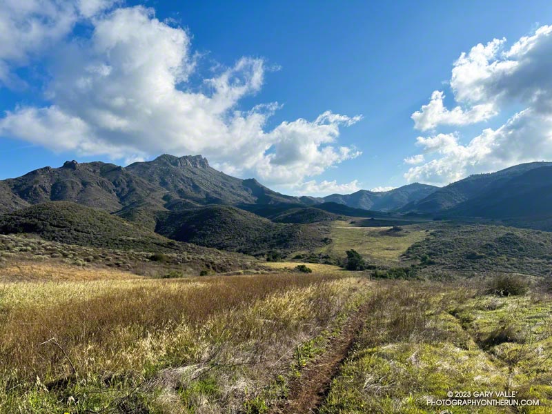
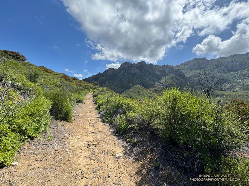
Western Ridge and escarpment of Boney Mountain from the Old Boney Trail

For months, it seems wet weather has had a particular affinity for Saturdays and Sundays. This has resulted in some wet, chilly runs. It’s also put a damper on other outdoor activities. A long-time rock climber, I enjoy going to Stoney Point and doing a circuit of easy bouldering problems. That’s been hard to do because 1) muddy climbing shoes don’t work so well, and 2) sandstone hand/footholds tend to break when wet.

That’s one of the reasons I was back on the western ridge of Boney Mountain — at least I’d get to climb something!
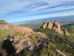
Near the halfway point on the Western Ridge of Boney Mountain. (thumbnail)
Near the halfway point on the Western Ridge.

Following a well-worn route, I scrambled up Boney’s western ridge to the crest and worked over Tri Peaks to the Backbone Trail. This time, after descending the Chamberlain Trail, I turned right (north) on the Old Boney Trail and looped back to where the western ridge route began. From there, I retraced my steps back to Wendy Drive. Here’s an interactive 3-D terrain map of my GPS track.

There were other reasons for doing this route. It’s been a very wet couple of years, and there is little trail infrastructure to handle the runoff from all the storms. Last weekend, another strong storm drenched Southern California, and on Friday, there was additional rain. The Boney – Old Boney route crosses just one creek (twice), and it usually has a decent limb/log/rock bridge. I suspected other routes would involve soaked socks and shoes.
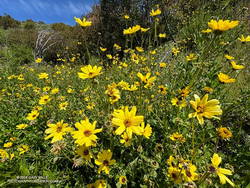
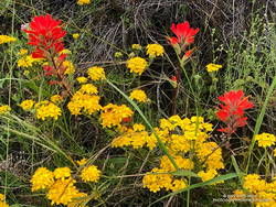
Bush sunflower along the Old Boney Trail. (thumbnail)
Bush sunflower along the Old Boney Trail.

I’d also read that the Santa Monica Mountains Trails Council (SMMTC) recently worked on the Old Boney Trail. After experiencing the challenges of brush on that trail firsthand, I was curious to see what the trail was like now. In addition, the Old Boney return has fantastic views of Boney Mountain’s impressive western escarpment. It’s fun to look up at where you’ve been!

Another consideration — not necessarily positive or negative — is the Boney Mountain – Old Boney keyhole loop has nearly a 1000′ more elevation gain than the similar length (16-mile) Blue Canyon, Sycamore Canyon, Upper Sycamore route.

Here are a few photos taken along the way, including some of the vibrant wildflowers.

Some related posts:
Looking for Boney Mountain
An End of Year Boney Mountain Adventure
Boney Mountain Western Ridge & Loop
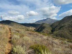
Back on the Old Boney and Serrano Valley Trails

Boney Mountain from the Serrano Valley Trail.

Not all trails will have a smooth tread, good footing, trimmed vegetation, trail signs and other luxuries. What you see is what you get, and sometimes what you get is not perfect.

That was the case on last May’s run to the Serrano Valley from Wendy Drive. A long stretch of the Old Boney Trail was all but impassable. The trail was badly overgrown, the day foggy and gray, and everything was dripping wet.

Sycamore leaves scattered along the Serrano Canyon Trail (thumbnail)
Serrano Canyon Trail

But there is just something about immersing yourself in the good and not-so-good that nature offers. It’s part of what nature is. The splendid display of wildflowers seen on that run was a result of the rainy season that produced the overgrown trail.

Curious to see how that section of trail had changed in seven months, this morning I was back on the Old Boney Trail and on my way to Serrano Valley. It had rained around 4 inches during the week, and I expected the mud to be like glue and creek crossings wet.

Use of the trail had improved its condition. There were still some overgrown sections but most of the time I could see my feet, as well as the ruts and rocks on the trail. It was muddy in the usual places but the globs of mud on my shoes didn’t reach dinner plate proportions.

The Fireline Trail climbs out of Sycamore Canyon. Boney Mountain is in the distance.
Fireline Trail with Boney Mountain in the distance.

In the wake of the storm, the weather was exhilarating. Postcard clouds decorated the crest of Boney Mountain and a cool breeze filtered through the canyons. Despite all the rain, Serrano Creek was flowing at a modest level, and I emerged from Serrano Canyon with dry shoes.

It was a day for a longer run, and when I reached Sycamore Canyon fire road, I turned left (south) and continued down the canyon to the Fireline Trail. Going up the Fireline Trail to Overlook Fire Road extended the run and expanded the views. A right turn on Overlook Fire Road lead to the top of the Ray Miller Trail, and from there to the Hub. These junctions offer additional opportunities for extending the run.

Today, I ran down Hell Hill, over to the Two Foxes Trail via Wood Canyon Fire Road, then picked up Sycamore Canyon Fire Road near the Danielson Multi-Use Area and followed it to the Upper Sycamore Trail, Danielson Road, and Satwiwa. This interactive, 3D terrain view shows the route.

Some related posts:
A Really Overgrown Trail, Thirty Creek Crossings, and Thousands of Wildflowers
Old Boney to Serrano Valley, Plus Fireline and Overlook
Serrano Valley from Wendy Drive

A Really Overgrown Trail, Thirty Creek Crossings, and Thousands of Wildflowers

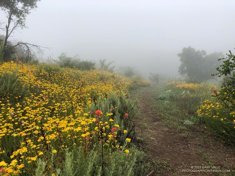
Yarrow and paintbrush along the Old Boney Trail in Pt. Mugu State Park.
Old Boney Trail in Pt. Mugu State Park.

Starting at the Wendy Drive Trailhead, I’d crossed Satwiwa, run down Danielson Road, rock-hopped across Upper Sycamore Creek, and picked up the Old Boney Trail. The condition of the Old Boney Trail between Danielson Road and the Fossil Trail junction was better than expected. Maybe the trail was going to be in good shape after all.

A section of the Old Boney Trail overgrown with black sage following the wet rain season of 2022-2023.
A section of the Old Boney Trail overgrown with black sage.

Wrong! Once I passed the turnoff to the Fossil Trail, the vegetation closed in. In places it was so thick I couldn’t see the trail at my feet, much less a few yards ahead. All I could do is smile and work my way through it. Everything was overgrown — bushes, grasses, wildflowers. And everything was wet with dew. A hundred yards past the Fossil Trail, I was soaked from head to toe.

I tried to see the positive. It was an amazing display of the effect of a wet rainy season. Without trail work and use, it wouldn’t take long for the trail to be completely consumed.

The Old Boney Trail continued to be a tangle of chaparral for about two miles — until I reached the Backbone Trail at Blue Canyon. At that point, it becomes part of the Backbone Trail system, and I was relieved to see that some work had recently been done on the trail.

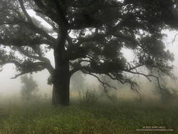
Coast live oak and fog along the Old Boney Trail in Pt. Mugu State Park.
Coast live oak along the Old Boney Trail.

As I worked up the Backbone Trail toward the Chamberlain Trail junction, I recalled other times I’d run to Serrano Valley using Old Boney. What would the condition of the trail be beyond this point? I’d been on that part of the Old Boney Trail following a wet rain season and knew how overgrown it could be. Some refer to that section of trail as “tick alley.”

But when I got to the junction, surprise, surprise, the Old Boney Trail had been trimmed. More than two miles of trail were groomed. It was good all the way to the Serrano Valley Trail and partway into Serrano Valley. The trail in Serrano Valley was a little overgrown, but NOTHING like the Old Boney Trail between the Fossil and Backbone Trails.

Part of the fun of doing this route is all the stream crossings in Serrano Canyon — what is it 13 or 14? Today, most of these could be done without getting your shoes wet — especially if you have poles. I didn’t have poles, and my shoes and socks were already wet, so I didn’t worry about keeping them dry. Some sections of the Serrano Canyon Trail were also overgrown, but not bad. However, there was a lot of poison oak, some of which wasn’t avoidable.

Paintbrush and golden yarrow along Sycamore Canyon Fire Road in Pt. Mugu State Park.
Paintbrush and golden yarrow

After getting a drink of water at the faucet at the junction of the Serrano Canyon Trail and Sycamore Canyon Fire Road, I headed up-canyon. Almost immediately, the fire road crossed Big Sycamore Canyon Creek. I did this first crossing without getting my shoes wet, but nine more crossings followed, and most resulted in soaked shoes. The water crossings and wildflowers helped distract me from the five mile run up Sycamore Canyon to the Upper Sycamore Trail.

Getting off Sycamore Canyon Road and onto the Upper Sycamore Trail was a relief. Whatever run I do from Wendy Drive, I always finish it via this trail. The trail gets enough use that it was in good shape. This time all the creek crossings could easily be rock-hopped.

Even with a few tedious sections, it was an adventurous and mostly enjoyable 20 miles. Here are some photos taken along the way.

Some related posts: Old Boney to Serrano Valley, Plus Fireline and Overlook; Looking for Ogres in Serrano Canyon; Running to Serrano and La Jolla Valleys from Wendy Drive; You Can’t Run Just Part Way Up Serrano Canyon