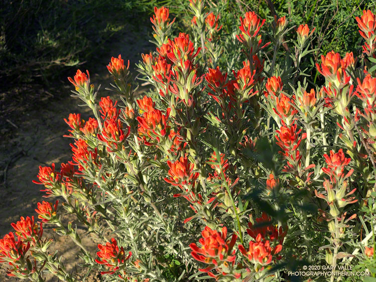
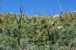
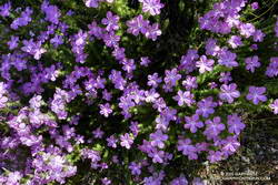
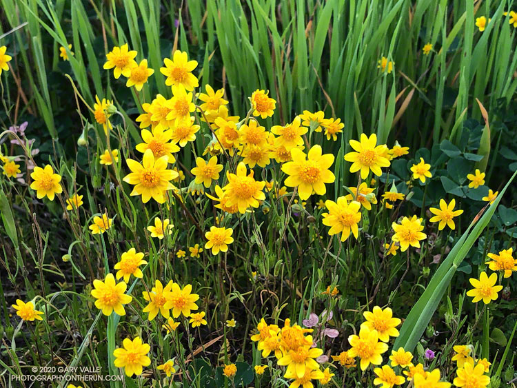
This rain season’s on again, off again pattern has produced an exceptional selection of wildflowers.
Here is a slideshow of a some of the flowers blooming in and around Las Llajas, Chivo, and Tapo Canyons.

This rain season’s on again, off again pattern has produced an exceptional selection of wildflowers.
Here is a slideshow of a some of the flowers blooming in and around Las Llajas, Chivo, and Tapo Canyons.
Update April 4, 2021. Wow! What a difference from last year! The Stone Canyon Trail was in great shape on this morning’s hike/run. All the dead limbs/small trees had been removed. All the washouts had been repaired. A ton of brush had been cleared. I didn’t even get my shoes wet crossing Big Tujunga Creek because there was a causeway of large rocks across the creek. Many thanks to whoever did the work on the trail!
At the deepest part of the creek, the cold water reached mid-thigh. I’d futzed around looking for a way to rock hop across slowly-flowing Big Tujunga Creek, but didn’t find one.
With squishy shoes, I followed the trail eastward along the creek. A little past Stone Canyon wash, the trail turned toward Mt. Lukens and started to climb.
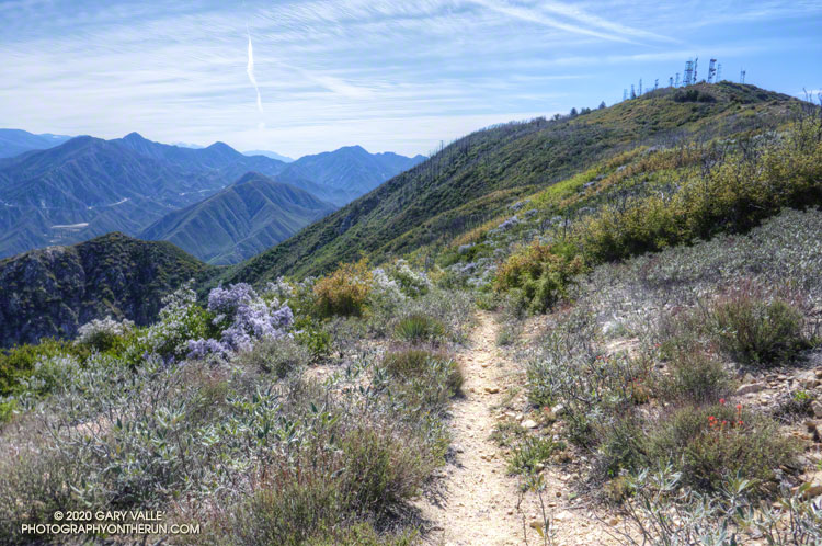
The Stone Canyon Trail is one of the trails on my list of trails less-traveled. Today, the trail choice had been between the Stone Canyon Trail and Condor Peak Trail. Recalling the difficulty of the Condor Peak Trail, I thought it would be better to do Mt. Lukens first, and save Condor Peak for later.
As I worked up the trail, I marveled at its condition. It was in surprisingly good shape! It had been groomed relatively recently, and I mentally thanked the person or group that had taken care of the trail. With a clear trail and cool morning temperature, it felt good to push the pace up the steep trail.
The last time I’d done this route was in November 2016. That outing followed five years of drought. With growth suppressed, the upper half of the trail was only moderately overgrown, and I did not see any poison oak. Ever the optimist, I thought today’s conditions might be even better.
Not this time. I don’t know if Winter rains or the pandemic had intervened, but about halfway up the peak, the trailwork abruptly ended. The upper half of the trail was badly overgrown, and at inconvenient times Spring-green poison oak lined the trail. In a few places, fallen scrub oak trees — burned in the Station Fire — were mixed in with the brush. Where the 2016 ascent had been after a drought, today’s followed a wet period in which three out of the past four years have had normal or above-normal rainfall.
With care, patience, and a bit of bushwhacking, I eventually reached the top of the Stone Canyon Trail and the old dirt road on the west side of the peak. A few minutes later I stood alone on the summit of Mt. Lukens. I had not seen anyone on the ascent and would not encounter anyone on the way down.
Here’s a Google Earth image overview of the Stone Canyon Trail and a 3D Cesium interactive view that shows a GPS track of the route up and down the Stone Canyon Trail on Mt. Lukens. The view can be zoomed, tilted, rotated, and panned. Placemark and track locations are approximate and subject to errors.
Related post: Mt. Lukens, Then and Now
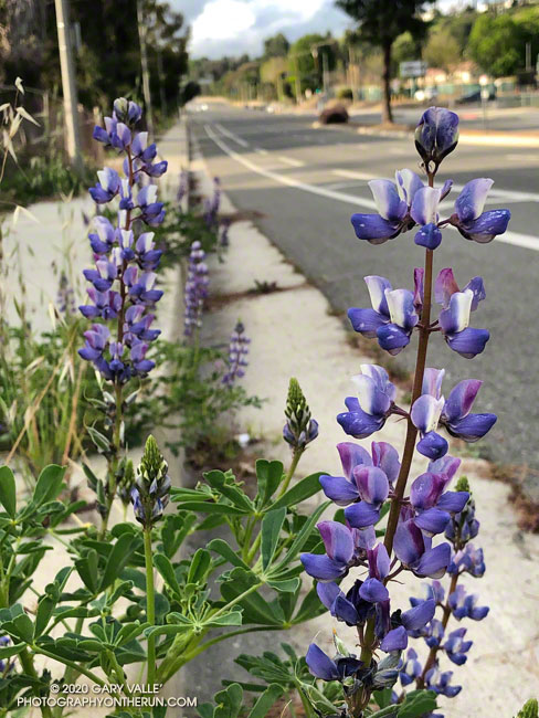
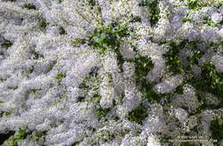
Arroyo lupine (Lupinus succulentus) is one of the first lupines to bloom in the local grasslands and open areas of chaparral. Here it’s blooming along Valley Circle Blvd. in the West San Fernando Valley.
Another early bloomer is miniature lupine (Lupinus bicolor), a tiny lupine that is best viewed on your hands and knees. On Lasky Mesa it typically begins to bloom in mid to late February, about the same time as goldfields.
From this morning’s out and back run to check out a local trailhead.
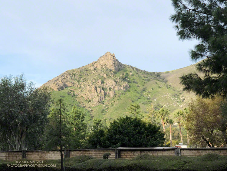
On today’s run, a muted morning sun highlighted Castle Peak in a tree-framed view from Valley Circle Blvd. This native bush sunflower (Encelia californica) was happily growing along a side street.
With MRCA/Santa Monica Mountains Conservancy lands and trails closed, local State Parks closed, and County trails closed, street views will be the norm for a while.
Related post: Castle Peak
Goldfields are tiny wildflowers, but their bright yellow color more than makes up for their diminutive size.
Goldfields bloomed a little early on Lasky Mesa this year. Depending on the conditions, they usually begin to bloom in mid-February. Because of this rain year’s wet December and dry January-February, the goldfields began to bloom a little early — around February 4. The flowers aren’t as numerous as last year, but there are still a few small patches of goldfields to be seen.
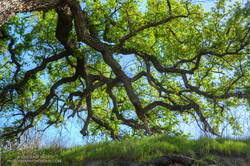
Usually, about the same time goldfields begin to bloom, valley oaks are starting to sprout new, bright green leaves. This Winter, the foliage on valley oaks at Upper Las Virgenes Canyon Open Space Preserve (Ahmanson Ranch) began to turn brown in mid-December and I saw the first new leaves begin to sprout at the end of February. This sprawling valley oak is in East Las Virgenes Canyon.
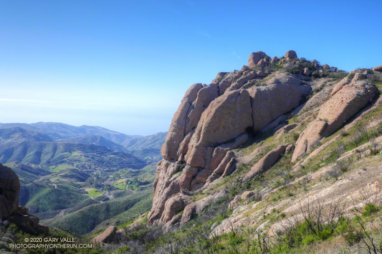
Along with Sandstone Peak, Tri Peaks, and Exchange Peak, Boney Peak is an officially named peak that is part of the Boney Mountain massif. The peak is located about 0.5 mile southwest of Sandstone Peak and is easily accessed from the Backbone Trail.
I’d climbed the other peaks in the area, and run past Boney Peak many times, but never scrambled to its summit. Getting to Boney Peak from the Wendy Drive trailhead was pretty much the same as doing Sandstone Peak. I took the “escalator” up the Western Ridge of Boney Mountain to Peak 2935 and then ran over to Tri Peaks. From there, I followed the Tri Peaks Trail to the Backbone Trail, near the Mishe Mokwa Trail junction.
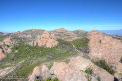
The use trail to the top of Boney Peak leaves the Backbone Trail about a mile from the Tri Peaks/Mishe Mokwa Trail junctions. Other than a little brush, it’s fairly easy to get to the peak’s boulder-strewn summit. There was a red register can stashed in the rocks. (The title photo of Boney Peak was taken where the use trail begins.)
The actual high point of the peak is atop, a large, exposed summit block. Various trip reports describe the easiest route up the summit block as class 3. That seems about right. Although relatively straightforward, the use of handholds is necessary, and a fall would ruin your whole day. Like many such boulders, it is easier to climb up than to climb down, and someone without rock climbing experience could easily find themselves unable or unwilling to climb down.
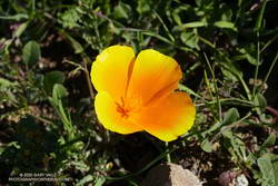
From Boney Peak, I returned to the Backbone Trail and headed west, down the Chamberlain Trail and on to the Danielson Multi-Use area. A few brightly-colored, yellow-orange poppies were already blooming along the trail. The rest of the run was the usual jog up Sycamore Canyon to the Upper Sycamore Trail, and then back to Satwiwa and Wendy Drive.
Here’s a 3D Cesium interactive view that shows a GPS track of my route. The view can be zoomed, tilted, rotated, and panned. Placemark and track locations are approximate and subject to errors.
Some related posts: Looking for Boney Mountain, After the Woolsey Fire: Boney Mountain and Pt. Mugu State Park, Boney Mountain’s Western Ridge